
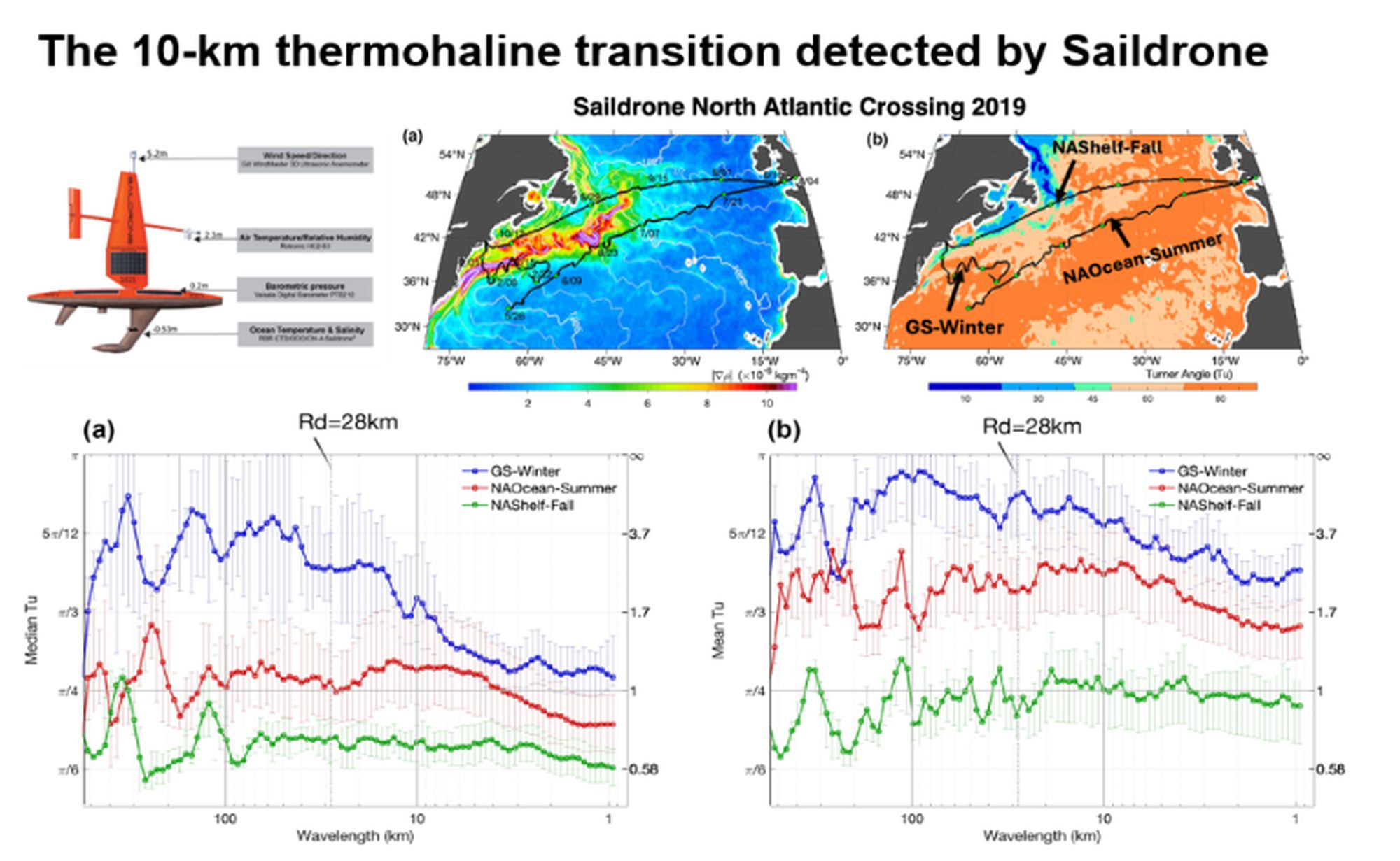
Figure 1. The 10-km thermohaline transition: where salinity takes control of ocean density. Saildrone autonomous vehicles crossing the North Atlantic in 2019 (top left) revealed a fundamental shift in what controls ocean density. Maps (top right) show three distinct regimes sampled: the winter Gulf Stream (GS-Winter, blue), summer open ocean (NAOcean-Summer, red), and fall continental shelf waters (NAShelf-Fall, green). Spectral analysis (bottom panels) shows median (a) and mean (b) Turner angle (Tu) and density ratio (Rρ) across spatial scales. At large scales (>100 km), temperature dominates density structure across all regimes; the ocean “weighs” water primarily by how warm it is. But near the ~10-km submesoscale and approaching the 28-km Rossby radius (Rd, vertical dashed line), a dramatic transition occurs: salinity begins to control density. This crossover is sharpest in temperature-dominated winter Gulf Stream waters (blue), where Tu drops from π/3 to near π/4 at 10 km, but remains gradual in salinity-stratified shelf waters (green). Image courtesy of Lisan Yu.
Why it matters: Existing satellite salinity measurements have resolutions of ~40-60 km, missing the critical ~10-km scale where density control transitions from temperature to salinity. This observational gap revealed by saildrone observations highlights the need for next-generation satellites capable of resolving submesoscale salinity variability. The regime-dependent behavior shows that interpreting satellite-derived density from temperature alone becomes increasingly inadequate at finer scales, particularly in salinity-dominated coastal and shelf regions where accurate representation of submesoscale dynamics is essential for ocean circulation models.