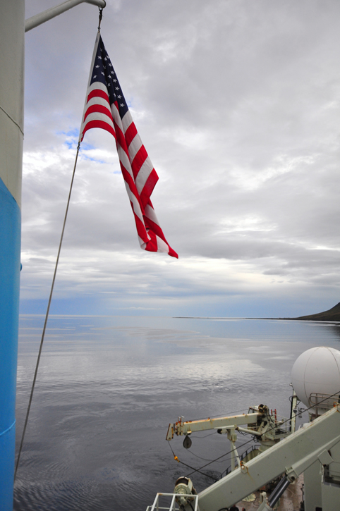

September 5, 2011When last we talked about physical oceanography specifically (Imagining Oceans), we introduced the Meridional Overturning Circulation. It sounds pretty daunting in that language. “Meridional” means simply along meridians, or lines of longitude, which run north/south, as opposed to lines of latitude, which run east/west. (The notion of gridding the earth in this way in order to determine geographic position was first conceived by Ptolemy of Alexandria in the second century.) In the North Atlantic, generally speaking, warm, salty water from the Gulf Stream System flows north into the Arctic, and cold water returns south back toward the tropics—along meridians. In order to sustain the circulation, remember, the tropical-origin water must first sink in the Nordic Seas north of that submarine mountain range called the Greenland-Scotland Ridge—the overturning—and then make its way back south through gaps in the ridge. The largest of these gaps is in the Denmark Strait. That quick review brings us up to date. Now let’s take a more detailed view of the circulation north of the Greenland-Scotland Ridge in order, later, to focus more finely on the North Icelandic Jet.
The presently accepted scheme contends that much of the warm-to-cold conversion in the MOC happens along the perimeter of the Nordic Seas. Credit: Jack Cook (WHOI). The North Atlantic Current (NAC) has crossed the ridge and proceeded up the Norwegian coast, sharing its warmth with the land. Its name has changed to the Norwegian Atlantic Current, but nature doesn’t care about that. The NAC is still transporting warm, salty Gulf Stream water. Some portion of that water—still identifiable by its temperature/salinity profile—nips over the top of Norway into the Barents Sea, and another arm of the Norwegian Current continues on northward into the High Arctic beneath the pack ice. But a significant volume of similar water takes a great loop around the Nordic Seas basin—currents like to hug the edges of ocean basins—and proceeds south along the coast of Greenland aboard the East Greenland Current into the Denmark Strait. For us, it’s important to remember that, while this is still identifiable as Atlantic-origin water, it has been chilled by the cold ambient air, or in the parlance, it has become “densified.” A large quantity of densified water, some 100-300 meters beneath the surface, travels with the East Greenland Current towards and into the Denmark Strait after taking its lap around the Nordic Seas basin.
In 1996, Cecilie Mauritzen, while still a graduate student at MIT/WHOI, published a paper in the technical journal Deep-Sea Research in which she proposed the above scenario. It flew in the face of the previous paradigm, which held that the Atlantic-origin water, having been densified by exposure to the cold Arctic air, sank at two or more locations in the interior of the Nordic Seas, then made its way southward to the Denmark Strait where it spilled over the sill into the deeper North Atlantic. In this, we have an interesting example of how oceanography and by extension science, works. An idea is proposed and, if satisfactorily proven within the limits of known data, becomes over time the accepted paradigm. Then another scientist(s), perhaps armed with new instruments producing better data or a different interpretation of existing data, hypothesizes a new paradigm. (Think of Newton, Darwin, and Einstein who literally revolutionized science and with it our view of the physical world.) Thus science advances (though the scientist whose paradigm is exploded may not like it so much).
A mere two weeks ago at this writing, Kjetil Våge, Bob Pickart, Hedinn Vladimarsson, Steingrímur Jónsson—co-principal investigators on this expedition—Michael Spall and other authors published a paper in Nature Geoscience hypothesizing that fully half the water flowing into the Denmark Strait is transported there by that newly discovered current they named the North Icelandic Jet (NIJ). This does not categorically contradict Mauritzen’s Denmark-Strait scenario, but most definitely modifies it—that is, if the new hypothesis is accurate. The exclusive purpose of this second half of the expedition—led by Bob and Kjetil—is all about proving or disproving their own hypothesis. It isn’t often that new currents are discovered. It’s likewise rare for an oceanographic cruise to so closely resemble exploration in the traditional sense. Since the days of Henry the Navigator in the early 15th century, no explorer, or at least none we’ve ever heard of, sailed into the unknown with no specific purpose, just to see what he happened to see. All had an a priori idea, an objective that their expedition was planned to test. One difference, however, is that the people who stayed ashore, from Queen Isabella to the Royal Geographic Society, had to wait until the expedition returned years later to learn whether the explorer found what he was looking for or something different or nothing at all. Here aboard Knorr, Bob and Kjetil are conducting real-time oceanographic exploration. Their tools are minimal—the CTD and ADCP. Finding North Icelandic Jet water where they expect it to be will go a long way toward proving their hypothesis. Likewise, they will need to look for NIJ water where it might be in order to disprove (they hope) other possible explanations for the NIJ and its origins. In the days to come, I’ll try with their help to explain the physical details of the oceanographic logic that led to their hypothesis in the first place—and the process by which they seek to verify it. The exciting thing about this cruise is that we won’t need to wait the usual year or more for the data to be analyzed to learn the results of their exploration. We’ll be right here during the search.
Last updated: December 27, 2011 | |||||||||||||
Copyright ©2007 Woods Hole Oceanographic Institution, All Rights Reserved, Privacy Policy. | |||||||||||||

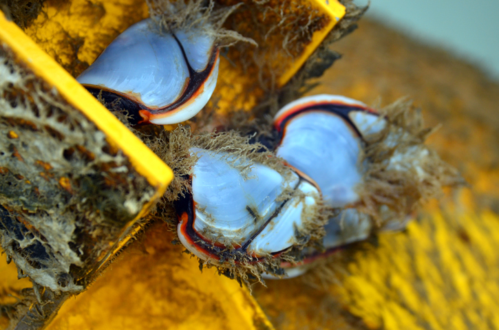 Life found on the Ghost Mooring. © Rachel Fletcher