
August 24, 2011To appreciate the elegant beauty of nature’s great ocean/atmosphere systems, we need to cast our minds out over vast distances and into opaque depths. And to begin to grasp the vital role played by the Denmark Strait in the circulatory system, let’s take an imaginary drift from the subtropics aboard the Gulf Stream back up here to the subarctic. The Straits of Florida might be a good place to start for the sake of context and a sense of the interconnectedness of the ocean system. Let’s picture ourselves in a little boat, maybe raft (we’ll assume fair weather), no power, letting the current do the work.
The deep-blue Gulf Stream water is blowing through the close quarters between southeast Florida and the Bahamas at a steady four knots, transporting some 25 million cubic meters of water every second past Miami, Ft. Lauderdale, and Palm Beach. North of the straits, we slow a bit, but the Gulf Stream, hugging the continental shelf, still sprints northward toward the bulge of Cape Hatteras at high speed. If the weather’s clear we’ll get a glimpse of Hatteras before the Steam carries us northeast into open ocean. Now, unconstrained by the presence of dry land, our mode of propulsion begins to meander sinuously, but if we don’t get spun off into one of the big eddies on either side of the main flow, we’ll ride on toward the Grand Banks of Newfoundland. It’s not entirely clear why the Gulf Stream departs the coast and heads toward Europe. Though it’s called a surface current, the Gulf Stream influence reaches down thousands of meters. So it’s probably being steered in that direction by bottom topography, bathymetry in technical parlance. However, contrary to popular belief, the Gulf Stream proper never reaches Europe. The fast, clearly defined current begins to dissolve into filaments of flow that bend southward in a broad, slow drift bound back for the tropics. But we’re not going that way. We’ve been entrained in an extension of the Gulf Stream called the North Atlantic Current (NAC) now veering off to the north from an area near the Grand Banks—toward the British Isles. We’ll ride that flow of warm, salty water past Ireland and England. This is the warmth that, in collaboration with the west winds, nurtures those famous incongruous palm trees in the south of England, offering a perfect example of the relationship between ocean circulation and climate when we consider that on the same latitude as London on the west side of the Atlantic, we find frozen Labrador. But as we pass north of Scotland, things are changing deep beneath the surface. Though our surface current hardly notices, we’re passing over a submarine mountain range running from northern Scotland west, through Iceland, and on across the Denmark Strait to Greenland. In fact, it’s called the Greenland-Scotland Ridge. Crossing the ridge, we enter Nordic Seas. Here the NAC gains a name change, to the Norwegian Atlantic Current, but its warmth still graces that nation with ice-free conditions north of the Arctic Circle.
Looking forward on calm seas. But now things are changing on the surface as autumn gives way to winter. It’s The current is quickly relinquishing its warmth to the cold air. Cold water is heavier—denser—than warm, and the tropical-origin salinity enhances its density. Now something important is happening, something we’ve not seen in our trip thus far. The cold, salty water has grown dense enough to sink due to the onset of winter and the storm season, which serves to mix the cold surface with the warmer water below, driving the cold water deeper. (The trip’s getting uncomfortable and dangerous now; it’s time to go ashore and let the ocean circulate without us.) There is still circulation on the surface, but it’s getting very complex and confusing. There’s no telling where our raft would go if we’d stayed aboard. It might drift off over the top of Norway into the Barents Seas. It might travel with an arm of the Norwegian Current over Spitsbergen into the High Arctic. Or perhaps it would flow around the edge of the basin—currents like to hug the edges of ocean basins—and down the East Greenland coast. In any case, an “ocean problem” has arisen.
Millions upon millions of cubic meters of Atlantic-origin water has flowed into the Nordic Seas basin, and now it must get out. Nature insists that if a quantity of water flows north, then an equal quantity must flow back south. Water can’t just pile up and submerge Western Europe. Or to put it more scientifically, mass must be conserved. But where can it go? It has already gotten a start by sinking behind the Greenland-Scotland Ridge. Now it can flow—or as they say, “leak”—back south through gaps in the ridge. However most of the southbound flow spills over the sill in the Denmark Strait into the deep Atlantic. Though an extremely complex, only partially understood process, this water forms up into the so-called Deep Western Boundary Current and proceeds southward at depth beneath the Gulf Stream toward the equator; and thus mass is conserved.
The magnificent system I’ve so cursorily described—the northward surface flow of warm, salty water from the Gulf Stream System and the return of cold water at depth—is called the Meridional Overturning Circulation (MOC). The stability of global climate literally depends on the integrity of the MOC. Should any segment of the circle be severed—say, by an influx of fresh water from the melting Greenland Ice Sheet—then climatic disaster will result. No serious scientist is going so far as to say that will happen. But it could happen; the potential is inherent to the system. Last updated: December 27, 2011 | ||||||||||||
Copyright ©2007 Woods Hole Oceanographic Institution, All Rights Reserved, Privacy Policy. | ||||||||||||
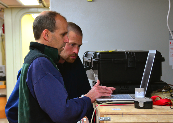 Co-Principal Investigators Bob Pickart and Kjetil Våge.
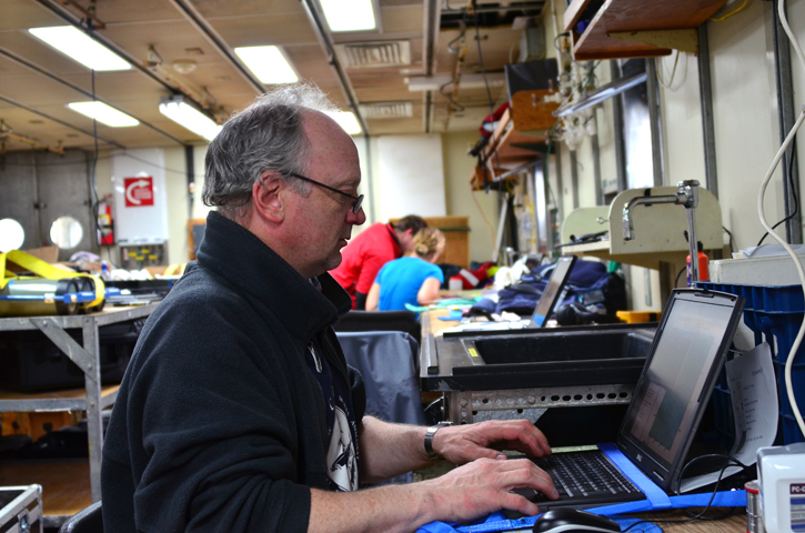 Icelandic technician Magnus Danielsen at work in the main lab.