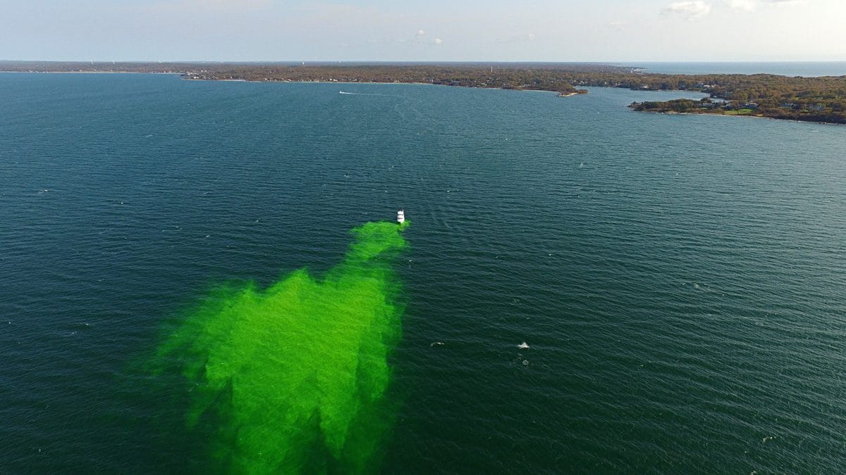
- In a field test of a robotic vehicle that can track oil spills, researchers released a harmless green dye to act as a mimic for oil. It spread out in Buzzards Bay, Mass., behind the research vessel Discovery. WHOI scientists are helping to develop a Long Range Autonomous Underwater Vehicle to help mitigate damage from oil spills in remote or ice-covered areas such as the Arctic Ocean and the Great Lakes. (Peter Traykovski, Woods Hole Oceanographic Institution)
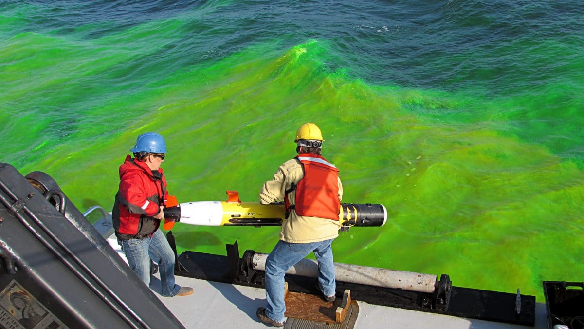
- WHOI engineer Amy Kukulya and a Discovery crew member deploy the easy-to-handle autonomous underwater vehicle called REMUS. (Erin Koenig, Woods Hole Oceanographic Institution)
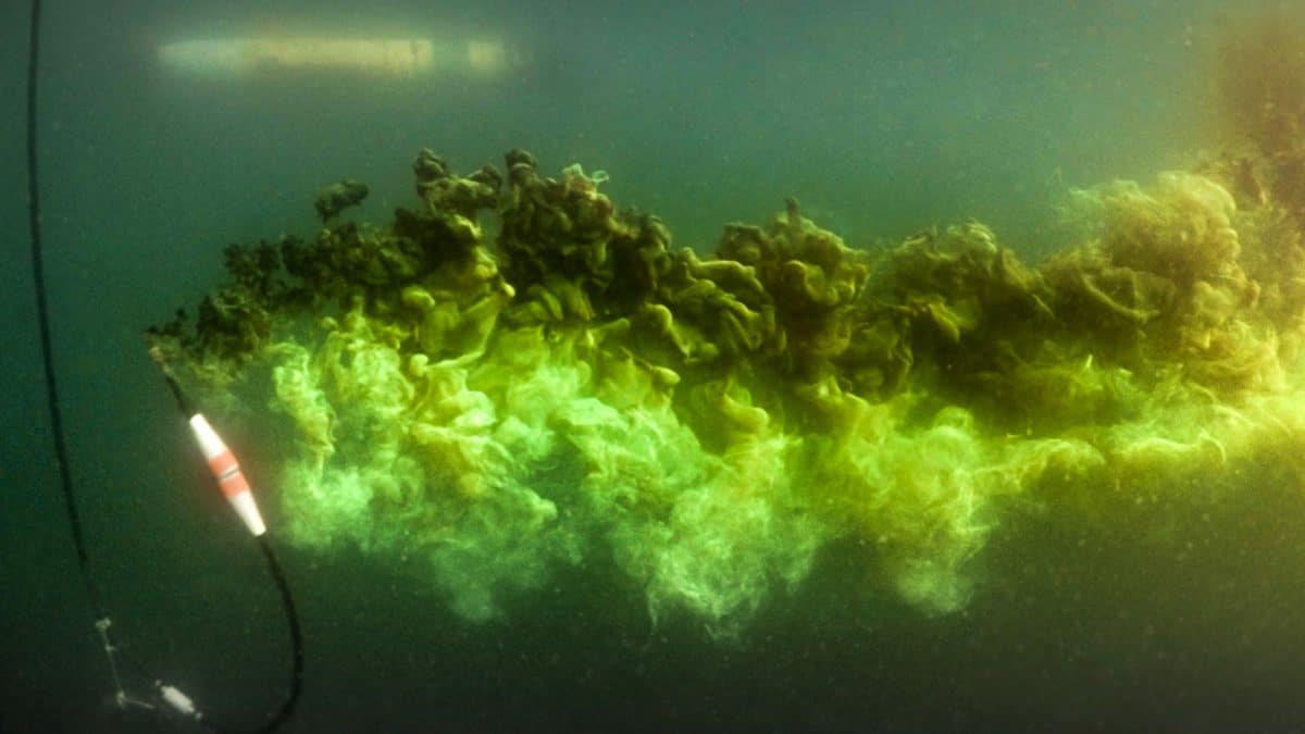
- As a hose discharges the green dye, REMUS waits to begin its mission. (Sean P. Whelan, Woods Hole Oceanographic Institution)
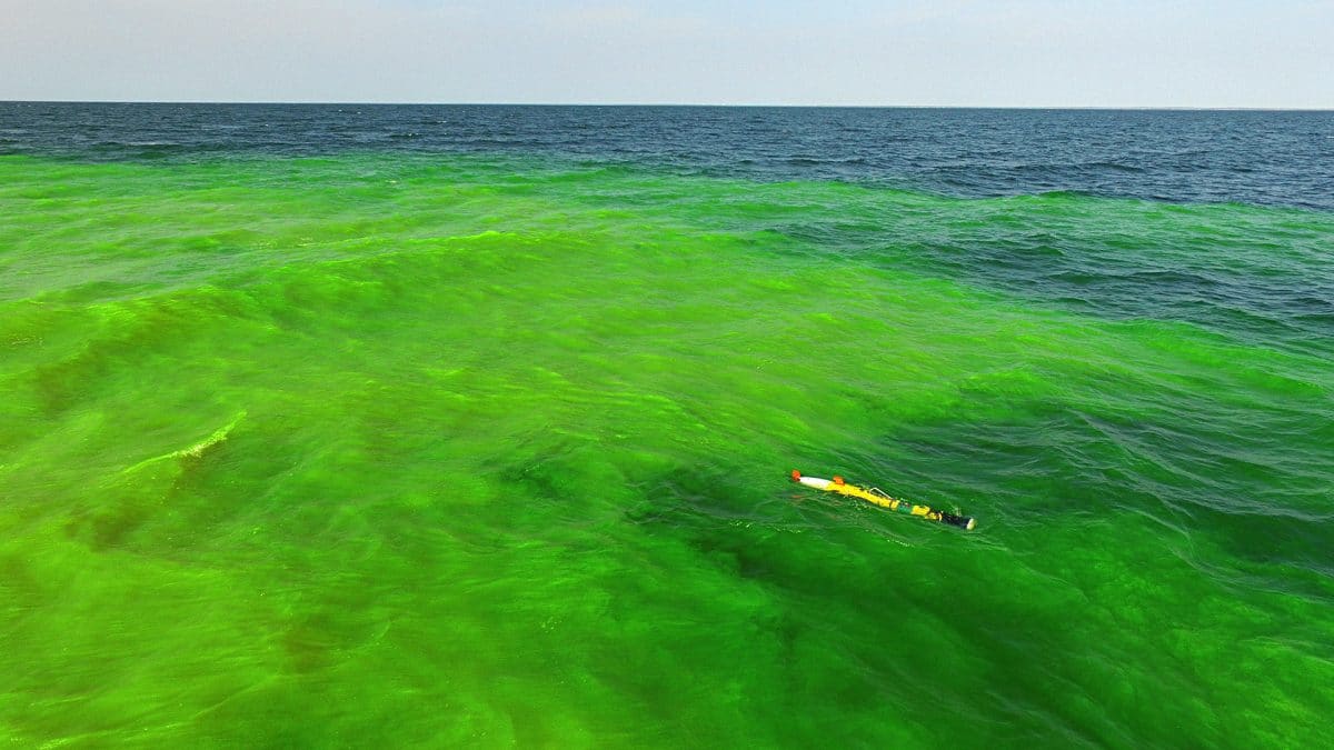
- Equipped with sensors to detect the “oil,” REMUS sets out to track it. It detects where the “oil” is spreading and, just as important, where it is not spreading, so that responders can deploy resources most efficiently and effectively to mitigate damage from oil spills. (Sean P. Whelan, Woods Hole Oceanographic Institution)
To Track an Oil Spill
Robotic "bloodhound" to sniff for oil in ice-covered oceans
Oil spills are bad enough, but imagine if one occurs in an ocean covered with sea ice. The Coast Guard sends up aircraft to survey the spill and mobilizes assets in a timely way to contain damage to the environment, local fisheries, and nearby communities. But the oil is flowing beneath the ice where it can’t be seen or followed. What to do?
Send in an undersea vehicle to track the oil into an area too dangerous and inaccessible for ships and people to go.
With funding from the Department of Homeland Security, scientists and engineers at Woods Hole Oceanographic Institution, the Monterey Bay Aquarium Research Institute, and the Arctic Domain Awareness Center (ADAC) at the University of Alaska are developing the Long Range Autonomous Underwater Vehicle (LRAUV). It is designed to be pitched from ship, shore, or helicopter into open water, where it can swim under the ice for more than 375 miles; locate where the oil is and, just as important, where it isn’t; map where it is flowing; and relay information to shore in real time.
“We are creating robotic systems that are small, mobile, connected, and enduring, making them a perfect match for the remote Arctic or the Great Lakes,” said James Bellingham, director of WHOI’s Center for Marine Robotics. “Our goal is to give the Coast Guard the ability to understand an incident while there is still time to react.”
“Integral to effective response operations is knowledge of where the oil is and predicting where the oil may go,” said Capt. Joseph B. Loring, chief of the Coast Guard’s Office of Marine Environmental Policy.
In a vast region with limited personnel, ports, ships, and planes, the LRAUV will give Coast Guard responders the ability to move nimbly to get sensors on the scene and under the ice and to map a spill over long distances, said retired Maj. Gen. Randy “Church” Kee, executive director of the ADAC.
The long-range remotely controlled underwater vehicle may also prove valuable one day for tracking far-reaching or deep oil plumes such as the 2010 Deepwater Horizon oil spill.
In November 2016, WHOI researchers tested the software that would be used to allow undersea vehicles to track the oil and transmit acoustic data to shore. They equipped a shorter-range REMUS vehicle with sensors to monitor and measure oil.
With Coast Guard personnel and ADAC Director Kee aboard the research vessel Discovery, they pumped a stream of bright-green fluorescein dye, a harmless mimic for oil, into Buzzards Bay off Cape Cod. The REMUS successfully tracked it, and the researchers are now on track to integrate their proven technology to detect and map oil spills on the LRAUV.
Related Articles
- The ocean currents behind Brazil’s pollution problem
- Sunlight and the fate of oil at sea
- A toxic double whammy for sea anemones
- WHOI scientists discuss the chemistry behind Sri Lanka’s flaming plastic spill
- Oil spill response beneath the ice
- WHOI scientist shares her perspective on ‘imminent’ oil spill in the Red Sea
- Rapid Response at Sea
- The Sun’s Overlooked Impact on Oil Spills
- Investigating Oil from the USS Arizona


