Crack! A Lake Atop Greenland Disappears
Water penetrates thick ice, lubricating the base of glaciers
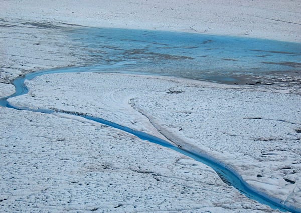
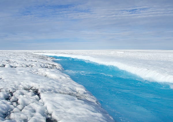
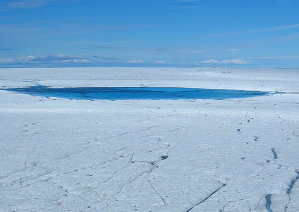
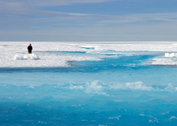
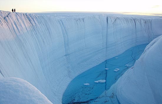
In late July 2006, a 2.2-square-mile lake atop the Greenland Ice Sheet sprung a leak. Like a draining bathtub, the entire lake emptied from the bottom, sending water through a crack that reached the base of the ice sheet 3,215 feet below. Most of the 11.6 billion gallons of water in the lake drained out in 90 minutes—at times flowing out faster than the water going over Niagara Falls.
Researchers from Woods Hole Oceanographic Institution (WHOI) and the University of Washington (UW) documented for the first time the sudden and complete drainage of this so-called supraglacial lake—one of thousands that form each spring and summer on top of the Greenland Ice Sheet as sunlight returns and melts snow and ice into water that pools into lakes.
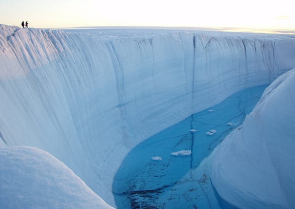
The observation uncovers a long speculated, but never detected plumbing system for ice sheets: Supraglacial lakes can build up enough pressure to crack their bottoms, creating conduits that can penetrate thick ice sheets. The cracks can send torrents of water all the way to the base of the ice sheets, where the water greases the skids between ice and ground. That speeds up the flow of the glaciers’ otherwise steady march toward the ocean, releasing more icebergs that melt into the ocean.
The finding adds a new wrinkle to climate change scenarios. Earth’s warming climate, especially near the poles, could extend the melting season, create more supraglacial lakes across the ice sheet, and cause even more widespread acceleration of the ice sheet each summer.
This could increase the rate of sea level rise in the future. (If Greenland’s 2-mile-thick ice sheet melts completely, it would ultimately raise global sea level by 23 feet, drowning coastal regions). Melting of the ice sheet would also add larger amounts of fresh water to the ocean, which might affect ocean circulation patterns that, in turn, could alter rainfall patterns, fisheries, and climate.
“We set out to examine whether the melting at the surface—which is very sensitive to climate change—could influence how fast the ice can flow,” said WHOI glaciologist Sarah Das, who led expeditions to Greenland in 2006 and 2007 with UW scientist Ian Joughin. “It’s hard to envision how a trickle or a pool of meltwater from the surface could cut through thick, cold ice a mile or more thick, all the way to the bed. For that reason, there has been a debate in the scientific community as to whether such processes could exist, even though some theoretical work has hypothesized this for decades.”
Das and Joughin reported their finding May 9, 2008, in the journal Science. The research team also included WHOI scientists Mark Behn, Maya Bhatia, and Dan Lizarralde of WHOI, Ian Howat of UW, and Matt King of Newcastle University.
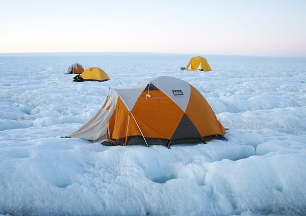
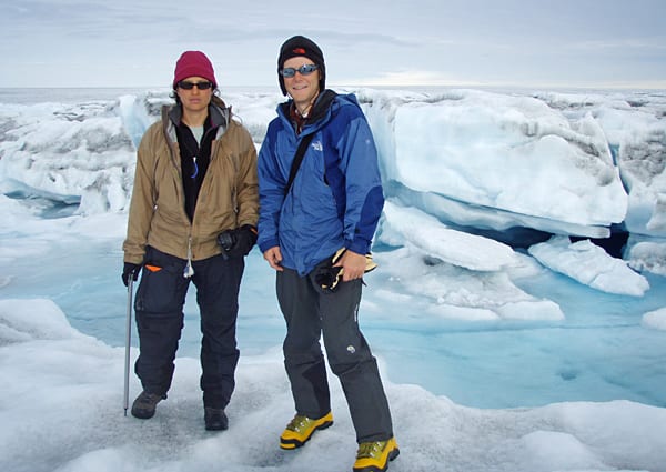
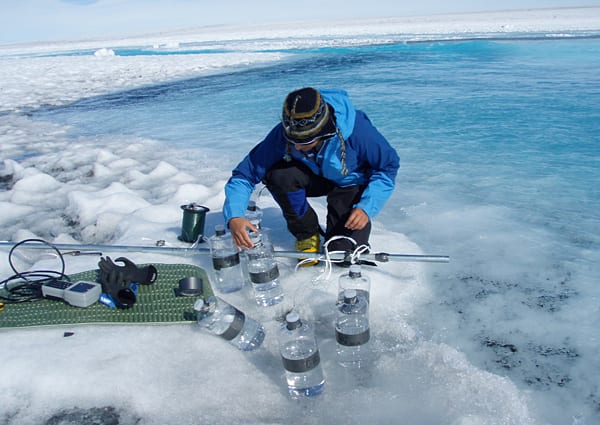
Das and colleagues used seismic instruments, water-level monitors, and Global Positioning System sensors to monitor the evolution of two supraglacial lakes and the motion of the surrounding ice sheet. They also used helicopter and airplane surveys and satellite imagery to monitor the lakes and to track the progress of glaciers moving toward the coast.
The research team returned July 8 for their third summer of field work—an expedition chronicled on polardiscovery.whoi.edu.
The research was funded by the National Science Foundation, the National Aeronautics and Space Administration, the WHOI Clark Arctic Research Initiative, and the WHOI Ocean and Climate Change Institute.
Slideshow