A rare mission north
America's sole heavy icebreaker returns to the Arctic for the first time in 40 years
Estimated reading time: 6 minutes
Bob Pickart was eating lunch in the mess of the R/V Sikuliaq last November 13 when a unique scientific opportunity knocked. A colleague on board the ship told him that the U.S. Coast Guard Cutter Polar Star, the United States' sole heavy icebreaker, would sail to the Arctic from Seattle in early December, instead of traveling to its usual wintertime destination-the National Science Foundation's (NSF) McMurdo Station in Antarctica. It turned out, the ship's resupply mission south wasn't needed due to coronavirus restrictions, so the Coast Guard decided in October to send the ship north.
"Are you kidding me?" exclaimed Pickart, a senior scientist in the Woods Hole Oceanographic Institution's (WHOI) Department of Physical Oceanography.
"I've been studying winter water in the Arctic for the past 20 years, and here is this once-in-a-lifetime opportunity to actually take shipboard measurements at a time of year when no one has them," he recalled thinking. The last time a Coast Guard cutter had visited the Arctic in winter was about 40 years ago. Polar Star had made that earlier trip in 1982.
But time was short to get permission and funding to add a science component to the Polar Star before the ship's launch on December 4. After Sikuliaq docked in Anchorage on November 19, Pickart typed out an NSF RAPID proposal for expedited funding while flying east back to WHOI. It called for measuring winter water in the Northern Bering and Chukchi Seas by releasing into the ocean dozens of expendable conductivity-temperature-depth (XCTD) probes. Because the Polar Star is not outfitted for science and there wasn't time to arrange for standard CTD probes, expendables were the only viable way to obtain the hydrographic data, including information about the presence of winter water. With time closing in, Lockheed Martin expedited shipment of the probes, and Pickart's technicians provided portable lab equipment for the ship, no easy task on such a short timetable.
Just eleven days later, the Coast Guard and NSF gave the go ahead. "And boom, we were in business," Pickart says.
Measuring winter water is important because it contains high levels of nutrients that spur primary production in the spring, Pickart says. "Anything we can learn about winter water, including where it's coming from, where it's going, and how it evolves is going to tell us a lot about the entire ecosystem, not just where the cold water is." He added that the formation and transformation of the winter water "is hugely impacted by the climate."
Polar Star commanding officer William Woityra, a career icebreaker sailor with an advanced degree in oceanography, had sailed with Pickart in the past, and agreed that obtaining the wintertime hydrographic data would be valuable.
"It's a gigantic mystery what the actual processes are and what the properties of the water are once the ice freezes over," he says. "It's been 40 years since we've had a chance to collect such data. If you think about what the climate was like 40 years ago, particularly in the Arctic, where it's changing so quickly, the importance of this mission and the chance to go collect those data and bring back that information is going to be revelatory in terms of our understanding of the flows of water and how things have changed over the intervening decades."

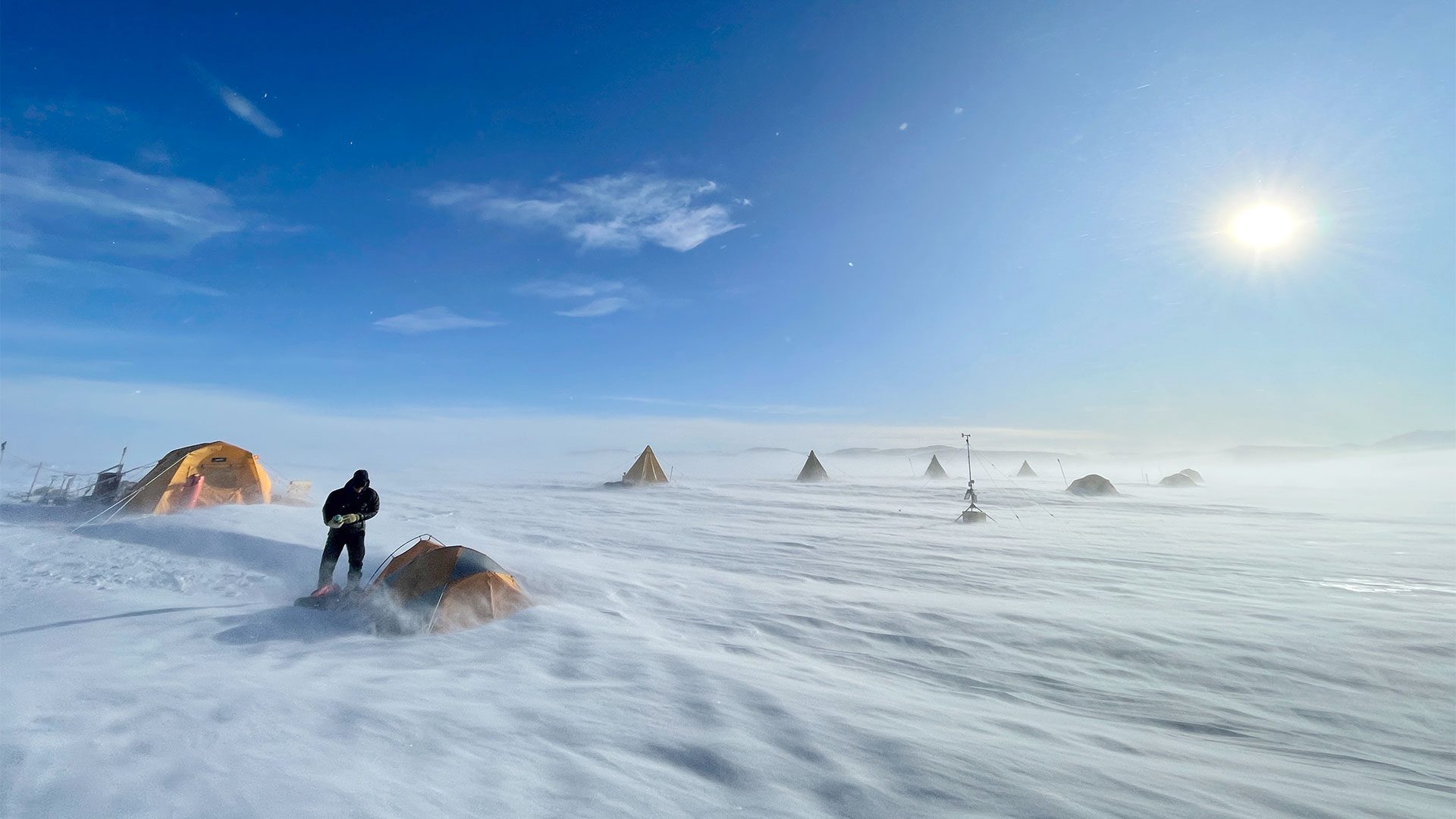
Crewmember Charles Fox looks for a place to launch one of the expendable conductivity-temperature/depth (XCTC) probes. The task of finding a suitable location was made more challenging due to the darkness and constant blowing snow. (Photo by Evan Neuwirth, U.S. National Ice Center)
The primary objectives of the expedition, though, were to navigate along the international maritime boundary line in order to assert U.S. sovereignty and show that the country is interested and invested in the Arctic. It was also an opportunity to train the crew on piloting in harsh winter conditions. And there was another goal: to break the record for the furthest north a U.S. surface vessel has sailed in winter.
As Polar Star sailed north, several crew members played key roles in deploying the probes in small openings in the ice about every 12 hours above 65 degrees north. Among the crew was Lieutenant Lydia Ames, serving as the National Oceanic and Atmospheric Administration's science liaison officer, and Evan Neuwirth, a physical scientist and senior ice analyst with the U.S. National Ice Center.
They, along with several other crew members, released the 18" long probes from a hand-held launcher by leaning over the side of the boat and directing the launcher downward. As a probe slid from the launcher and descended to the seafloor, a thin connected copper wire spooled out to deliver the hydrographic data to a computer onboard the ship until a few minutes later when somebody snipped the wire. Ames says the information from the probes would help to fill "a big vacuum of data." Pickart was able to monitor the incoming scientific data from his office at WHOI.
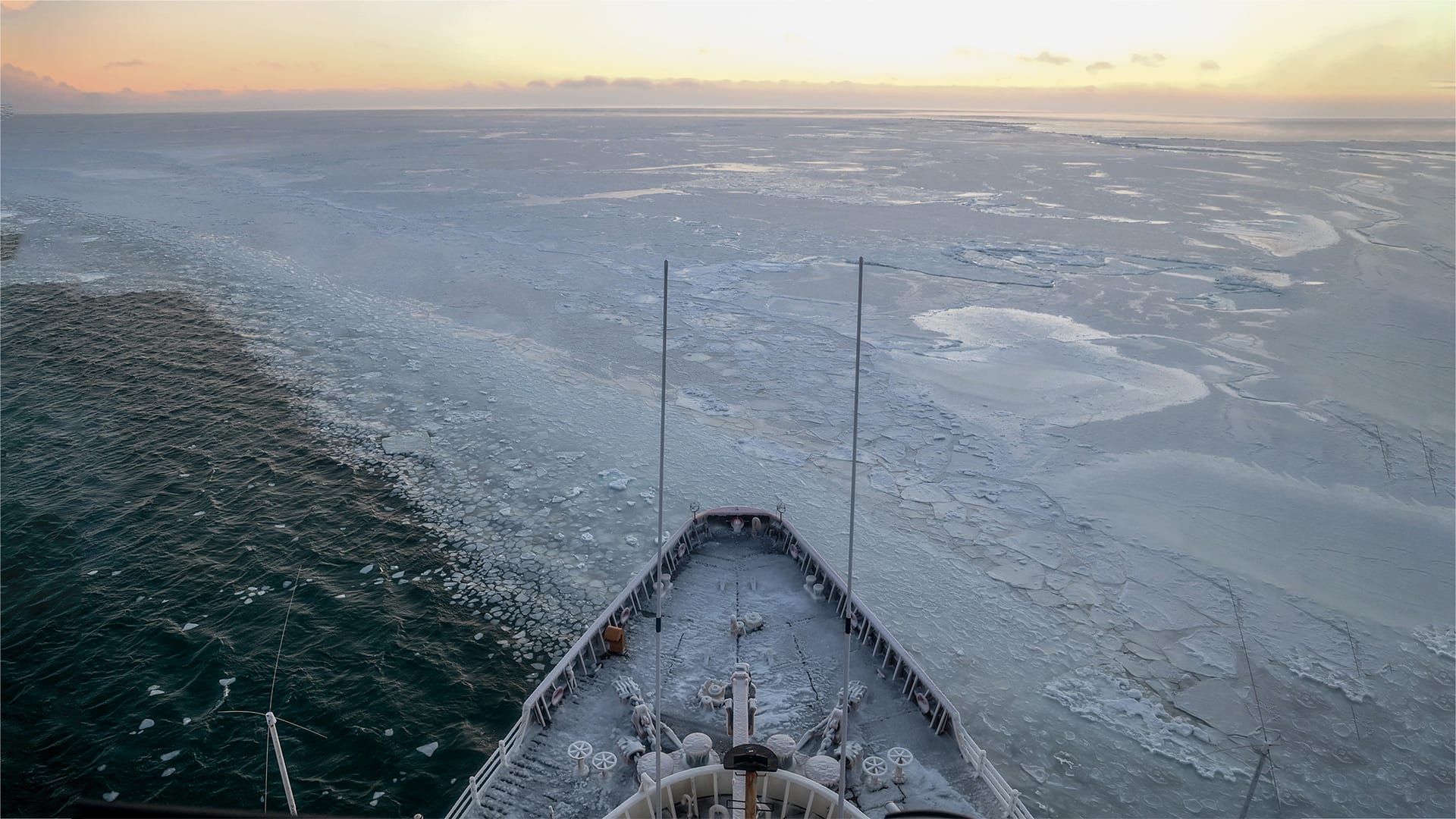
As Polar Star continued north, the ridged sea ice was so hard that the ship would make just a one- or two-mile advance during a four-hour watch. It was "tough sledding," says Woityra. The loud sound of the ship scraping through the ice around the clock was awful: like nails on a chalkboard, he says. Woityra says the crew had a hard time sleeping because they could feel vibrations in their chests. The temperature got down to negative 11 degrees Fahrenheit. But the biggest difficulty was the unremitting darkness of the far north in winter. Even with the ship's floodlights and spotlight, they could only see 100 yards in front of the ship. "It was like driving down a road in a snowstorm when you can't see past the hood of your car. Really challenging," says Woityra.

Large ice ridges and rubble, illuminated by the ship's searchlight, made it extremely challenging for the Polar Star to move northward through the Chukchi Sea. (Photo by Cynthia Oldham, U.S. Coast Guard)
Despite the conditions, the ship set a new latitude record. The old record, also set by Polar Star, was somewhere around Point Barrow, Alaska. So, the crew kept going until reaching the latitude of 72 degrees 11 minutes north, about 80 miles off the coast of Utqiaġvik, the northernmost town in Alaska, around 7:30 a.m. on Christmas morning.
Ames found out about the new record that morning, after she climbed up the ladder to the highest vantage point on the ship, the aloft conning tower, known as the aloft conn, where the pilot operates the ship through ice. After entering the tower, gaining situational awareness, and examining the electronic chart display information, Ames said to her colleague up there, Coast Guard Lieutenant (junior grade) Lauren Kowalski, "Oh, we're going south. Cool. How far north did we get?" They high-fived. More celebrations followed later.
Some of the difficult environmental conditions onboard the ship felt like "a suffer fest in the moment," says Neuwirth. "But if you look back, you're like' wow, we did this together'. We really accomplished something big and did something cool for our country."
And, along the way, they also did something really cool for science.
As Pickart put it, "We got this once-in-every-40-years snapshot of the winter water formation." In the coming months, Pickart and his team will be analyzing the data and comparing them to additional data collected in the same region a few months later by Sikuliaq, to help determine how the winter water moderates in spring.
This work was funded by the Office of Polar Programs at NSF.