Estimated reading time: 4 minutes
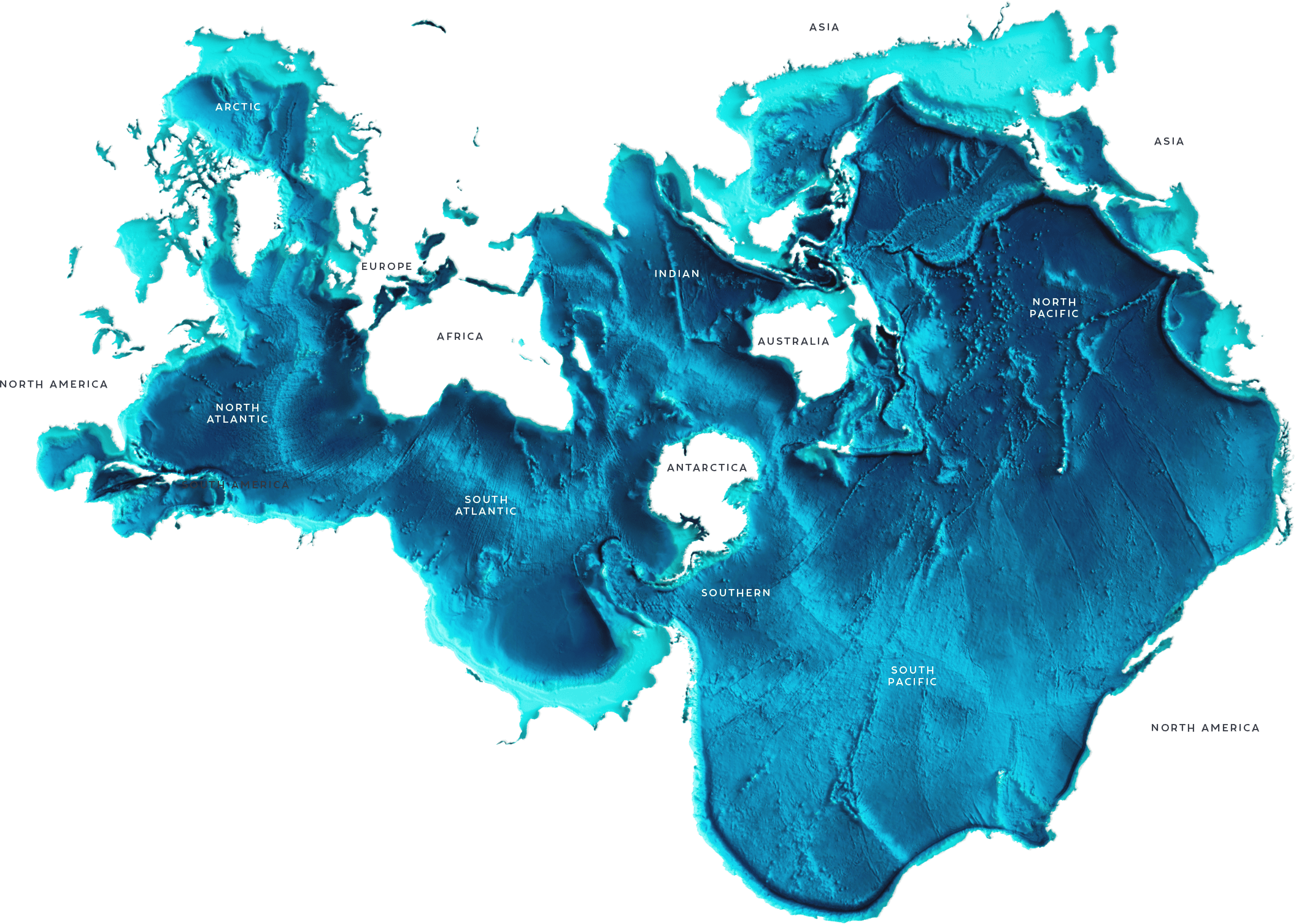
The ocean is constantly moving, circulating water, heat, salinity, and nutrients around the planet. While a big picture of ocean currents has been well established to widely explain how water and these tracers move throughout the oceans, variations in both space and time on the smaller submesoscale (1-100 kilometers) level are largely unresolved in both models and observations. At the same time people are interested in better understanding what happens on these local scales and how the smaller variations in currents affect biological productivity and influence water movement.
For example, in Cape Cod Bay, the water, on average, circulates counterclockwise along the coastline, slowing down as it approaches the more quiescent eastern elbow of the bay. But tides, winds, seasonal shifts, rainfall, and other influences from the atmosphere can alter the pattern of this flow. And because the water carries heat, nutrients, and salt within it, the distribution of these properties is affected.
The smaller-scale variation in circulation plays out in ways humans can observe. For example, sudden drops in water temperature can shock turtles and, unable to move, they float along with the surface currents and are found beached on the shore. Changes in temperature and distribution of nutrients influence the presence of harmful algal blooms, which can cause problems for shellfish and the humans that consume them. Our lab, which includes Irina Rypina, Alison Macdonald, Sachiko Yoshida, and me, is working to improve the understanding of ocean circulation and its temporal variability on these smaller scales so these phenomena and numerous others can be better explained.
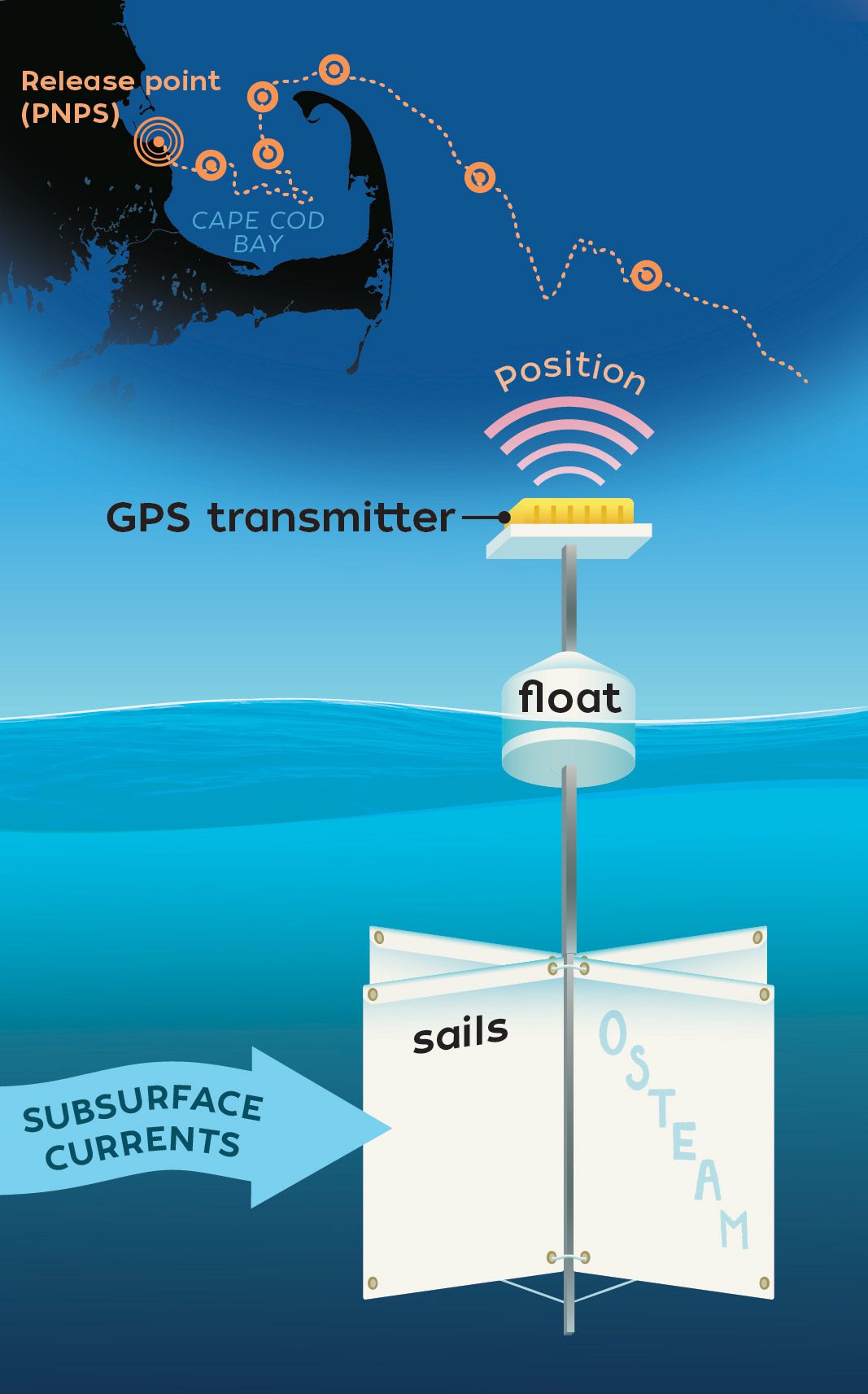
Drifter illustration by Charin Park, © Woods Hole Oceanographic Institution
One way to map the complex ocean circulation is using drifters, instruments that are set out into the ocean to follow the currents. Drifters are made of three main components: a GPS transmitter, a surface buoy, and an underwater sail or “drogue.” The sail allows the drifter to follow subsurface ocean currents, similar to a sailboat that’s been turned upside down so that it is moved by the water instead of the winds. A float at the top keeps the drifter from sinking and the GPS transmitter periodically sends the drifter's position to a satellite and then a scientist’s computer. By knowing the difference between a drifter’s position at two consecutive times, we can easily calculate the current velocity and direction, which makes drifters ideal instruments for mapping ocean currents and transport pathways.
The simplicity of drifters makes them relatively inexpensive (with GPS transmission being the greatest cost) and easy to build and work with, allowing professional researchers to collaborate with local schools and summer programs, thereby enabling students and teachers to actively participate in ongoing research. In August 2025, our team worked with the 2025 WHOI Sea Grant Ocean Steam Powered Women (O-STEAM) fellows, high-school-age bright young women from across Massachusetts, to build eight drifters that are currently being used to study some open questions about how ocean currents move in and around Cape Cod Bay.
Recently, our team has used ocean models to predict the spreading pathways of a potential release of wastewater from the Pilgrim Nuclear Power Station (PNPS) located in Plymouth, MA, motivated by local and state concerns regarding potential environmental impacts on fisheries, aquaculture, and tourism. Regional ocean models map currents on sub-kilometer and hourly scales, making them useful for studying the small variations we are interested in for multiple years. We found that the fate of the wastewater varies by season: more wastewater is able to leave Cape Cod Bay during spring and summer as compared to winter and fall, when it was essentially “trapped” within the Bay for longer than 2 months. Similar seasonal changes in water transport also hold true in our model for many other locations in Cape Cod Bay, not just for wastewater released at PNPS.

However, this important model-based finding needs to be verified with real data. To do this, we plan to release groups of 3 to 4 O-STEAM drifters every season for a year to investigate if the seasonal differences we found using the model can be confirmed by the drifters. The first two releases were carried out in October 2025 and February 2026 and the third release is planned for May 2026. If you would like to follow our blog about these and future O-STEAM drifter releases, please visit https://seagrant.whoi.edu/o-steam-drifter-blog/.

The drifter pathways collected from the October release are depicted above, with circles indicating where the drifters were released into the ocean and diamonds marking their location as of December 1, 2025. So far, the data collected from our first two releases has been extremely useful in revealing transport pathways within the bay and highlighting the processes and features that numerical models of Cape Cod Bay have trouble capturing. With this knowledge, we hope to improve our understanding of the complex and varying current system within Cape Cod Bay and, in turn, better predict the movement of various bio-geophysical tracers, such as environmental hazards, pollutants, nutrients, fish larvae, HABs, microplastics, and many others, within the bay.
Margaret Gregory is a fifth-year PhD candidate in the MIT-WHOI Joint Program. She studies the formation of waves over the continental slope (where the shallow continental shelf extends to the deep ocean floor) as well as transport within Cape Cod Bay.