To Catch an Erupting Volcano
Rapid mobilization team springs into action
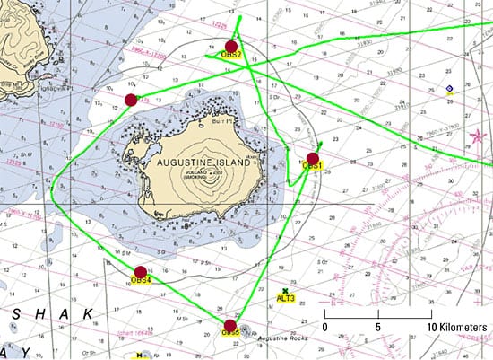
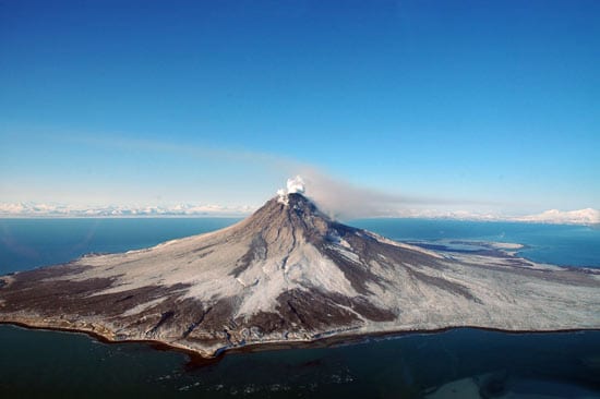
Augustine, an island volcano 170 miles southwest of Anchorage, Alaska, began erupting in December 2005. By February, Uri ten Brink of the U.S. Geological Survey (USGS) in Woods Hole had mobilized a team to seize the rare opportunity and deploy five portable ocean bottom seismometers (OBSs) on the seafloor around Augustine.
The OBSs came from the U.S. national Ocean Bottom Seismograph Instrument Pool at Woods Hole Oceanographic Institution, which builds and operates deep-sea seismic equipment for use by the scientific community. After six weeks, the team retrieved the OBSs in April. The seismic recordings they collected should reveal what goes on inside and underneath an active volcano, improving understanding of the magmatic processes that precede and lead to eruptions, said ten Brink, who is an adjunct scientist in the WHOI Geology and Geophysics Department.
The operation off Augustine Island, funded by the USGS’s new Rapid Mobilization program, was the first OBS rapid response to a potential natural disaster in U.S. waters, ten Brink said.
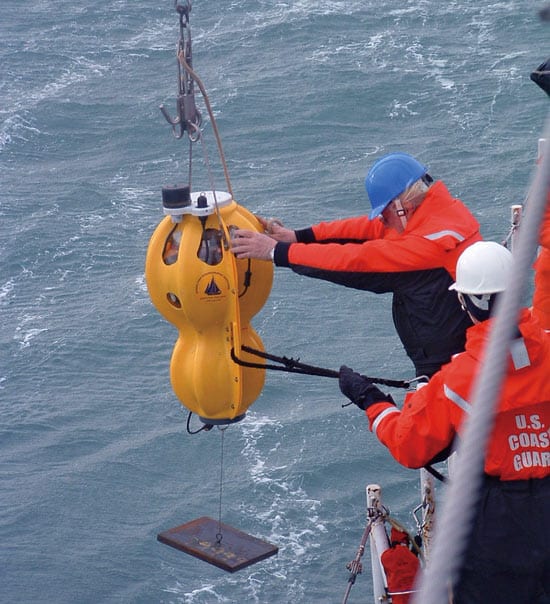
“We put OBS technology to use, capturing volcanoes and other seismic events as they happen, where they happen,” said WHOI Senior Engineering Technician Vic Bender, who helped deploy and retrieve the OBSs from the U.S. Coast Guard Cutter Roanoke Island.
“He knows the OBS inside and out,” ten Brink told a local newspaper, The Homer News. “He (is part of the team that) actually built them, and when something doesn’t work, he is the guy you want to have.”
Weighing 100 pounds each, the OBSs are easy to ship and can be deployed and retrieved from many types of ships. They are neutrally buoyant and are sunk to the ocean floor and maintained above it with a small weight. They can record data for several weeks, until their batteries run out. Then they are recovered by ship, which sends an acoustic signal to the OBS to release its weight.
Placing seismometers on the seafloor, rather than on the volcano itself, provides advantages, ten Brink said. On the ocean floor, the seismometers are beyond the range of noise generated by ocean waves, which can mask seismic signals. Often, that confounding noise is also amplified by loose rocks that make up the flanks of many volcanoes, he said.
Positioning seismometers around (rather than atop) the volcano also gives scientists the ability to record and triangulate signals from many angles and from deeper beneath the volcano. That enhances scientists’ ability to more accurately locate earthquakes caused by magma and other fluids moving under the volcano and to glean a better picture of the volcano’s internal structure, ten Brink said.
Slideshow
Slideshow
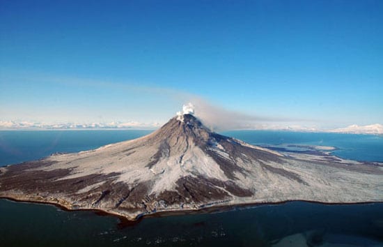
- When Augustine Island volcano off Alaska began erupting in December 2005, researchers rapidly mobilized to deploy instruments to monitor it. (Photo by T.A. Plucinski, Alaskan Volcano Observatory/U.S. Geological Survey)
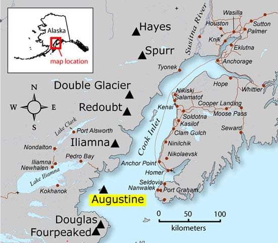
- The volcano on Augustine Island is located in Cook Inlet, about 170 miles southwest of Anchorage, Alaska. (U.S. Geological Survey)
- Vic Bender, a senior engineering technician at Woods Hole Oceanographic Insitution, deploys a 100-pound ocean bottom seismomemter from the national Ocean Bottom Seismograph Instrument Pool at WHOI in February 2006. The NOBSIP builds and operates deep-sea seismic equipment for use by the scientific community. (Photo by McKibben Jackinsky, The Homer News)
- Five ocean bottom seismometers (red dots) were deployed around the Augustine volcano in February 2005 and retrieved in April. The seismic recordings they collected should reveal what goes on inside and underneath an active volcano, improving understanding of the magmatic processes that precede and lead to eruptions. Green lines indicate the ship track of U.S. Coast Guard Cutter Roanoke Island. (Courtesy of U.S. Coast Guard Cutter Roanoake Island)
Related Articles
- How did the ocean remain so quiet during Tonga’s eruption?
- Spock versus the volcano
- In Search of the Pink and White Terraces
- ROV Jason Images the Discovery of the Deepest Explosive Eruption on the Sea Floor
- Undersea Asphalt Volcanoes Discovered
- Deeply Submerged Volcanoes Blow Their Tops
- Robot Paints Stunning Map of Deep-sea Volcano
- Plumbing the Plume That Created Samoa
- New Wrinkles in the Fabric of the Seafloor
Featured Researchers
See Also
- Latest Augustine activity from the Alaskan Volcano Observatory
- U.S. National Ocean Bottom Seismograph Instrument Pool
- Rapid Mobilization of Ocean Bottom Seismometers from the USGS Woods Hole Science Center
- Stories in the News, Ketchican, Alaska

