The ocean weather nexus, explained
The vital role of ocean observations in extreme weather forecasting
 This article printed in Oceanus Winter 2025 - SPECIAL ISSUE
Estimated reading time: 6 minutes
“Drought Deepens Across the Northeast.”
“Hurricanes Milton, Helene Taking Heavy Toll on Mental Health in Florida.”
“California Braces for Another Atmospheric River.”
These headlines, once rare, now feel routine—stark reminders of a climate in overdrive. From 1980 to 2024, the National Centers for Environmental Information within the National Oceanic and Atmospheric Administration (NOAA) recorded a whopping 403 “billion-dollar” disasters, one-third of which occurred in the past five years alone. The list includes everything from wildfires and droughts to tornadoes and hurricanes, flash freezes, and coastal flooding.
You’re not alone if you think these disasters are solely the consequence of a warmer atmosphere. Few are aware of the ocean’s enormous role in driving such weather. A 2010 Yale University study found that nearly half of Americans say they recognized the ocean’s connection to extreme weather. One-third of the study’s participants said they doubted whether the ocean-atmosphere connection was real.
“We’re seeing this rapid temperature rise, especially in the last two years,” says WHOI scientist emeritus Ray Schmitt. “That’s creating a feedback loop in the water cycle in a way many people don’t understand.”
The ocean and the atmosphere exchange energy back and forth in a process scientists refer to as flux. As the sea surface warms, it releases energy in the form of heat and moisture. The hotter the sea surface temperatures become, the more energy can be released into the atmosphere, where it can exacerbate extreme weather in several ways.
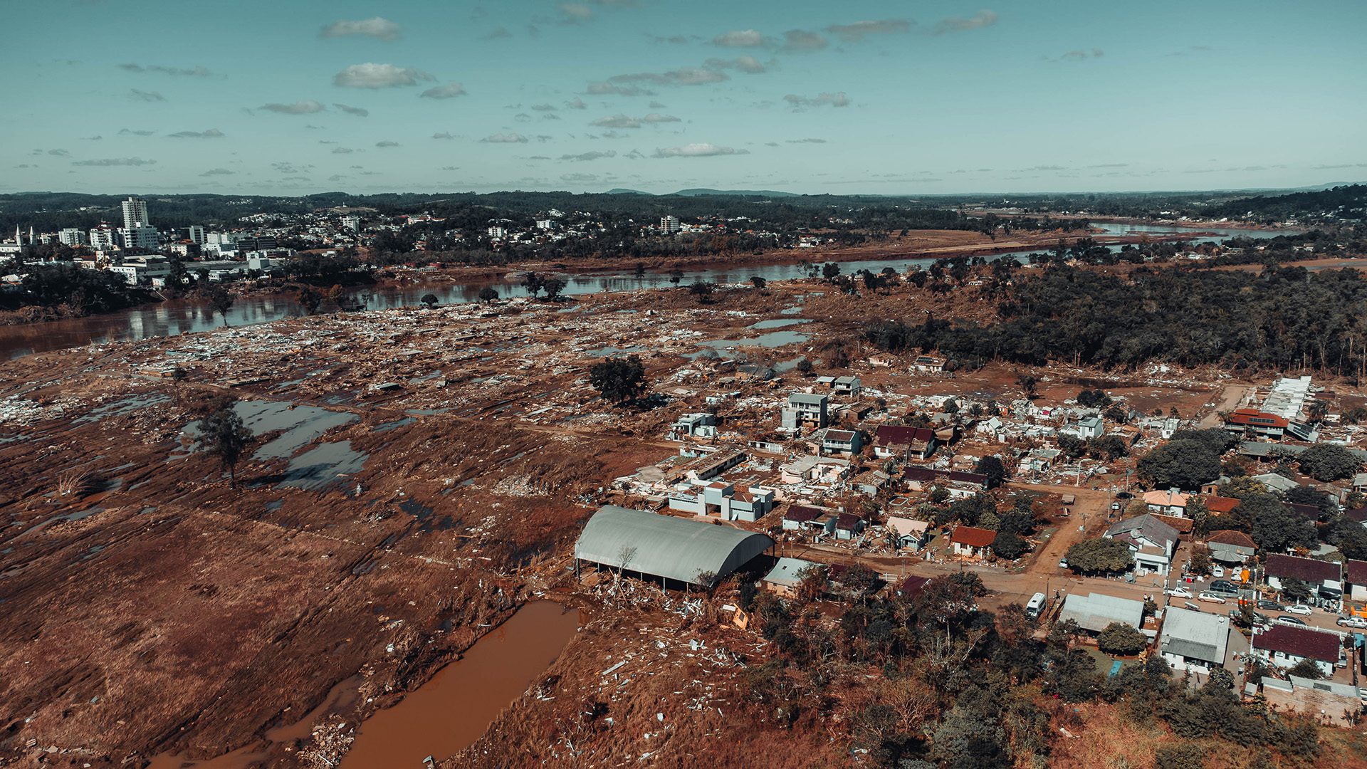
Hurricanes absorb heat and moisture from seawater in the Caribbean, intensifying their momentum as well as the amount of precipitation they unleash upon landfall. For example, after it passed over hot pockets of seawater in the Gulf, Hurricane Harvey dumped a record-breaking 27 million gallons of water over Texas in six days in 2017.
Atmospheric rivers are similarly influenced by this energy flux. These moisture-rich corridors form in the tropical Pacific, where converging trade winds force evaporating seawater into the atmosphere. This moisture condenses into heavy rain clouds that travel around the globe. In 2023, Google searches for “atmospheric rivers” doubled after one led to catastrophic flooding and mudslides in California that claimed 22 lives.

Weather forecasters need a lot of data to be able to predict and track these events accurately. Thankfully, ocean scientists can help, first by making direct observations through research cruises and remote sensing instruments, and second, by running computer simulations called ocean models, which help predict future conditions based on historical data.
“For a long time, there wasn’t much data coming from the ocean, and so it was easy for the meteorology community to forget, ignore, or neglect it,” says Schmitt.
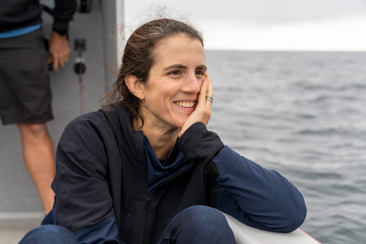
Schmitt is one of many scientists at WHOI who have demonstrated the predictive power of direct ocean observations—with salinity data in particular.
Salt concentrates wherever seawater warms and evaporates into the atmosphere. By studying satellite data on salinity levels, Schmitt has been able to reveal hidden patterns between evaporating seawater and nearby rainfall events.
“Rainfall is tough to predict,” says Schmitt. “But for certain regions, salinity is the best predictor on seasonal timescales.”
In 2016, Schmitt and his WHOI colleagues leveraged salinity measurements and artificial intelligence to create an algorithm that reliably predicted rainfall in the arid belt of Africa known as the Sahel. The team’s algorithm then made similar forecasts of rainfall in the American Midwest, winning a National Weather competition and leading to the establishment of an independent forecasting company, Salient Predictions.
Others researchers manage programs focusing on ocean temperature as a key indicator of extreme weather. In 2019, senior scientist Amy Bower and a contingent of WHOI scientists started a multi-year effort to continuously monitor ocean temperature—both at and below the sea surface—as a predictor of hurricane intensity in the Gulf of Mexico.
“Currents push heat around, and so we need to measure the temperature and the currents to know where that warm water is headed,” says Bower. “Once meteorologists know what the ocean’s heat content is and how it’s distributed, they can better predict both a hurricane’s path and its intensity.”
The research is part of the Understanding Gulf Ocean Systems (UGOS) Initiative, part of the Gulf Research Program of the National Academies of Sciences, Engineering, and Medicine. Bower’s team is responsible for launching and maintaining scientific buoys that collect key temperature data for hurricane forecasters around the country.
UGOS is just one of countless long-term ocean data collection efforts designed to improve weather forecasting. Since 1999, WHOI, Scripps Institution of Oceanography, and others have deployed and maintained more than 4,000 scientific floats as part of the Argo program. These buoys, along with autonomous robots called gliders, dive through deep columns of the ocean to record salinity, temperature, pH, and more, then transmits the data to publicly available online repositories.
Government organizations like NOAA have come to depend on data from these platforms to generate complex computer simulations that predict how the ocean could behave in the next days, weeks, and months, and, in turn, how that could impact regional weather patterns.
“The ocean subsurface is already sparsely sampled,” says NOAA ocean modeler Santha Akella. “So if, for example, the Argo floats or gliders were to disappear, then those parts of the ocean would be completely unobserved—we would have no idea what’s going on.”
Gathering ocean data will become increasingly important as extreme weather becomes more frequent. The sea has already absorbed over 90 percent of the excess heat generated by the burning of fossil fuels. Understanding where and how that heat is moving between the ocean and the atmosphere will be critical for weather alert services that are responsible for saving thousands of lives every year in the U.S.
“I think what’s happening now is, more and more, oceanographers and meteorologists are starting to see that we need to work together on these coupled ocean-atmosphere models,” says WHOI meteorologist Jim Edson.
To this end, WHOI has been a leader in developing long-term data observatories, including maintenance of surface moorings as part of the global OceanSITES network, and construction of the Martha’s Vineyard Coastal Observatory and its Air-Sea Interaction Tower. In 2016, in partnership with UW and OSU, WHOI launched the National Science Foundation-funded Ocean Observatories Initiative (OOI). Comprising five coastal and deepwater arrays and more than 918 scientific instruments, the program provides publicly available data to weather experts worldwide. Edson was appointed to lead OOI in 2022 and has since continued the program’s mission of providing publicly available data for weather experts around the world.
“What we do is deploy sophisticated instruments in difficult regions to collect the necessary data,” says Edson. “This infrastructure allows us to provide high-quality data.”
The global community continues to recognize the importance of collecting ocean data over the long haul. In 2021, the United Nations Assembly officially began the “UN Decade of Ocean Science for Sustainable Development.” One of its goals included the expansion of ocean observatories like OOI to track extreme weather and climate.
“If you want to understand the weather, you need to make long-term, continuous measurements of the ocean,” says Edson. “WHOI is one of the few institutions that is still going out and deploying these massive instruments to accomplish that.”