Extreme Measures
Superpowered Technologies Expand Our Reach to the World’s Most Challenging Environments
 This article printed in Oceanus Spring 2021
Estimated reading time: 15 minutes
THE OCEAN DOESN'T REVEAL ITS SECRETS EASILY. By observing natural phenomena, throwing instruments over the side of ships, and diving to ever-greater depths, humankind has gleaned an impressive understanding of our watery planet. Yet stubborn barriers to our knowledge remain. Extreme cold, depth, and pressure shroud a vast area of the ocean in mystery, withholding answers to such fundamental questions as what the Earth is made of-and how human activities are changing it. Now, with the help of superpowered technologies, researchers are pushing the limits of scientific inquiry, exploring where no scientist has gone before, and coming back with data from the utmost extremes.
"There’s this whole huge biosphere that we know exists below the seafloor, and its extent is still unknown."
—Ginny Edgcomb, WHOI microbial ecologist
DRILLING TO THE EARTH"S MANTLE
Think back to elementary school Earth science class. You may recall pictures of a sliced-open planet, revealing a layer cake of molten rock below our feet. For decades, it was accepted that there was just too much heat and pressure-not to mention no light or oxygen-for life to exist beyond a relatively thin layer of crust. Research has since revealed that when superhot seawater percolates through rocks below the ocean crust, the methane produced by that reaction might provide microbial life with a potent energy source. Although researchers have barely scraped the surface of this deep biosphere, further investigation could reveal primitive genes and geochemical survival strategies that hold the key to the origin of life on Earth-and possibly on other planets.
"There's this whole huge biosphere that we know exists below the seafloor, and its extent is still unknown," says Ginny Edgcomb, a WHOI microbial ecologist whose lab found evidence of carbon-recycling fungi and bacteria lurking in rocks 750 meters (nearly 2,500 feet) below the seafloor. "These extreme environments tell us about the limits of life on Earth, but the only way to get to them is with a drill."
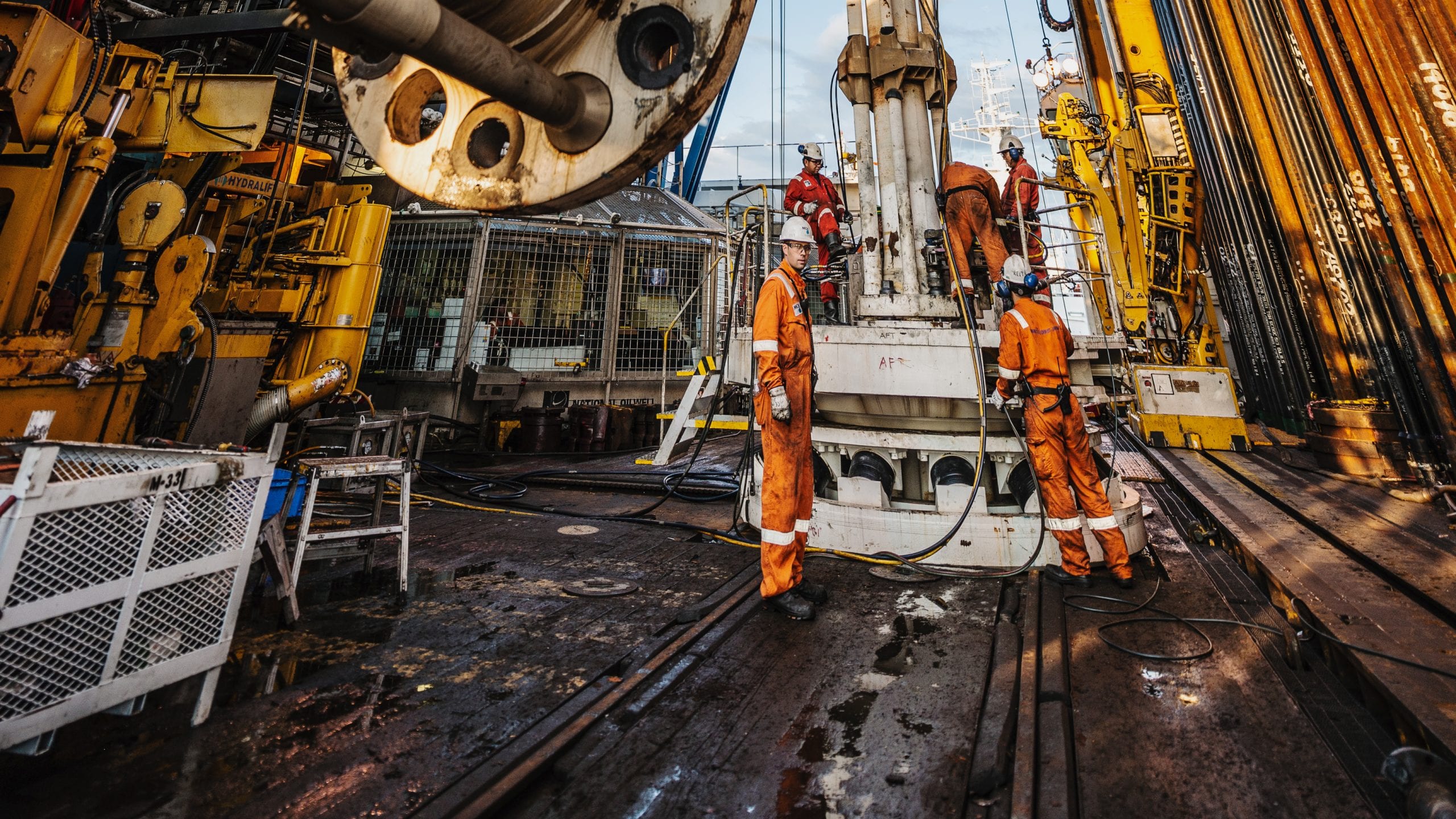
The next frontier in the search for life at the extremes is to go deeper-much deeper. Drilling to the Earth's mantle is actually more feasible in the ocean than on land because in some areas, lower crust is exposed on the seafloor. Getting to the transition zone between the Earth's crust and mantle-the Mohorovičić discontinuity, or "Moho"-has been something of a scientific Holy Grail since it was first attempted in 1961. The deepest hole ever drilled through ocean crust, on the second leg of an expedition led by WHOI geologist Henry Dick in 2006, bored 1,500 meters (5,000 feet) below Atlantis Bank, an area of the Indian Ocean where lower crust is exposed. As impressive a feat as that is (16 football fields could fit into that hole), the Moho is twice as deep in that area. Reaching 2,500 meters (8,200 feet) is a daunting task for even the most advanced ocean drilling technologies, not to mention an exorbitant expense.
"Crust is basically hell to drill. Rocks shatter and cause drill cones to break and bits to get stuck," says Dick, whose most recent attempt at Atlantis Bank in 2016 was stymied by stubborn rocks in what turned out to be a fault zone. But even rocks from shallower-than-desired depths have much to reveal about the oceanic crust, which Dick says is not nearly as uniform or thick as previously imagined.
"It's still an open question what the Moho is. We'd like to know if it's really the bottom of the crust and whether we can use it to determine how much crust there is around the Earth," Dick says. "Understanding how the crust of the planet forms is critical because we're looking at the exchange of heat, mass, and volatile elements between the interior and exterior of the Earth. If we can get there, we'll learn a great deal about how processes occurring on the sea floor affect global climate on the scale of tens of thousands of years."
Another chance to answer these questions may come as soon as 2024, when an international team of scientists plan to drill into the fast-spreading crust of Hawaii's North Arch using the Japanese deep-sea drill ship Chikyu. The multiphased "21st Century Mohole" project would make use of Chikyu's existing riser technology to drill a "pilot hole" 2,500 meters (8,200 feet) under the seafloor-which is already 4,500 meters (nearly 15,000 feet) below the ocean surface. In the meantime, the project proponents, led by the Japan Agency for Marine-Earth Science and Technology (JAMSTEC), will strategize a way to drill another 2,500 meters-for a staggering total of five kilometers (3.1 miles)- into the upper mantle.
"Nobody has actually tried this level of experiment before, using riser technology to drill into oceanic crust," says Greg Moore, a geologist at the University of Hawaii and one of the project's lead proponents. "But right now, we think we have the technology to drill this pilot hole, and that will tell us more about what's there and what challenges we will have as we go deeper."
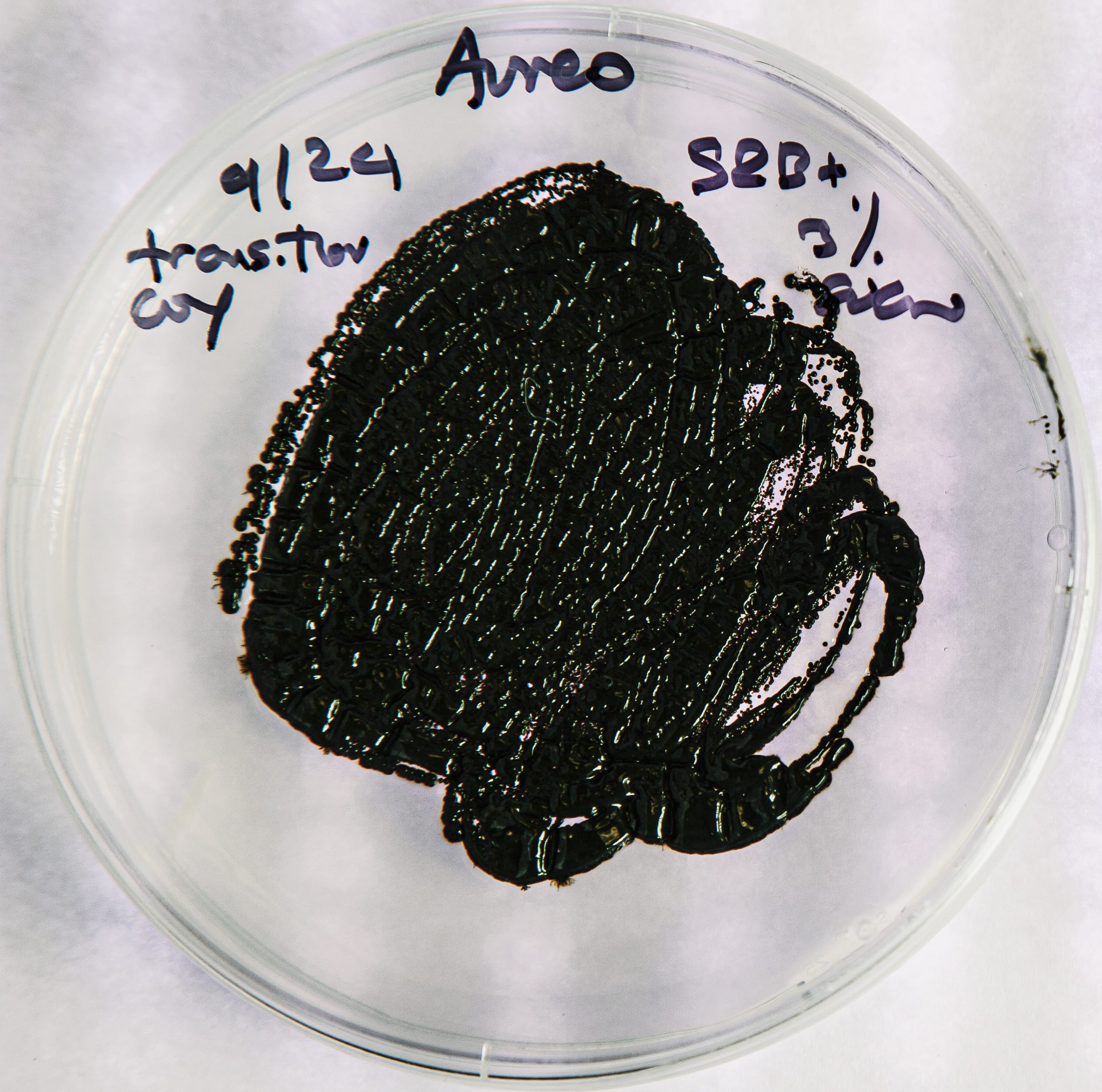
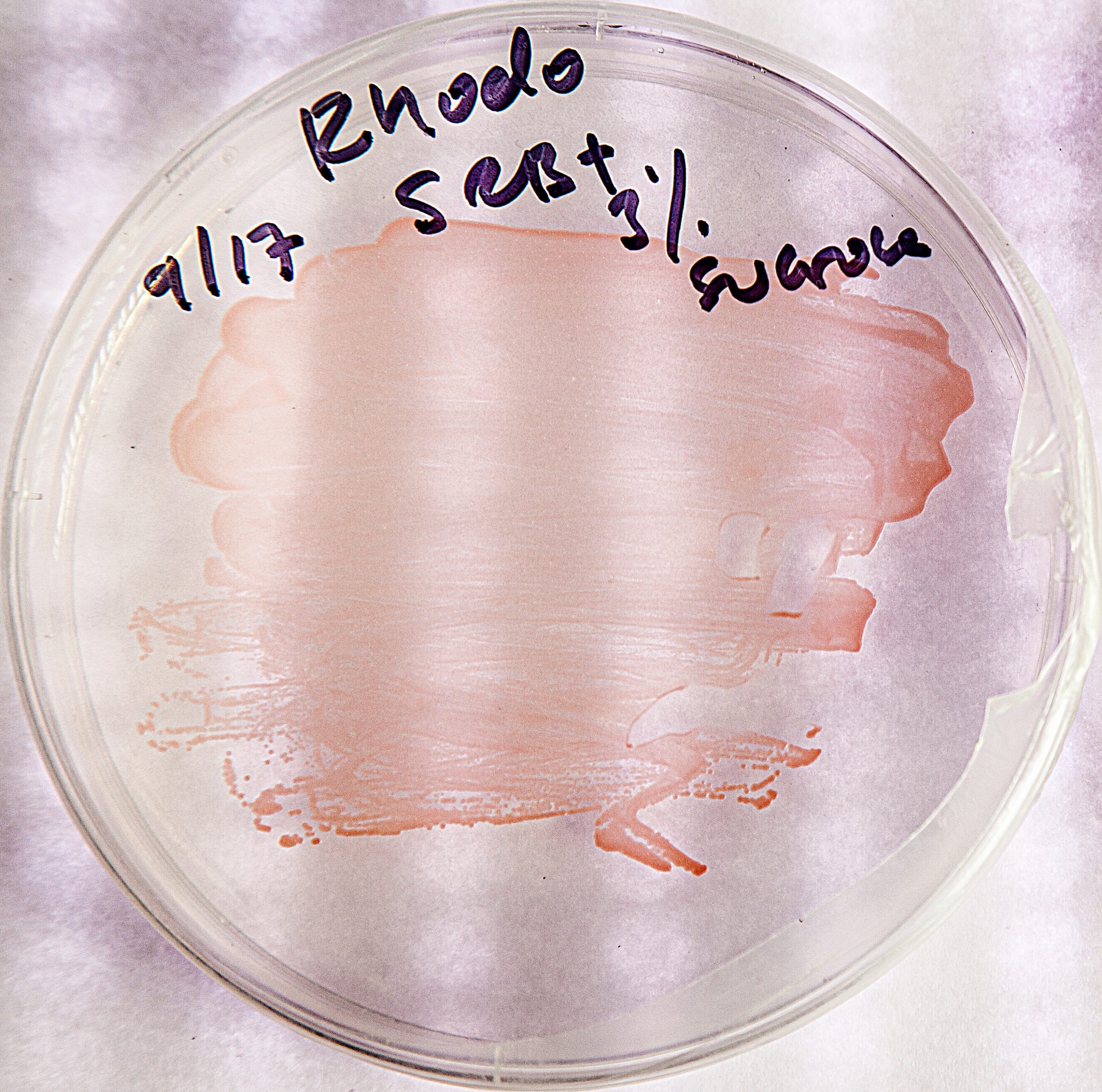
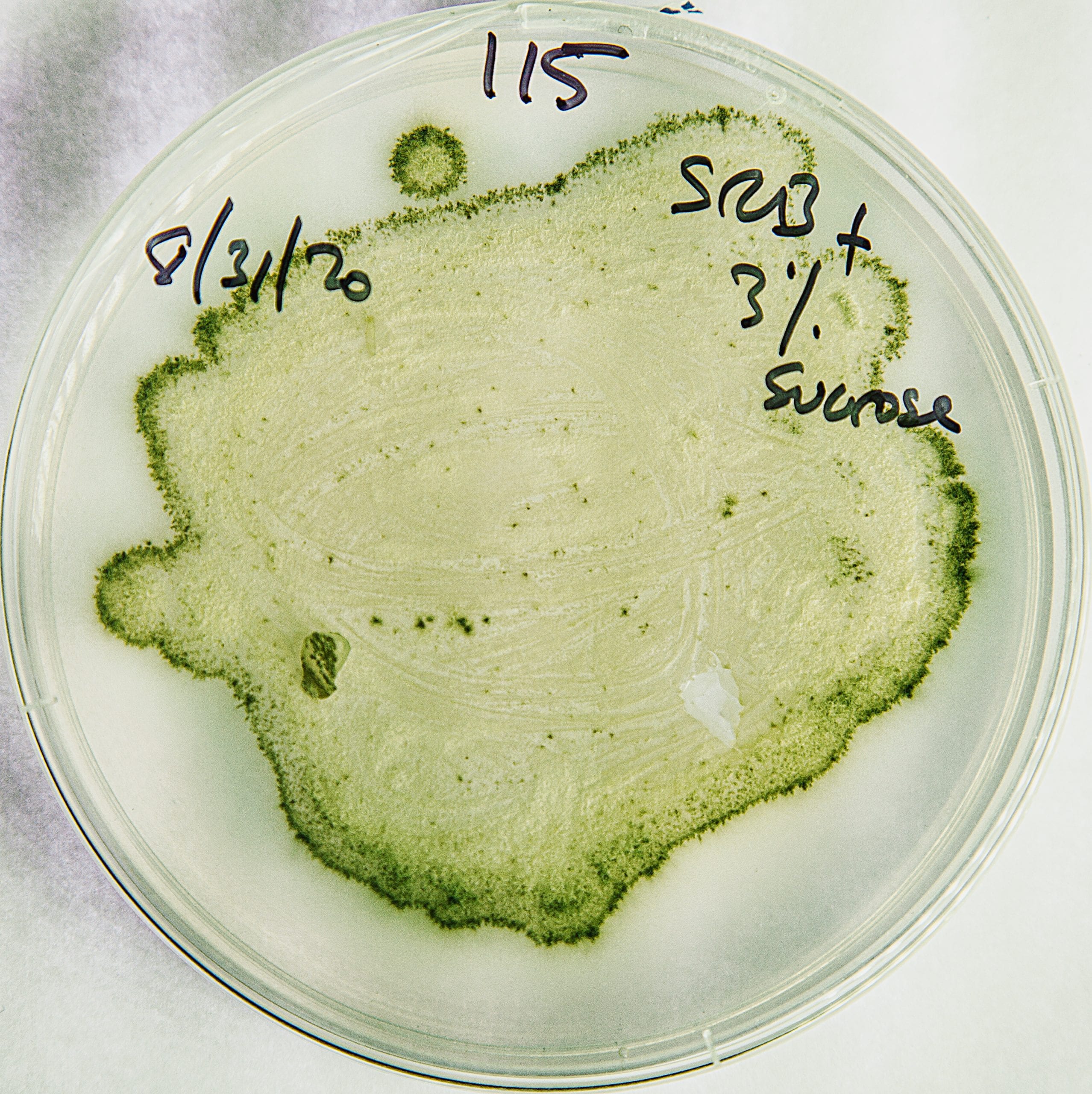
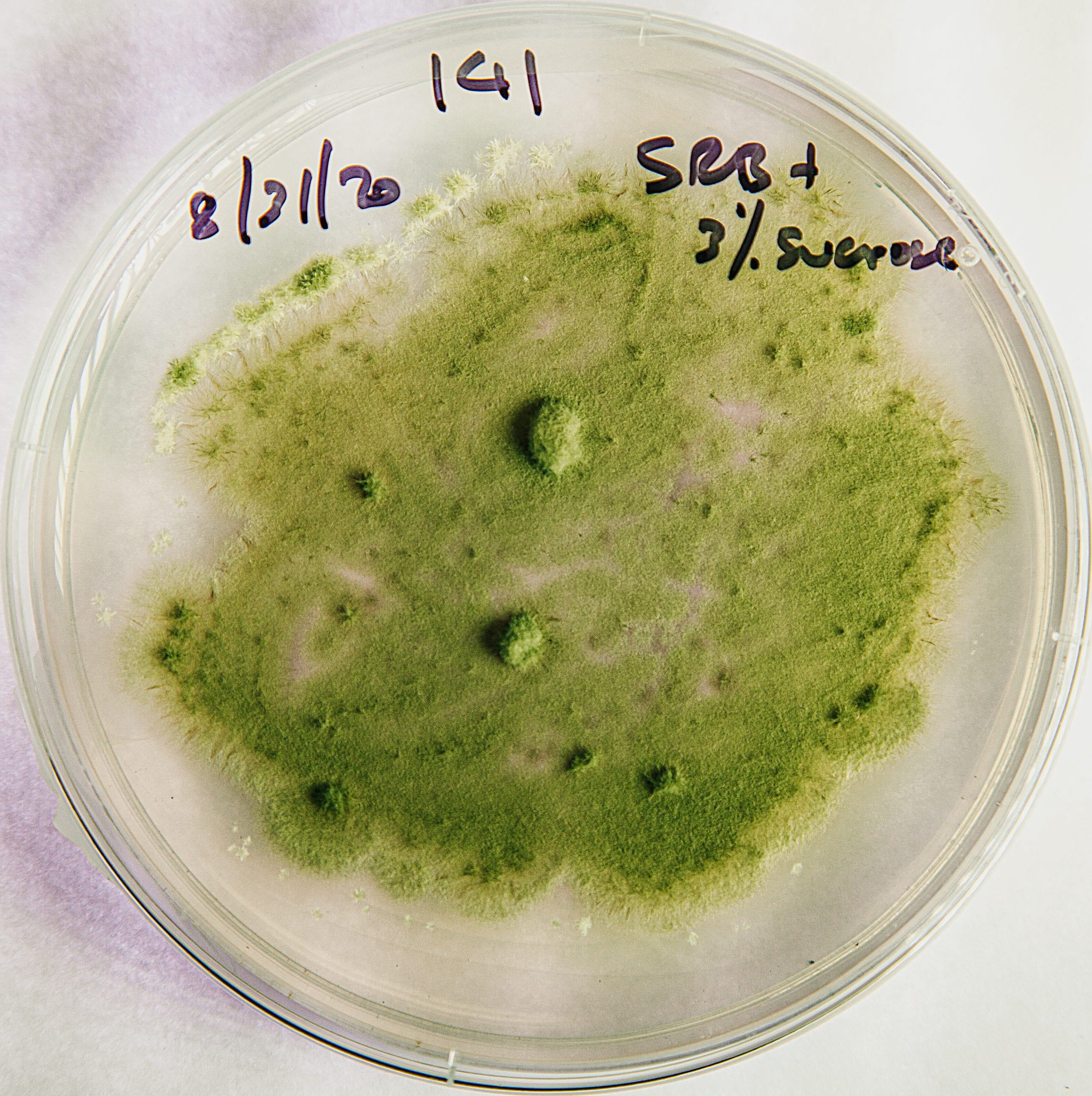
Deep-sea fungi (pink/black) and yeasts (green) are painstakingly cultured in Edgcomb’s lab. These slow-growing extremophiles play an important role in cycling nitrogen and carbon in the deep sea—and below the seafloor. (Photo by Daniel Cojanu, © Woods Hole Oceanographic Institution)
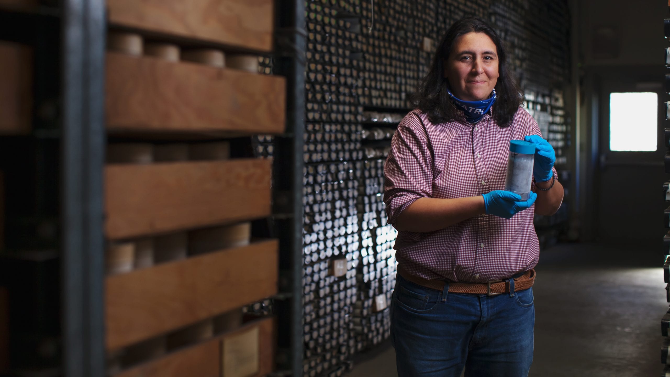
Paraskevi "Vivian" Mara, a research associate in the Edgcomb Lab, is investigating how deep-sea and sub-seafloor microbes break down hydrocarbons-potentially in cooperation with one another-which could lead to a bioremediation tool for cleaning up oil spills or developing new anti-microbial compounds or biosurfactants. (Photo by Daniel Cojanu, © Woods Hole Oceanographic Institution)
The challenges are extreme in and of themselves. Keeping the drill hole from collapsing is one; ensuring that the steel pipe and cement casing remain in place at increasing depth is another. Due to the age of the lithosphere at this site, researchers estimate that temperatures will be relatively cool, at around 150˚C (302˚F)-but that's still hot for drilling. They can only guess what kind of rocks the drill bit will encounter and the difficulty of getting through them. Moore says it will take at least two years to drill the initial "Pre-Mohole," and funding for the final phase must come through in time to keep drilling-or the project could suffer significant setbacks.
While the effort and expense of drilling to the mantle is extreme, lessons learned from the deep biosphere have direct implications for our search for life on other planets, says Frieder Klein, a WHOI geologist and co-proponent of the "21st Century Mohole" project.
"Microbes have learned to adapt to extreme environments," says Klein, who plans to join the project in search of methane bubbles and mummified microbes trapped in olivine-rich rocks below the seafloor. "You can study rocks on Earth and learn about similar processes we might find on other planets. Enceladus, Titan, and Europa likely host abundant olivine and also have water and heat, so as long as it's not too hot, they represent habitable environments."
GOING TO EXTREMES FOR EXTREMOPHILES
The deep sea hosts a wide variety of "extremophiles"-marine microbes that eke out a living in what we would consider unlivable temperature and chemical conditions. While it's easier to reach extreme habitats in the water column than below the Earth's crust, the relatively low abundance of deep-sea microbes means that special tools are required to capture them.
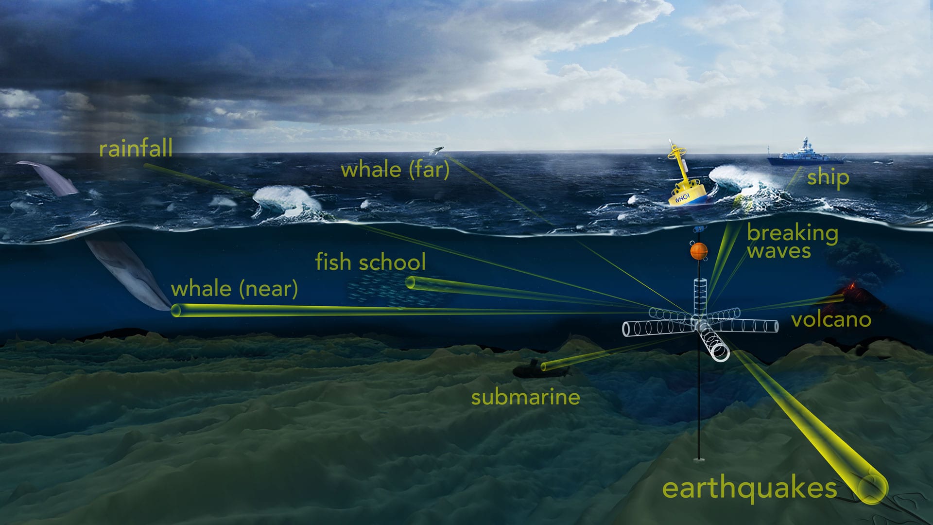
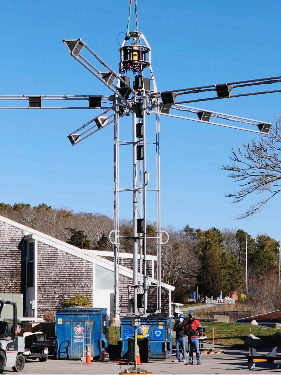
To probe the ocean’s opaque interior, sound is one of the most efficient tools available. WHOI scientists have developed an “acoustic telescope” to “see” into a noisy ocean and pick out unique sounds produced by distant acoustic phenomena, such as whale calls and fish schooling, as well as the rumble of earthquakes, volcanoes, and storms. Illustration by Natalie Renier, WHOI Creative
SEEING WITH SOUND
In the ocean, sound can travel as fast as a speeding bullet-and much farther. A team led by WHOI scientists Ying-Tsong "Y.-T." Lin is leveraging this acoustic superpower to eavesdrop on the ocean soundscape in three dimensions. (Take that, Superman!)
Much like an optical telescope brings faraway planets into focus, the WHOI-Keck 3D Acoustic Telescope gives scientists the ability to tune into marine creatures, man-made vehicles, and natural phenomena thousands of miles away. But instead of just "looking" in one direction, the 3D telescope creates a globular soundscape. This is possible due to an umbrella array of 25 underwater microphones (called hydrophones) and still more hydrophones placed along a stretchy mooring cable. Scientists are now able to pinpoint where a broad range of acoustic frequencies are coming from-simultaneously.
"Sound contains tremendously important environmental information," says Lin. "If you can locate where the sound comes from in three dimensions, you can extract concrete information. Once we know that, the ocean becomes more transparent."
Attached to a surface mooring at the edge of the Northeast U.S. continental shelf, the acoustic telescope takes advantage of the Ocean Observatories Initiative (OOI) Pioneer Array's satellite connection to send data to supercomputers on shore, which identify sounds using artificial intelligence.
The ultimate goal, says Lin, is to build an array of acoustic telescopes capable of recording the soundscape of an entire ocean basin. Integrated with oceanographic and meteorological sensors, the data collected by such a network could be used to evaluate how natural phenomena and ocean chemistry are changing over time.
Traditionally, deep-sea water samples are taken with Niskin bottles attached to a conductivity, temperature, and depth (CTD) rosette. After the CTD comes back on board a ship, scientists must filter copious amounts of water and pray that they retrieved enough microbial biomass to run an experiment or view under a microscope. That arduous process prompted Edgcomb and WHOI biogeochemist Mak Saito to team up with engineers to develop instruments capable of filtering water samples at precise points, thousands of meters under the ocean surface. These tools can work simultaneously with other shipboard operations and automatically perform basic lab functions, maximizing the efficiency of research cruises. That's helping researchers understand the role marine microbes play in the nutrient cycle, especially in oxygen-minimum zones and deep hypersaline anoxic basins (DHABs).
To save valuable (and costly) ship time, Saito teamed up with engineers Mike Jakuba (WHOI) and Chip Breier (University of Texas) to develop a deepwater sampling autonomous underwater vehicle (AUV) called Clio. "Until now this sort of microbiological sampling has been done with a student and a bottle and a filter," Saito says. "It's a very low-tech approach, so now with Clio we have the engineering to match our high-tech ships."
Traveling on a preprogrammed mission up to 6,000 meters (nearly 20,000 feet), the refrigerator-sized Clio samples with 2-centimeter (1-inch) precision, even as currents move, filtering thousands of liters of water over 14-hour dives. That rounds up enough biomass for researchers like Saito to perform proteomic and metallomic analysis back in the lab-or in other words, figure out the relation of enzymes and metals to life-sustaining processes at specific depths.
"Clio is designed to traverse ocean basins, sampling the entire water column from the surface to the bottom each day," Saito says. "It will allow us to get global ocean coverage, in a way that's really feasible for the first time. And that will enable us to understand the ocean's contribution to the Earth's life support system."
For researchers probing microbes at the genetic level, the quantity of biomass in a sample is less important than the quality. While studying a low-oxygen basin off Venezuela, Edgcomb and WHOI biologist Craig Taylor realized that their microbes weren't surviving the rapid transition from deep-sea temperature and pressure to the surface. Working with now-retired WHOI engineer Ken Doherty, they designed an instrument called the Submersible Incubation Device (SID) that could preserve microbes at deep-ocean conditions and perform time series experiments, making it possible to capture microbial gene expression as if it were happening at a depth of 1,000 meters (3,300 feet).
"It's important to be able to forecast and assess the impact of things like oxygen depletion on microbial processes, which are the foundation of marine nutrient cycles and food webs," says Edgcomb. "So to do that, you need to accurately measure the production of certain molecules behind those processes. Doing experiments and preserving samples right there, in situ, makes sense."
With additional funding from the National Science Foundation (NSF), Edgcomb and WHOI engineers Fred Thwaites, Ed Hobart, and Steven Faluotico have transformed the original SID into a robotic minilab that can be taken almost anywhere. Researchers can direct this Rube Goldberg-like device from a ship, much like a CTD, or it can be preprogrammed and attached to a mooring for months at a time. The most recent version-the Microbial Sampler-SID (MS-SID)-filters water 30% faster than previous models and can incubate and preserve microbial RNA at up to 6,000 meters (about 20,000 feet).
The MS-SID will be put to the test in an upcoming research cruise at the oxygen-minimum zones of the Eastern North Tropical Pacific, where Edgcomb and WHOI biologist Maria Pachiadaki will investigate fungi's role in degrading carbon particles. They also plan to bring it back to the Mediterranean Sea, where they first found evidence of microbes in DHABs a decade ago, and to hydrothermal vents at the Mid-Cayman Rise, in collaboration with WHOI microbiologist Julie Huber.
"These are all very challenging environments," says Edgcomb. "Now we have better tools to learn what enables microbes to survive and adapt to such conditions."
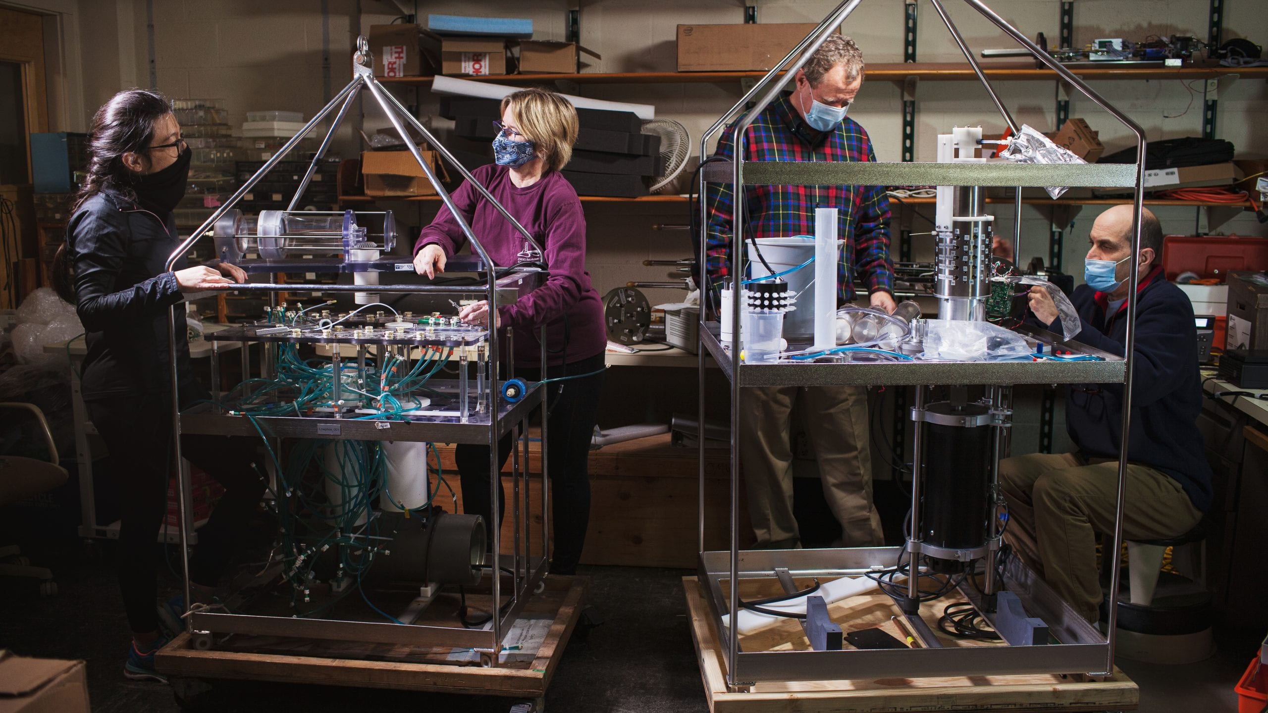
From left, WHOI biologists Maria Pachiadaki and Ginny Edgcomb move components from the Microbial Sampler-Submersible Incubation Device (MS-SID) to a new frame engineered by Fred Thwaites and Steven Faluotico. (Photo by Daniel Cojanu, © Woods Hole Oceanographic Institution)
SWIMMING UNDER ICE FOR WEEKS
In the polar regions of the planet, conditions are often more hostile above the surface than below the ice, where it can reach a balmy 1-2˚ C (34-37 ˚F). Measuring the thickness of that ice-and what's happening in the water underneath it-is critical for our understanding of how these extreme regions are changing. But it's easier said than done. Putting vehicles below ice is risky, and even the most robust technologies are thwarted by a lack of energy (batteries drain more quickly in the cold). Researchers really want to know how the polar oceans are changing over seasons and years, but they've had to rely on snapshots from probes here and there or estimates from satellite data.
Until now. New technologies developed at WHOI are proving their long-term, under-ice prowess, even in the most treacherous conditions.
The once far-out idea of putting robots below the ice has been in the works for over a decade. In 2014, the hybrid remotely operated vehicle Nereid Under Ice (NUI) broke the ice barrier with its ability to autonomously (or remotely) map and collect data, transmitting high-definition video and data back to researchers on a ship through a thin fiber-optic cable-all at 2,000 meters (6,560 feet) under the icy surface. The 40-kilometer (25 mile) range of this vehicle is greater than that of most tethered vehicles. But the taste of what NUI could do left researchers craving more time-and autonomy-under the ice.
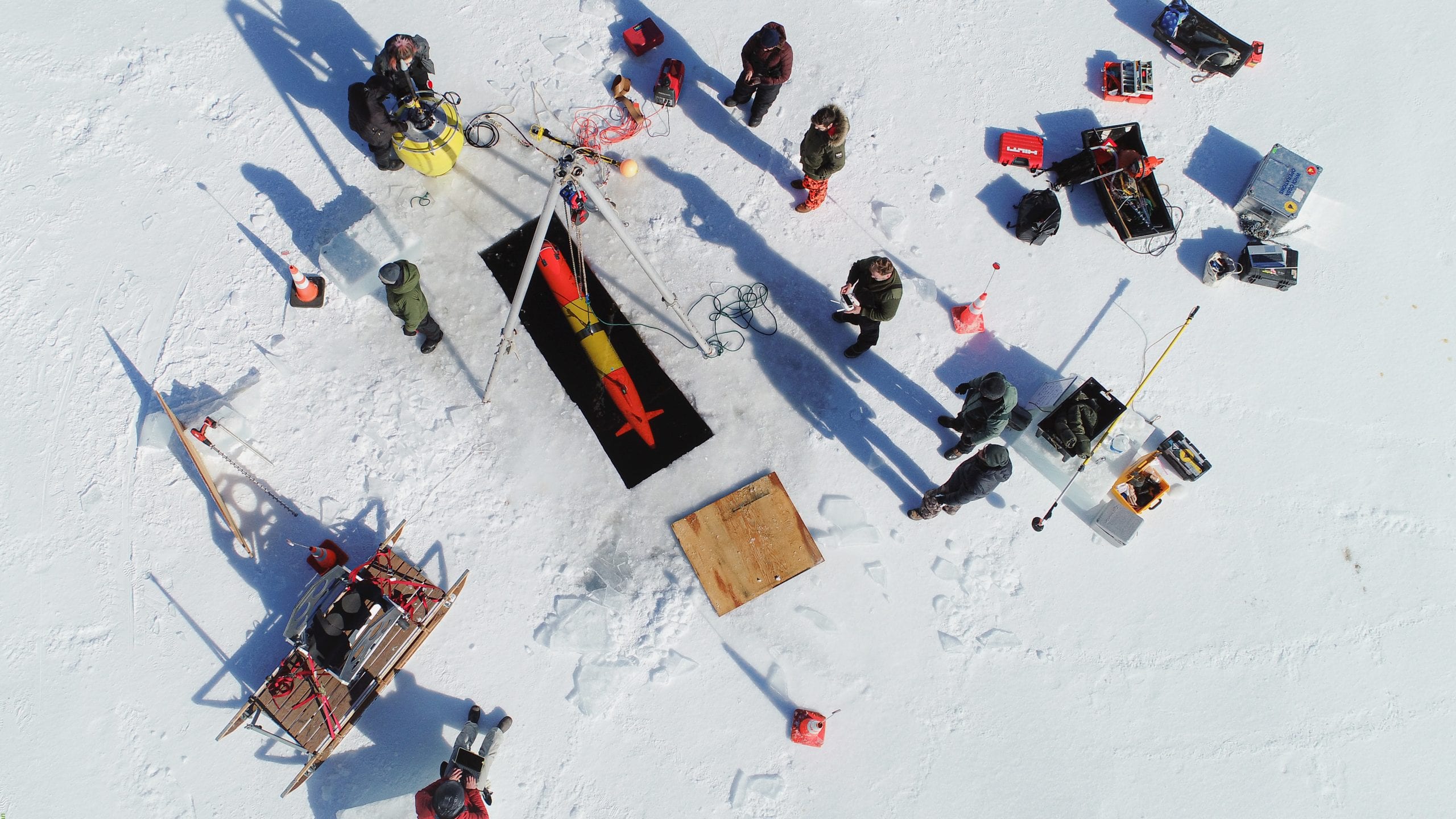
WHOI engineers test a long-range autonomous underwater vehicle under a frozen New Hampshire lake. Capable of traveling under ice for 15 days at a time, the vehicle is designed to track and characterize oil spills in polar regions without human intervention. (Photo by Sean Whelan, © Woods Hole Oceanographic Institution)
In an effort to measure a wide swath of ice-covered ocean, WHOI researchers Rich Camilli and Ted Maksym are developing a vehicle that blurs the lines between a buoyancy-driven glider and a conventional AUV. The suitcase-sized Polar Sentinel has a superefficient thruster that allows it to maneuver like an AUV, combined with "intelligent control policies" and pared-down sensors that bring its power budget under 10 watts, the equivalent of a CFL lightbulb. Designed to take measurements of ice thickness along the edge of the Arctic ice cap, the vehicle, says Camilli, will be able to gather crucial data about seasonal ice melt and growth over weeks or months.
"The ice in this region is dynamic and moves kilometers in a day," he says. "You currently can't operate safely with anything less than an icebreaker. This vehicle will be able to conduct a survey for hundreds of dollars a day rather than hundreds of thousands. From a scientific standpoint, it's exciting to be able to make observations in places that were previously unobservable."
In tests next summer, Camilli and his team plan to send the Polar Sentinel on a 900-kilometer (559-mile) round-trip to take measurements in a remote area of the Chukchi Sea. The next goal is to cross a polar basin like the Bering Sea, and eventually, traverse the Arctic ice cap, if navigational challenges brought on by the magnetic North Pole can be overcome.
As under-ice navigation technologies have evolved, so too have the applications. In collaboration with Monterey Bay Aquarium Research Institute, engineer Amy Kukulya and her team at WHOI's Scibotics Lab modified an AUV to track oil under ice, providing a rapid-response solution in the event of an oil spill in the Arctic. Capable of following a preprogrammed mission in an 1,800-kilometer (1,120-mile) radius, this long range autonomous underwater vehicle (LRAUV) is unique for its ability to sniff out chemical anomalies and track an oil plume without human intervention. It can remain under the ice at depths up to 300 meters (984 feet) for 15 days, gathering data and images that make it possible to measure and characterize oil droplets in real time.
In order for communications to work, buoys receive data from the vehicle by acoustic signal, then relay it to researchers, located anywhere in the world, via satellite. The vehicle and buoys can be deployed anywhere a helicopter can take them. Although the technology has yet to be tested in the extremes of the Arctic, these capabilities open up new horizons for remote, rapid-response research, from marine protected species to national defense, Kukulya says.
"Our goal is to develop reliable, easy-to-use technologies in the most complicated environments and get the data back as quickly as possible in order to mitigate damages," she adds. "This vehicle can help first responders and scientists figure out where to apply their resources, and extend the reach of those resources. The opportunities are endless."

