Luxury cruises with a side of climate science
WHOI-Ponant partnership gives scientists rare access to remote Antarctic glaciers—and a new way to engage the public
Estimated reading time: 4 minutes
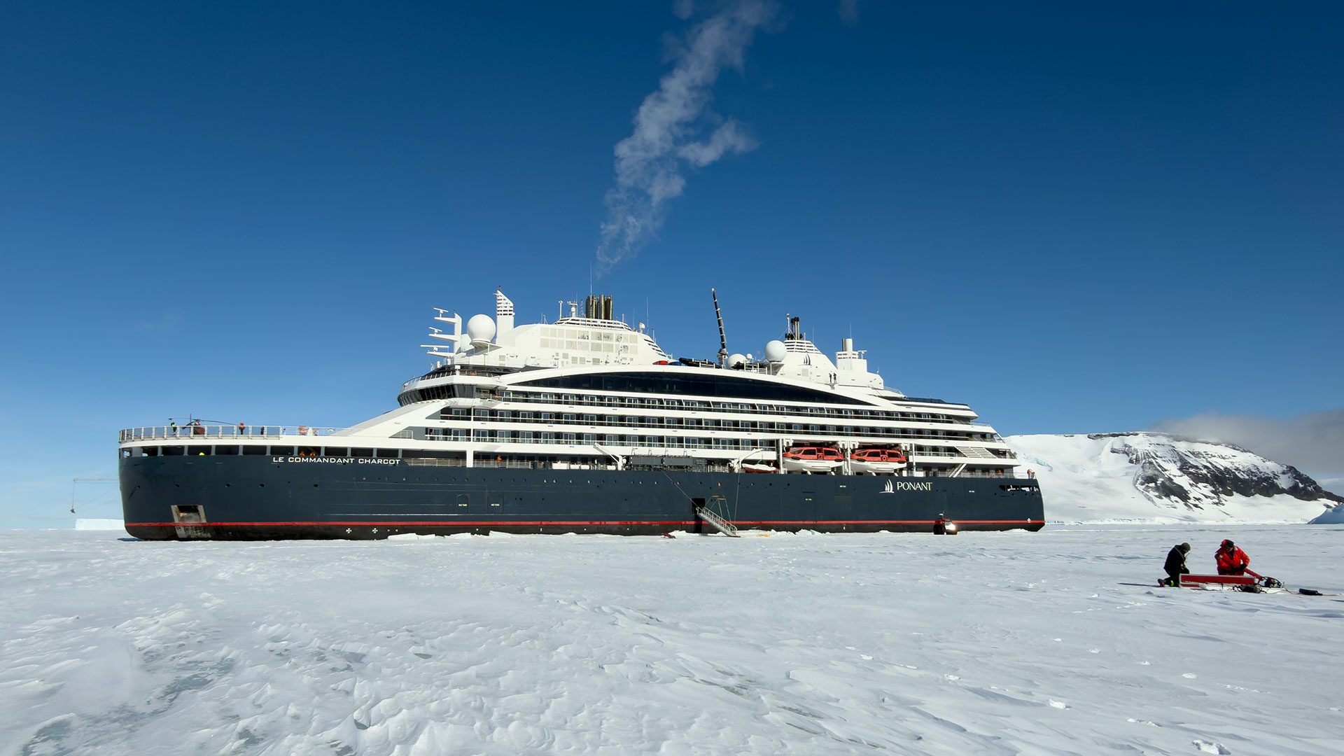
In early November 2025, Caroline Needell stepped off Le Commandant Charcot — a luxury cruise ship owned and operated by Ponant Explorations Group — onto a large sheet of sea ice on the eastern side of the Antarctic Peninsula. As the rest of the passengers looked for penguins, Needell and the ship’s science officer hiked toward the towering front edge of a nearby glacier.
Needell, a doctoral student in the MIT-WHOI Joint Program, was measuring the glacier’s height with a laser altimeter when she was interrupted by loud, two-toned honking. A group of four emperor penguins had spotted the scientists and decided to take a closer look. The three-foot tall birds dropped to their bellies to slide forward, then stood up to examine the researchers and honk before tobogganing nearer.
“They continued to do that until they got right up next to us, and then we had to get out of the way because they were going to keep coming closer,” Needell said. “Nowhere else in the world can a penguin interrupt you while you’re trying to work.”
The penguins were no surprise — the two-week-long trip was specifically marketed to guests as a penguin-watching excursion. But thanks to a new partnership between WHOI and Ponant, Needell was able to come aboard as a sponsored scientist and collect data as well.
“We’re really excited to be working with WHOI scientists,” said Megan Clampitt, Ponant’s head of science. “Not only are we gaining more information about the areas that we’re navigating through, but we’re adding to broader scientific knowledge and also giving this really enriching experience to the guests.”
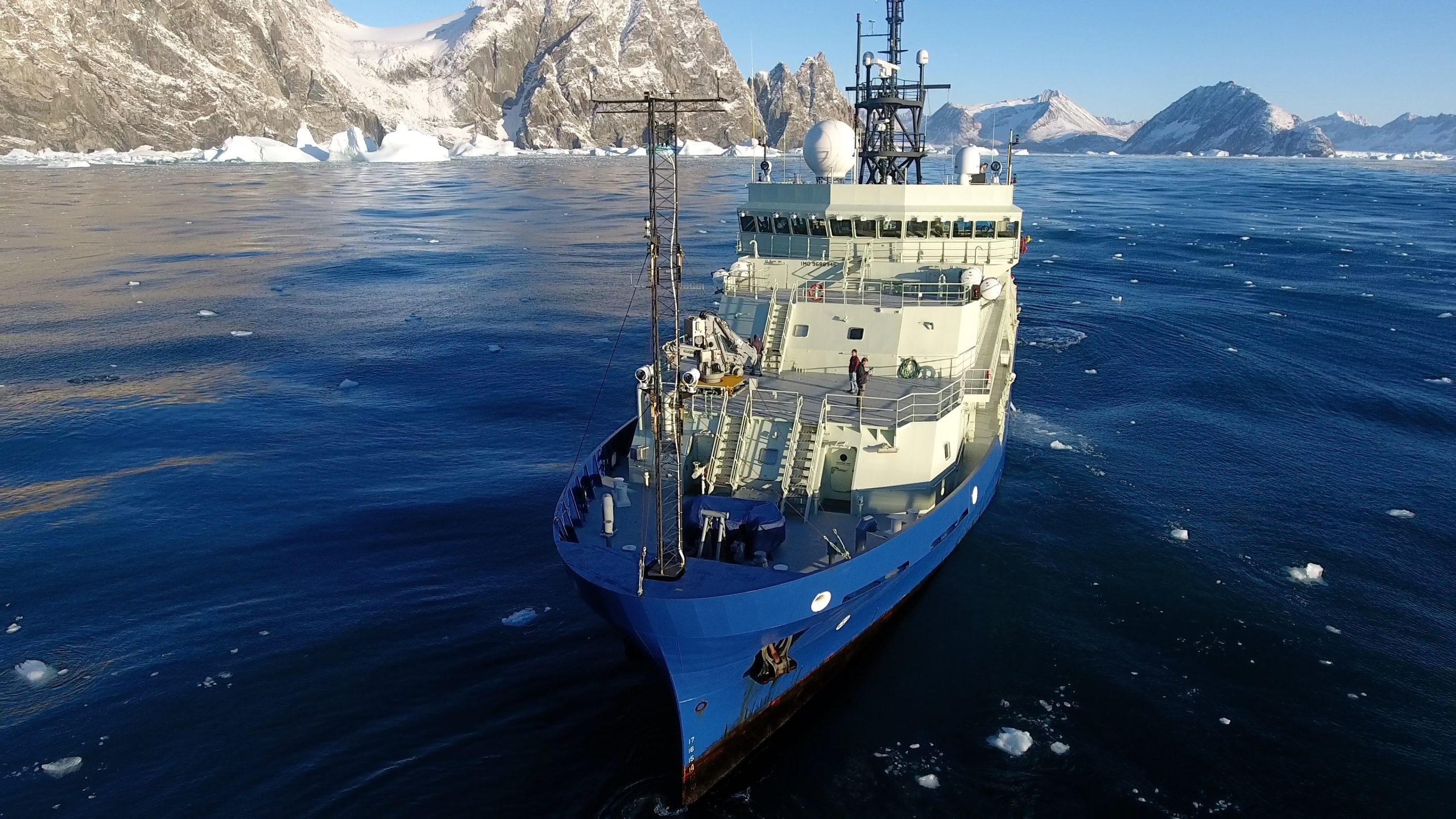
The three-year partnership is providing berths aboard Le Commandant Charcot for WHOI scientists to conduct fieldwork in some of the most remote parts of the planet. The 200-passenger ship was designed with spaces specifically dedicated to science, including wet and dry labs, and is a hybrid polar exploration vessel that can penetrate thick, multiyear sea ice (up to 2.5–3 meters or roughly 8-10+ feet). This allows it to navigate uncharted ice flows and visit areas of Antarctica and other regions that are beyond the reach of most passenger ships.

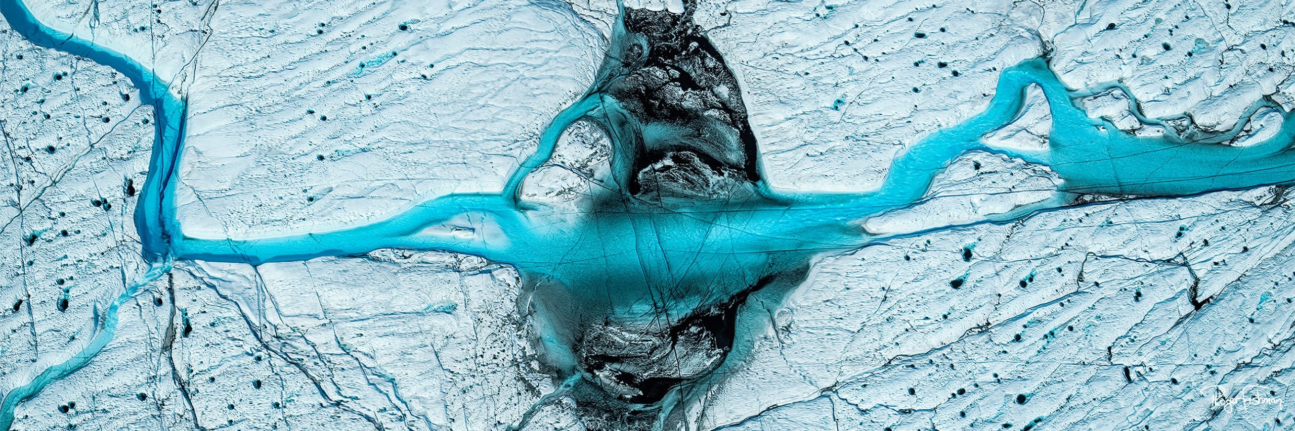
Needell’s glacier measurements were part of a larger project run by WHOI glaciologist Catherine Walker intended to improve our understanding of how the Antarctic Ice Sheet may change in the future. Antarctica’s ice sheet holds enough water to raise sea levels by 190 feet (58 meters), but estimates of how much will melt as a result of human-induced climate change vary widely.
“One of the leading reasons for uncertainty in future sea level estimates is that we don’t actually know how strong ice is. We don’t know at what threshold it will collapse under its own weight,” Walker said.
Current computer models typically estimate that the leading edge of a glacier will collapse when it’s taller than 295 feet (90 meters). But nobody has actually checked those measurements in the wild. Walker has been able to collect some data from satellites, but satellite orbits are often badly aligned with specific glacier orientations and measurements can be plagued by clouds, which occur more frequently along the coasts and the Antarctic Peninsula.
From Le Commandant Charcot, Walker’s students can get real measurements of the heights of glaciers where they meet the ocean. The scientists are also taking high-resolution photos of the fronts of glaciers — an angle that satellites can’t capture — to look for signs of weakening, such as cracks or deformation, and to later create 3D models of the glacier.

“Every piece of data that we collected was essentially new data — it’s amazing how much there is to be discovered in these areas and how little data we have,” said Bailey Fluegel, a doctoral student in the Joint Program who spent 14 days aboard Le Commandant Charcot in January.
On Fluegel’s trip, the cruise ship went down the western side of the Antarctic Peninsula, crossing into the Antarctic Circle. While each cruise has a general route planned, the actual itinerary may change day-to-day to provide the best experience for guests. For this project, the dynamic itinerary is not a problem, Walker said. And the fact that the ship rarely stays in one place for more than a day is actually a benefit. “You have far more of an opportunity to get a broader geographic distribution of data points than you would on a planned expedition on a research ship,” she said.

Conducting research from a cruise ship has other benefits as well – aside from the excellent meals and luxury accommodations. The researchers are surrounded by passengers, rather than fellow scientists. It’s a rare opportunity to engage a wider audience in science as it is happening, in the place where the results will matter most.
In addition to heading out every day to measure glaciers, Fluegel gave several talks, participated in lab tours led by Ponant’s science coordinators, and brought her instruments out onto the ice for a workshop. Passengers were able to experience science in real time as Fleugel collected data from the ship, as well as having the possibility to discuss her work and its implications more casually over dinner.
“It was this very distinct experience in which research and exploration and engagement were all reinforcing each other and building this genuine relationship between passengers and researchers,” Fluegel said. “It makes you feel like your science matters more, and has more power to it.”