
|
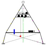
Bathymetry and site description of LEO-15
|
|
1999 Deployment
DATA FROM LEO-15 WHOI-DALHOUSIE Sediment
Transport Sensor Frame
Rotary Sidescan Sonar
Image
of the Seafloor
Shows the planform of ripple morphology. Bright colors are surfaces facing
towards the sonar.
Vertical Pencil Beam Sonar
Image
A vertical slice
of sonar imagery showing the bedform profile along a line and puffs of suspended
sediment.
1999 Deployment page....under development
|
|
1995 Deployment
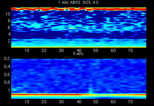
In this deployment the same acoustic backscattering systems that were
deployed in 1994 were used, but we also deployed a Rotary SideScan Sonar
(SSS) to make images of the bottom bedforms. Six tropical storm passed to
the east of the site in this deployment providing a very interesting data
set.
|
Instruments deployed on the 1995
LEO-15 Tripod.
|
|
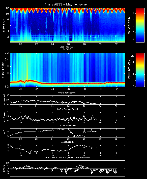
Overview of the 1995 deployment
Acoustic Backscattering time series with wave and current
forcing.
|

|
The Sector Scanning Sonar data is best viewed as a movie so you can see the
evolution of the ripple patterns in response to wave forcing. Before you
look at the movies take a look at
one frame
to famaliarize yourself with the movie data presentation format.
- Movie 1 (8.4Mb-mpeg
) shows ripples changing direction in response to swell
direction via a interesting "ripple kinking" mechanism
- Movie 2 (11.4Mb-mpeg
) shows the formation and onshore migration of the
largest ripples seen during the deployment.
- Movie 3 (6.3Mb-mpeg)
shows the erosion of these large ripples by first shorter
waves, and then a large current event.
|
|
|
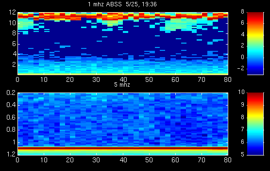
1994 Deployment
This deployment featured acoustic and optical backscattering measurements
of suspended sediment and water velocity measurements.

|
Overviews of the May and June
segements of the deployment
|

|
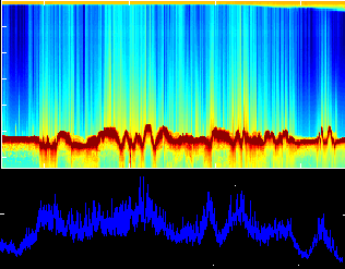
Plumes of sediment suspended
and advected by waves
|

|
Image and Movie
of biological scatterers gathering near a front
|

|
Acoustic scattering from bubbles
injected by surface waves
|
|
