Scientists aboard the R/V Atlantis recover an ocean-bottom seismograph (OBS) off the Galapagos Islands. Seismographs measure movement in the Earth’s crust, and scientists use data from these instruments to calculate the energy released by earthquakes. A recent $1 million grant from the W. M. Keck Foundation will allow a WHOI team led by geologist Jeff McGuire and John Collins, director of WHOI’s OBS Lab, to build and install the first seafloor geodesy observatory above one of the most dangerous faults in North America, the Pacific Northwest’s Cascadia fault.(Photo by Jeff McGuire, Woods Hole Oceanographic Institution)
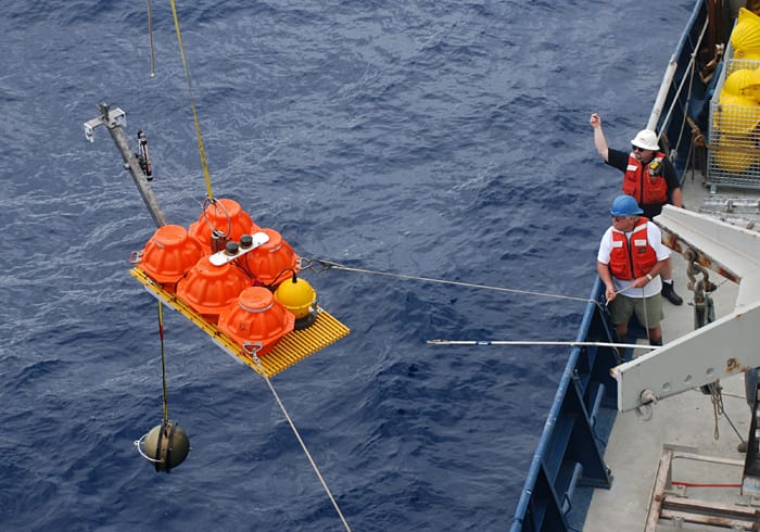
Image and Visual Licensing
WHOI copyright digital assets (stills and video) on this website can be licensed for non-commercial use upon request and approval. Please submit your request via our Media Request Form.
For assistance or accessibility accommodations, call (508) 289-2647.