 Two Remote Environmental Monitoring Units (REMUS) vehicles were stowed on R/V Neil Armstrong before the ship departed on the final leg of a three-leg expedition to service parts of the National Science Foundation’s Ocean Observatories Initiative (OOI) at the Coastal Pioneer Array. The array is located at a frontal boundary in the ocean where coastal and offshore waters meet and mix. During the cruise, WHOI engineer Amy Kukulya sent these vehicles on a trial mission, during which they traveled autonomously 45 kilometers along the edge of the shelf and dove hundreds of meters to collect information on ocean current circulation. (Photo by Ken Kostel Woods Hole Oceanographic Institution)
 The hybrid remotely operated vehicle Nereid Under Ice (HROV NUI) returns from a dive to the deck of the icebreaker Polarstern in October of last year. WHOI senior scientist Chris German led a team of scientists and engineers from WHOI's Deep Submergence Lab and NASA's Jet Propulsion Laboratory to conduct NUI's first-ever dives to the seafloor beneath 100 percent ice-cover in the Arctic as part of an exploration for seafloor hydrothermal vents. German's project, funded by NASA, seeks to help inform future exploration for life on other ice-covered ocean worlds—for example, Jupiter's moon Europa. (Photo by Chris German, Woods Hole Oceanographic Institution)
- In a collaborative project with researchers at Scripps Institution of Oceanography (SI0), a REMUS 600 autonomous underwater vehicle (AUV) equipped with imaging LiDAR—a remote sensing technology that uses laser light—was deployed off the SIO research pier in March 2016. It was the first in a series of tests that will pave the way for adding high-resolution, optical imaging and 3D sensing capabilities to AUVs. The vehicle, which is capable of diving to 600 meters, is part of the Remote Environmental Monitoring UnitsS (REMUS) family of AUVs designed and built by the WHOI Oceanographic Systems Lab. (Photo by Andrew Girard, Woods Hole Oceanographic Institution)
- WHOI research engineer Lee Freitag, aboard the U.S. Coast Guard icebreaker Healy, displays the electronics that is part of a long-range sound-based communication and navigation system that he and a team of WHOI engineers developed and tested in the Arctic. The new system sends sound signals under the ice between buoys and autonomous underwater vehicles, so the vehicles can explore, send information, and receive navigation commands without surfacing. The sound can travel for hundreds of miles through naturally-occurring sound-conducting channels in the ocean water. (Photo courtesy of Lee Freitag, Woods Hole Oceanographic Institution)
- WHOI engineer Jennifer Batryn (right) and Raytheon engineer Edward Colgan prepare pH sensors on a surface mooring for deployment from the R/V Neil Armstrong at the Ocean Observatories Initiative's Pioneer Array. The array is located at the edge of the continental shelf off New England, a region of interest to scientists for its biological productivity and transition from relatively fresh, nutrient-poor water near shore to saltier, nutrient-rich water in the deep ocean. The scientific instruments on the Pioneer Array's moorings and ocean gliders transmit physical, chemical, and biological measurements via satellite in near-real time to researchers worldwide, via an open access online data portal. The OOI project is funded by the National Science Foundation. (Photo by Véronique LaCapra, Woods Hole Oceanographic Institution)
- WHOI engineers Jim Ryder (center) and Mark Anderson (right) assist the U.S. Antarctic Program's Ross Hein (left) to deploy a scientific mooring at the Ocean Observatories Initiative (OOI) Global Array in the Argentine Basin. Because the four OOI Global Arrays are located in the deep ocean, their mooring lines can be several miles long. This bright orange float contains an acoustic release, a device that can be triggered from the ship to divide the mooring into two parts while it's still in the water, allowing the mooring to be safely recovered. (Photo by Mitch Elend, University of Washington)
- WHOI senior scientist Britt Raubenheimer gets help recovering an ultrasonic sensor she deployed near Duck, N.C., to measure beach erosion and waves during Hurricane Matthew. Raubenheimer lost her sight more than 10 years ago, but continues to do field research thanks to her guide dog Hugger and her first dog, Whit. After Whit died suddenly, Raubenheimer spent part of the summer training with Hugger on the basics of helping her get around and then quickly immersed her new partner in the complexities of aiding an active research scientist. (Photo by David Clark, Woods Hole Oceanographic Institution)
WHOI engineers examine the underside of remotely operated vehicle (ROV) Jason while prepping it for tests on the WHOI dock. A $2.4 million upgrade by the National Science Foundation (NSF) made Jason even more capable, including increasing its lift capability from 400 pounds to 2 tons of scientific samples and instruments. A key reason for the upgrade was to enable Jason to efficiently perform maintenance to seafloor infrastructure related to the NSF-funded Ocean Observatories Initiative and to Ocean Networks Canada’s cabled observatories. WHOI operates Jason on behalf the nation's ocean scientists as part of the National Deep Submergence Facility (NDSF). (Photo by Erika Fitzpatrick, Woods Hole Oceanographic Institution)
- The autonomous underwater vehicle (AUV) Sentry can carry advanced scientific equipment and work down to 6,000 meters deep in the ocean, but it still needs help getting in the water. Lead mechanical engineer Justin Fujii pulls the suspended 2,750-pound robotic vehicle out over the test pool in WHOI's Iselin Marine Facility before overseeing ballast tests. The test results help the Sentry team ensure that the vehicle uses power efficiently, allowing longer dives and more data collection. (Photo by Ken Kostel, Woods Hole Oceanographic Institution)
- Third mate Amy Biddle (right) and bosun Peter Liarikos prepare to tie up to a surface mooring to ready it for ship recovery on the R/V Neil Armstrong. The mooring is part of the Global Irminger Sea Array, one of four global arrays in the NSF-funded Ocean Observatories Initiative (OOI). The OOI's global arrays provide researchers with year-round, long-term access to under-sampled waters in critical areas of the Atlantic, Pacific, and Southern Oceans. Scientific instruments attached to the moorings and to ocean gliders at the arrays make physical, chemical, and biological measurements that are available online to researchers worldwide, many in near-real time. (Photo by Sheri White, Woods Hole Oceanographic Institution)
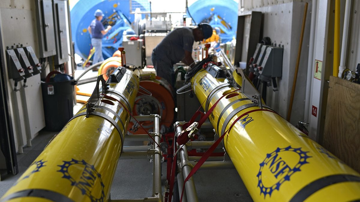
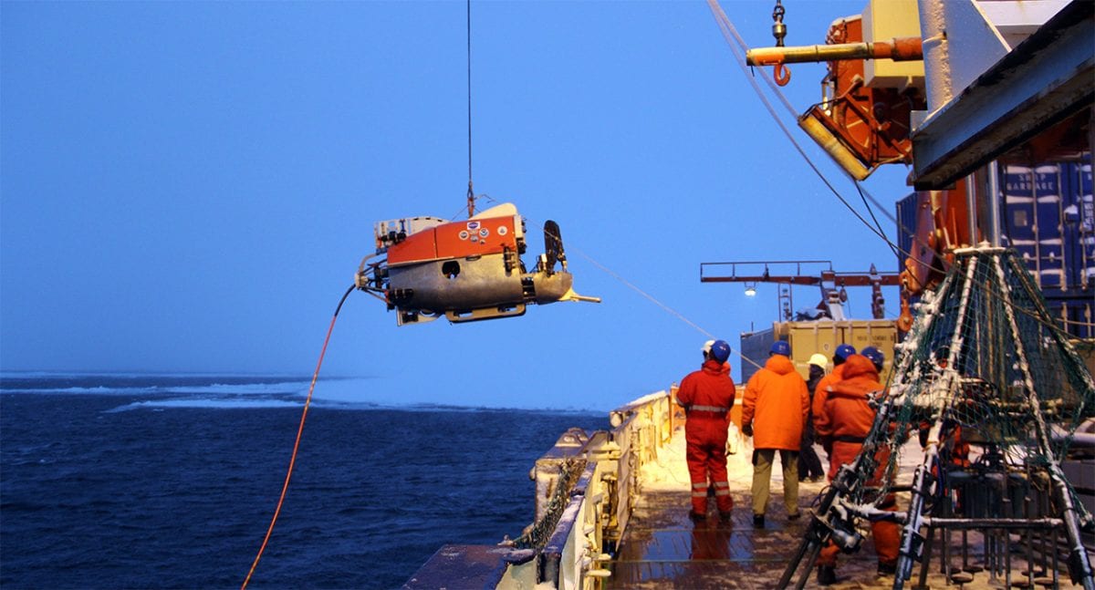
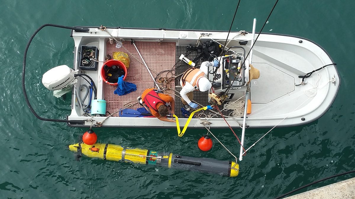
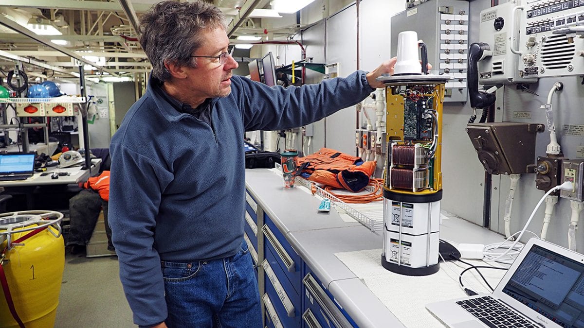
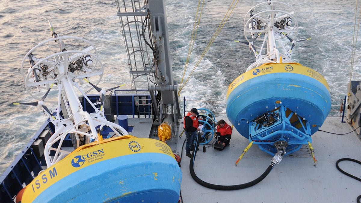
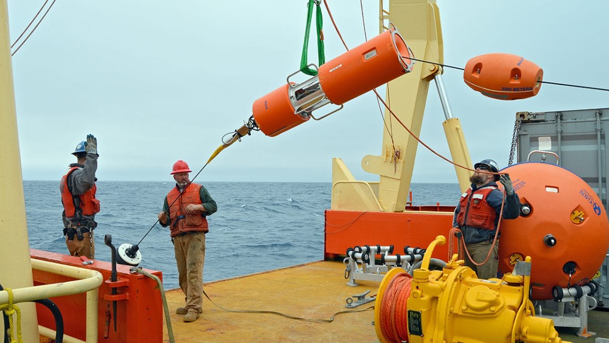
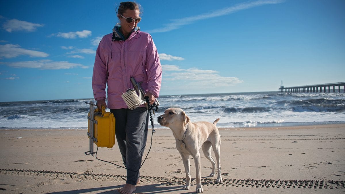
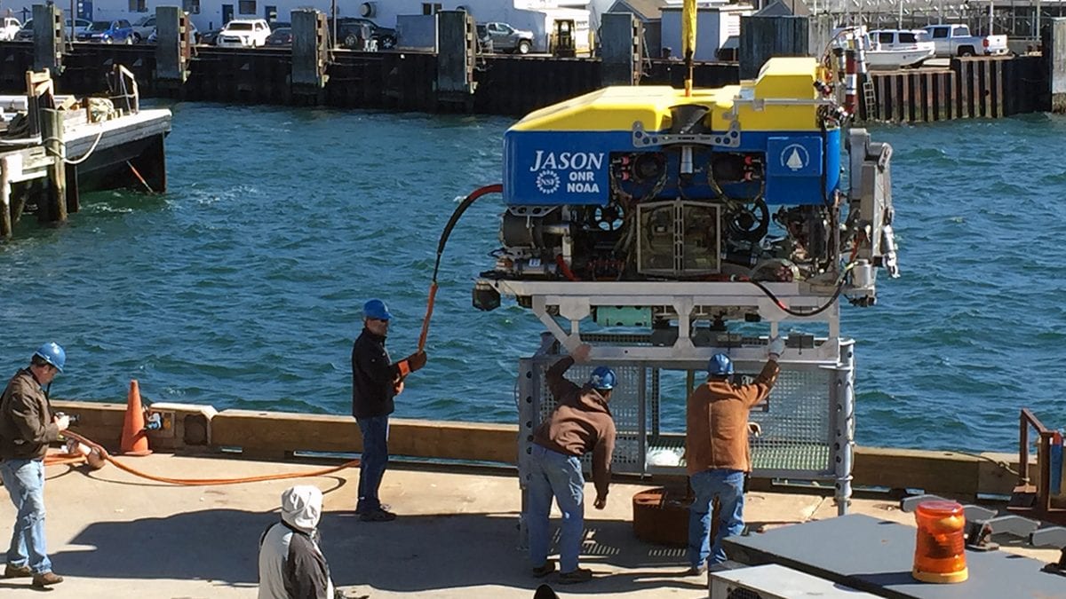
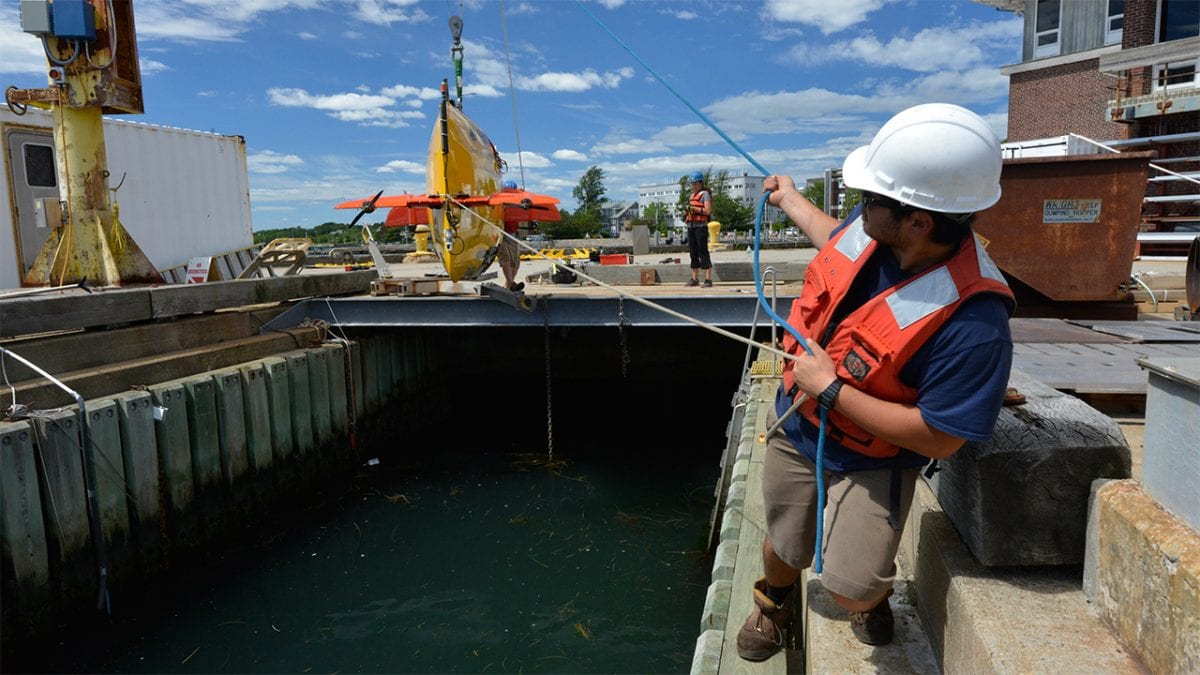
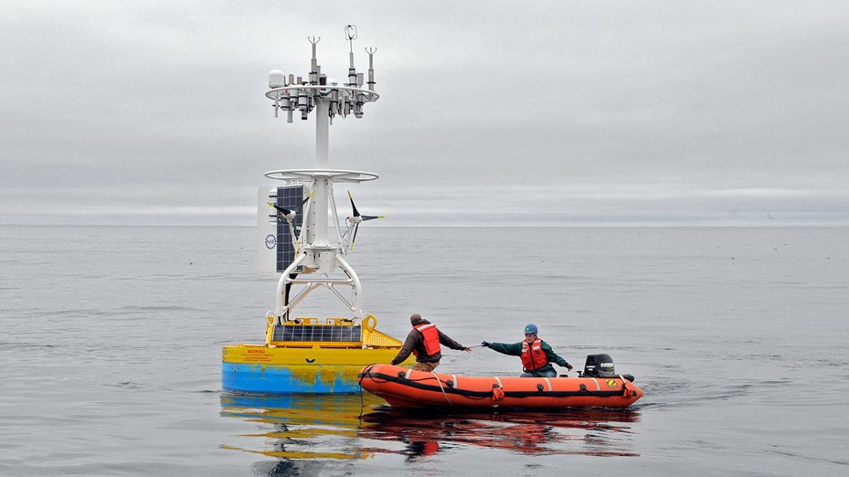
Image and Visual Licensing
WHOI copyright digital assets (stills and video) contained on this website can be licensed for non-commercial use upon request and approval. Please contact WHOI Digital Assets at images@whoi.edu or (508) 289-2647.