An autonomous underwater vehicle called ABE—for Autonomous Benthic Explorer—systematically “flew” over the seafloor on the volcanic Mid-Atlantic Ridge, midway between Africa and South America, photographing the ocean bottom. Some 3,000 overlapping photos were made into this photomosaic map, encompassing an area of roughly 15 acres or 6 hectares. WHOI scientist Chris German collected the data, and working with WHOI volcanologist Adam Soule, Summer Student Fellow Garrett Mitchell color-coded the map according to seafloor features. Blue=sheet lava; green=lobate lava flows; red=pillow lavas; purple=jumbled formations; gray=areas affected by hydrothermal vents. Built as a prototype by WHOI scientists in the 1990s, ABE became a legendary research vehicle. (Photo by Tom Kleindinst, Woods Hole Oceanographic Institution)
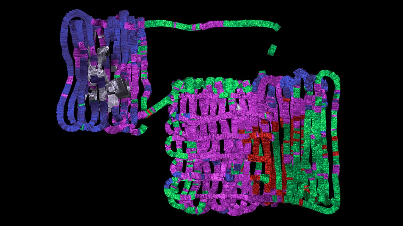
Image and Visual Licensing
WHOI copyright digital assets (stills and video) on this website can be licensed for non-commercial use upon request and approval. Please submit your request via our Media Request Form.
For assistance or accessibility accommodations, call (508) 289-2647.