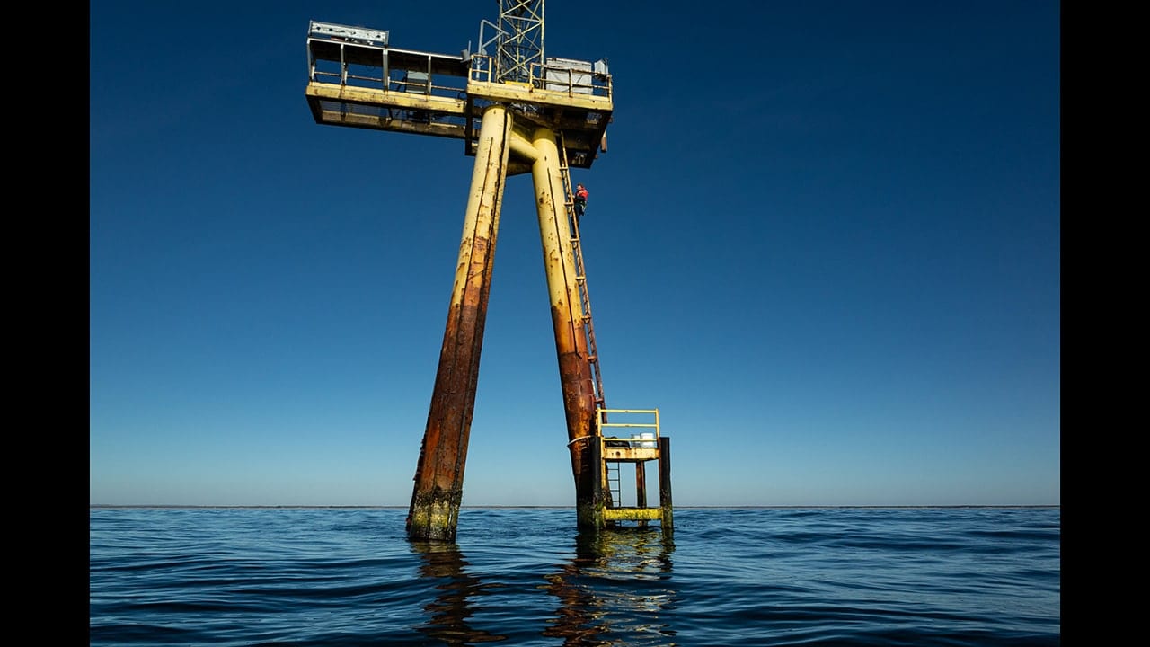
WHOI physical oceanographer Anthony Kirincich climbs a ladder up the Air-Sea Interaction Tower at the Martha’s Vineyard Coastal Observatory (MCVO). WHOI operates the MCVO, which collects and provides real-time coastal oceanographic and meteorological information for researchers, students, and the general public. Kirincich was scaling the tower to service its laser-based (LiDAR) remote wind measurement system. WHOI is partnering with the State of Massachusetts to collect observations of wind far above the sea surface—critical information to assess the potential of offshore wind energy as a source of electricity for the state. (Photo by Sean Patrick Whelan, Woods Hole Oceanographic Institution)
More Content From :
Sustainable Ocean


Image and Visual Licensing
WHOI copyright digital assets (stills and video) on this website can be licensed for non-commercial use upon request and approval. Please submit your request via our Media Request Form.
For assistance or accessibility accommodations, call (508) 289-2647.