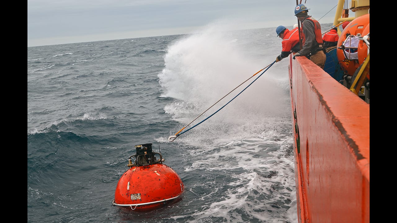
Crew members aboard the research vessel Nathaniel B. Palmer recover a subsurface flotation sphere of a Global Array mooring off the coast of Argentina. The subsurface moorings have sensors that measure water temperature and salinity; nitrate, dissolved oxygen, and carbon dioxide levels; and biological activity. Global Arrays also have surface moorings with buoys that support meteorological stations that record atmospheric conditions so that scientists can investigate air-sea interactions; wind turbines, solar panels, and rechargeable batteries to power instruments; and communications equipment that relays data to shore in near-real time to scientists, educators, and the public. Global Arrays are part of the National Science Foundation-funded Ocean Observatories Initiative. (Photo by Sheri White, Woods Hole Oceanographic Institution)
More Content From :
Ocean Tech


Image and Visual Licensing
WHOI copyright digital assets (stills and video) on this website can be licensed for non-commercial use upon request and approval. Please submit your request via our Media Request Form.
For assistance or accessibility accommodations, call (508) 289-2647.