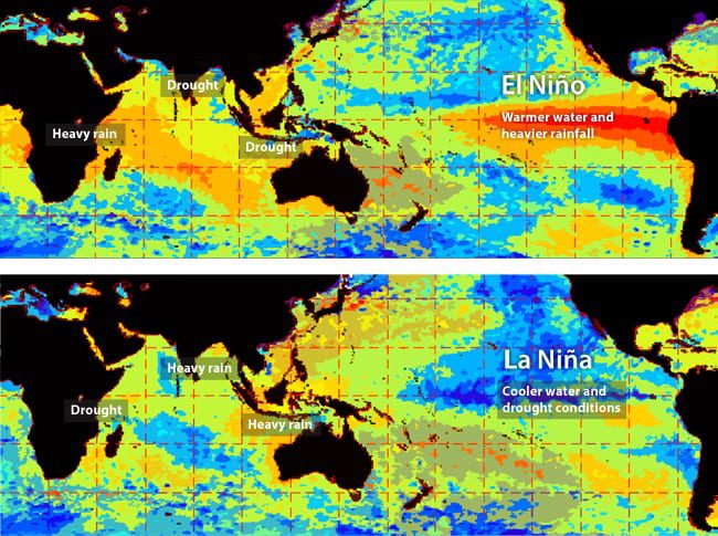
The El Niño-Southern Oscillation is a natural cycle that recurs over two to seven years. When surface temperatures in the eastern equatorial Pacific are warmer than usual (an El Niño event), heavy rains hit East Africa and droughts beset India, Indonesia, and Australia. When ocean conditions flip-flop (a La Niña), so do global rainfall patterns. (Fern Gibbons, Woods Hole Oceanographic Institution)
More content from : How the ocean works



Image and Visual Licensing
WHOI copyright digital assets (stills and video) on this website can be licensed for non-commercial use upon request and approval. Please submit your request via our Media Request Form.
For assistance or accessibility accommodations, call (508) 289-2647.