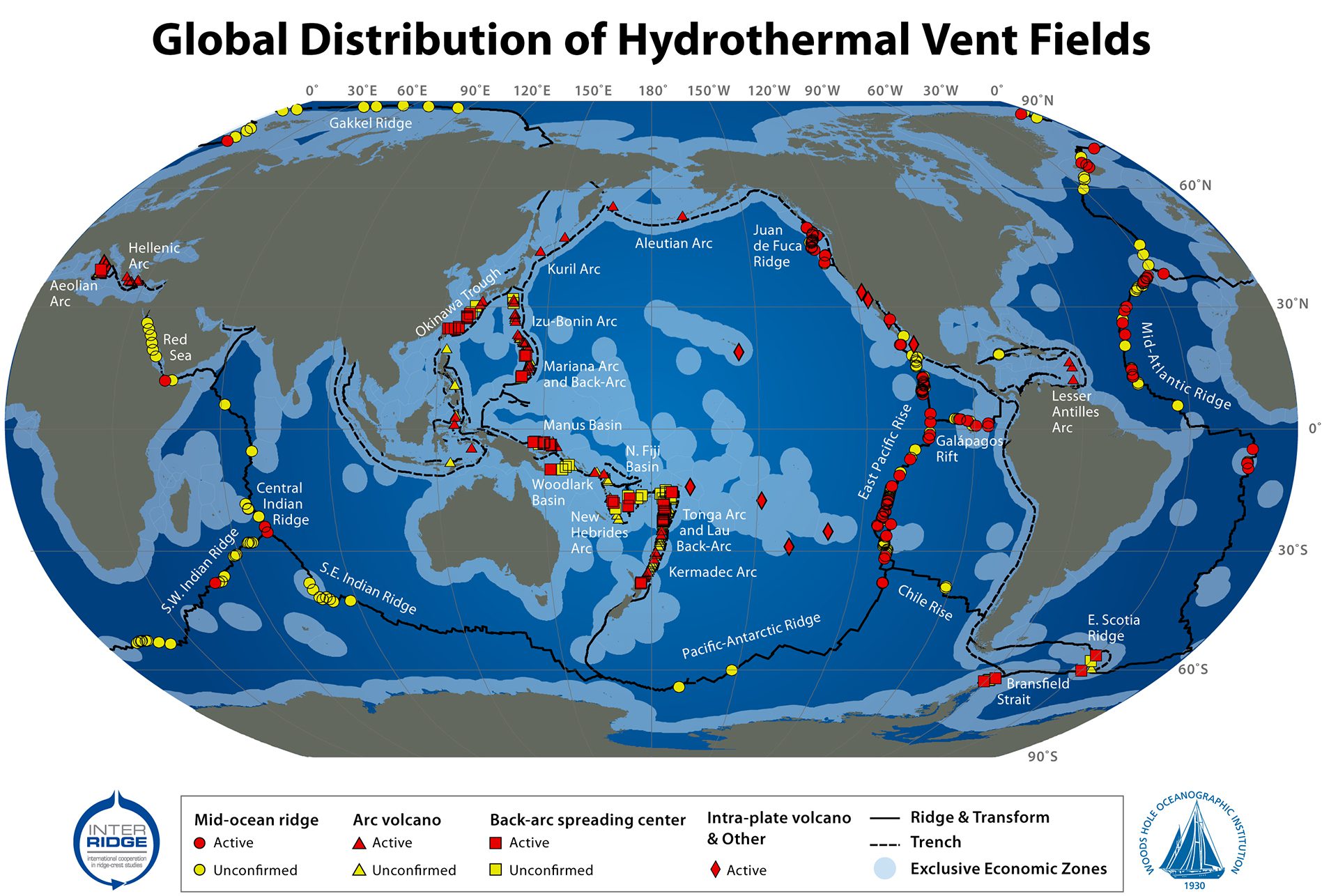
2009 Global Hydrothermal Vents map. Funding from InterRidge and Morss Colloquium Program at WHOI. Data sources: InterRidge Vents Database, Version 2.0, release date 5 Mar. 2010; University of Texas PLATES Project plate boundary shapefiles; World EEZ GIS shapefiles, Version 5.0, Oct. 2009, from the VLIZ Maritime Boundaries Geodatabase. (S. Beaulieu, K. Joyce, and S.A. Soule, © Woods Hole Oceanographic Institution)
More Content From :
How the ocean works


Image and Visual Licensing
WHOI copyright digital assets (stills and video) on this website can be licensed for non-commercial use upon request and approval. Please submit your request via our Media Request Form.
For assistance or accessibility accommodations, call (508) 289-2647.