The NZASRoF?07 Kermadec Arc expedition departed from Auckland Harbor, heading up the Ngatoro Rift Basins and on to Brothers Volcano. The bathymetry fly-through begins over the North Island of New Zealand, then heads northeast over the Ngatoro Rift Basins, turns east and then north flying over the Kermadec Arc submarine volcanoes. The flight path continues north to Brothers caldera, turns around and looks south over the arc and backarc with New Zealand in the background. The bathymetry data consist of multibeam data (GNS) overlaid on satellite altimetry (Smith and Sandwell), and are exaggerated 2.5 times. (Movie courtesy of the NOAA Vents Program)
By Kristen M. Kusek :: Originally published online December 13, 2007
More Content From :
How the Ocean Works
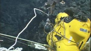


Image and Visual Licensing
WHOI copyright digital assets (stills and video) contained on this website can be licensed for non-commercial use upon request and approval. Please contact WHOI Digital Assets at images@whoi.edu or (508) 289-2647.