University of Connecticut scientist Jim Edson (left) and WHOI technician Steve Faluotico install an instrument on a buoy prior to a cruise to the saltiest spot in the North Atlantic as part of the Salinity Processes in the Upper Ocean Regional Study (SPURS). The multi-year project led by WHOI physical oceanographer Ray Schmitt will study how salt content fluctuates in the ocean’s upper layers and how these variations are related to shifts in rainfall patterns. As global temperatures go up, evaporation increases, altering the frequency, strength, and distribution of rainfall around the planet. These changes to Earth’s water cycle may intensify droughts and floods around the globe. Data obtained from the study will also help calibrate the salinity measurements NASA’s Aquarius satellite has been collecting since 2011.
(Photo by Tom Kleindinst, Woods Hole Oceanographic Institution)
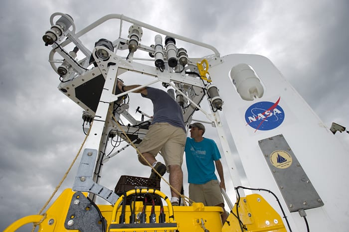
Image and Visual Licensing
WHOI copyright digital assets (stills and video) contained on this website can be licensed for non-commercial use upon request and approval. Please contact WHOI Digital Assets at images@whoi.edu or (508) 289-2647.