To forecast hurricane intensities more accurately, scientists need to know a critical piece of information: how much heat is stored in the in upper 1,000 meters of the ocean. Hurricanes gather energy from warm water at the ocean surface. As high hurricane winds blow across the water, they can mix this warm surface layer with cooler water hundreds of feet below. If the warm surface layer is thin, cold water mixing to the surface will rob storms of their strength. But if warm waters extend down deeper, the surface will stay warm, even as deeper waters are mixed to the surface, giving the storm more energy to continue growing as it moves. (Illustration by Natalie Renier, Woods Hole Oceanographic Institution)
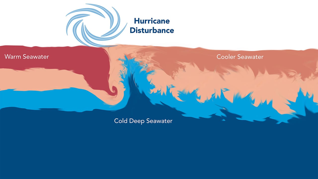
Image and Visual Licensing
WHOI copyright digital assets (stills and video) contained on this website can be licensed for non-commercial use upon request and approval. Please contact WHOI Digital Assets at images@whoi.edu or (508) 289-2647.