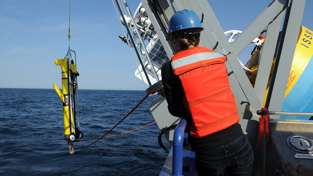
WHOI engineer Jennifer Batryn assists with the launch of an ocean glider at the Ocean Observatories Initiative’s Coastal Pioneer Array, about 90 miles south of Martha’s Vineyard. The autonomous underwater vehicles “fly” between and beyond the array’s stationary moorings, measuring temperature, salinity, and other ocean properties from near the surface down to almost 3,300 feet. The gliders transmit their data via satellite to WHOI glider pilots back on shore, who can monitor and reprogram them remotely to keep them on course or investigate oceanographic features of interest. (Photo by Véronique LaCapra, Woods Hole Oceanographic Institution)
More Content From :
Ocean Tech


Image and Visual Licensing
WHOI copyright digital assets (stills and video) on this website can be licensed for non-commercial use upon request and approval. Please submit your request via our Media Request Form.
For assistance or accessibility accommodations, call (508) 289-2647.