Researchers from WHOI and the Scripps Institution of Oceanography carry an instrument tower into the surf near La Jolla, California, to measure the movement of water beneath the breaking waves. Specifically, the science team measured wave heights, water speed and direction, and the movement of sediment on the bottom, all with an eye toward deciphering how the surf- and swash zones work on complicated coastlines. (Photo by Britt Raubenheimer, Woods Hole Oceanographic Institution)
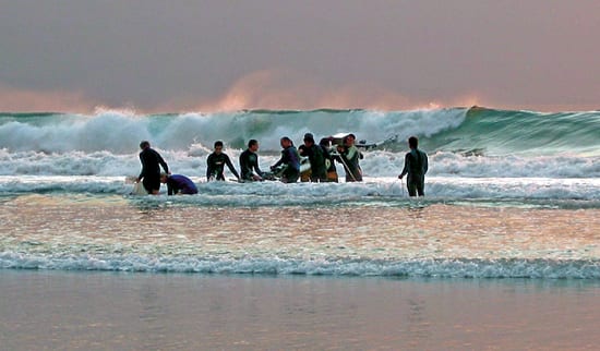
Image and Visual Licensing
WHOI copyright digital assets (stills and video) on this website can be licensed for non-commercial use upon request and approval. Please submit your request via our Media Request Form.
For assistance or accessibility accommodations, call (508) 289-2647.