
Thank you to Dianna Rathert and her 5th grade students from Happy Hollow School in Indiana, US, for their second set of questions. Question 1: Does atmospheric pressure affect ocean currents? Answer: Yes, but not in a direct way. Atmospheric pressure is the primary driver for the winds all over the planet. The easterly trade winds along the equator and the westerly mid latitude jet stream are both forced by atmospheric pressure as are the winds of the cyclones that spin through America and Europe. So the atmospheric pressure produces the winds, and the winds can, in turn, go on to stir the ocean. Many of the ocean currents in the world's oceans exist because of, or at least are influenced by, the wind providing a push to the surface waters. The easterly trade winds along the equator, for example, drive surface waters westward across the Atlantic Ocean. In smaller regions the wind causes a range of different effects on currents - the wind can change the ocean's speed and direction, make deep waters rise to the surface, or descend in to depths. There are other factors at play for the full picture of how and why currents flow, but winds are certainly of great importance. And these winds wouldn't exist without the atmospheric pressure systems on the planet. Answered by Ben Harden, Meteorologist and Videographer, Outreach Team
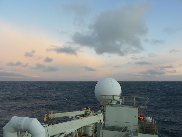
Off the east coast of Iceland, clearing skies announce the departure of the stormy, low pressure system we’ve been experiencing the last couple of days and the arrival of a high pressure system that promises calmer seas and lots of sun. © Pat Keoughan
Question 2: How does the ocean tide and/or the contour of the ocean floor contribute to the current in the Denmark Strait? Answer: This is an excellent question. The topography of the ocean floor is critical to what happens in the Denmark Strait. As you've read in Dallas' essays, there is a ridge that extends from Greenland all the way to Scotland (Iceland is one location where the ridge "pops above the water"). North of this ridge is the area we call the Nordic Seas, and it is in this region where the warm water becomes cold and sinks to deeper depths. Then, in order for the cold water to flow towards the equator, it must flow through the gaps in the Greenland-Scotland ridge. One of the main gaps is the Denmark Strait, and the height of the ridge there is about 600 meters. The current that we've been following north of Denmark Strait (we call it the "North Icelandic Jet") happens to be situated at 600 meters as well. We believe that this is not a coincidence, and that the height of the ridge actually determines how deep the North Icelandic Jet is! Answered by Bob Pickart, Chief Scientist
Question 3: What is the biggest factor in affecting the speed of a surface current? Answer: There are numerous factors that dictate how fast a surface current flows. One obvious one is wind. For instance, earlier on this cruise when we were next to Greenland we experienced strong winds blowing to the south. This accelerated the "East Greenland Current" to the point where it was flowing very fast. However, changes in density of the water can also determine how fast it flows. Thinking again about the East Greenland Current, part of the reason it is there is because of coastal runoff of melt water (which has nothing to do with wind). The more runoff there is, the faster the surface current is apt to flow. Finally, astronomical forcing can cause very strong surface currents. I'm talking here about the tides...in various parts of the world tidal currents are really fast! Answered by Bob Pickart
A plot of the LADCP data, created by Dan Torres, tells the scientists the velocity and depth of the different currents the CTD went through during its cast. Question 4: How far below the ocean’s surface does the North Icelandic Jet flow? Are the moorings measuring the flow of the surface currents or are they gathering information about deep ocean currents? Answer: The North Icelandic Jet resides below the surface. As I mentioned in question #2, the center of the current is located at a bottom depth of 600 meters. However, the current extends far above this into shallower depths. So you can think of it as a "tall and skinny current". To be honest, we really don't understand why it extends so far off the bottom, we're still trying to figure that out. The moorings will return an amazing amount of information about the North Icelandic Jet. Consider the following: up until now we've only measured the jet a single time during the winter (from a ship). The moorings will measure this current once every hour for a full year! Answered by Bob Pickart
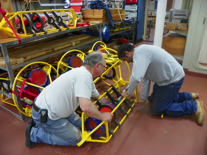
Magnus Danielsen and Dan Torres ready an ADCP to be placed on a mooring in the Denmark Strait to collect data for a year. © Pat Keoughan
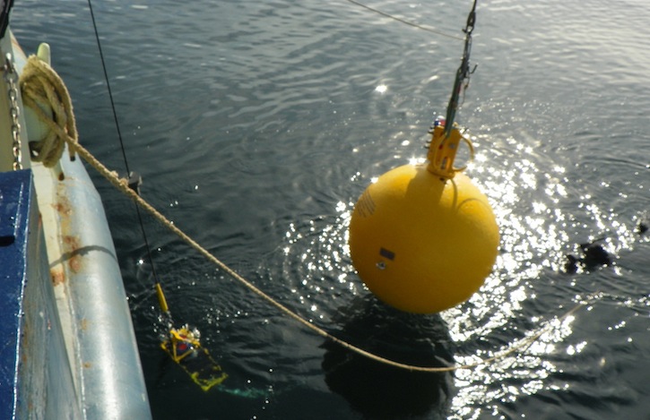
The ADCP, now attached to the mooring line, dangles off the transom. It will soon to be part of the string of instruments that float off behind the Knorr as it moves slowly forward. © Pat Keoughan
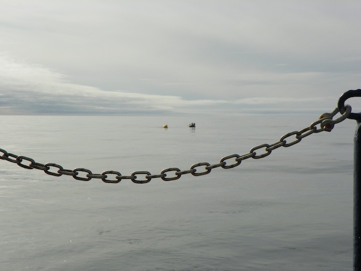
When I don’t use the zoom on my camera, you get an idea of how far behind the Knorr the mooring line floats. That’s our Zodiac full of people beside the top float. Once the anchor is dropped off the transom at the back of the boat, the top float will be at least this far above where the anchor lands on the bottom, and still be 100m (300’) below the surface of the Strait. © Pat Keoughan Last updated: October 10, 2011 | |||||||||||
Copyright ©2007 Woods Hole Oceanographic Institution, All Rights Reserved, Privacy Policy. | |||||||||||
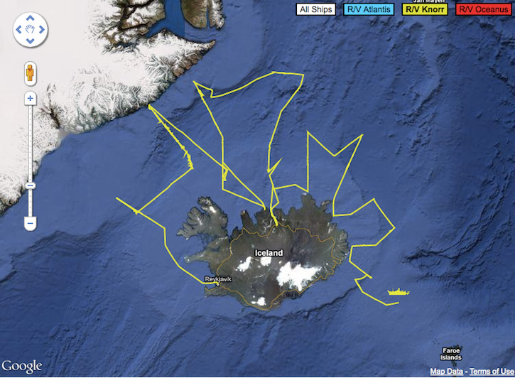 This screen shot from the WHOI website shows the position of the Knorr and the bottom topography of the Iceland Sea. The Denmark Strait is between Iceland and Greenland.
 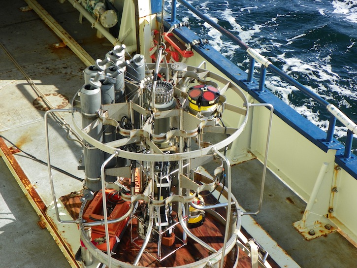 Every CTD cast carries an upward and a downward facing ADCP (LADCP for “lowered”) to measure the velocity (speed and direction) of the water as the CTD goes down and up from the bottom. They are the round, yellow instruments on the top and bottom of the CTD frame. © Pat Keoughan
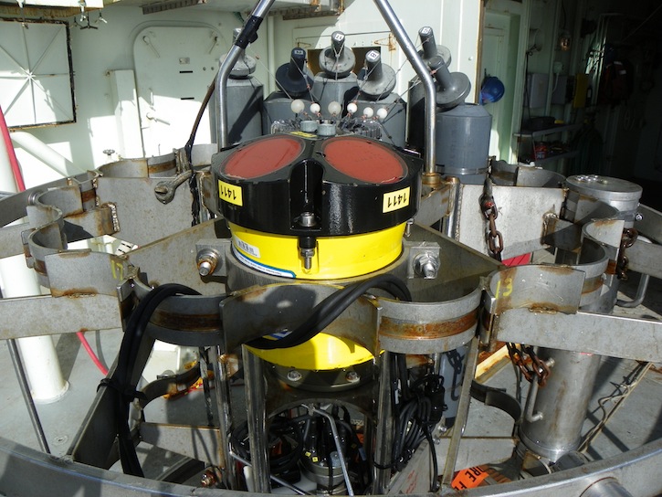 This is a close-up of the LADCP on the top of the CTD frame. You can see the open Niskin bottles behind it. © Pat Keoughan