
Thank you to the students from Gretchen Pickart’s Environmental Science class at King Philip Regional High School from Massachusetts, US, for your thought provoking questions.
Question1. Were you or your research impacted at all by the hurricane? Answer: Yes, believe it or not we were impacted quite significantly by the remains of hurricane Irene. After it passed the US east coast it eventually traveled to the region between Greenland and Iceland and merged with another storm. Then it became stationary for a few days causing high winds in our working area. But there is more to the story. The normal wind patterns of the storm proceeded to interact with the high coast of Greenland to cause a phenomenon known as "Barrier Winds" (see the video on our website about stormy weather). These are very strong winds that blow out of the north along the East Greenland shelf, just where we were trying to make measurements. Not only did this cause high waves, but the winds pushed icebergs and smaller chunks of ice (known as growlers) into our working area. So we had to vacate the area before finishing our measurements. This is an example of how inclement weather can affect oceanography (especially at high latitudes). Answered by Bob Pickart, Chief Scientist
Waves crash around the Knorr off the east coast of Greenland as the winds of the remnants of hurricane Irene whip up the Denmark Strait.© Pat Keoughan Question 2. Why did you choose this region of the ocean to study? Answer: We are working in an area known as the Nordic Seas. It is a particularly fascinating part of the ocean to study because warm water is converted to cold water during the cold winters. As a result, the newly chilled water sinks and flows southward at deeper depths. However, in order to get to more southern latitudes the cold water has to cross an underwater ridge known as the Greenland-Scotland ridge. This ridge has a few gaps in it, and one of those gaps is known as Denmark Strait (between the islands of Greenland and Iceland). On this cruise we put a "picket fence" of moorings across the northern part of Denmark Strait in order to measure the cold water as it flows southward. Such and array of moorings has never been deployed before. (You can see the map of where the Knorr is on the WHOI Website and a screen shot of it in the #7 Happy Hollow answers.) Answered by Bob Pickart
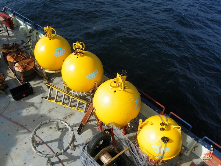
Four of the top floats of the “picket fence” of moorings that were placed across the Denmark Strait await their turn to be deployed. © Pat Keoughan Question 3. How did you realize this was a new current? Answer: Please see the second part of question three for Tertnes School, Norway. Hedinn Valdimarsson, co-discoverer of the North Icelandic Jet, describes its discovery. Answered by Pat Keoughan, Outreach Team
Question 4: What is the most dangerous part of taking all the measurements and other aspects of the job? Answer: One of the most dangerous parts of getting samples of any kind is the deployment and recovery of equipment. To see cranes picking up heavy weights (like the mooring anchors) it is a little more obvious, but there are plenty of "lighter" devices and equipment that can also hurt someone, not to mention the machinery used to lift and control them. Anyone involved in these types of operations certainly has safety gear on (such as hard hats and work vests), but everyone still needs to follow safe procedures and pay attention to what they are doing. The CTD rosette, for instance, doesn't appear as heavy or dangerous as the big mooring equipment does, but if it gets out of control and swings, it can hurt someone just as badly. We have procedures and rules for most things on board a ship, and certainly for deploying and recovering equipment. Our most important job at all times is preventing anyone getting hurt in any situation. Answered by Kent Sheasley, Master, R/V Knorr
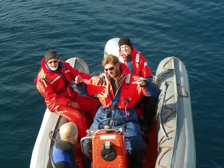
Captain Kent Sheasley, drives the Zodiac (small boat) so Rob, from National Geographic, in the wet suit, Dallas Murphy and Sindre Skrede can get a close up look at the mooring operations. (Rob will get a closer look than the other two.) © Pat Keoughan
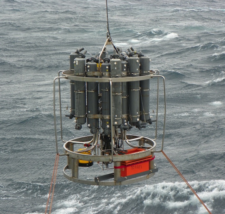
It’s not easy keeping equipment, like this CTD, and the people using it all in one piece during weather like we saw from the leftovers of Irene. That is ultimately Captain Sheasley’s responsibility. © Pat Keoughan Question 5: How often are new discoveries made in the oceanography field? Answer: Oceanography is a young science because the tools necessary to understand the ocean are themselves new. Before 1900, there were few tools much more advanced than a bucket and a lead line for measuring depth. Before World War II, solid-state electronics, sonar, radar, and other devices capable of measuring ocean were in their infancy. Then during the Cold War, instruments designed, for instance, to hunt submarines were adapted to use by ocean scientists. And only then were people inventing and designing electronic instruments specifically to study the ocean such as the CTD and ADCP. Since then enormous progress has been made. However, the ocean, vast, deep, and rough, is a very difficult thing to study, and there remain many things to learn. So it’s not terribly surprising that people discover new currents. Ten years ago, Bob discovered another new current south of the Denmark Strait. But this, like the NIJ, is a relatively small current in an area that is both difficult to study and very complex. It’s probably safe to say that all the really big currents like, say, the Gulf Stream have been discovered. But one learns very quickly from reading science and talking to scientists never to say never when it comes to the ways of nature. And it wouldn’t be surprising if other small currents came to light in the near future, particularly in the more remote oceans and seas. But this might be a useful point to keep in mind: We can’t say we understand the oceans until we know all their currents. And that’s a very lot to ask. Answered by Dallas Murphy, Writer, Outreach Team
Question 6: It was hypothesized that the North Icelandic Jet is not a current that flows from somewhere else but that it formed in the north slope waters of Iceland. What about these waters would create the North Icelandic Jet? Answer: There are two important aspects of the area north of Iceland that allow the North Icelandic Jet to be formed. The first is the climate. Not surprisingly, winters in the Iceland Sea are frigid. This means that the surface waters lose a lot of their heat to the atmosphere and become cold. Hence, there is a big reservoir of cold water north of Iceland. The second important aspect is the sloping continental slope north of the island. This makes is easier for large quantities of water to sink to deeper depths. It is this sinking water that forms the North Icelandic Jet which then flows southward through the Denmark Strait. To be honest, the sinking process is quite complex and we are still trying to figure out exactly how it happens. Answered by Bob Pickart
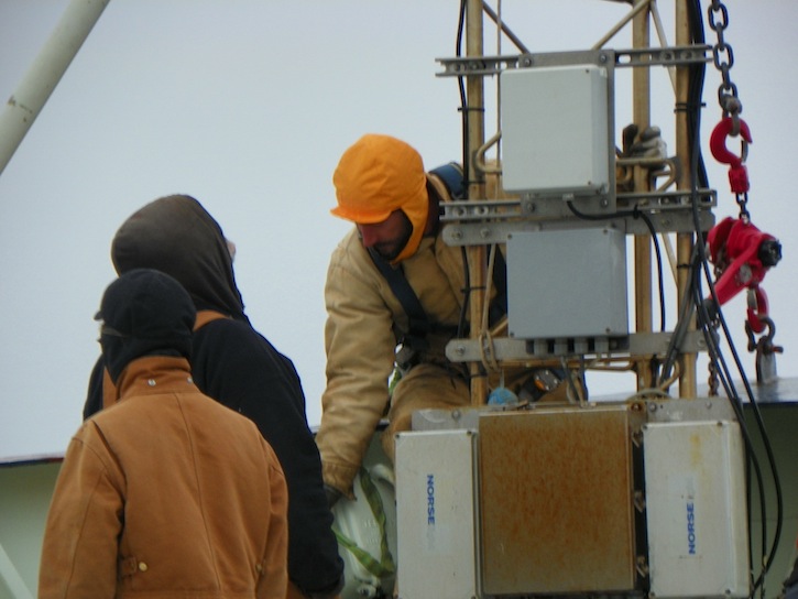
It was cold sailing north of Iceland, even in early September. Here Knorr Electrician Russ Adams, and the crew helping him replace the ice light on the bow tower, are bundled up against the chilly wind. © Pat Keoughan
Last updated: December 27, 2011 | |||||||||||
Copyright ©2007 Woods Hole Oceanographic Institution, All Rights Reserved, Privacy Policy. | |||||||||||
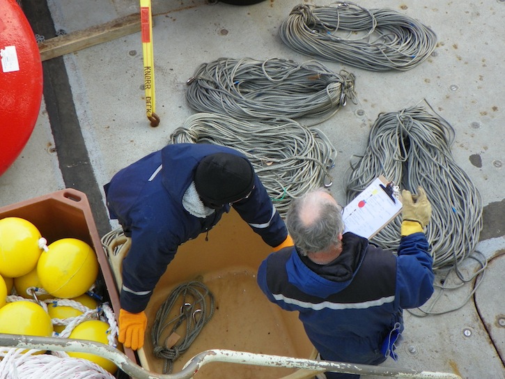 Physical scientist and co-discoverer of the North Icelandic Jet, Hedinn Valdimarsson (left) and his science tech Magnus Danielsen, double check that they have what they need for their first Icelandic mooring the next day. The diagram Magnus is holding shows what goes where on the mooring line. © Pat Keoughan