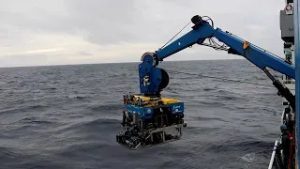
Maintaining a constant altitude and precision navigation, ABE is programmed to fly back and forth over the seafloor (which scientists call “mowing the lawn”), surveying the seafloor with sonar to create high-resolution bathymetric maps.
Originally published online April 19, 2006
More Content From :
Ocean Tech


SEARCH RELATED TOPICS: Ocean Tech / Underwater Vehicles
Image and Visual Licensing
WHOI copyright digital assets (stills and video) on this website can be licensed for non-commercial use upon request and approval. Please submit your request via our Media Request Form.
For assistance or accessibility accommodations, call (508) 289-2647.