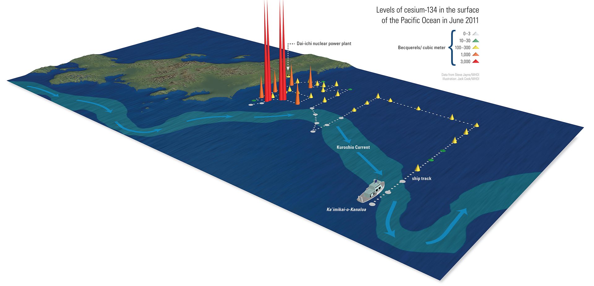
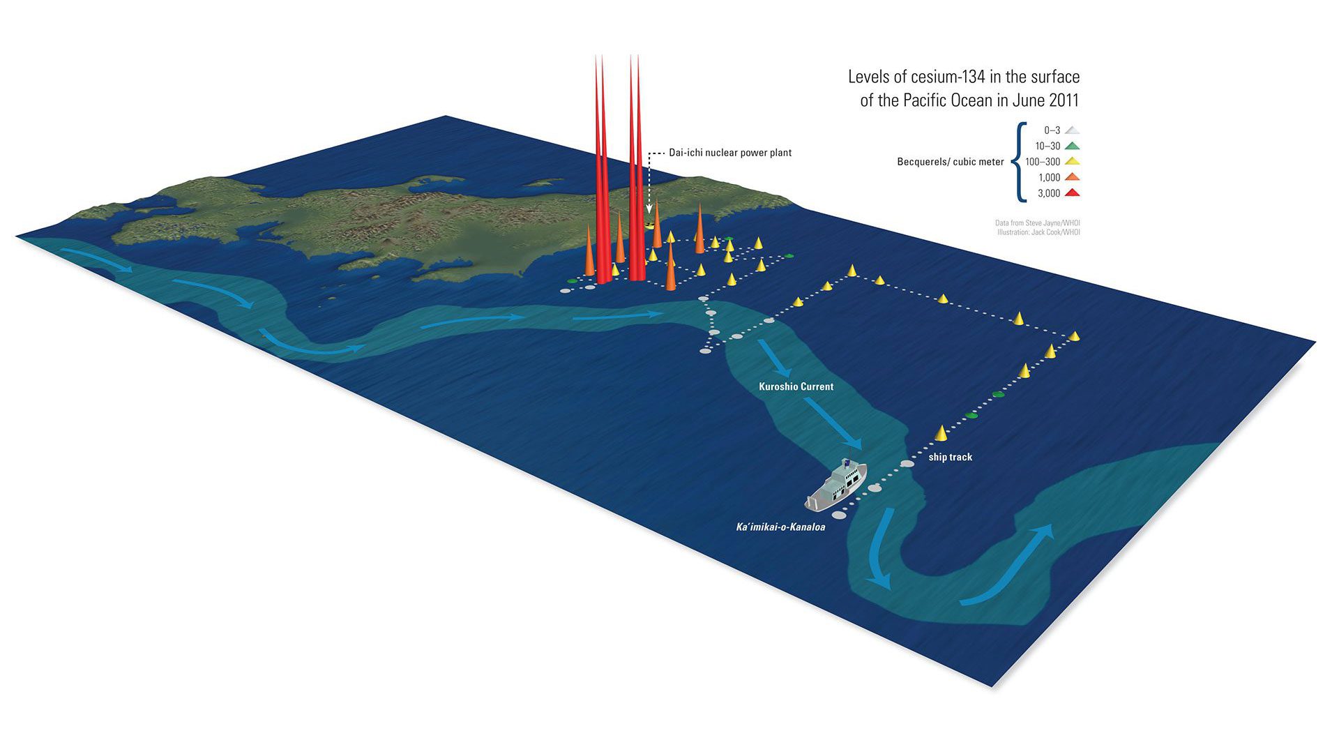
Starting 375 miles off Japan, researchers on the Kaimikai o-Kanaloa measured radioisotope levels in various locations. They found that the Kuroshio Current blocked the southward flow of radioisotopes. Highest levels concentrated south of Fukushima, where currents trapped contamination in a swirling eddy. (Illustration by Jack Cook, © Woods Hole Oceanographic Institution)
More Content From :
Ocean & Human Lives


Image and Visual Licensing
WHOI copyright digital assets (stills and video) on this website can be licensed for non-commercial use upon request and approval. Please submit your request via our Media Request Form.
For assistance or accessibility accommodations, call (508) 289-2647.