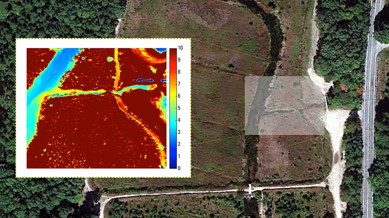
WHOI scientists used a drone equipped with a thermal imaging sensor to create this image (inset) of a section of the Coonamessett River watershed in Falmouth, Mass. The thermal image reveals “hot spots”—red and yellow areas—where warmer groundwater is seeping into the colder river in winter. The research will help planners at the Coonamessett River Trust restore the river’s natural pathway. As they reroute the channel, they want to incorporate spring-fed tributaries that would discharge cooler water into the river. That would recreate cool pools and encourage the return of sea-run trout that once flourished there. (Image Courtesy of Erika Johnson, Woods Hole Oceanographic Institution)
More Content From :
How the Ocean Works


Image and Visual Licensing
WHOI copyright digital assets (stills and video) on this website can be licensed for non-commercial use upon request and approval. Please submit your request via our Media Request Form.
For assistance or accessibility accommodations, call (508) 289-2647.