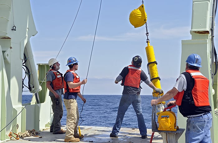
Andy Davies (second from left) and colleagues deploy a Vector Averaging Current Meter (VACM) in May during the last research cruise of the Line W project. Line W is a set of moorings across the Deep Western Boundary Current and the Gulf Stream, and is named after the late WHOI physical oceanographer Val Worthington. During the ten-year project, scientists used moored instruments and shipboard hydrography to gain an understanding of how the oceans and atmosphere affect Earth’s climate, and to create a baseline for future climate changes. (Photo by Susan Sholi, Woods Hole Oceanographic Institution)
More Content From :
Ocean Tech


Image and Visual Licensing
WHOI copyright digital assets (stills and video) on this website can be licensed for non-commercial use upon request and approval. Please submit your request via our Media Request Form.
For assistance or accessibility accommodations, call (508) 289-2647.