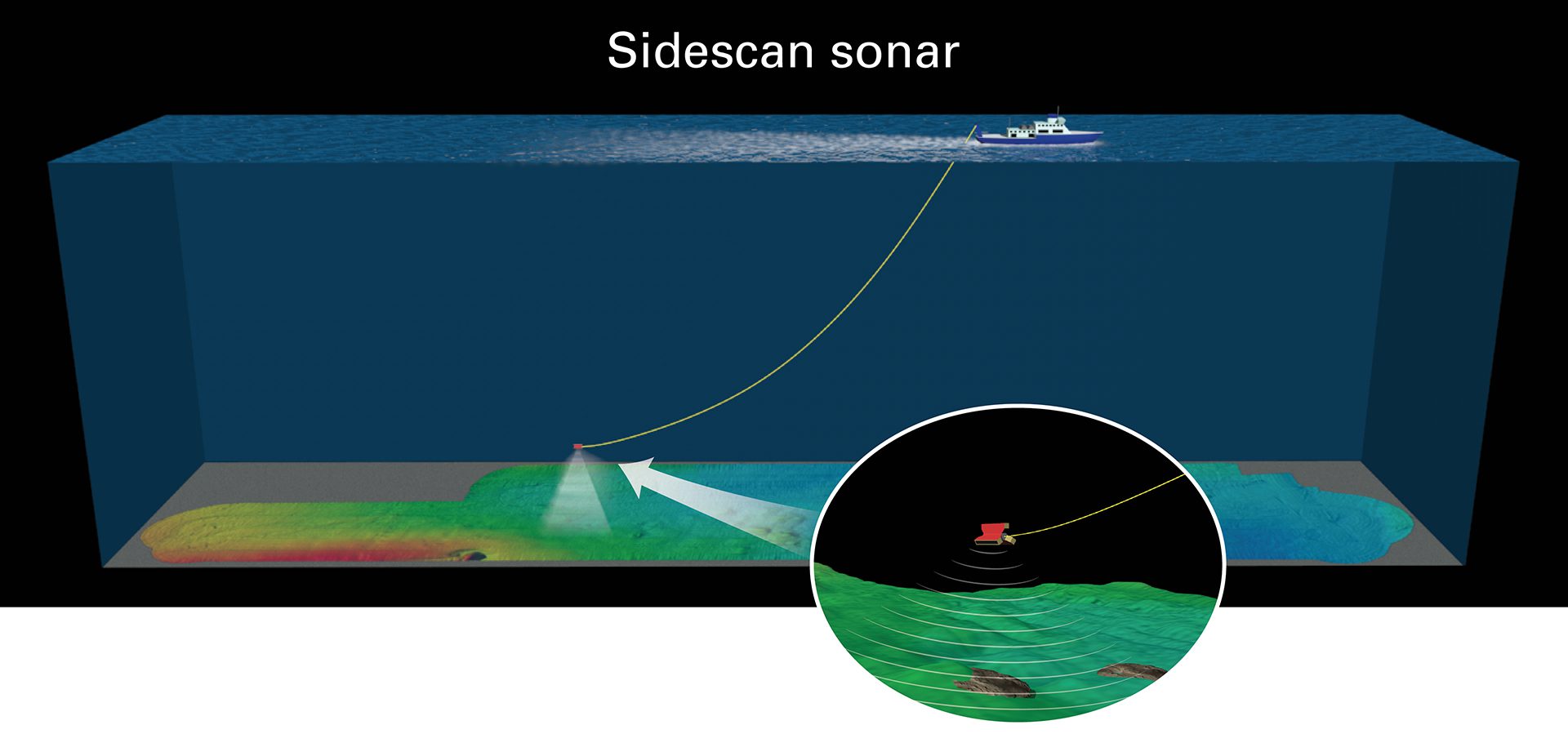
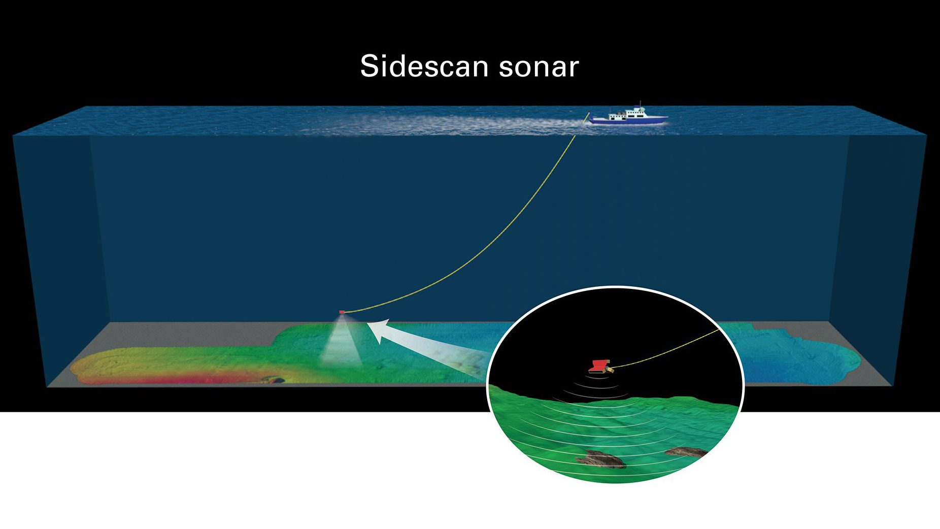
To map the seafloor, scientists tow a sidescan sonar 500 meters above the bottom. It sends sound waves that reflected off surfaces, revealing texture and hardness. The return signals created detailed images—soft mud appeared dark, while harder surfaces like carbonate crusts or shell beds showed up as bright features. (Illustration by Jack Cook, © Woods Hole Oceanographic Institution)
More Content From :
Ocean Tech


SEARCH RELATED TOPICS: Ocean Tech
Image and Visual Licensing
WHOI copyright digital assets (stills and video) on this website can be licensed for non-commercial use upon request and approval. Please submit your request via our Media Request Form.
For assistance or accessibility accommodations, call (508) 289-2647.