Following the 1985 French-American expedition that discovered the wreck of Titanic, WHOI researchers William Lange, Elazar Uchupi, and Bob Ballard examined all the still and video images captured by deep-sea cameras and created this first map of the wreck site, published in 1988. It remained the best record of the debris field until WHOI researchers returned to the site in 2010 with autonomous underwater vehicles to map the entire site using sonar. The 2010 expedition also used 3-D optical systems created by the Advanced Imaging and Visualization Laboratory at WHOI to capture some of the most detailed and haunting photographs of the famous wreck.(Illustration by R. Ballard, E. Uchupi, and W. Lange, Woods Hole Oceanographic Institution)
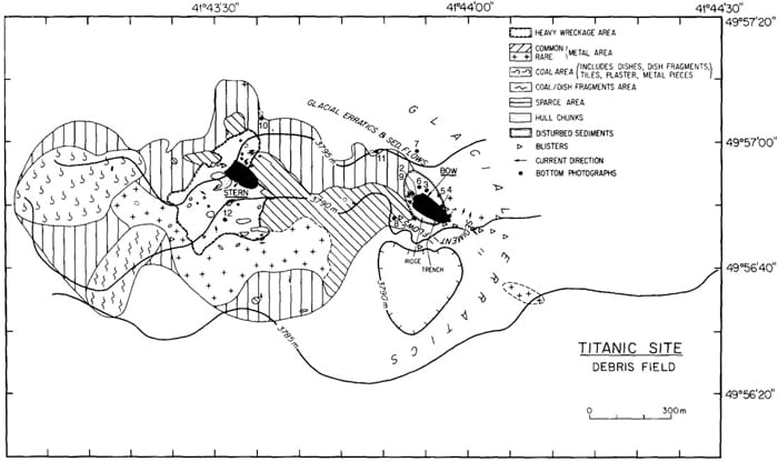
Image and Visual Licensing
WHOI copyright digital assets (stills and video) on this website can be licensed for non-commercial use upon request and approval. Please submit your request via our Media Request Form.
For assistance or accessibility accommodations, call (508) 289-2647.