WHOI guest student Dan Litchmore and research assistants Charlotte Wiman and Nicole D’Entremont (left to right) conduct a sonar survey of coastal ocean bottom sediments near the Caribbean island of Curaçao in November. The group used compressed high intensity radar pulse (CHIRP) sonar to produce two-dimensional maps of sub-bottom sediment layers. The work was part of ongoing research to map ancient hurricane deposits in Caribbean lagoons, in order to develop a detailed historical record of hurricanes in the region going back as much as 2,000 years. (Photo by Kelly McKeon, Woods Hole Oceanographic Institution)
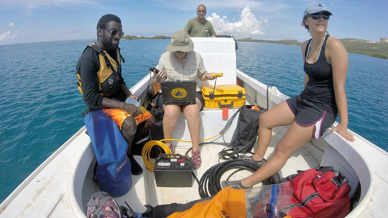
Image and Visual Licensing
WHOI copyright digital assets (stills and video) on this website can be licensed for non-commercial use upon request and approval. Please submit your request via our Media Request Form.
For assistance or accessibility accommodations, call (508) 289-2647.