Most oceanographic survey instruments look down at the seafloor. On a recent trip to the Southern Ocean, though, members of Hanu Singh’s lab equipped one of their SeaBED vehicles to look up–at the underside of sea ice. Clay Kunz and Peter Kimball fitted the autonomous underwater vehicle (AUV) Puma with an upward-looking sonar to measure and map the underside of sea ice floes. These data will be combined with airborne measurements of sea-ice surface elevation and with information from ice coring surveys to improve estimates of ice thickness and total sea-ice volume. (Photo by Peter Kimball, Woods Hole Oceanographic Institution)
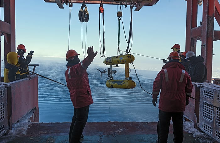
Image and Visual Licensing
WHOI copyright digital assets (stills and video) on this website can be licensed for non-commercial use upon request and approval. Please submit your request via our Media Request Form.
For assistance or accessibility accommodations, call (508) 289-2647.