Lightship
& Light Station Home > About
About
This web site serves digitized records of continuous historical
meteorological as well as seawater temperature data recorded
from U.S. Atlantic coast Lightship, Light and Weather Stations.
Some of these data have been recovered with support in the
form of a grant from the Woods Hole Oceanographic Institution
Coastal Research Center (CRC) in 1997 and since 2002 under
a grant from the National Oceanic and Atmospheric Administration
as part of the Climate
Database Modernization Program (CDMP).
Early work supported by the CRC focused on subsurface water
temperature and salinity records from XBTs and can be accessed
through the Woods Hole Oceanographic Data Library web page
by clicking here.
All XBT and weather data from this prior work is has been
incorporated into this website and can be accessed via the
GIS interface.
| |
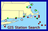
Search
for data using the GIS tools. |
 |
Select data by
region or station via the interactive map. |
 |
| Help
using GIS toolbar. |
The work has been organized primarily by Kathryn Elder of
the Woods Hole Oceanographic in collaboration with Joe Elms
of the National Climatic Data Center in Asheville North Carolina.
Special thanks to Roger Goldsmith for his development of the
GIS interface and Lori Dolby and Danielle Fino for their web
design expertise (both from the Woods Hole Oceanographic Institution).
|