|
|
|
Submarine groundwater discharge: identification and quantification via remote
sensing, hydrologic sampling, and geochemical tracers
|
Groundwater discharge to coastal waters can have
a significant impact on local ecological structure because of its low salinity
and, often times, high nutrient content. Proper management of coastal
water resources requires that the quantity and quality of significant inputs
be adequately characterized. Groundwater input to coastal waters, often
termed submarine groundwater discharge (SGD), is particularly difficult to
characterize because it can vary significantly through space and time.
While hydrologic measurements can quantify fluid flux at specific points,
the spatial variability of flow can lead to significant errors when making
estimates using point data. Geochemical tracers, on the other hand,
are useful in quantifying total groundwater flux to a surface water body,
but are unable to identify the spatial distribution of flow. We propose
to examine the utility of remote sensing technology, specifically airborne
thermal imaging, in identifying key groundwater discharge locations to coastal
surface water bodies. Hydrologic measurements will be collected before
and after the imaging, with the sampling locations after the remote sensing
work chosen based on image results. We will also collect surface water
and groundwater samples for radium and dissolved nitrogen analyses. The radium
samples will be used to estimate groundwater discharge to the water bodies
and will be compared with the hydrologic estimates. Nitrogen samples
will be used, together with the flow estimates, to determine nitrogen loading
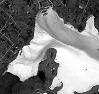
to the coastal waters. We propose to conduct the remote sensing
at three locations in southeastern New England: Quonochontaug Pond in
Rhode Island and Waquoit Bay and off the west coast of Truro on Cape Cod.
Previous work in these three locations indicates that groundwater fluxes in
these three areas vary by one to two orders of magnitude.
Many thanks to the Coastal
Ocean Institute for their support of this project.
back to top
|