

STRESS-III
This deployment took place from late Oct. 1994 till Feb. 1995. Two tripods
were deployed. One containing the narrow beam ABSS system, a rotary bottom
survey sonar, a vertical array of optical backscattering sensors (OBS),
and two electromagnetic current meters (EMCMs). The second tripod included
the wide beam ABS system, and an array of OBS and EMCM sensors. Unfortunately
the ABSS did not return any data, but the ABS displays an excellent record
with several large storm events.
-
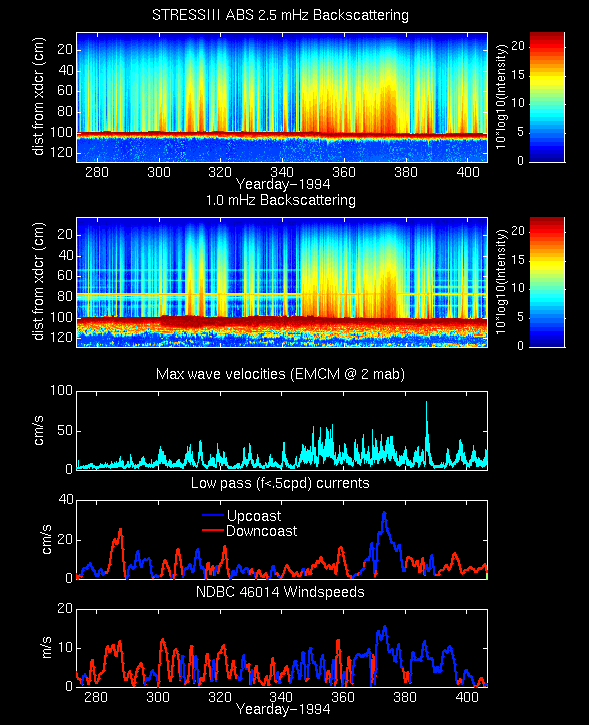
Uncalibrated ABS record for entire
deployment with maximum wave velocities from the EMCM current meter.
-
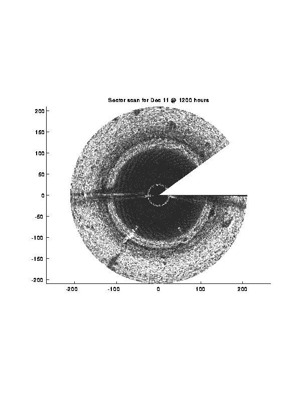
An image of the seafloor obtained
from the sector scanning rotary side scan sonar.
-
Time series (movies) showing the evolution of seafloor from the
sector
scanning rotary sonar. These images are mininally processed. A 3x3
pixel averaging (low-pass) filter was used for some smoothing and 12 hourly
images were averaged for each frame of these movies.
The most evident and interesting features in these movies are the creation
of subsequent erosion of boilogical "burrow" holes. An sector scanning
rotary sonar image that overlaps with a photo (taken by R. Wheatcroft)
is shown here.
Created and Mantained by Peter Traykovski(last
update: 4/7/95)