Ice Tethered Profiler 70 Data

Data from ITP70 deployed in August 2013


Last buoy status on 2015/9/25 0 UTC : temperature = 0.36 °C, battery = 10.31 V

Plot of ITP Buoy Status

Last position on 2015/9/25 0 UTC : 75.4078° N, 138.6354° W

Plot of ITP Locations

Last profile (number 3713) on 2014/7/15 1502 UTC

Last profile mean motor current = 92.5012 mA, mean battery = 8.6624 V

Plot of ITP Profiler Engineering Data

Last profile depth: minimum = 7.4646, maximum = 250.7765 m

Last profile temperature: minimum = -1.5177, maximum = 0.20659 °C

Last profile salinity: minimum = 27.4865, maximum = 33.5866

Composite Plot of ITP T & S Profiles

Plot of ITP T & S Contours

Composite Plot of MAVS Raw Velocity Profiles

Composite Plot of MAVS Raw Heading Profiles

Plot of ITP MAVS Contours

No microcat data yet

The raw GPS buoy location data are available in an ASCII file: itp70rawlocs.dat

Depth averaged profiler data files (with interpolated location) are available in two formats:

itp70grddata.tar.Z or itp70grddata.zip

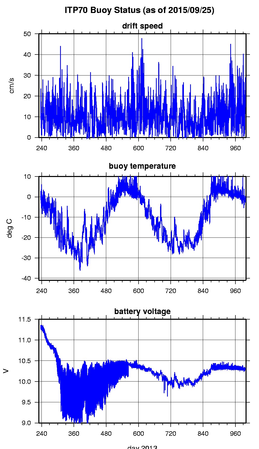
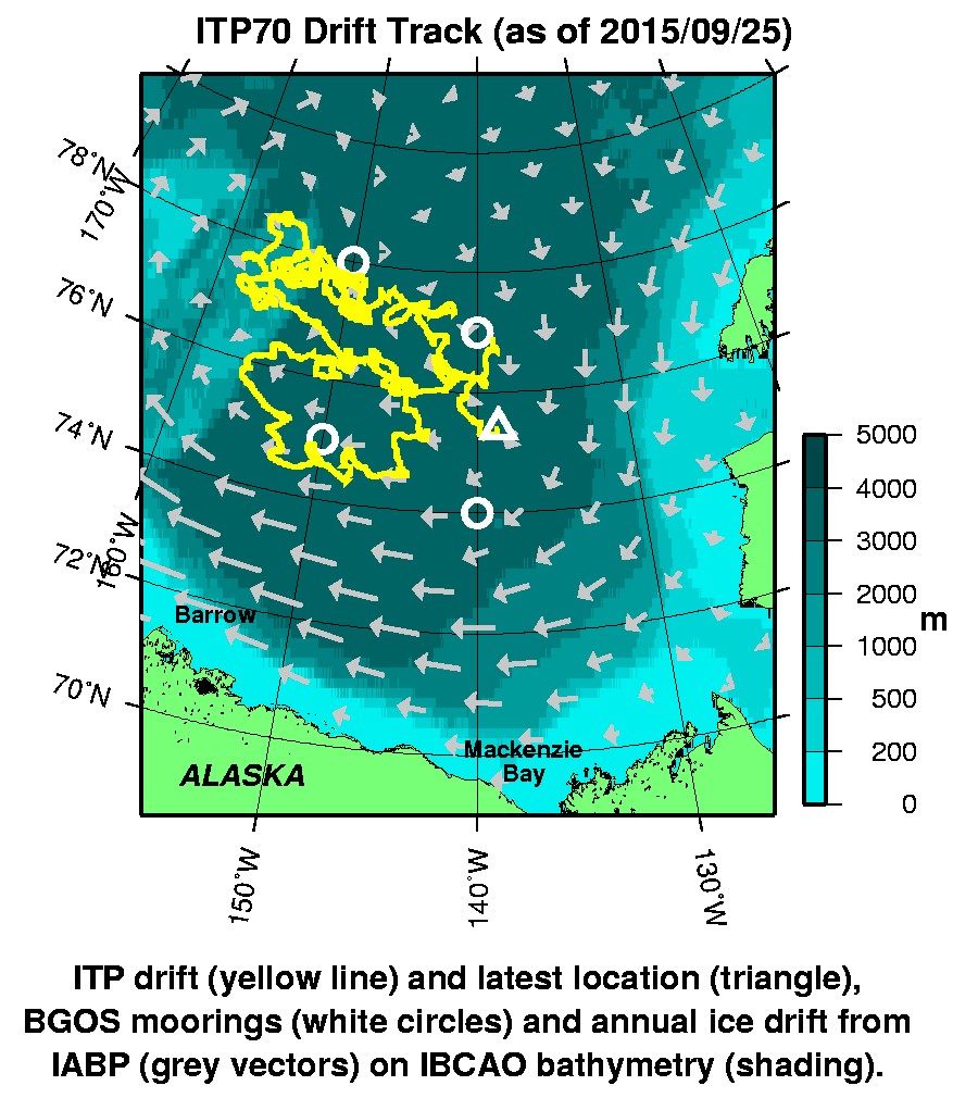
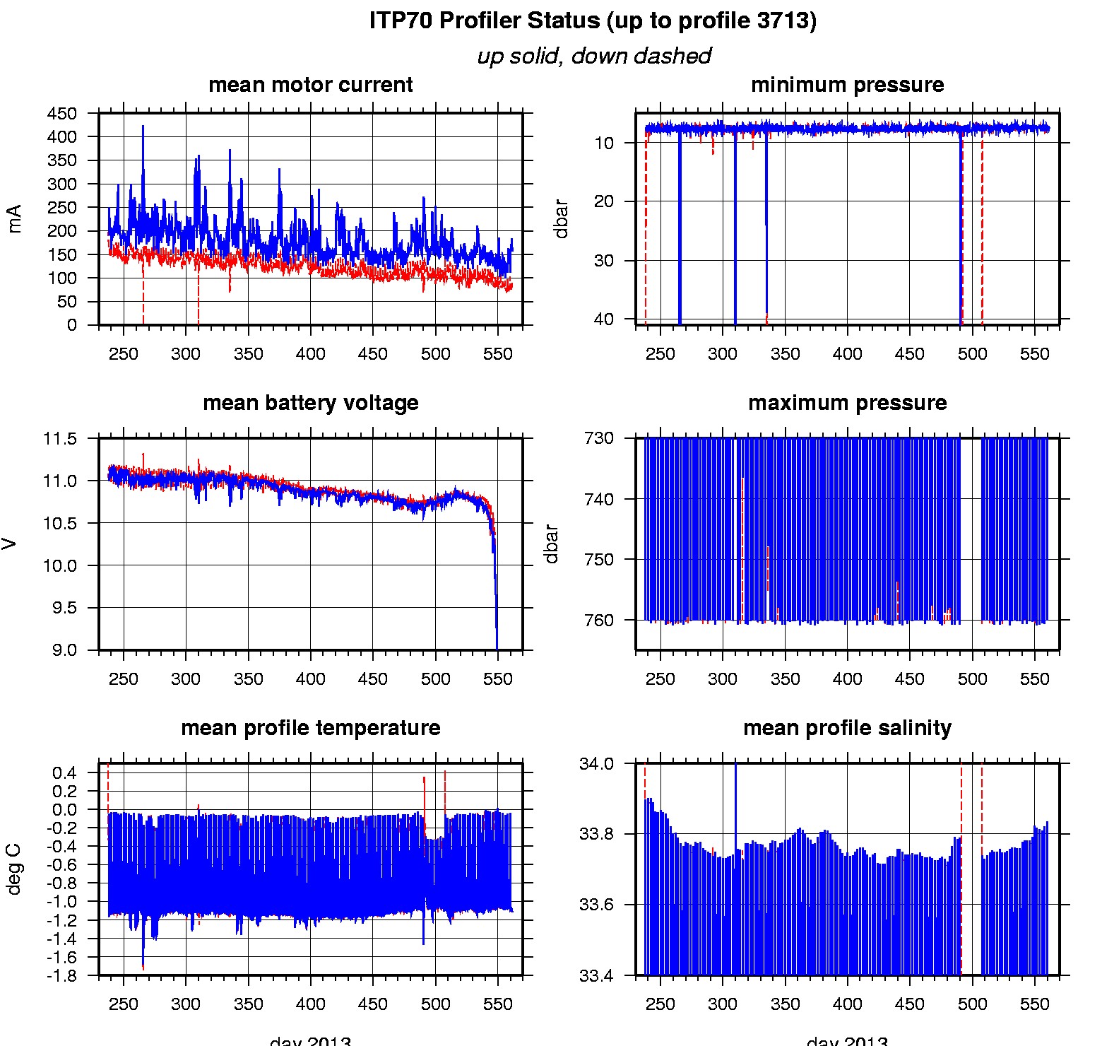
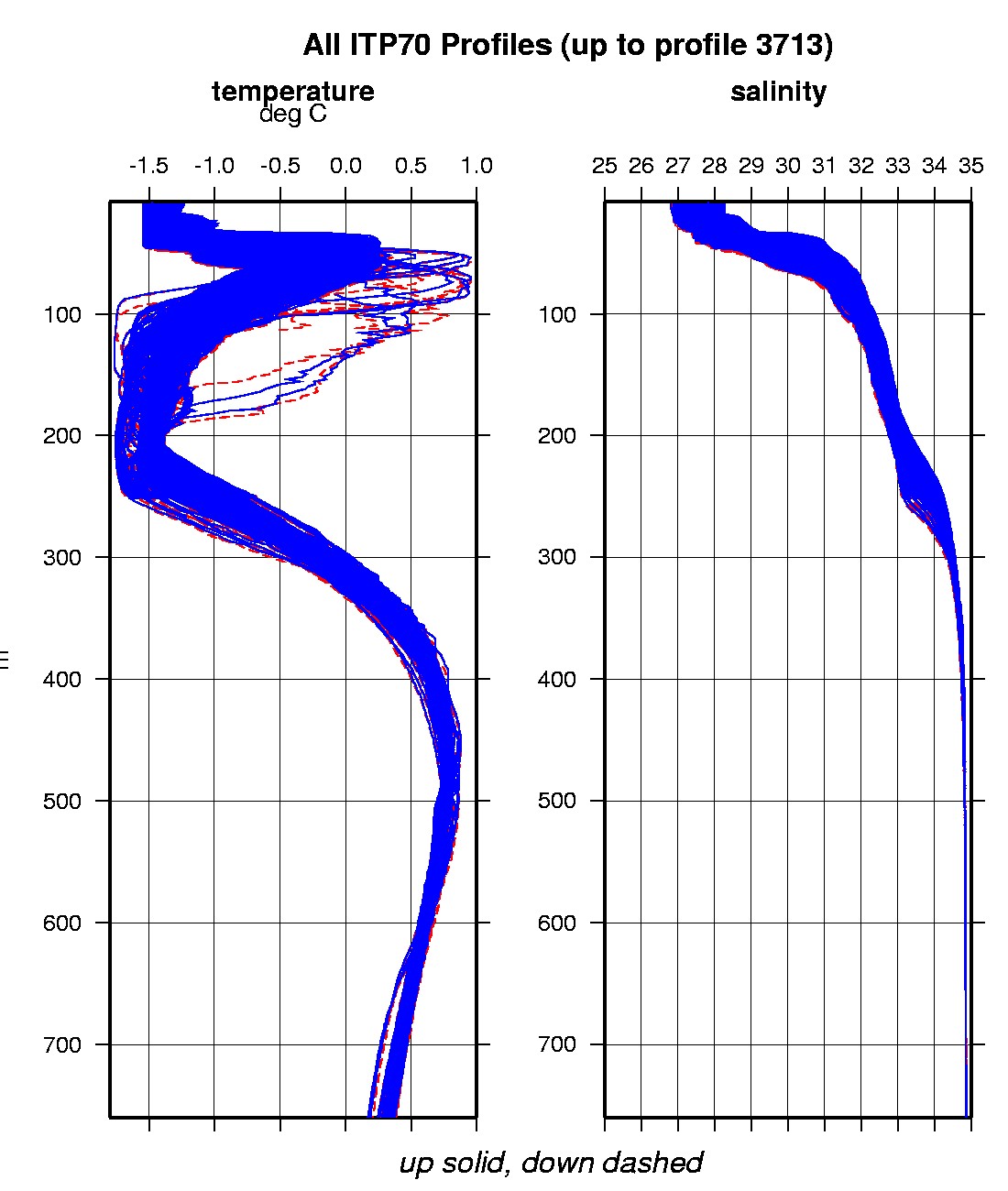
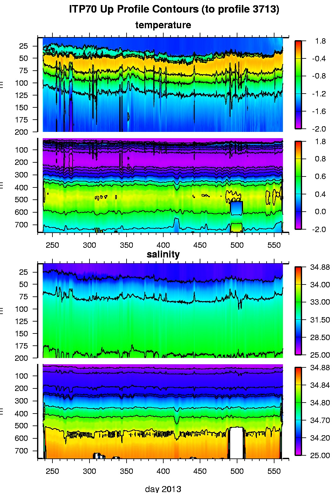
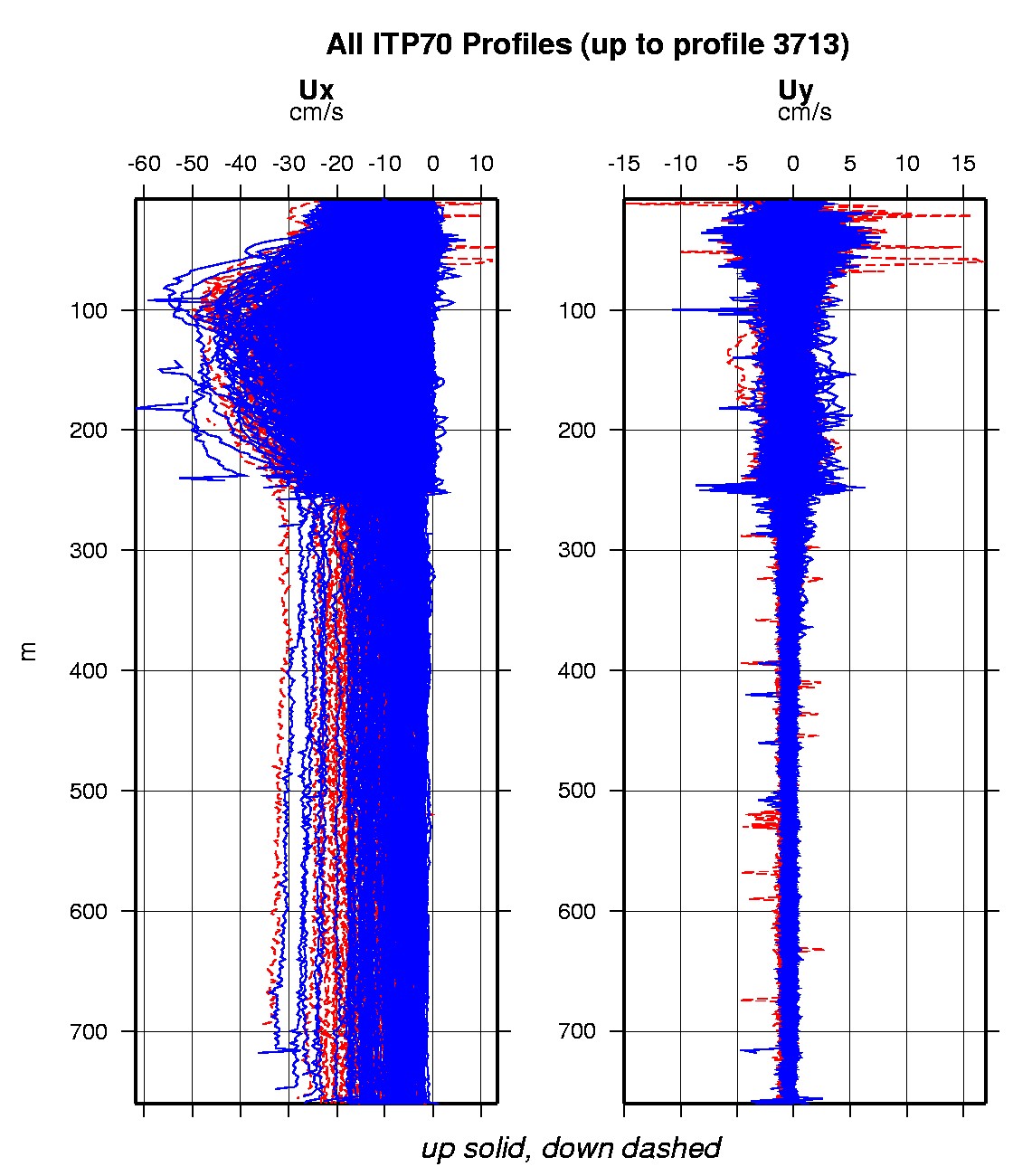
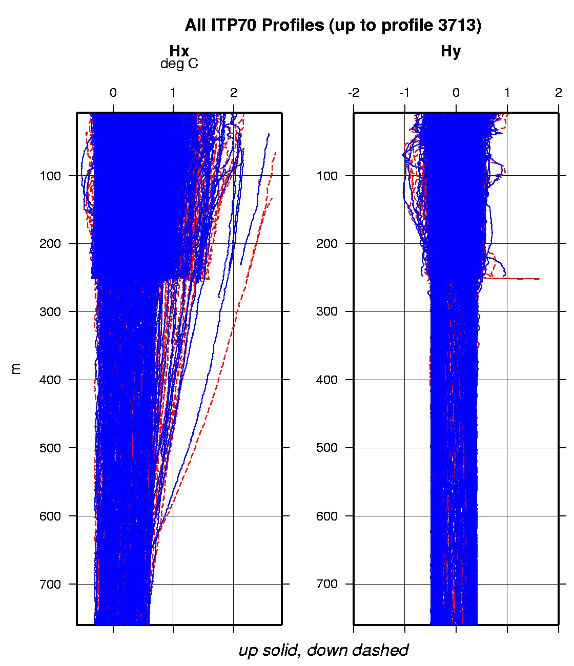
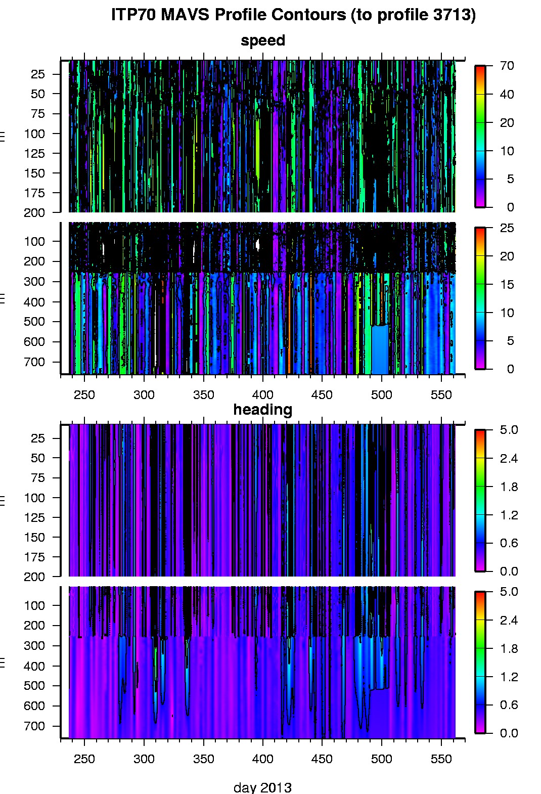
ITP70 was deployed on a 1.03 m thick icefloe in the Beaufort Sea on August 25, 2013 at 76° 55.4 N, 138° 50.9 W as part of the Beaufort Gyre Observing System (BGOS) during the JOIS 2013 cruise on the CCGS Louis S. St. Laurent. On the same icefloe, a Naval Postgraduate School Arctic Ocean Flux Buoy (AOFB), a US Army Cold Regions Research and Engineering Laboratory (CRREL) Ice Mass Balance Buoy (IMB), an autonomous atmospheric chemistry buoy (O-Buoy) , an Ice-Tethered Micro , and a wave buoy were also installed. The ITP includes a second generation prototype MAVS current sensor operating on a pattern profiling schedule including 2 one-way profiles between 7 and 760 m depth each day and SBE-37 microcat fixed at 6 m depth.