
Earth Science
Formation cycle of piteraq winds
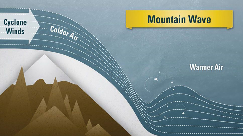
Piteraqs form when cyclones push cold air downhill, creating fast, turbulent winds funneled by valleys that accelerate and crash like giant mountain waves.
Read MoreIllustration depicting the formation of the Samoan Islands chain
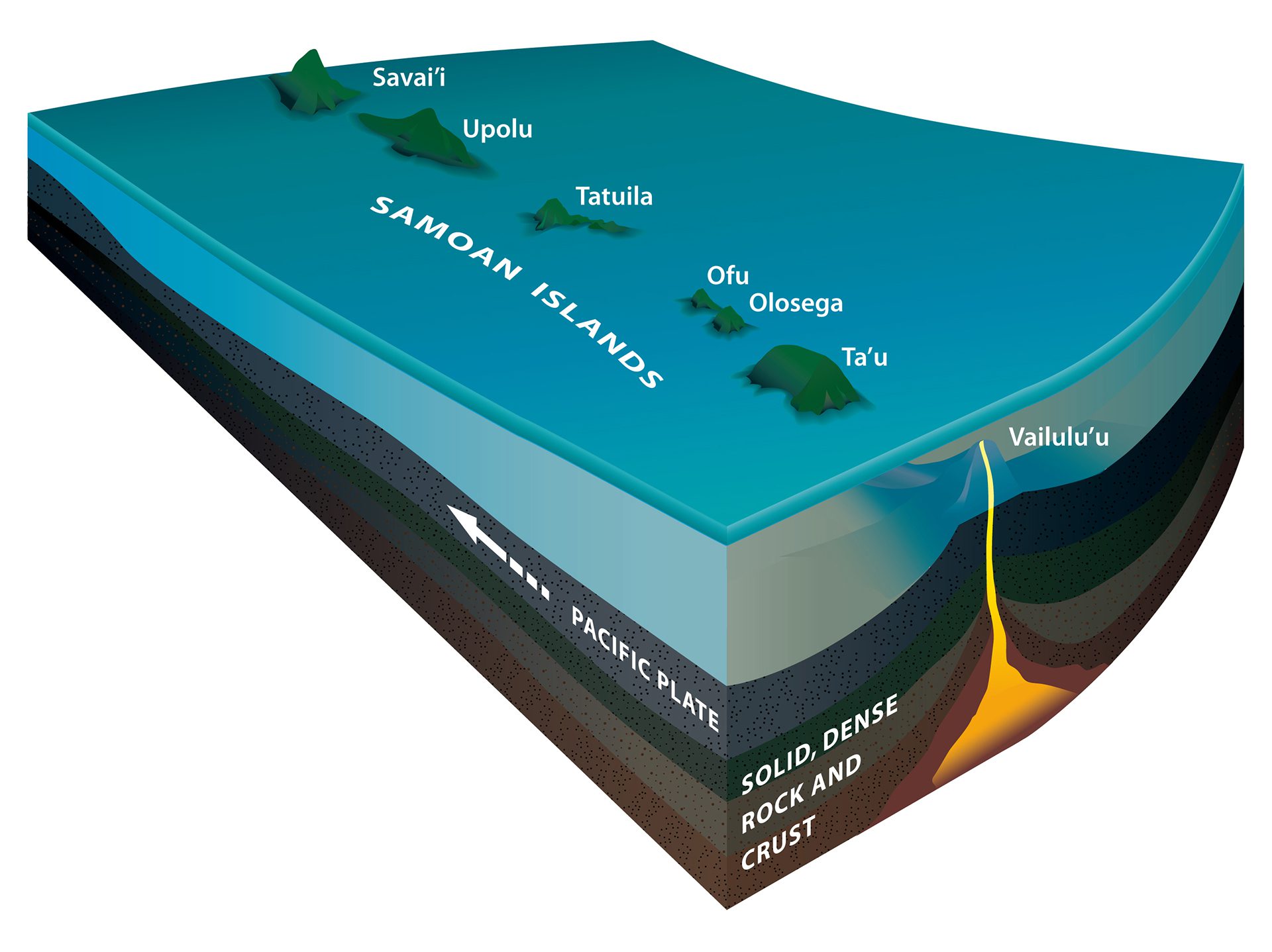
Like Hawaii, the Samoan Islands formed over a volcanic hotspot.
Read MoreNorth Icelandic Jet
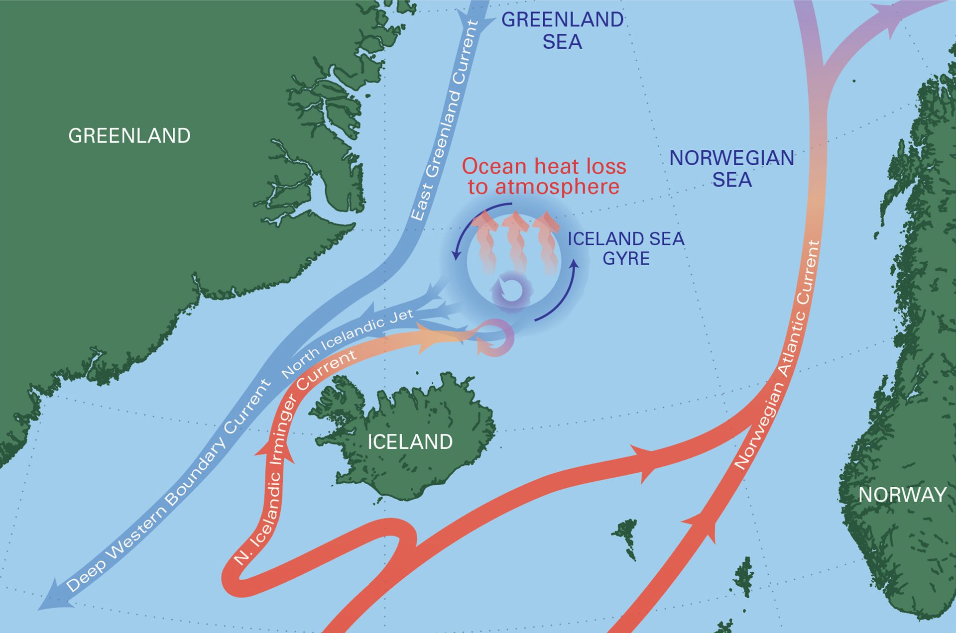
Map centered on the Iceland Sea Gyre, where turbulent waters cool and feed the North Icelandic Jet, returning cold water south via the Deep Western Boundary Current.
Read MoreThe ocean’s Biological Carbon Pump
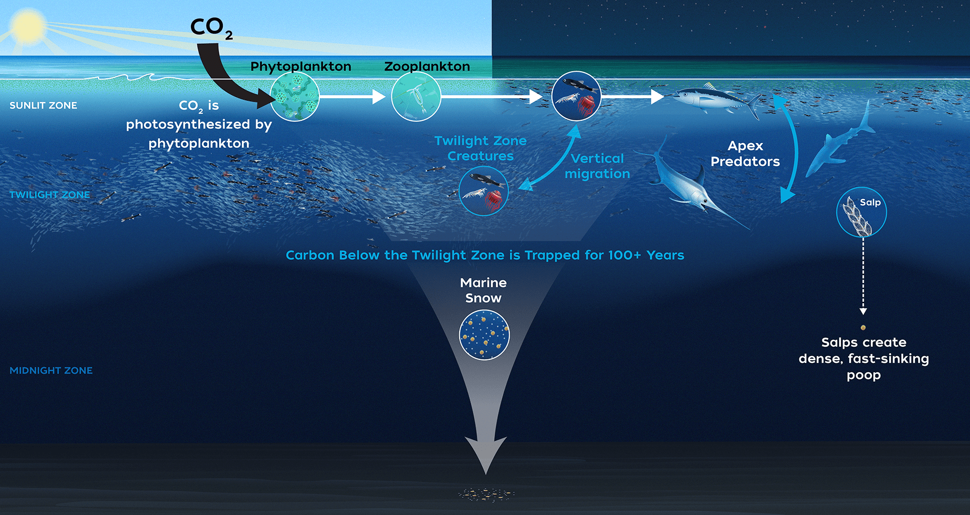
Tiny ocean plants absorb CO? via photosynthesis, then sink or get eaten, moving carbon from surface waters to deep ocean—key to Earth’s carbon cycle.
Read MoreMicrobial life is discovered in vents
Scientists found 100-million-year-old microbial life in seafloor rocks near Portugal, thriving deep underground where hydrothermal fluids mixed with seawater.
Read MoreHow a Deep Hypersaline Anoxic Basin (DHAB) forms
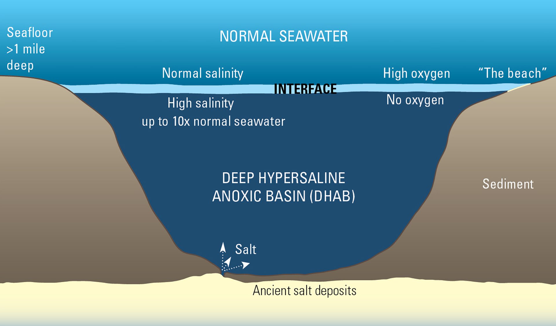
Deep hypersaline anoxic basins form when salt dissolves into seafloor water, creating dense, oxygen-free water trapped below normal seawater in ocean valleys.
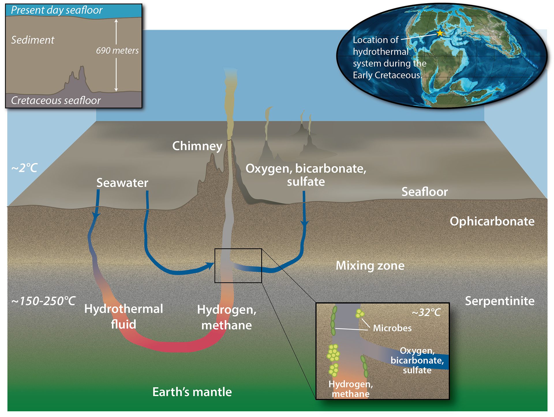
Read MoreThe existence of ancient vent microbes
Microbes deep below the seafloor survive on chemicals from seawater-rock reactions. Ancient mantle rocks reveal preserved traces of their life.
Read MoreThe Indian Ocean Dipole
3D maps showing seasonal shifts in atmospheric and ocean conditions in the Indian Ocean that drive the monsoon system.
Read MoreGalápagos Islands unique ecosystem involving trade winds and EUC
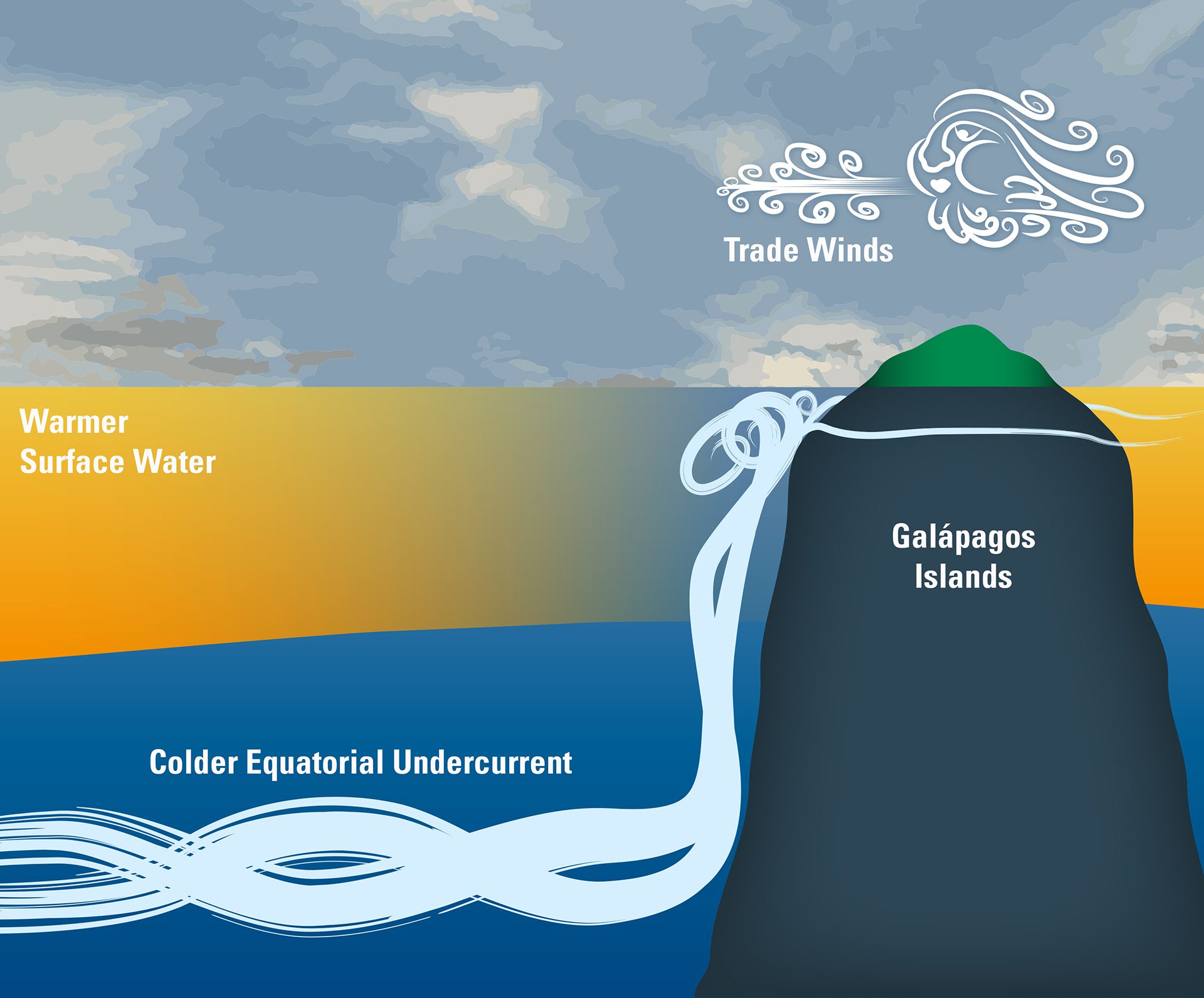
Trade winds push surface water west, while an eastward undercurrent hits the Galápagos, lifting deep, nutrient-rich water that fuels its unique ecosystem.
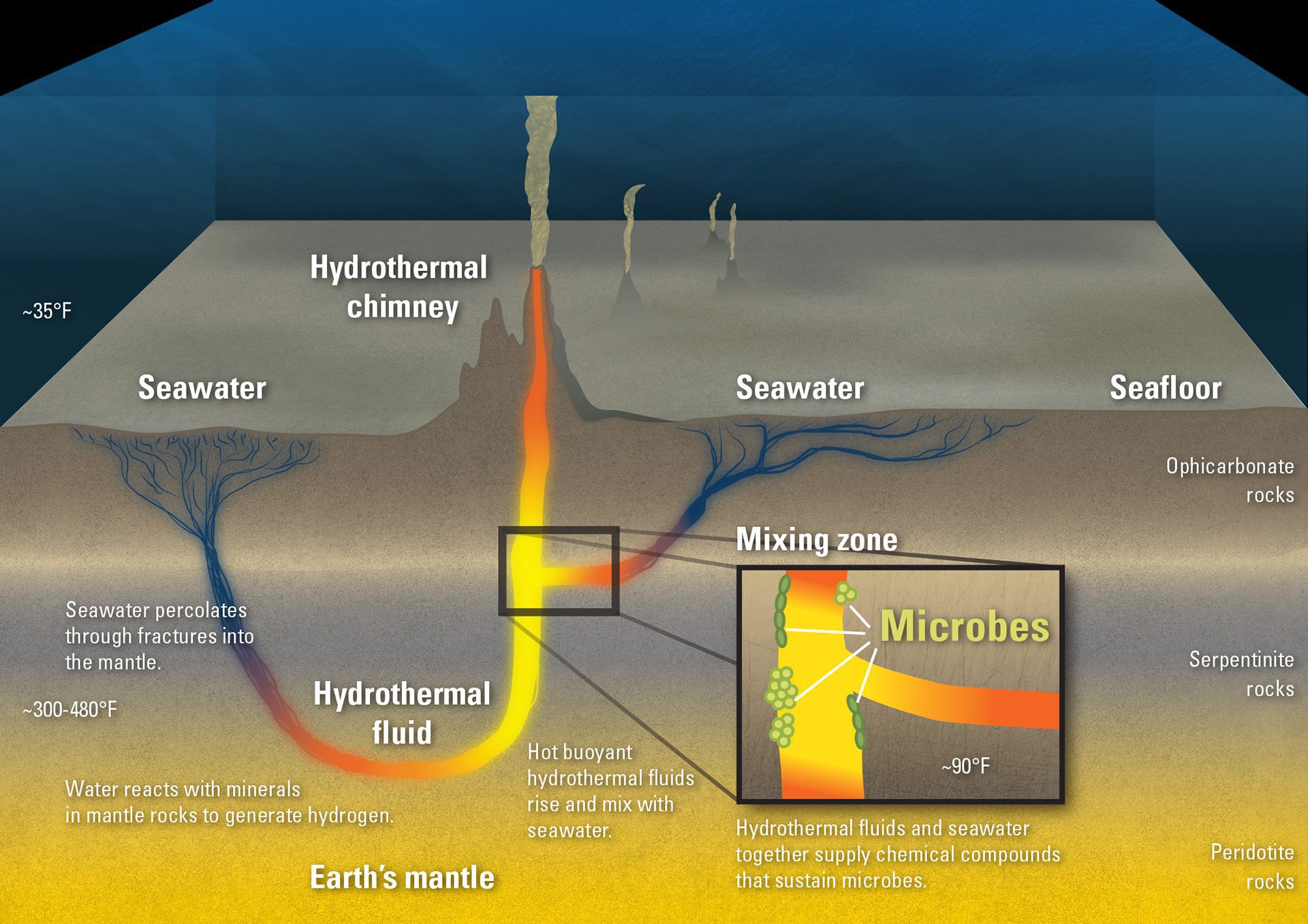
Read MoreHow a hydrothermal vent system works
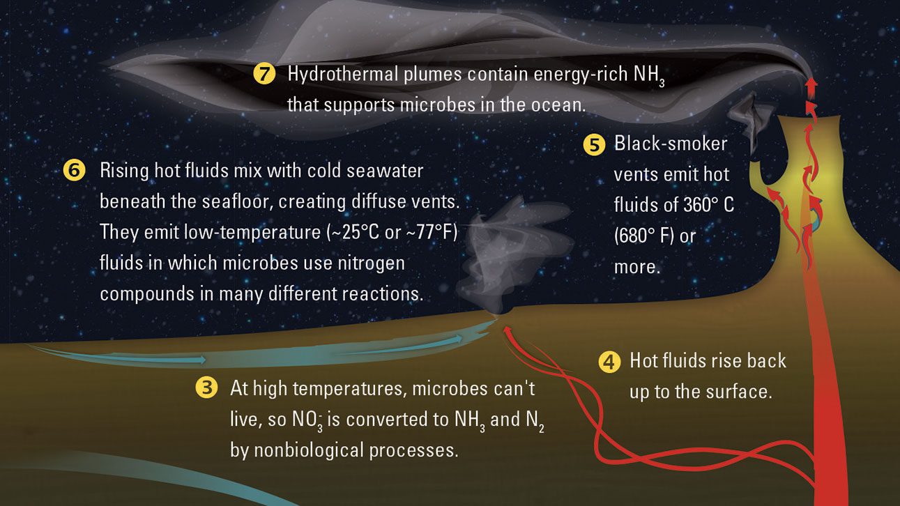
Hydrothermal vents form in places where there is volcanic activity, such as along the Mid-Ocean Ridge.
Read MoreHow biological compounds from phytoplankton blooms enter the atmosphere
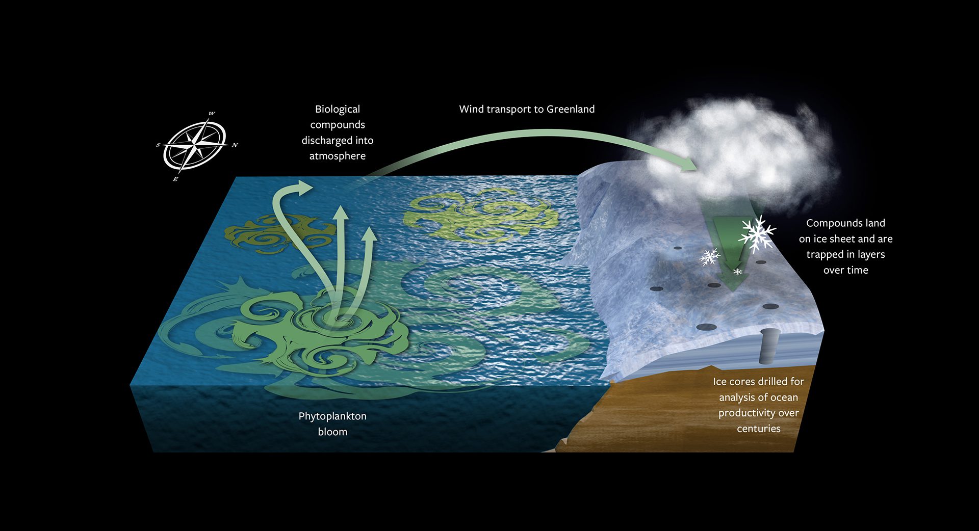
Biological compounds from phytoplankton blooms could end up trapped in centuries-old ice cores that scientists can use to measure ocean productivity over time.
Read MoreHow blue holes are formed
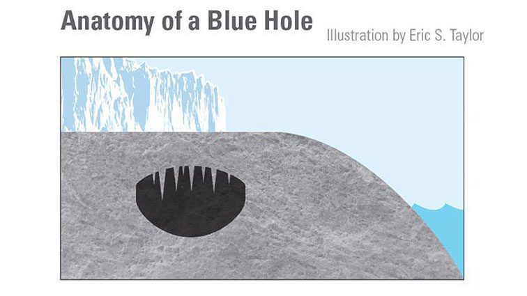
These sinkholes formed on dry land during the last ice age, when much of the Earth’s water was frozen in ice sheets and sea levels were almost 400 feet lower than today.
Read MoreHow the Fraser River picks up chemical signatures along its journey
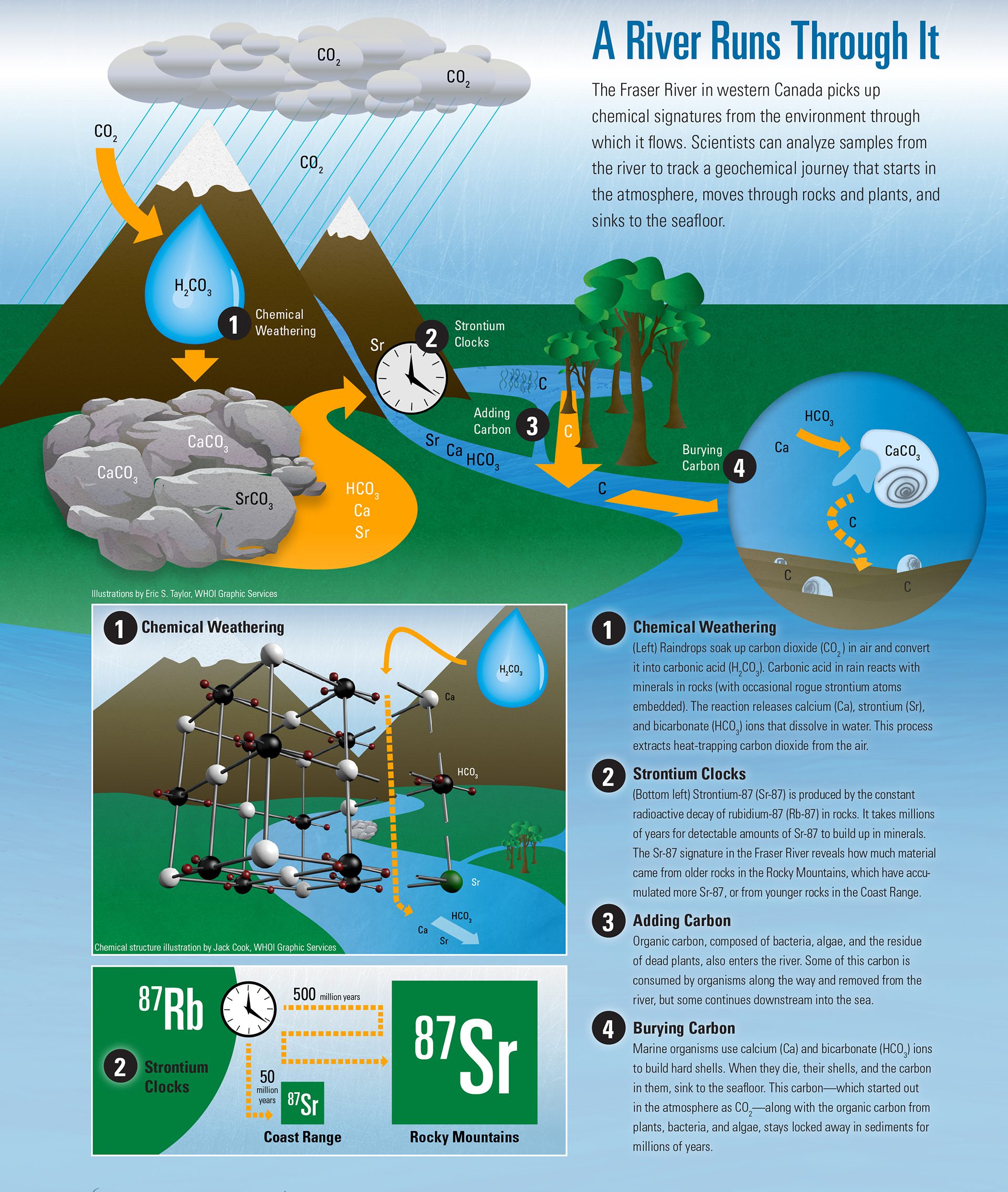
Samples from the Fraser River help scientists track a geochemical journey that starts in the atmosphere, moves through rocks and plants, and sinks to the seafloor.
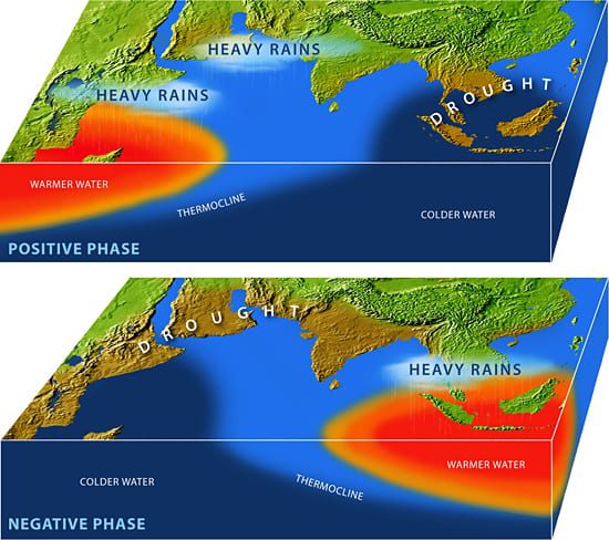
Read MoreHow the Pacific influences rainfall in Asia
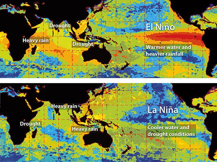
Maps comparing the connection between the Pacific and Indian Ocean regions in the equatorial region, during El Nino/La Nina conditions.
Read MoreIcy wind blows from the Antarctic Continent
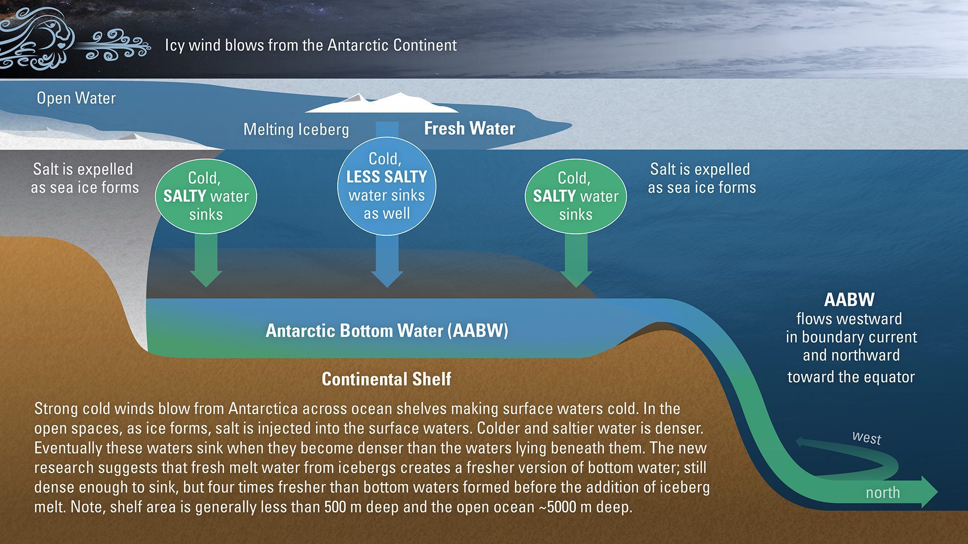
New research suggests that fresh melt water from icebergs creates a fresher version of bottom water, with potentially significant consequences for the ocean and climate.
Read MoreAir-sea exchange mechanisms
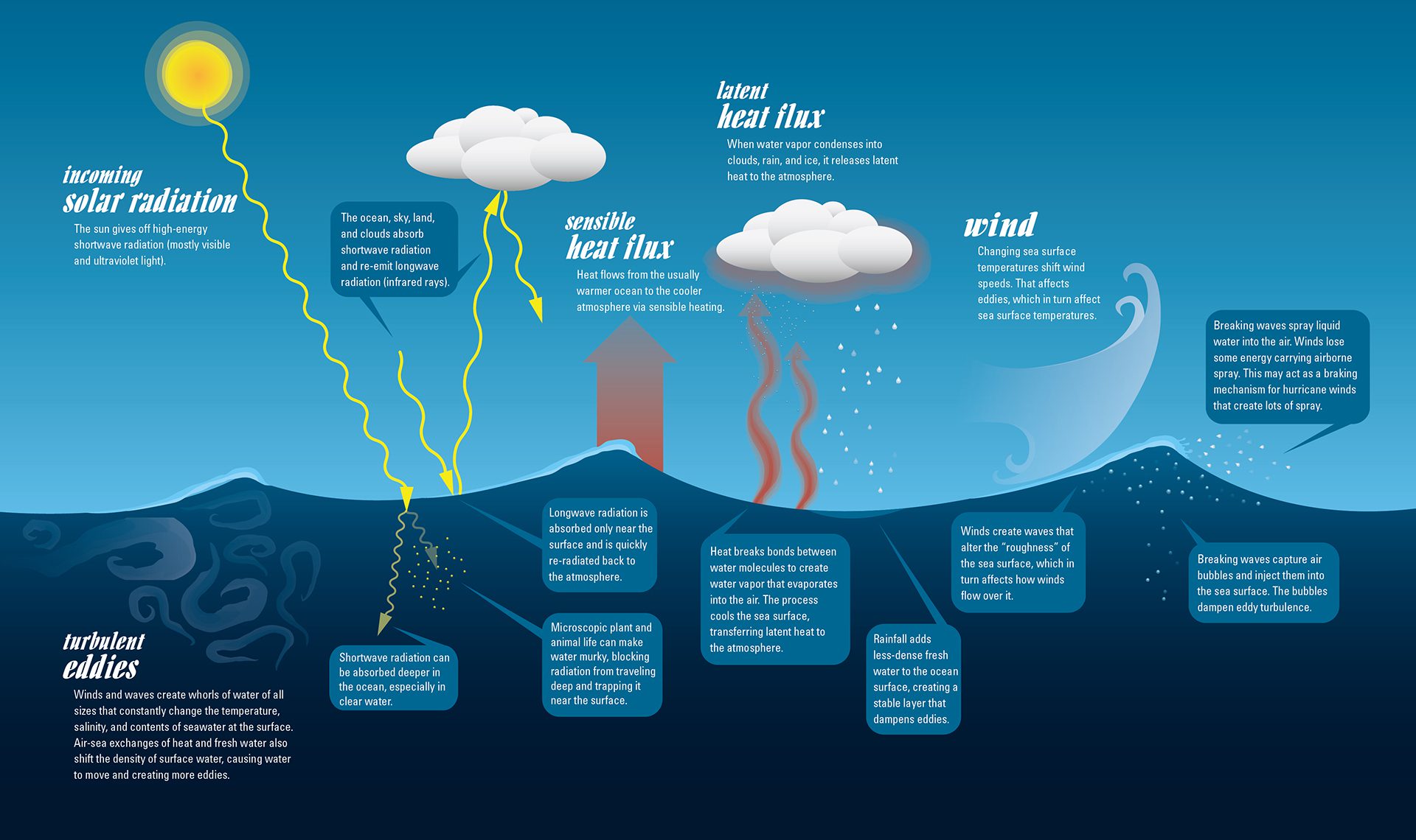
Climate change shifts Earth’s water cycle, increasing rain in wet areas and drought in dry ones. Scientists study how water moves between ocean and air.
Read MoreGulf of Maine ocean circulation
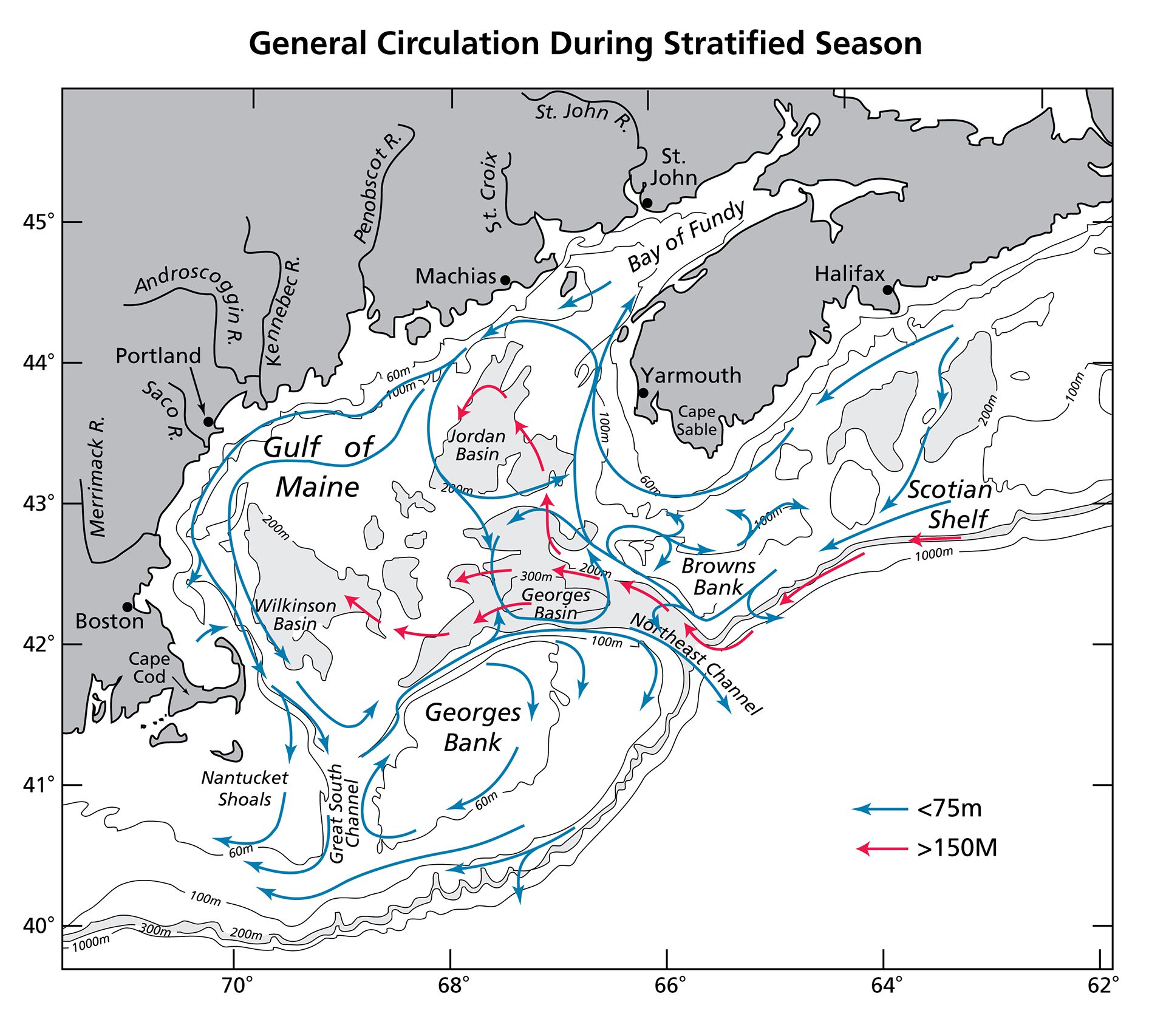
Detailed map showing general circulation and bathymetry in the Gulf of Maine during stratification season.
Read MoreEstrogens comes in several "flavors"
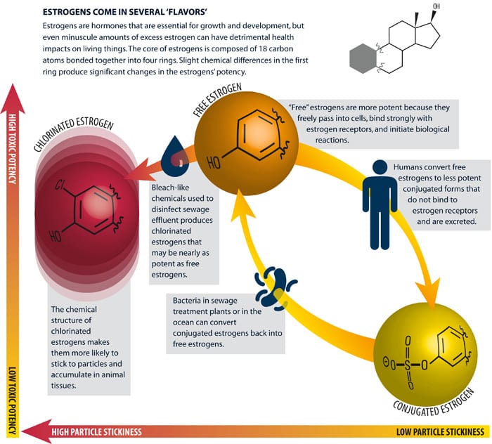
Estrogens are hormones that are essential for growth and development, but even minuscule amounts of excess estrogen can have detrimental health impacts on living things.
Read MoreTaking a deeper look at Deep-Sea
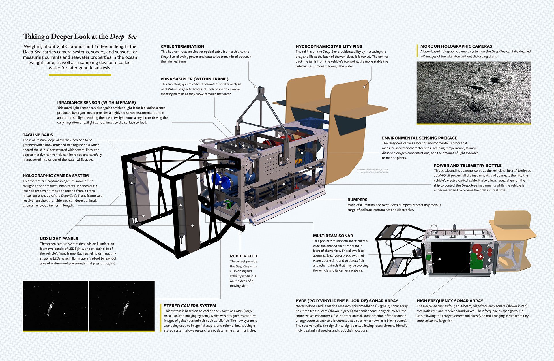
Deep-See carries camera systems, sonars, and sensors for measuring currents and seawater properties in the ocean twilight zone, as well as a sampling device.
Read MoreDevelopment of a rip current along a coastal beach
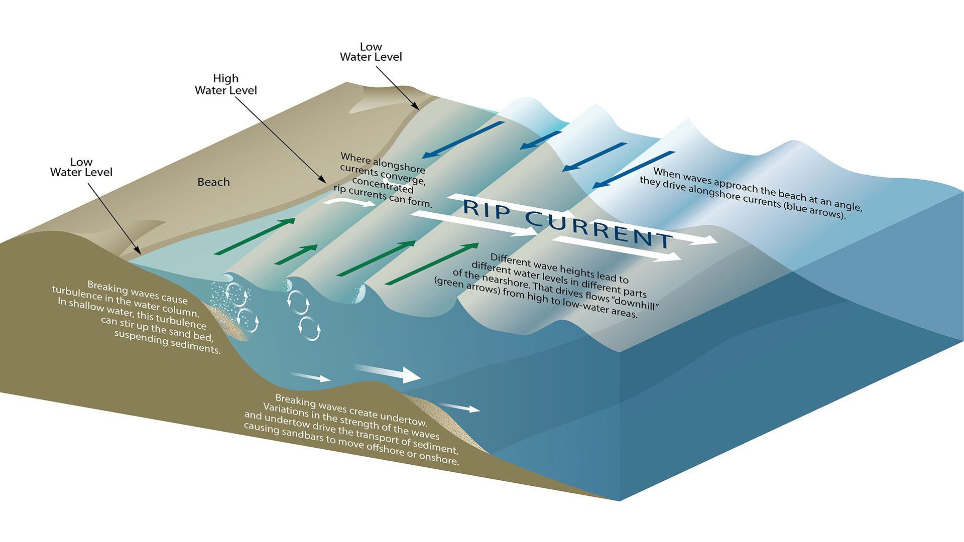
Waves, currents, and seafloor shape interact in coastal surf zones, moving sand and water up, down, and along the shore, constantly reshaping the coastline.
Read MoreNorth Atlantic circulation
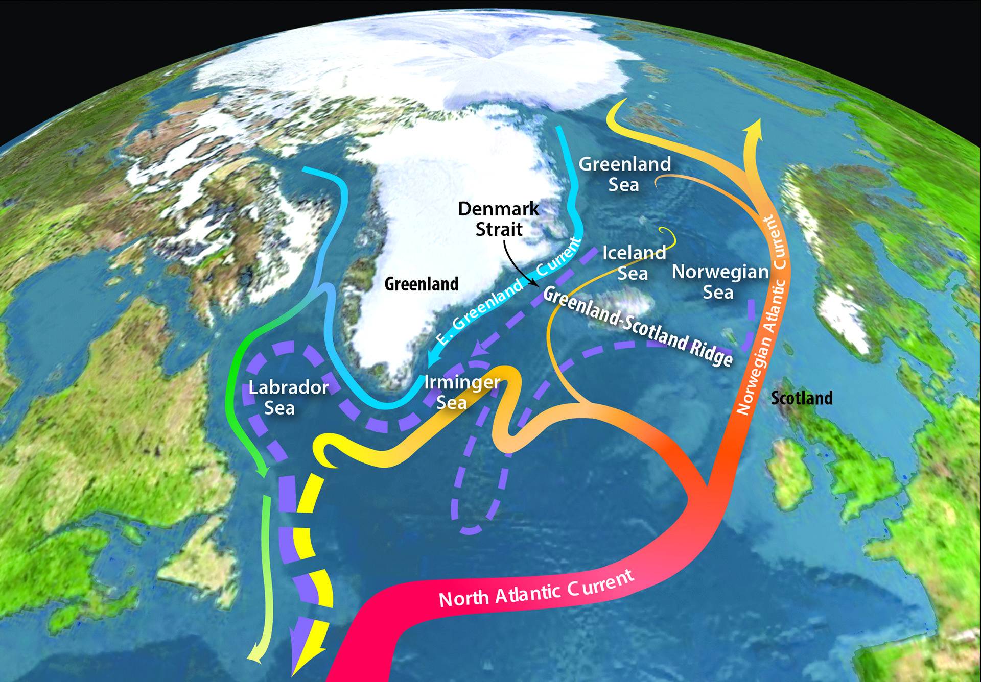
Global map illustrating general circulation patterns in the Northern Hemisphere with a focus on the Greenland Strait.
Read MoreDiatoms and Coccoliths carbon-dioxide carbon removal from atmosphere
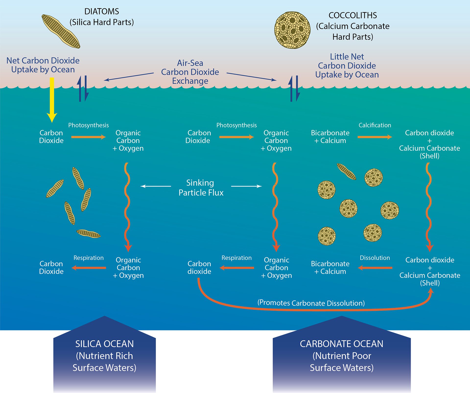
Conditions that influence how diatoms and coccoliths removal of carbon-dioxide — from the atmosphere to the deep ocean.
Read MoreKuroshio Current: Both highway and barrier for Fukushima radiation
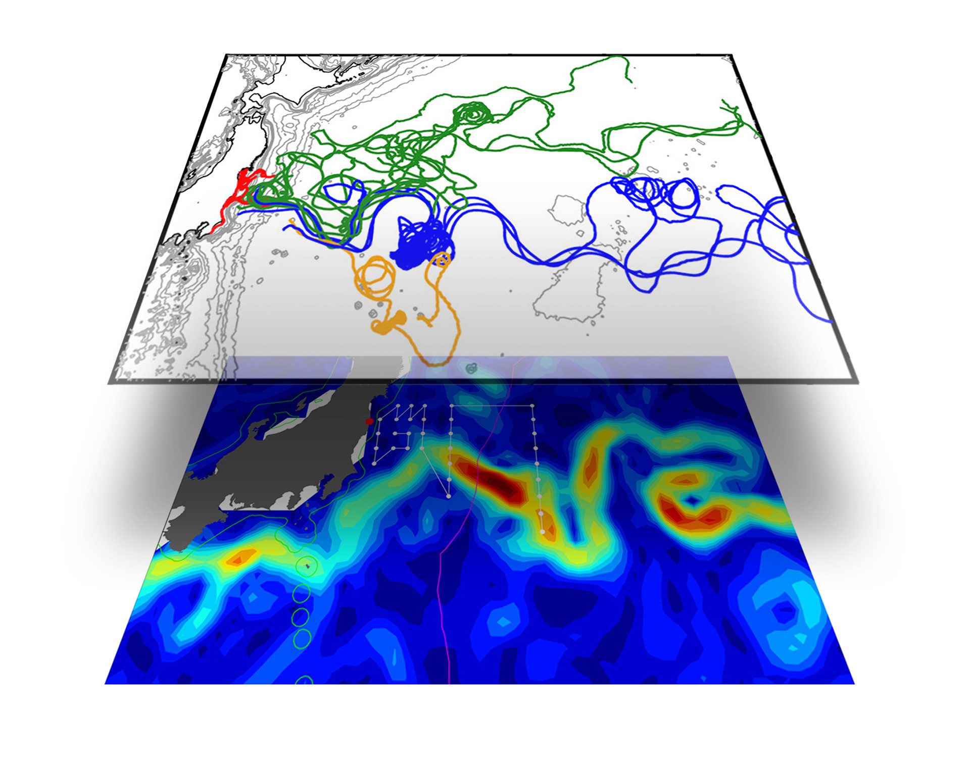
Map of drifter flow lines overlaid on the Kuroshio Current shows how Fukushima disaster radiation was swept away from shore, but blocked from flowing South.
Read MoreSharks ride eddies to the depths
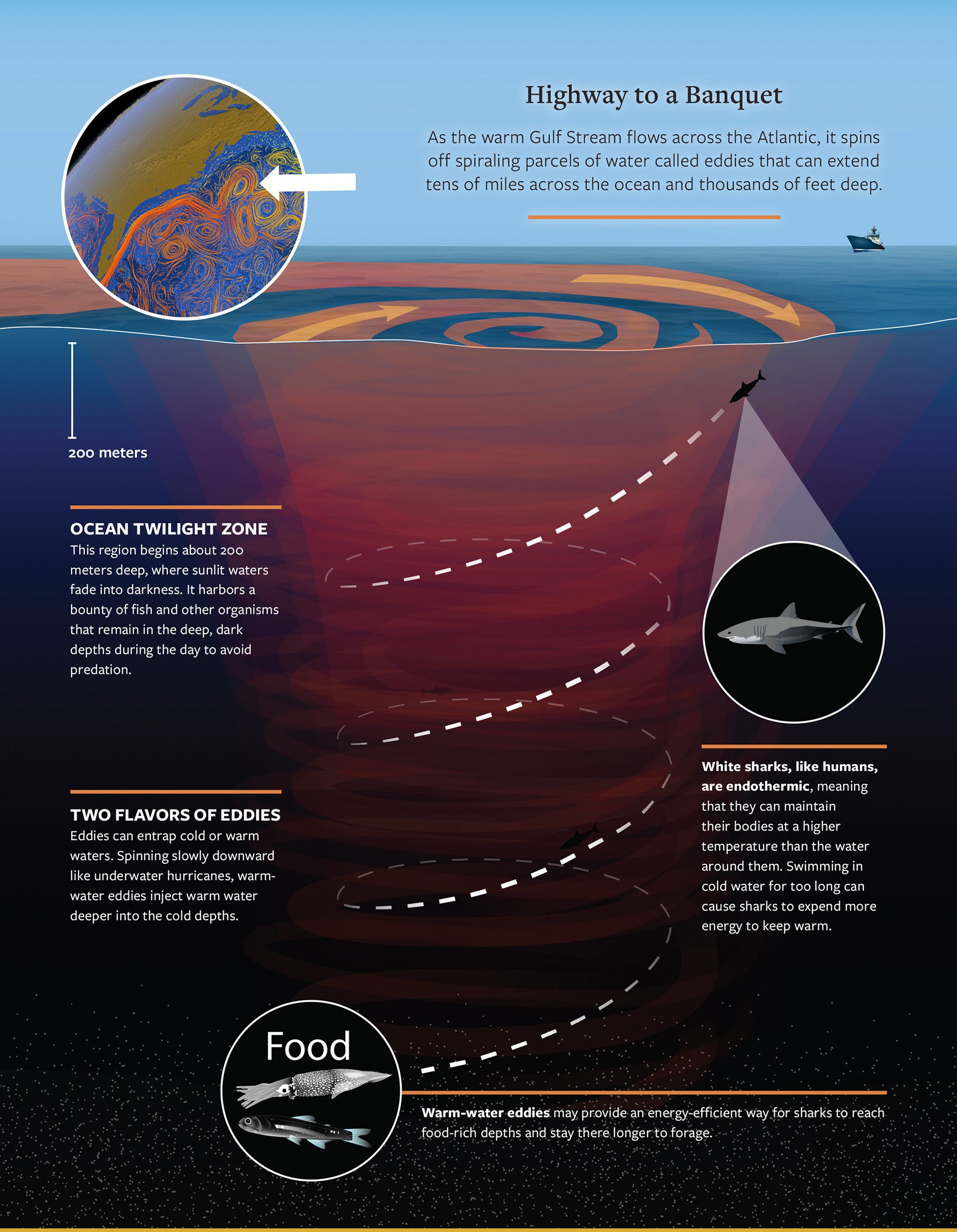
White sharks in the open ocean seem to seek out eddies for a surprising reason: The eddies offer a beeline to a banquet of food.
Read More