
Earth Science
Sinking water in the North Atlantic
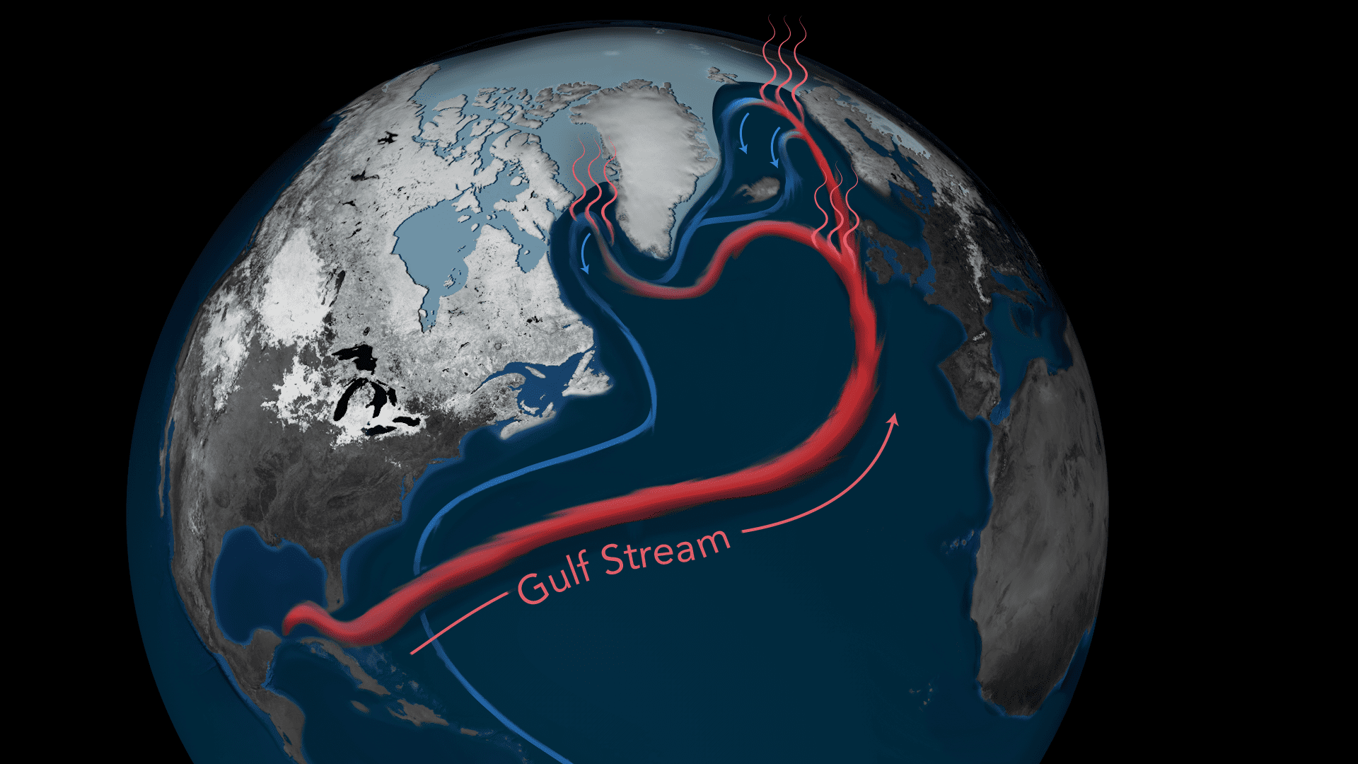
Global map showing warm Gulf Stream waters flowing north toward the Arctic, where they cool, sink, and return south as part of the global ocean circulation.
Read MoreNorth Atlantic Ocean circulation pump
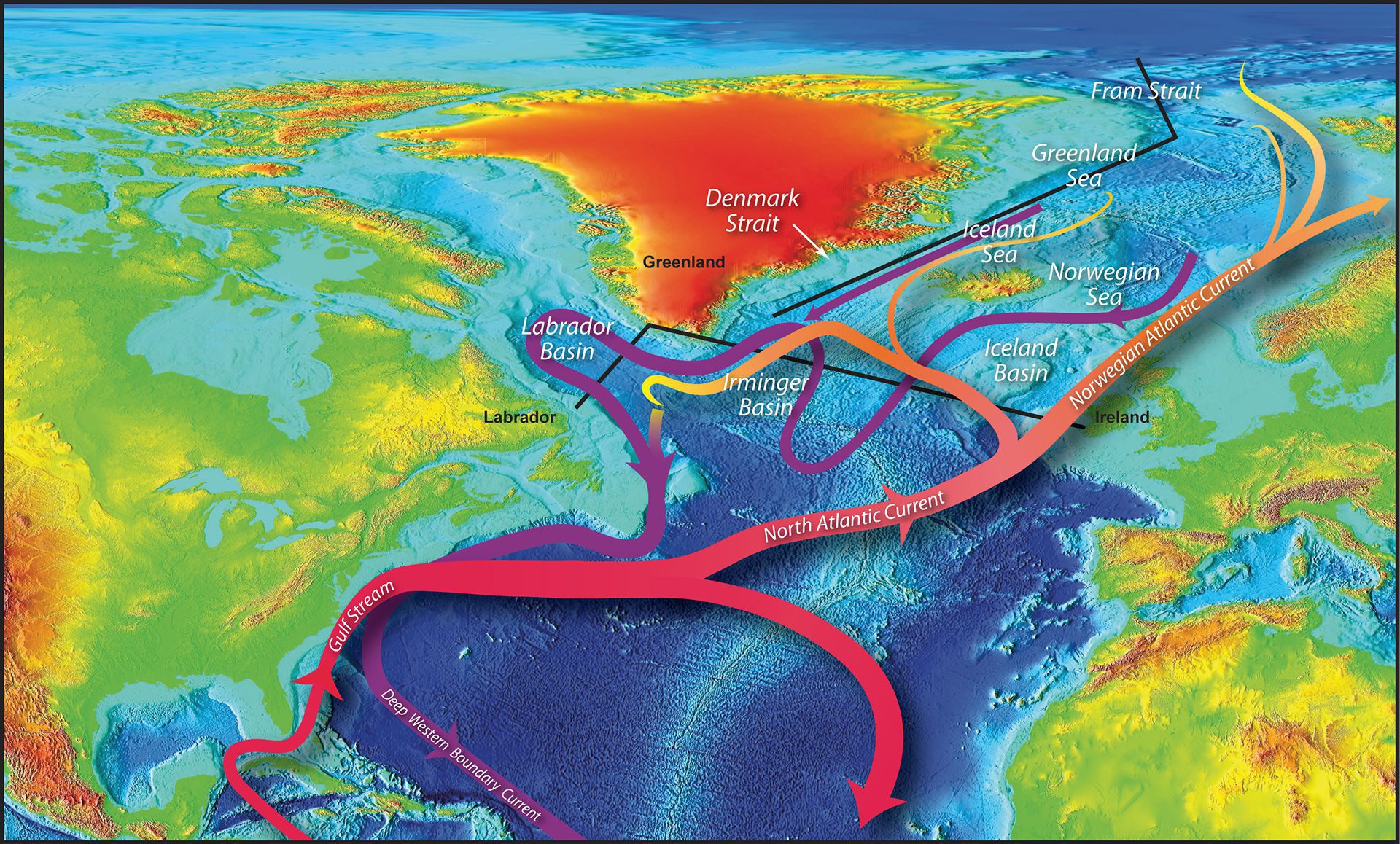
Map of North Atlantic currents labeled, with temperature shown in color and ocean surface elevation represented using a rainbow color ramp.
Read MorePhases of North Atlantic Oscillation
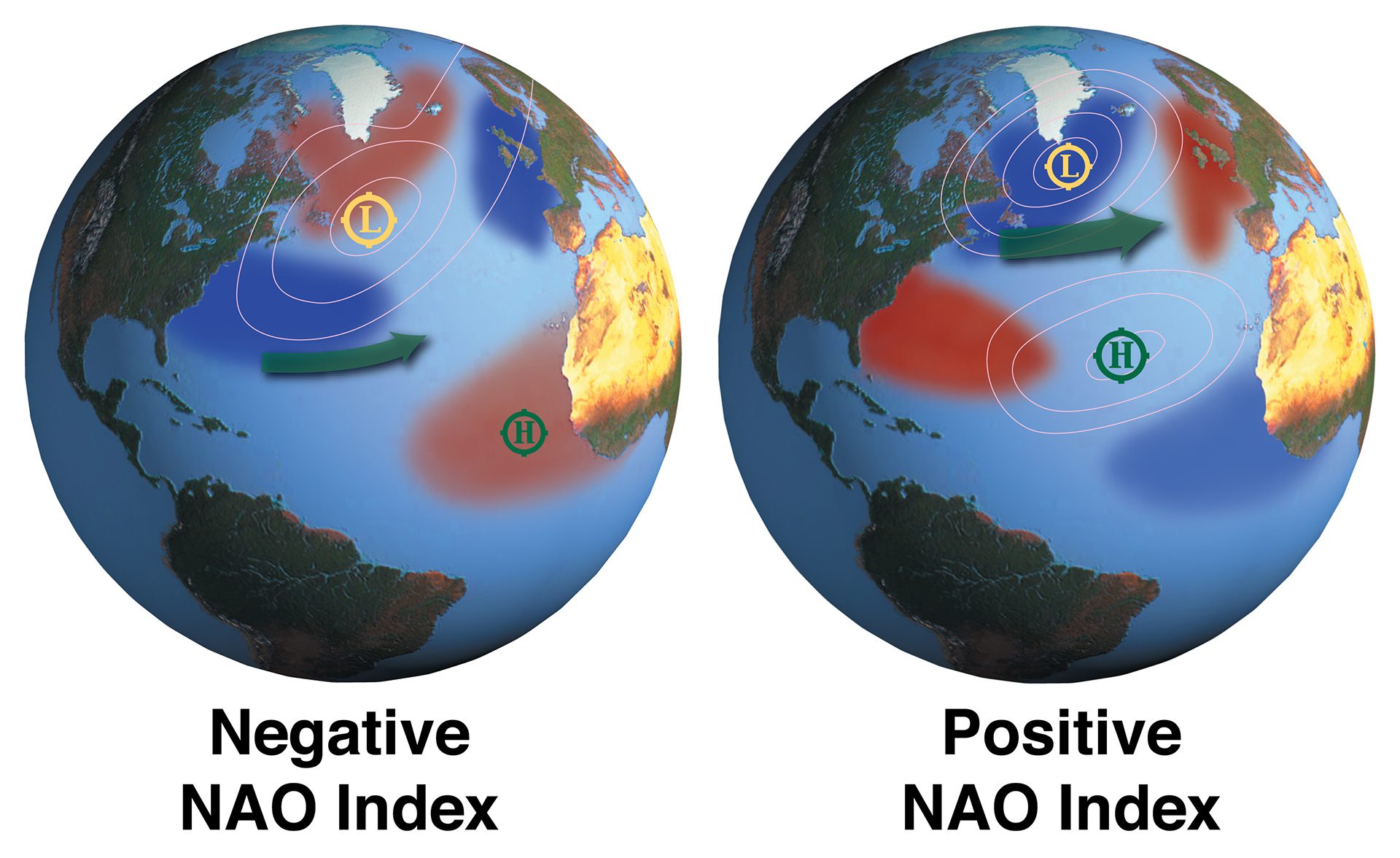
Global maps comparing weather over the North Atlantic during positive and negative oscillation phases.
Read MoreOcean-atmosphere interactions in the Northern Hemisphere
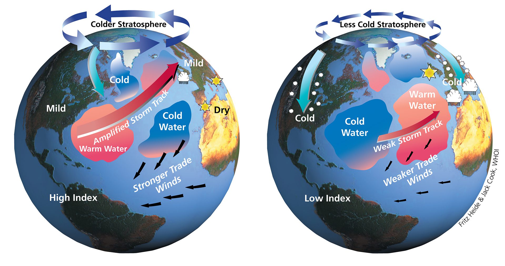
Global maps showing how atmospheric and ocean conditions interact in the Northern hemisphere, influencing sea surface temperature, weather patterns and climate.
Read MoreOcean eddies transporting plankton throughout the water column
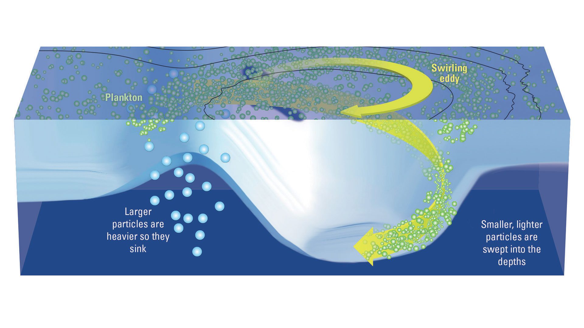
Plankton help reduce atmospheric carbon dioxide by using it to grow. Larger particles sink to store carbon, while scientists study how smaller particles might also descend.
Read MoreOcean food web processes that drive carbon cycle
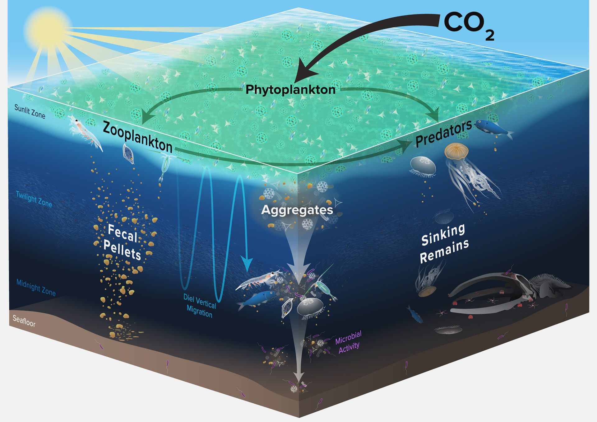
Ocean carbon cycles as phytoplankton convert CO2 into organic carbon, feeding zooplankton that respire CO2; some carbon sinks or is mixed into deeper ocean layers by various pumps.
Read MoreOcean iron recycling illustration
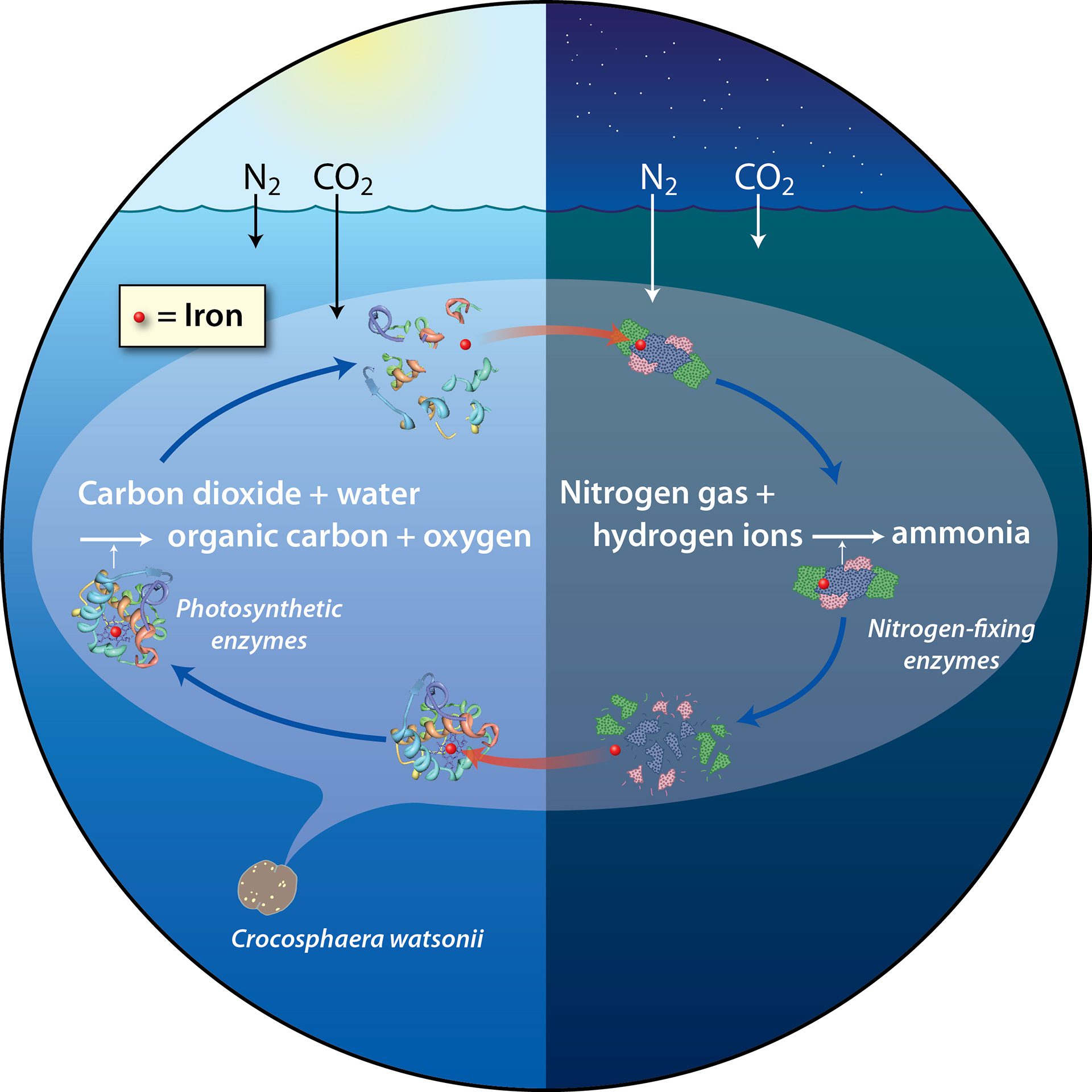
One ocean bacterium halves its iron needs by recycling enzymes—using iron-rich enzymes for photosynthesis by day, then switching to others for ammonia production at night.
Read MoreOceanic conveyor belt
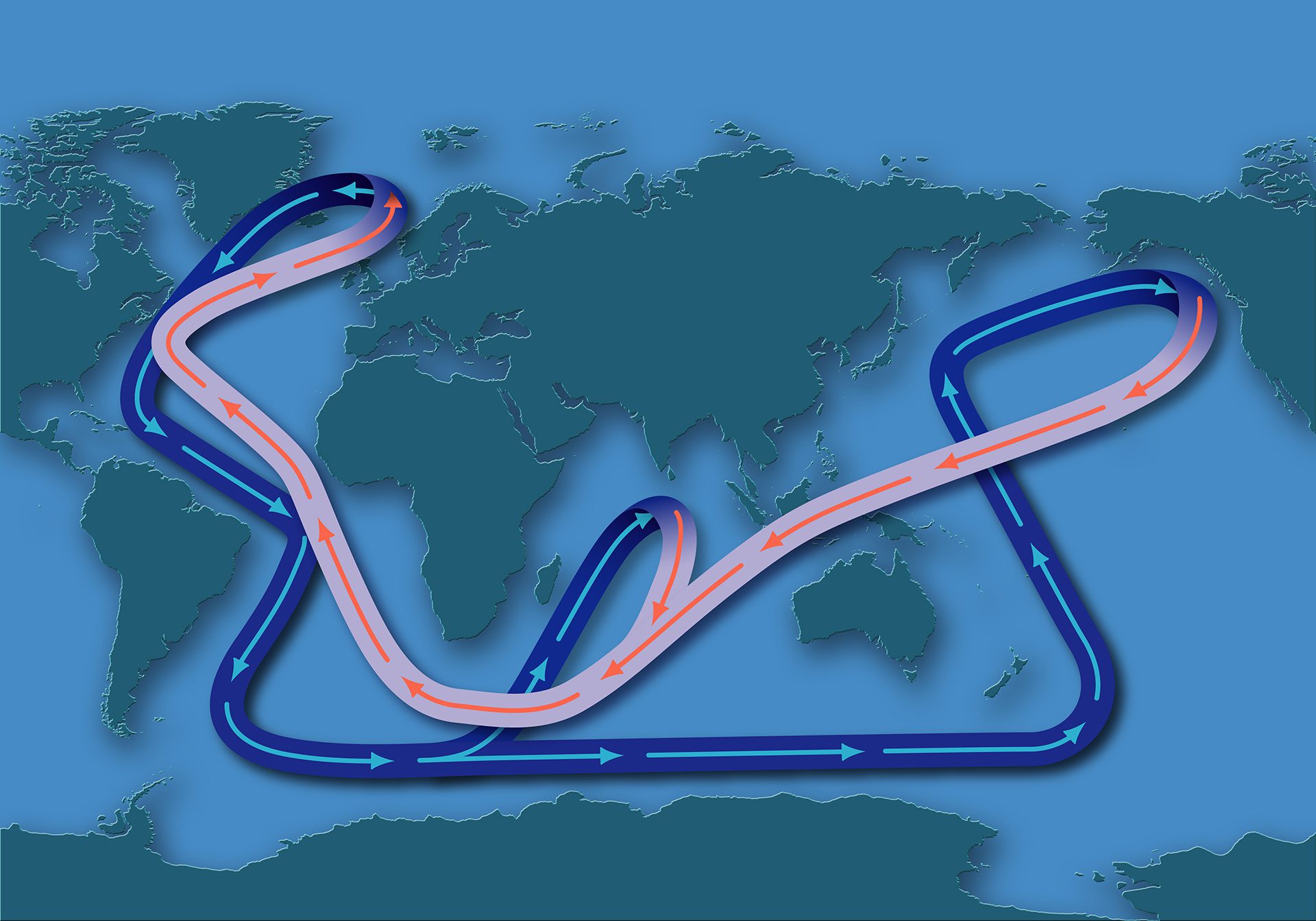
Global map showing ocean current temperatures and flow patterns, illustrating a conveyor beltlike connection across the world’s oceans.
Read MoreLa Nina
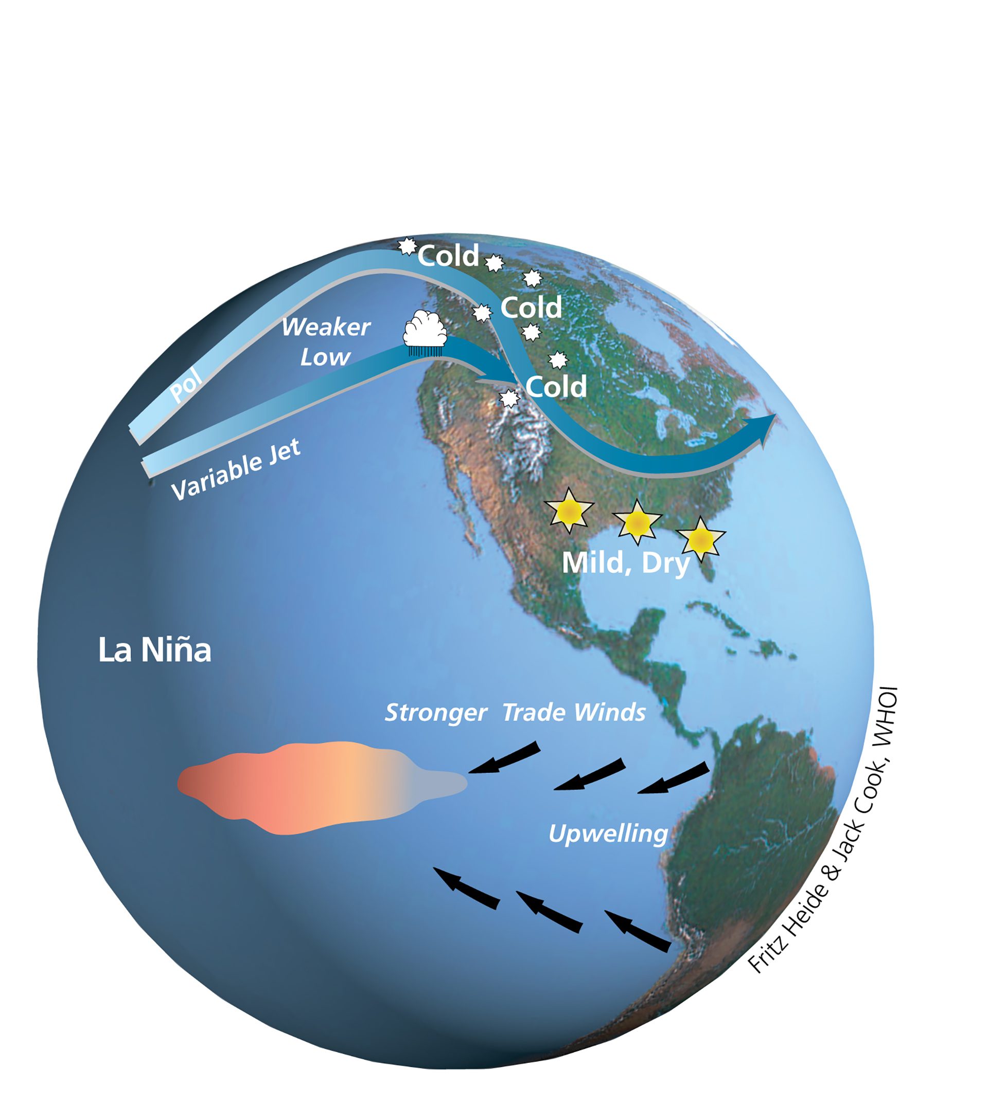
Global map illustrating changes in sea surface temperatures, wind, and weather patterns that define an El Niño event.
Read MoreLavas forming at volcanic arcs
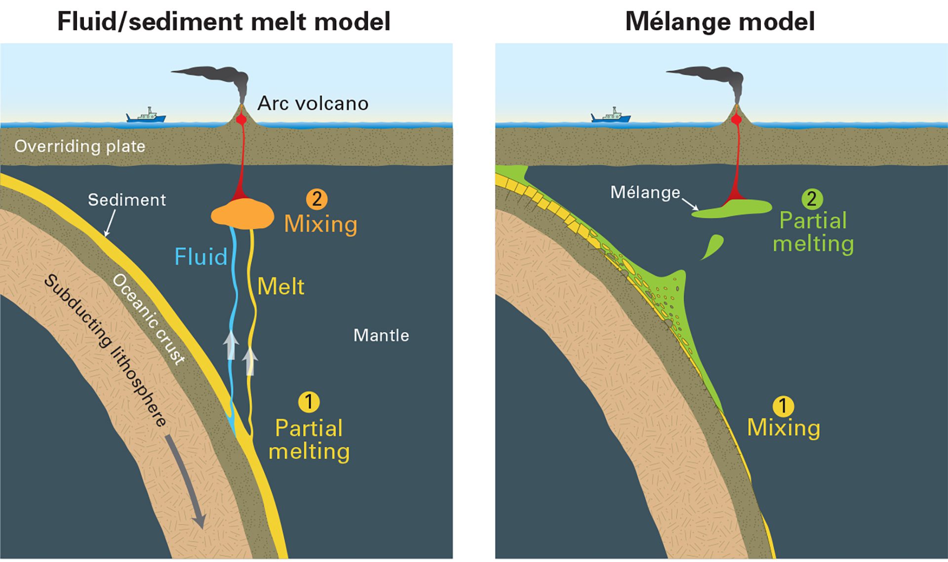
A new study shows volcanic arc lavas may form from melting of mélange rocks at the slab-mantle boundary—reshaping our view of eruptions and earthquake risk.
Read MoreGlobal Map of Cesium-137 Levels in the Ocean
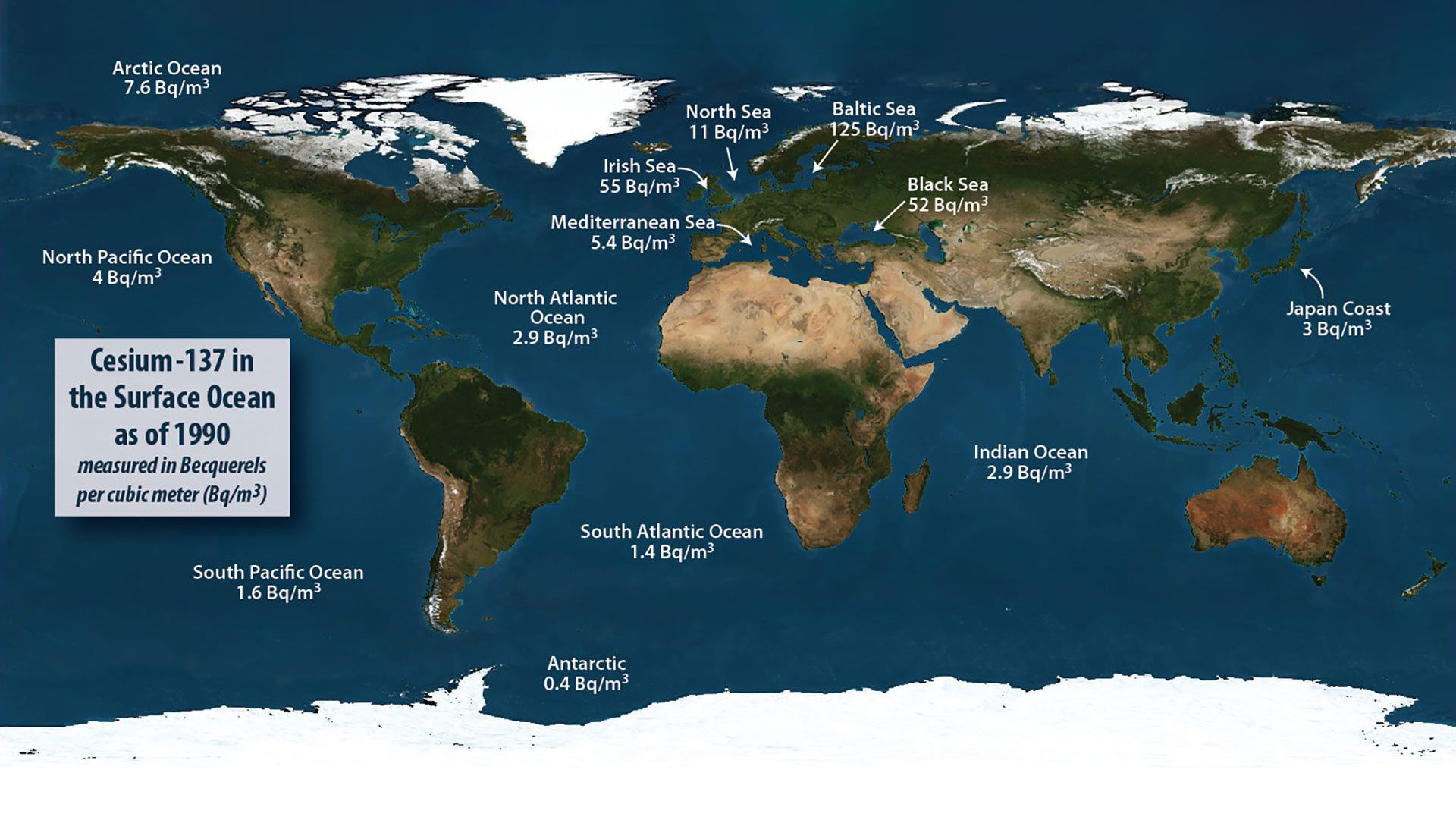
Map shows global ocean levels of Cesium-137, a radioactive isotope released from nuclear fission and major nuclear events like weapons tests and reactor accidents.
Read MorePlastic debris in the North Atlantic
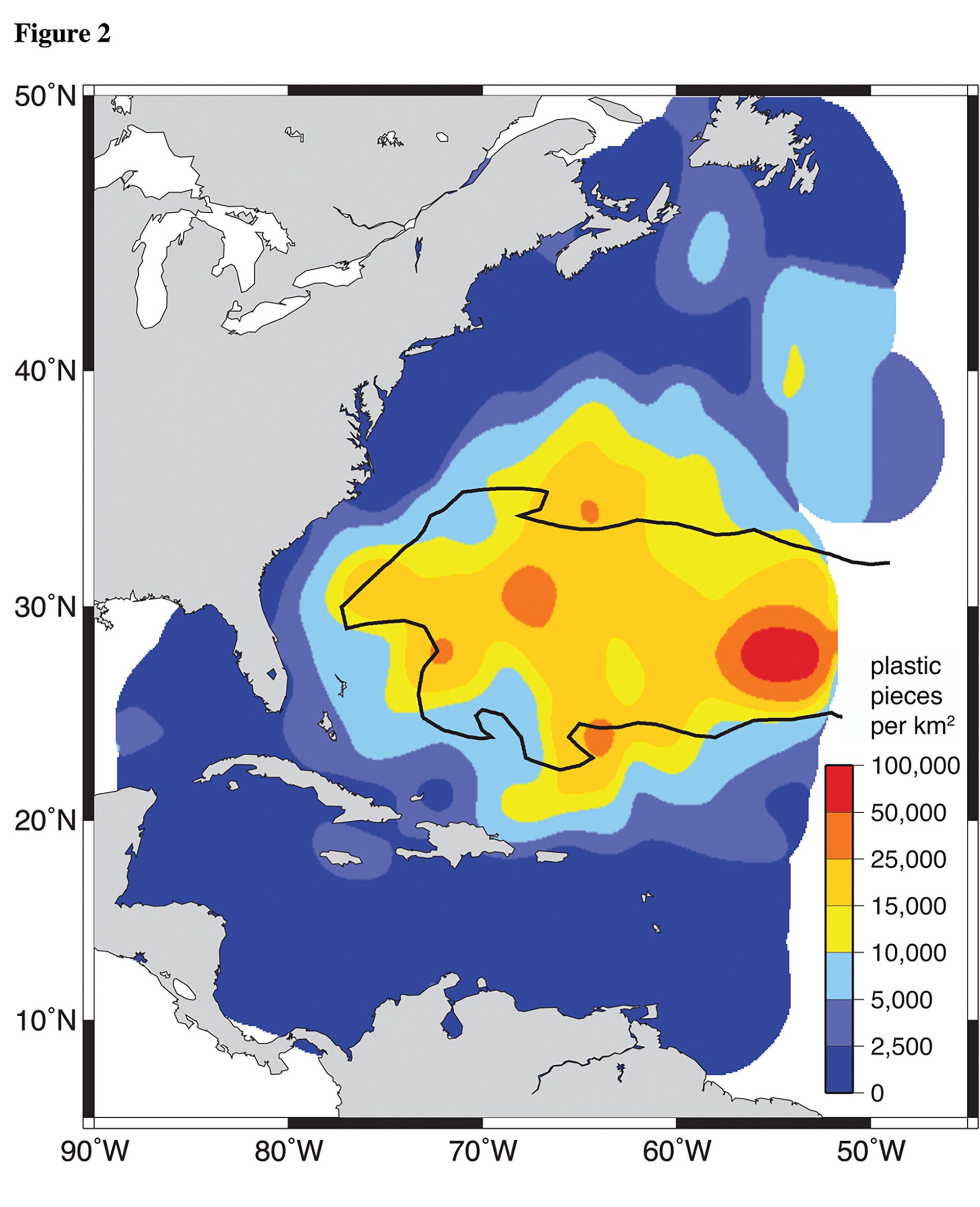
Map of floating plastic debris collected over 22 years by students at sea shows high concentrations trapped in the slow-moving North Atlantic Subtropical Gyre.
Read MoreSubsea asphalt volcano
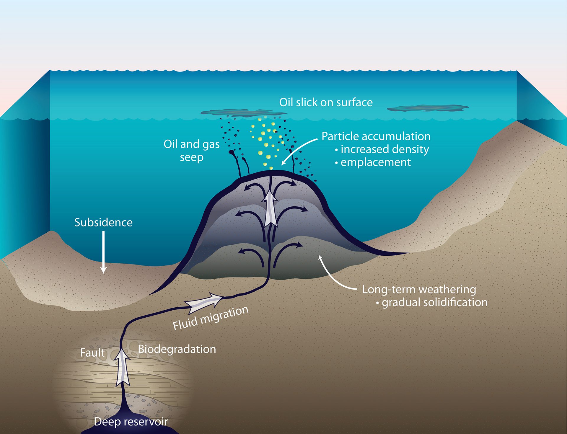
Faulting or rupturing in the Earth around allows oil and gas from subterranean reservoirs to seep up to the seafloor, while some oil solidifies to create asphalt volcanoes.
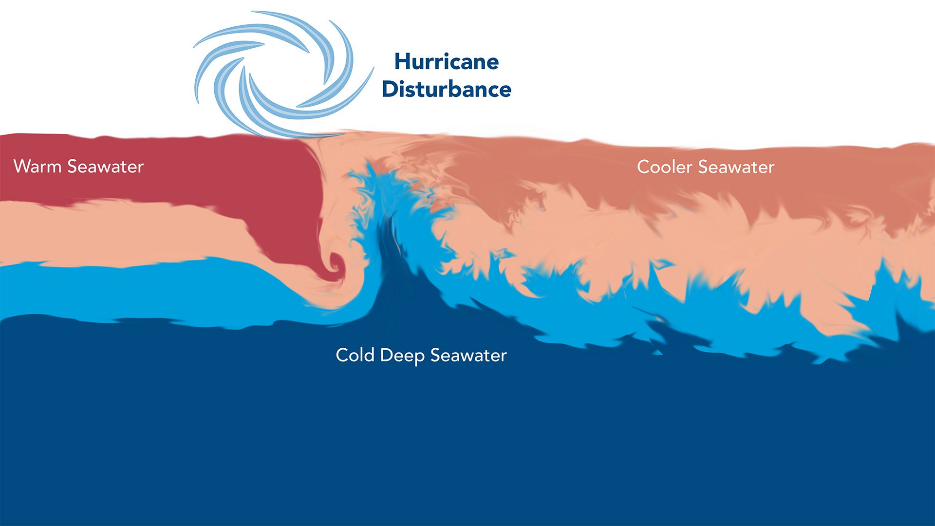
Read MoreHow a hurricane forms
At the equator, trade winds create a surface current east to west, while the Equatorial Undercurrent brings cooler, nutrient-rich water, promoting marine life.
Read MoreHow dispersants were used during the Gulf oil spill
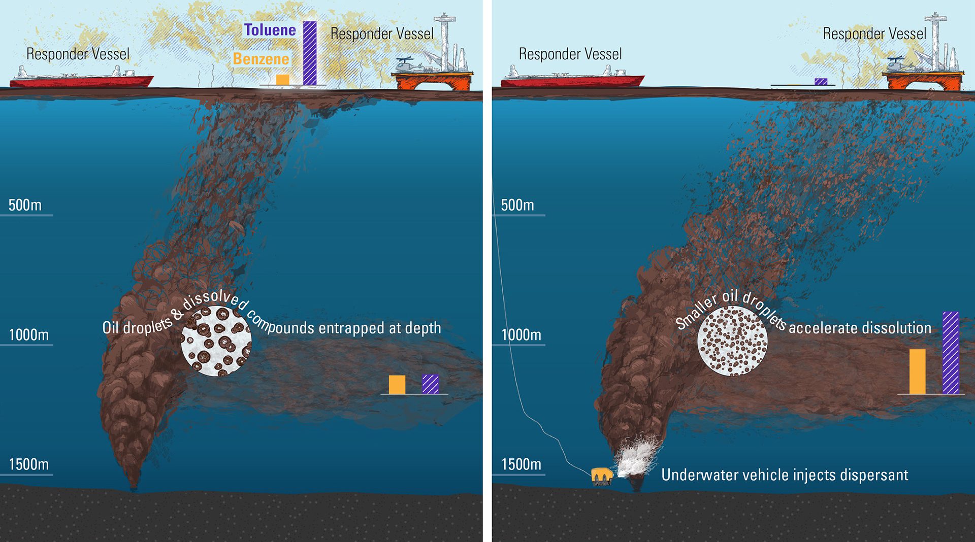
A study modeled the impact of dispersants during Deepwater Horizon, showing they reduced oil droplets, limiting toxic gas levels and health risks.
Read MoreHow fast deoxygenation can happen
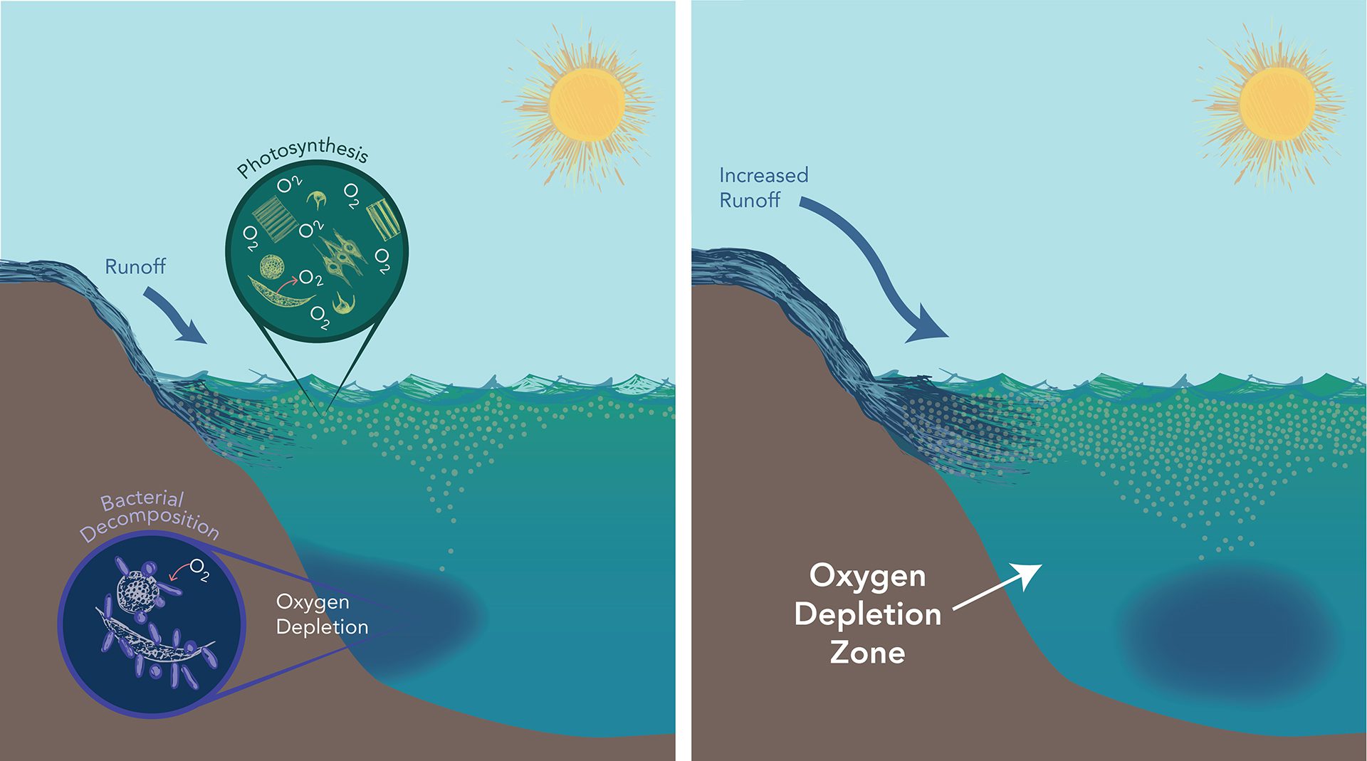
Phytoplankton use nutrients and sunlight to produce oxygen. Past nutrient spikes caused oxygen-depleted zones, echoing today’s ocean symptoms.
Read MoreThe carbon exchange cycle
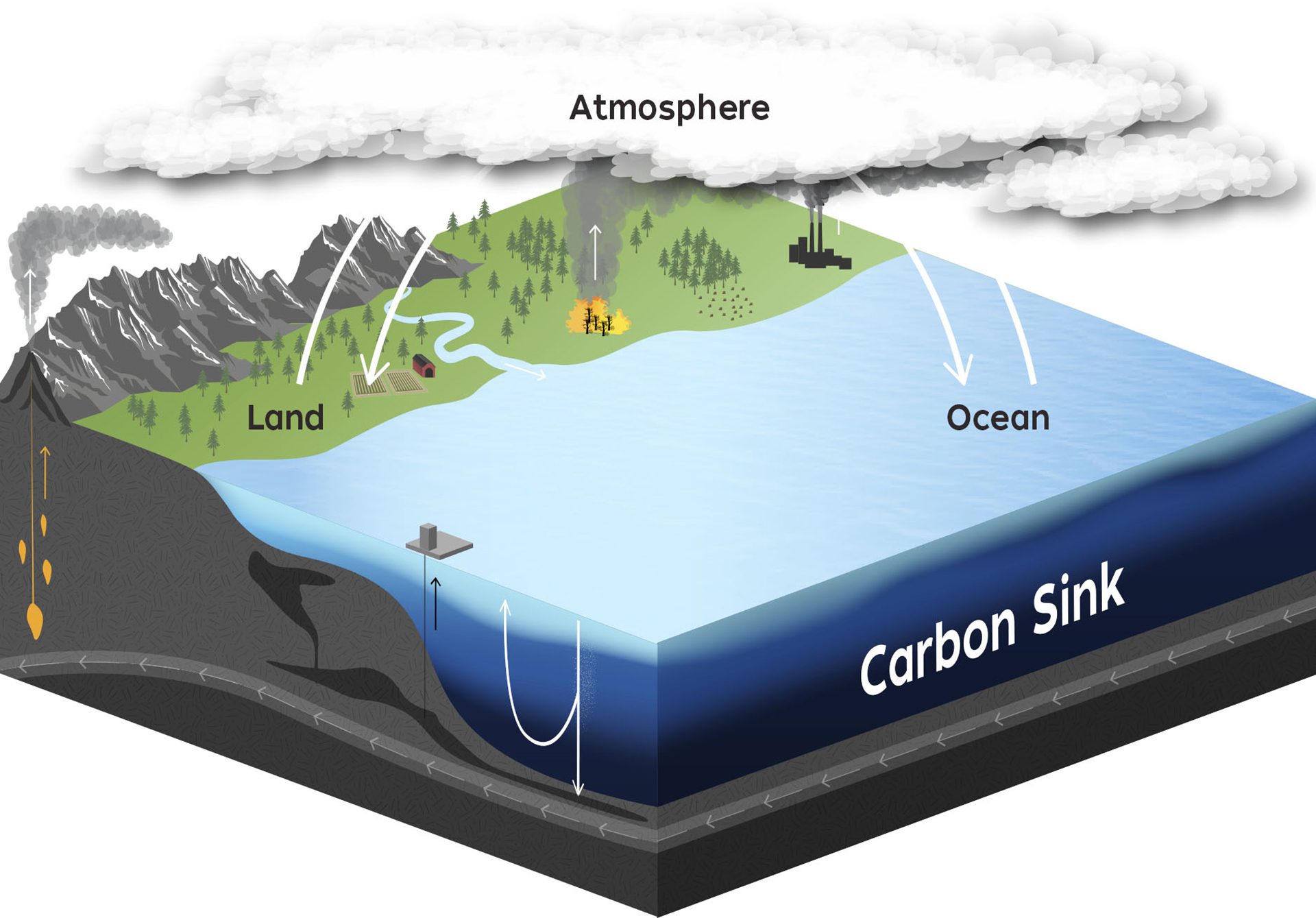
Carbon moves between air, land, and sea. In the ocean, CO? dissolves, is used by life, or stored in deep rocks—key to climate and life on Earth.
Read MoreTransport of copepods through the water column
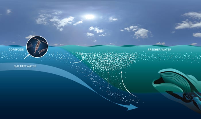
The Great South Channel ocean front forms where fresh coastal water meets saltier water, causing copepods to gather in dense patches as they sink and swim back up the front.
Read MoreHow Monsoon Shifts Transformed Ancient South Asian Civilizations
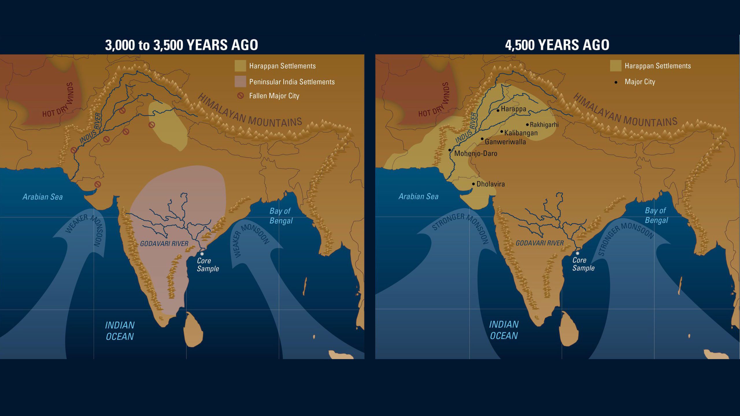
Maps showing changing monsoons led to the fall of Indus Valley cities and spurred the rise of farming communities across the Indian peninsula 4,500 years ago.
Read MoreThe Great South Channel ocean front
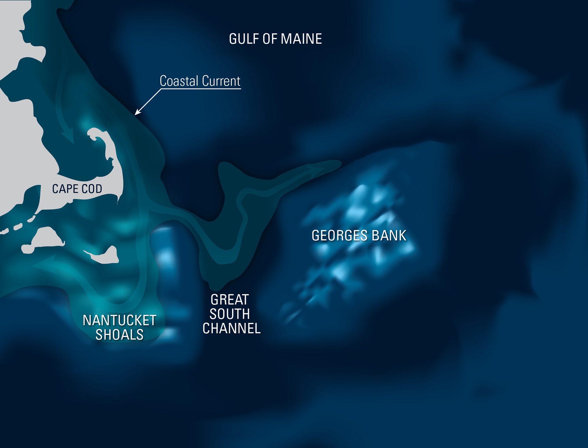
Map showing an ocean front where cold, dense water from the Great South Channel meets fresher flows from the New England Coastal Current.
Read MoreAir-sea daily rhythm
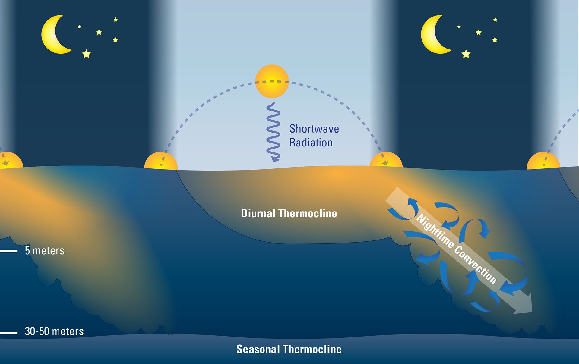
Daily, sunlight warms ocean surface waters; at night, cooled, heavier water sinks and mixes down, renewing the surface for the next day’s heat exchange cycle.
Read MoreIllustration depicting Air-Sea exchanges
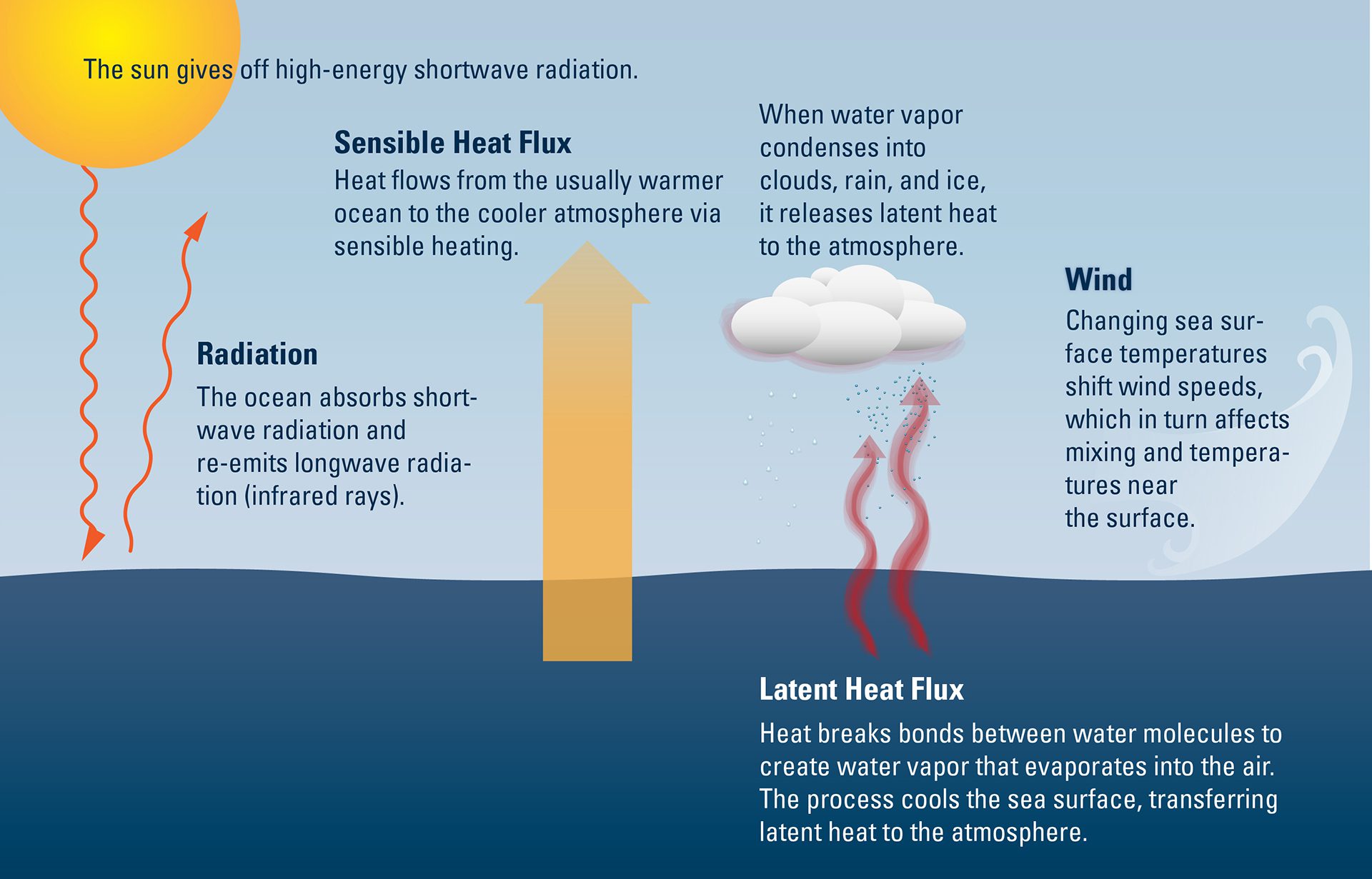
Scientists have assumed that under calm conditions, the ocean’s surface layer doesn’t mix with deeper waters. New observations suggest that this may not be true.
Read MoreSources of dissolved iron in seawater
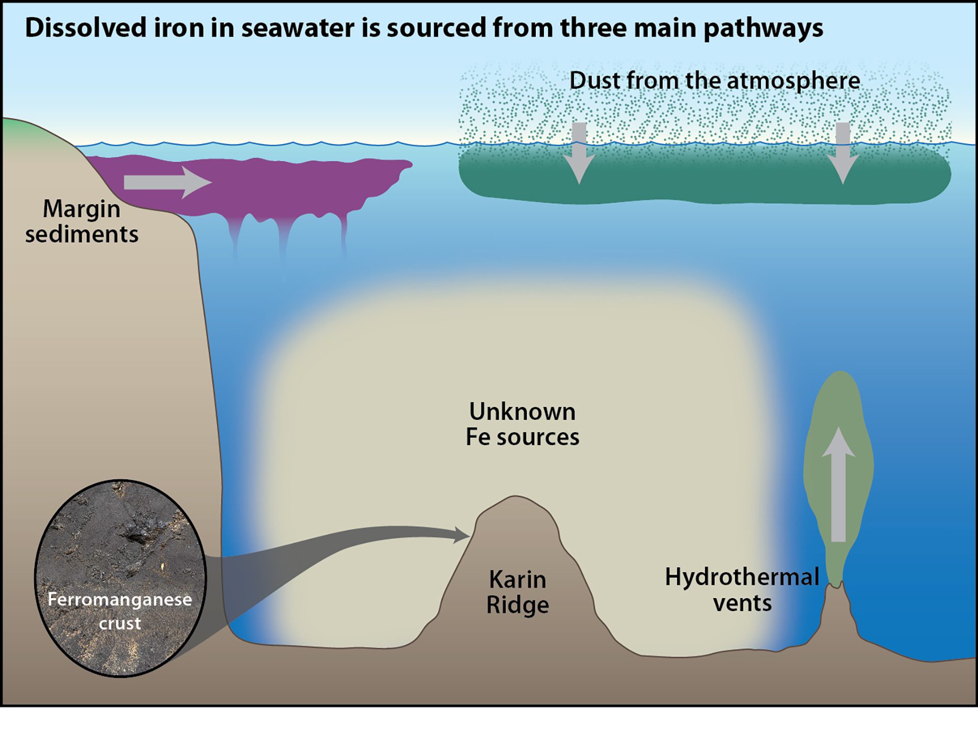
New research shows deep-ocean vents and sediments supply much dissolved iron to the central Pacific, traveling far—challenging the dust-only iron source view.
Read MoreDeep Western Boundary Current Circulation
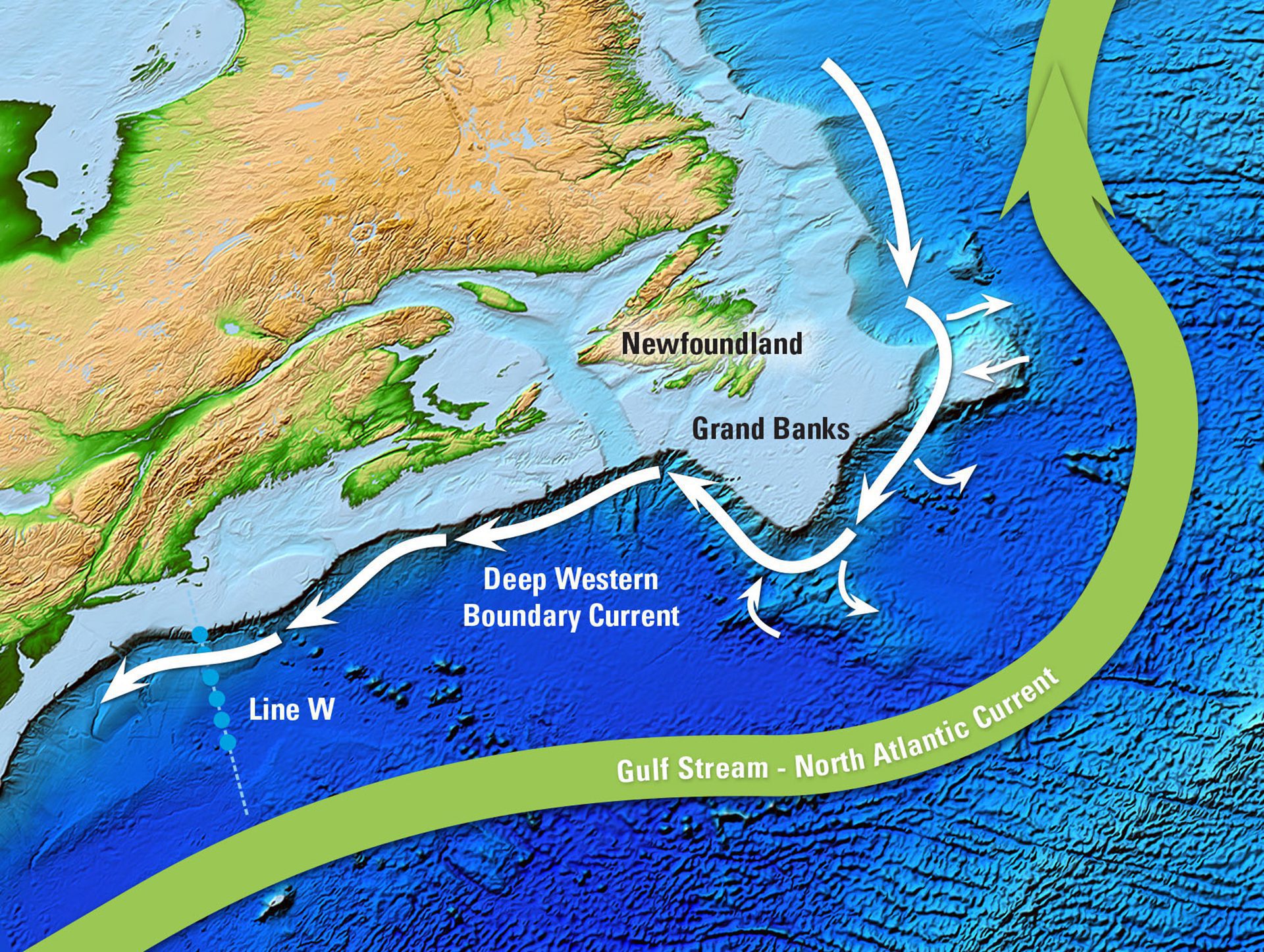
Map of Newfoundland coast showing drifter data revealing most of the Deep Western Boundary Current flows offshore near the Grand Banks.
Read More