
Earth Science
How Earth got its water
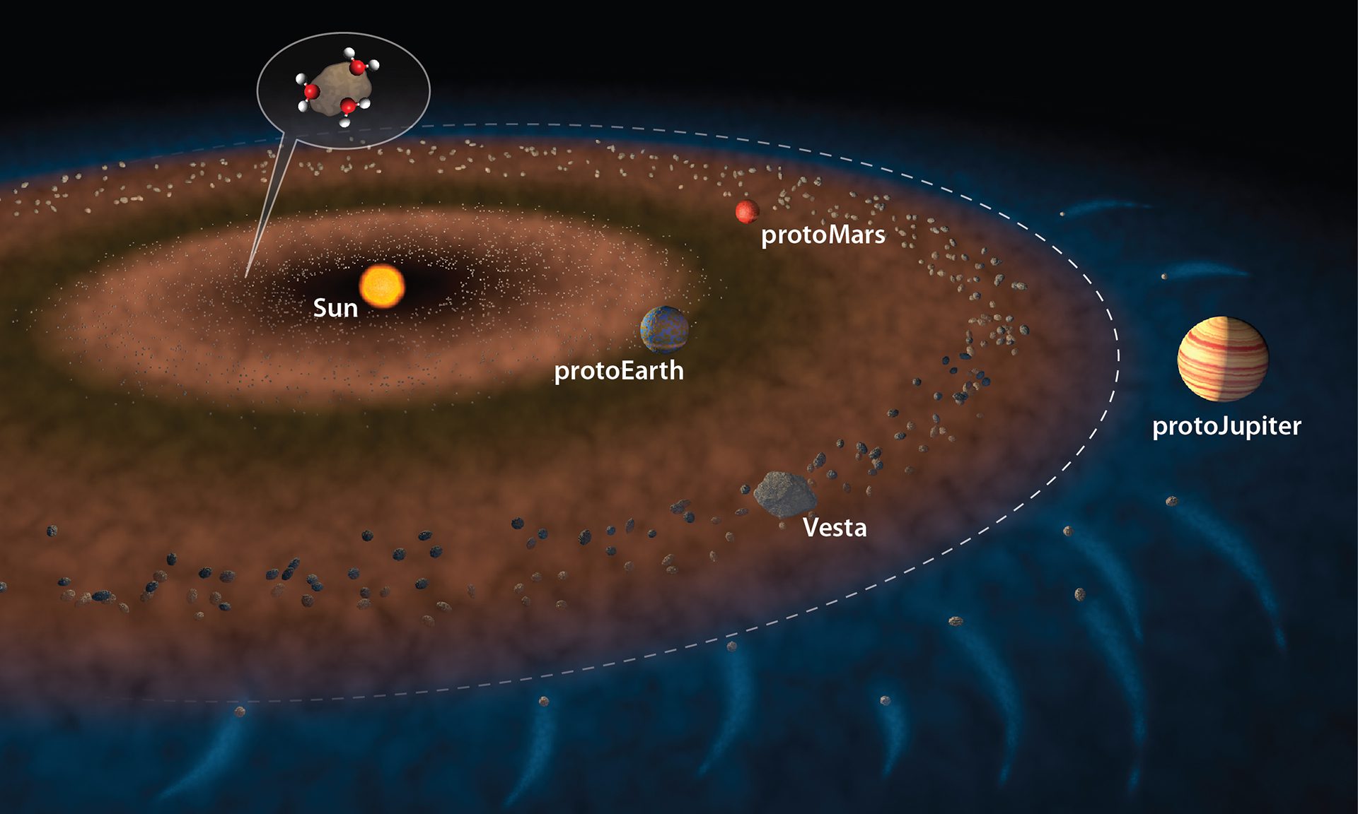
Water likely arrived in the inner solar system early on, flung by gravity from proto-Jupiter via meteorites, according to research on asteroid Vesta.
Read MoreMapping the seafloor with sound
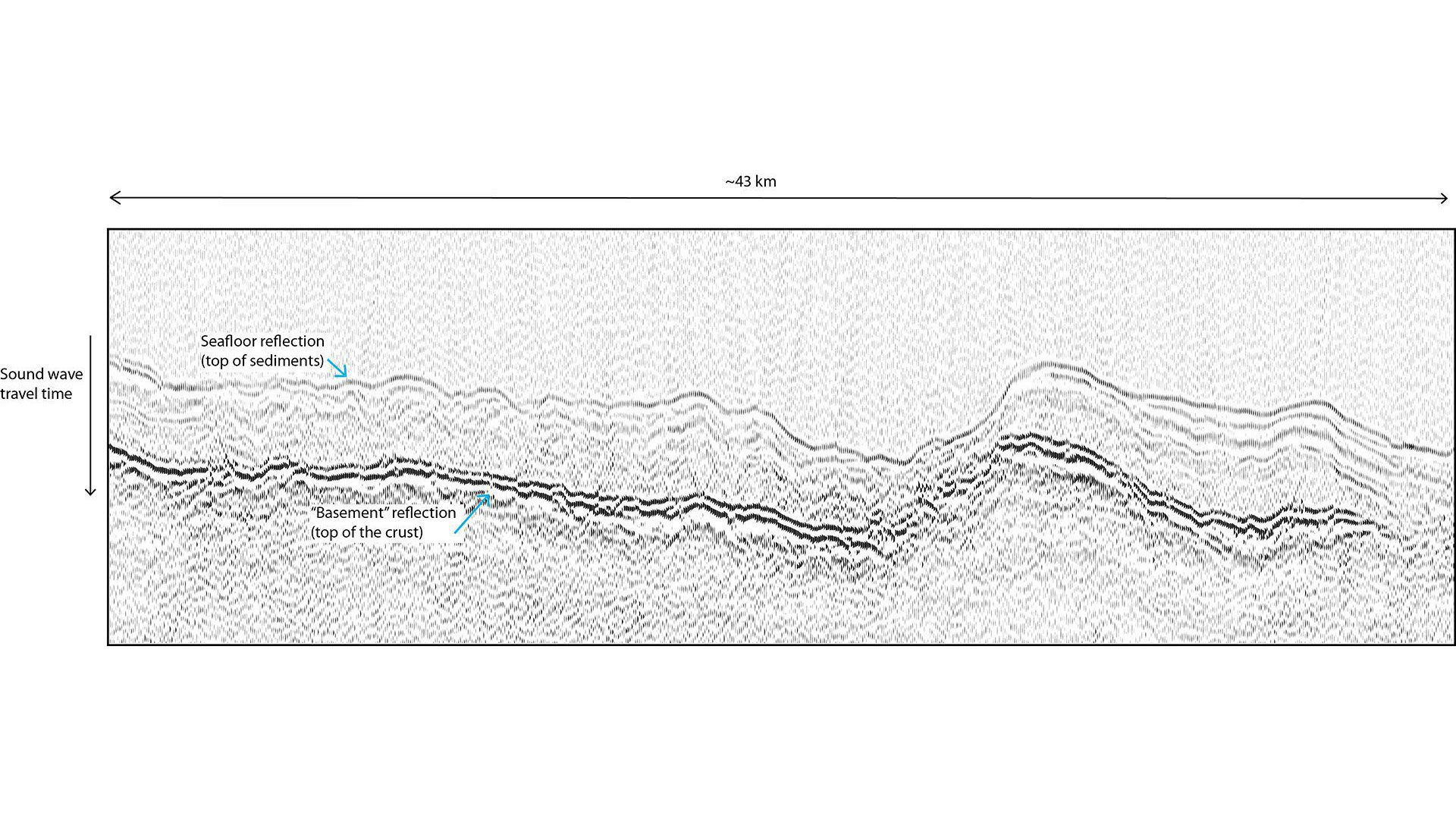
Scientists use sound waves to map layers beneath the seafloor by measuring how long waves take to bounce back from sediments and crust.
Read MoreSources of oil pollution in the ocean
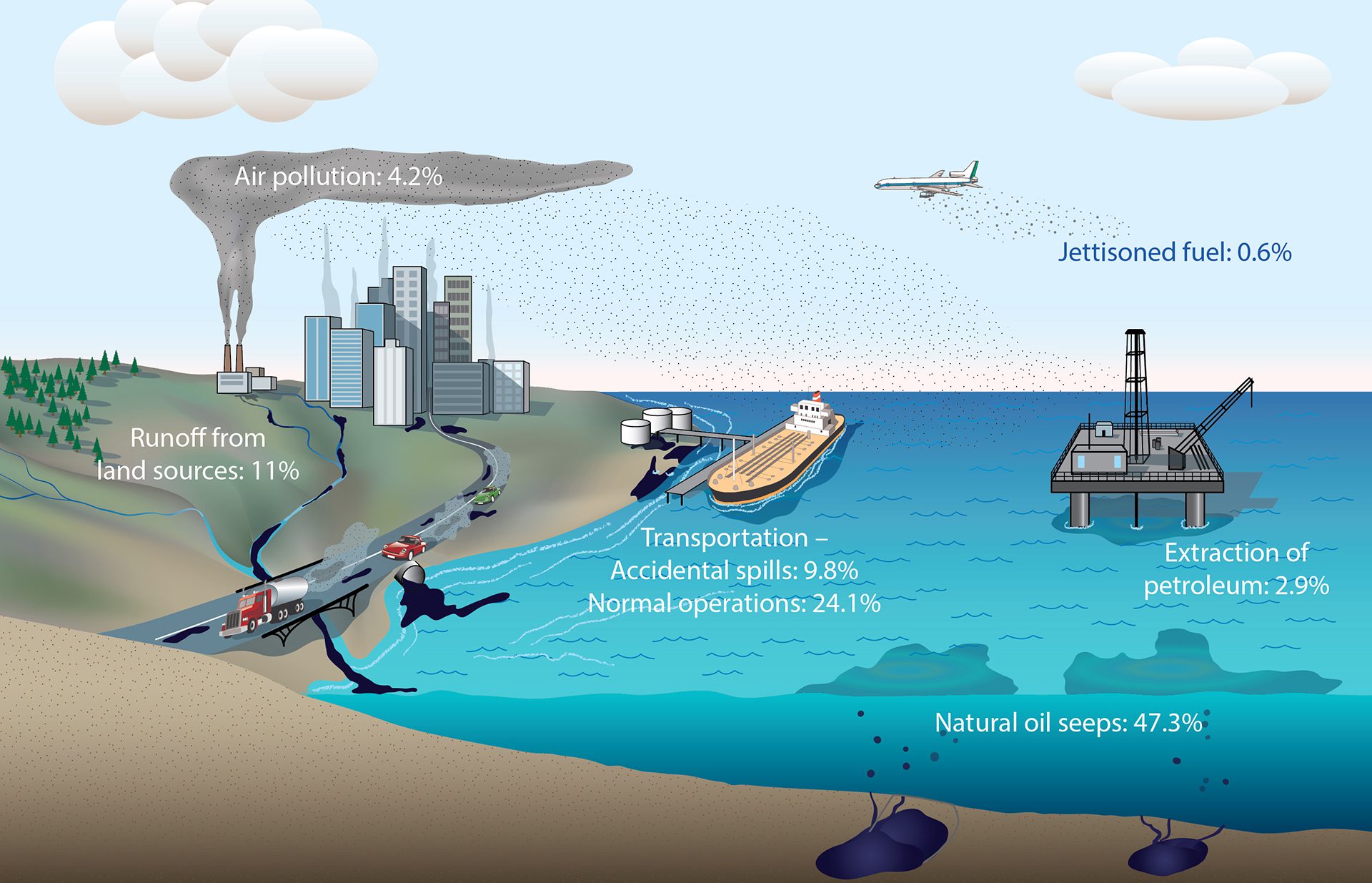
Roughly 380 million gallons of oil enter the ocean each year—most from human activities like shipping and runoff, with natural seeps also contributing.
Read MoreOne connected global ocean
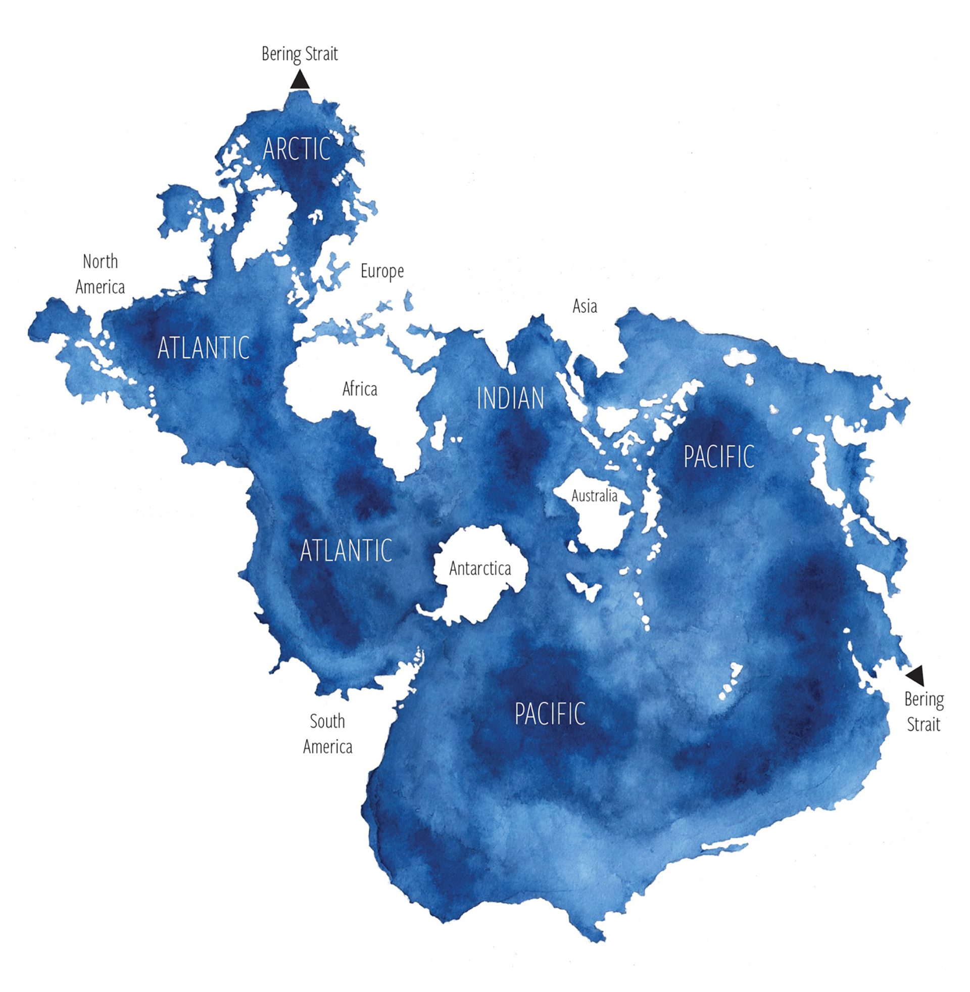
Watercolored map of the global ocean in the Spilhaus projection with regional labels
Read MoreSunlit, Twilight, and Midnight Zones in a cube
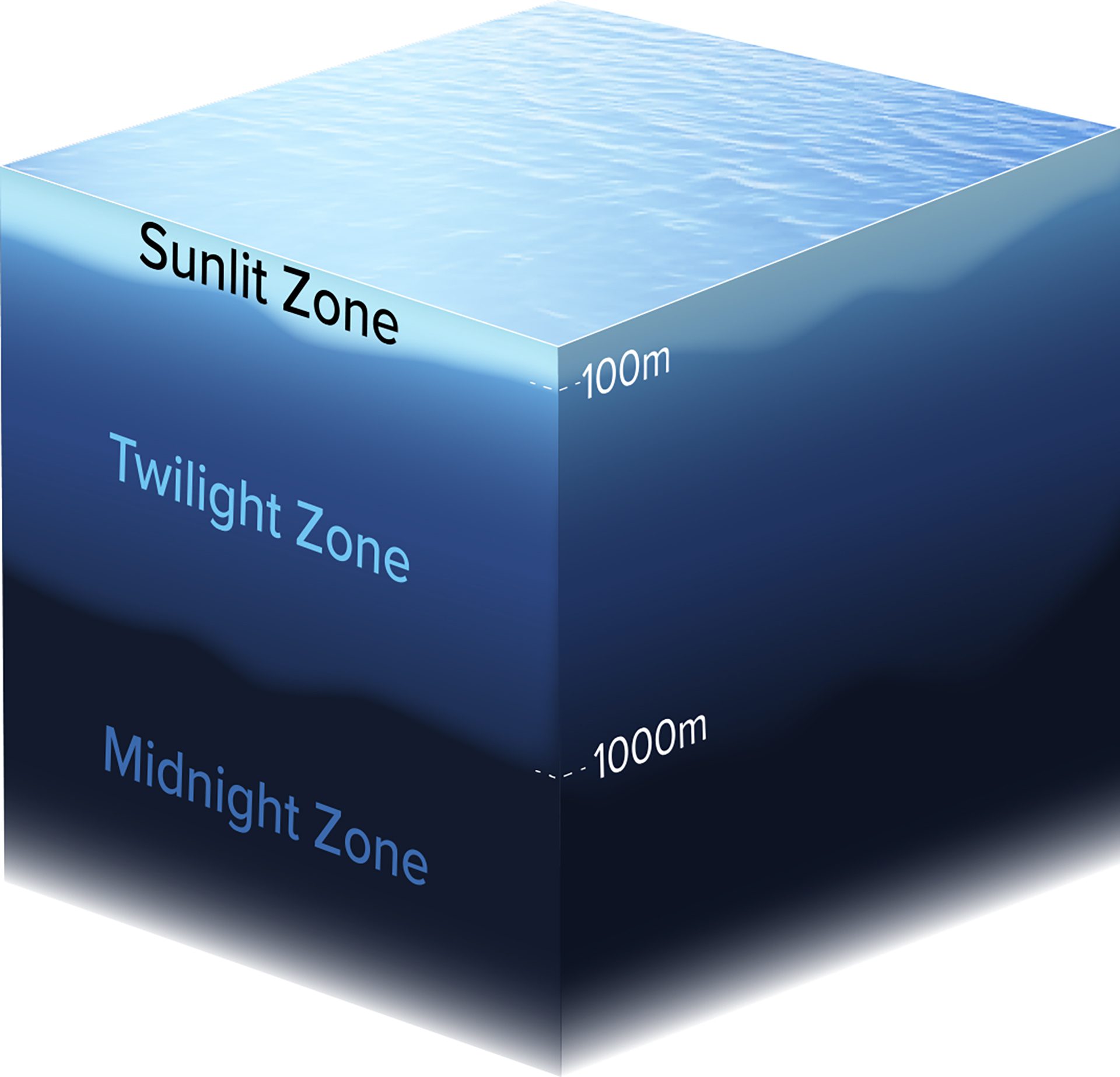
This cube shows the mesopelagic zone—an ocean layer from 1001000m deep—stretching from coastal EEZs to the high seas, including around island nations.
Read MoreThe Atlantic Meridional Overturning Circulation (AMOC)
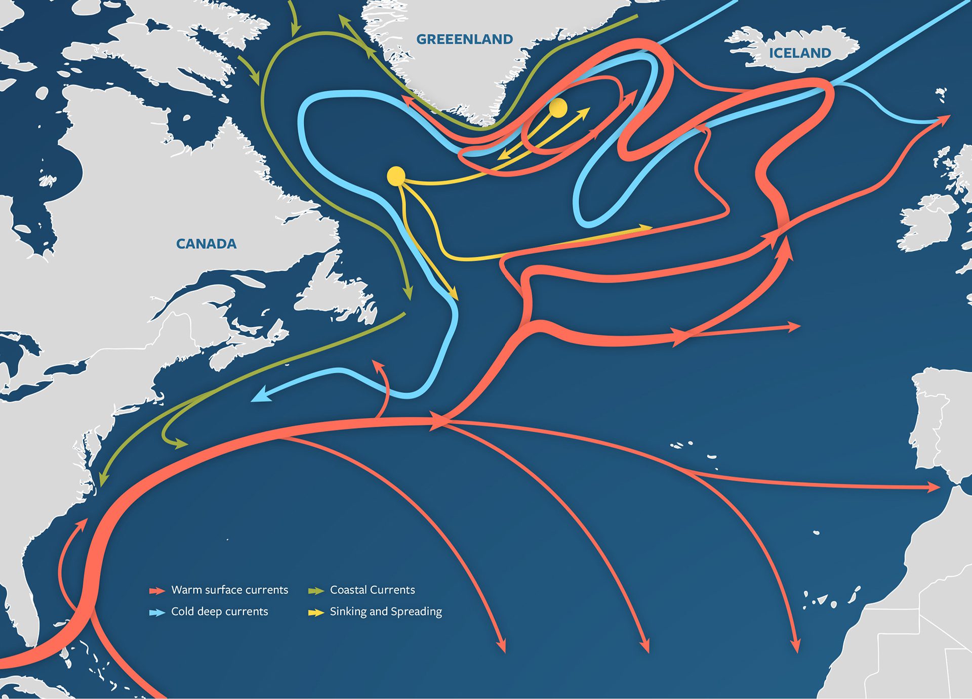
Illustrated map of the AMOC, part of global thermohaline circulation, showing warm surface flow, deepwater currents, and key sinking and spreading sites.
Read MoreThe Earth’s water supply in perspective

If all Earth’s water formed a ball, it would be just 950 miles wide—and only a tiny fraction of it is fresh and accessible for human use.
Read MoreThe formation of 18° mode water
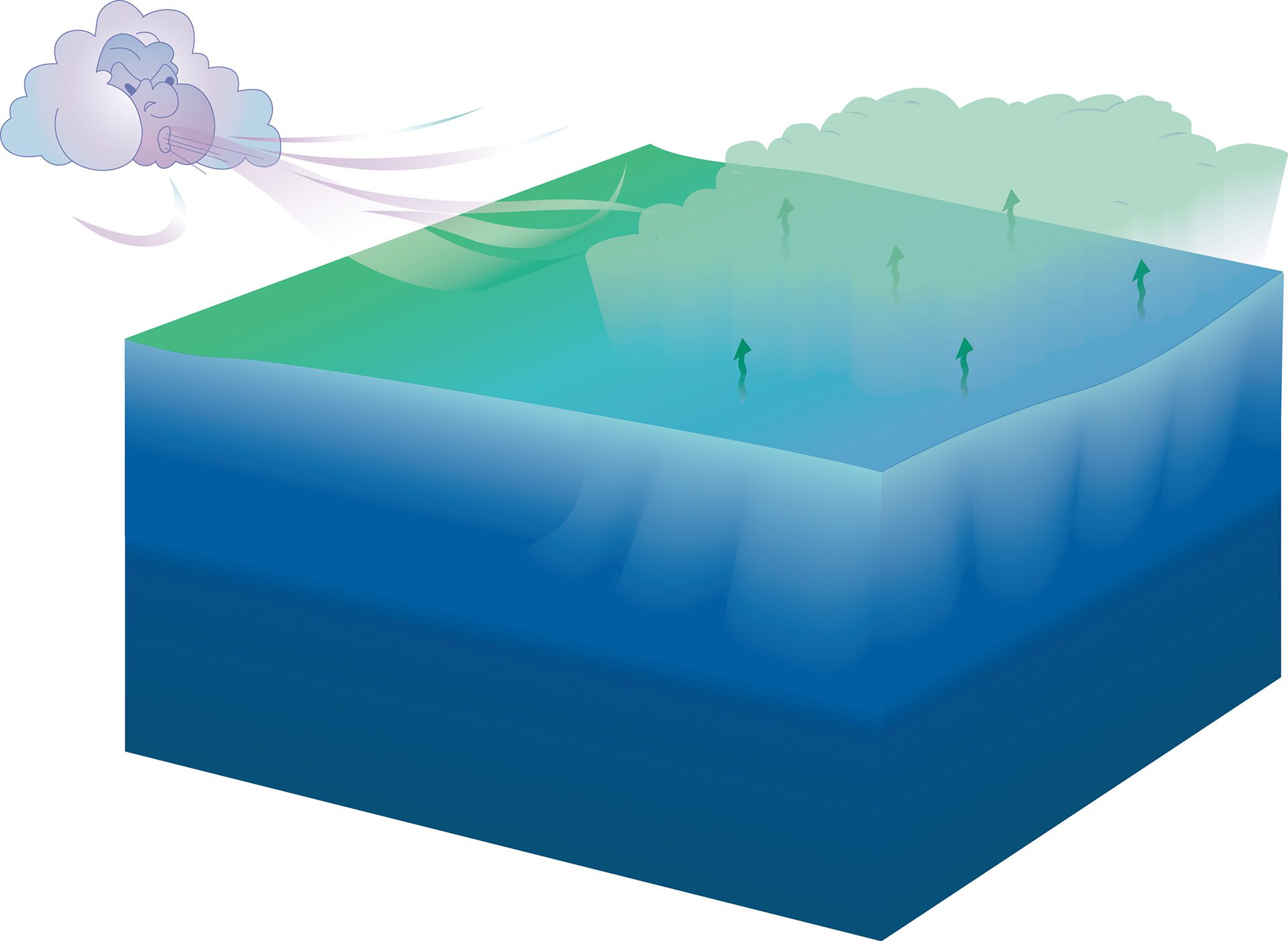
Cold winter winds cool warm ocean surfaces. The dense water left behind sinks, forming a distinct layer called 18° water between surface and deep seas.
Read MoreOpposing currents, Deep Western Boundary Current and Gulf Stream
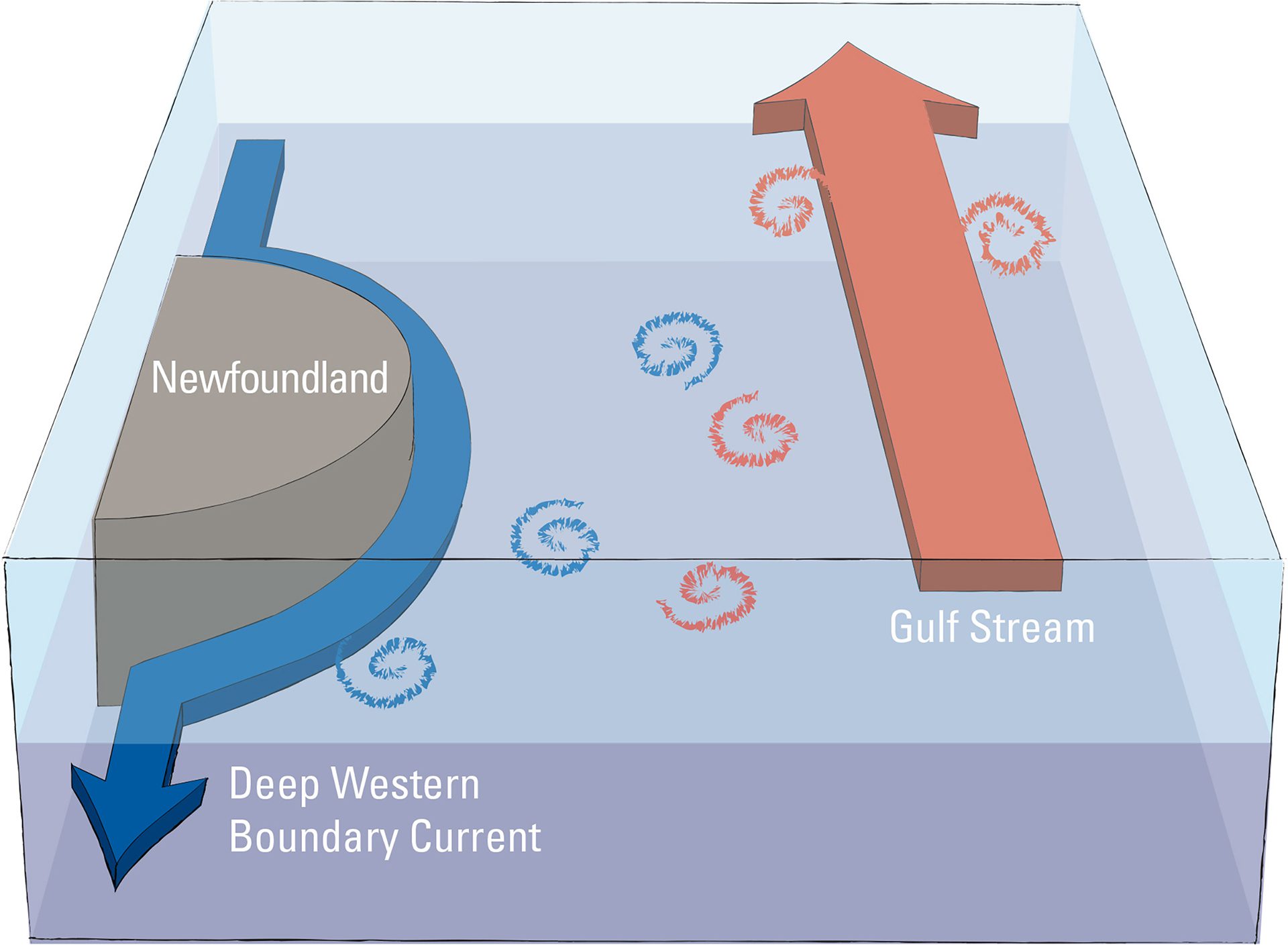
Scientists use mathematical models of the Deep Western Boundary Current, Newfoundland’s topography, and the Gulf Stream to study what causes water to divert from the current.
Read MorePlates Separate
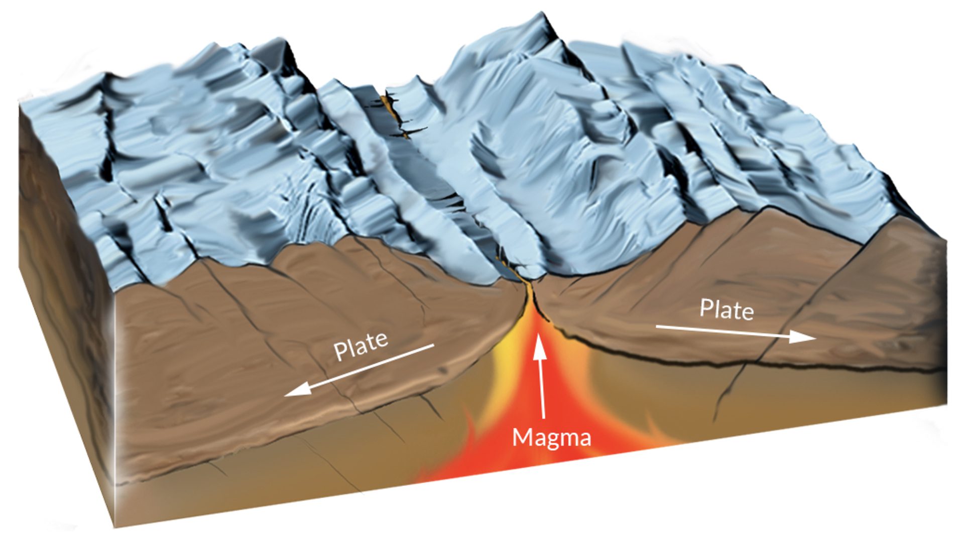
Mid-ocean ridges and rift valleys form where tectonic plates spread apart, creating new ocean crust as molten rock rises, causing earthquakes and volcanic eruptions along the way.
Read MorePlates Slide
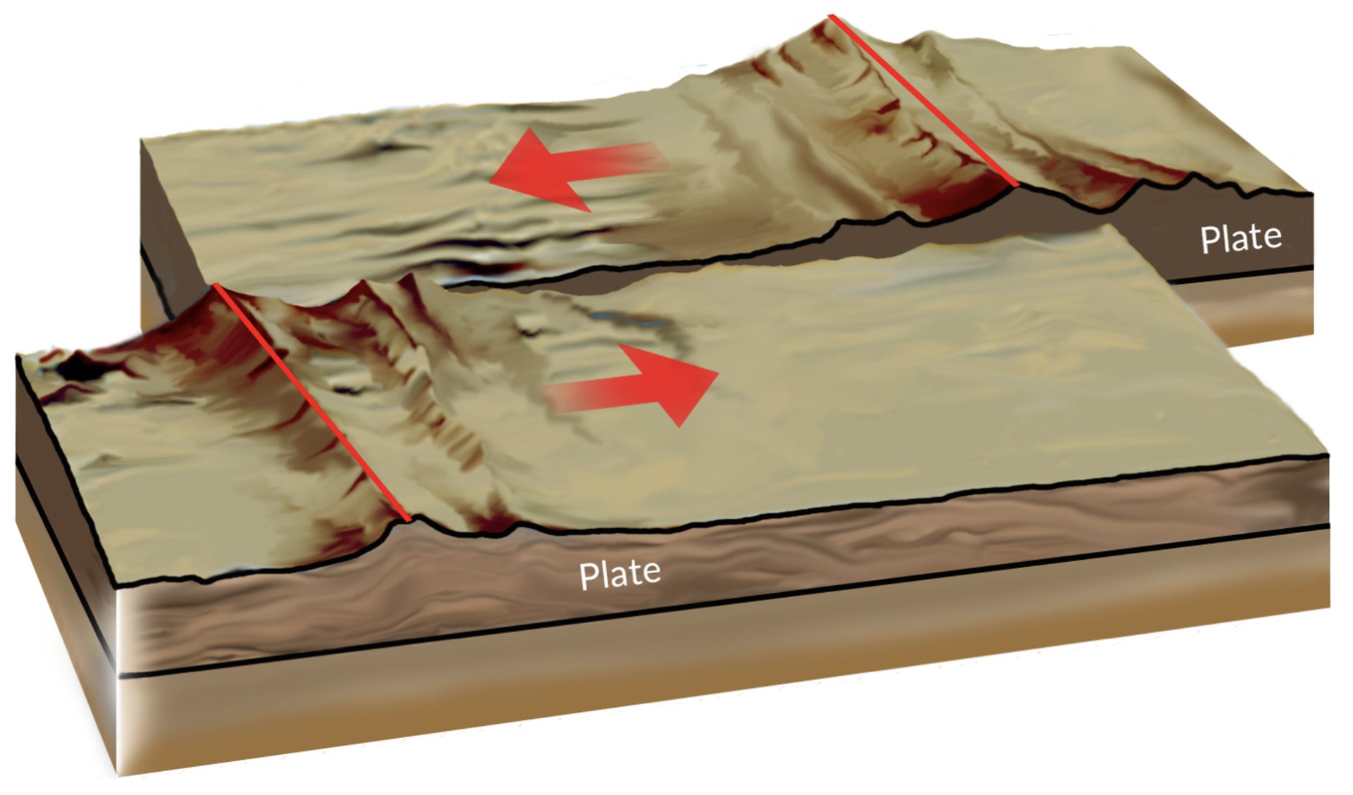
Transform faults form where plates slide past each other, causing powerful quakes. The San Andreas Fault between Pacific and North American Plates fuels major California earthquakes.
Read MorePlates Subduct
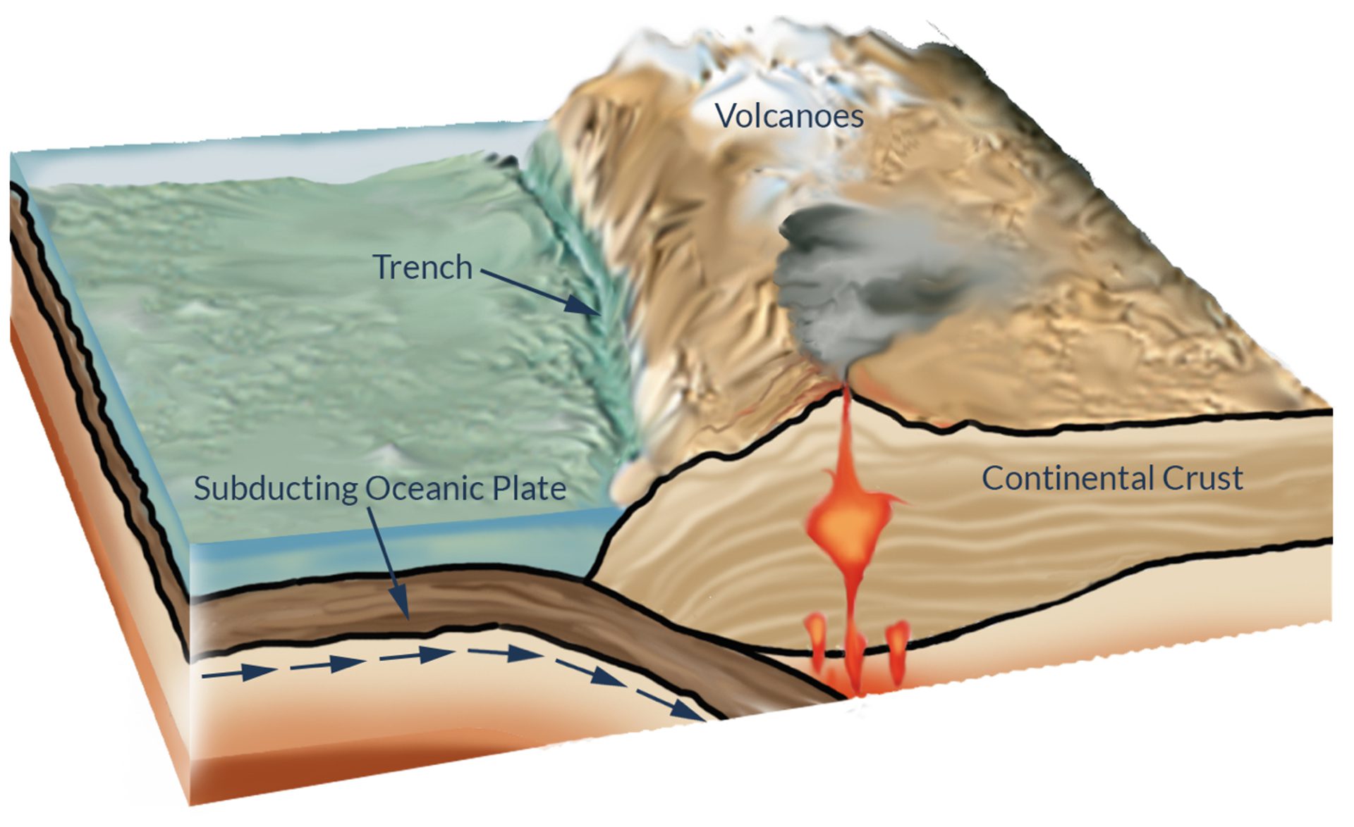
When ocean plates collide, one subducts beneath the other, forming trenches and causing molten rock to rise, creating volcanic mountains or island arcs like Japan or the Andes.
Read MoreRainfall prediction illustration
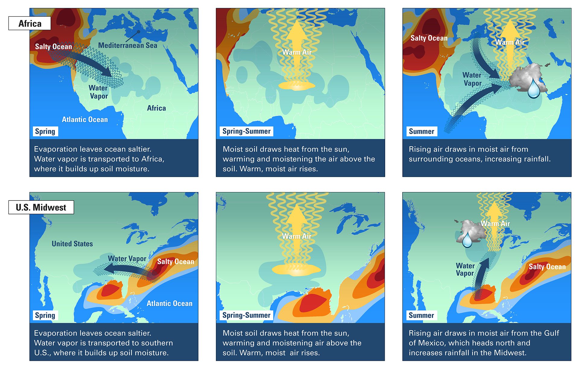
Spring winds boost Atlantic salinity, fueling summer rains in Africa and the U.S. via soil moisture buildup, convection, and increased moisture transport.
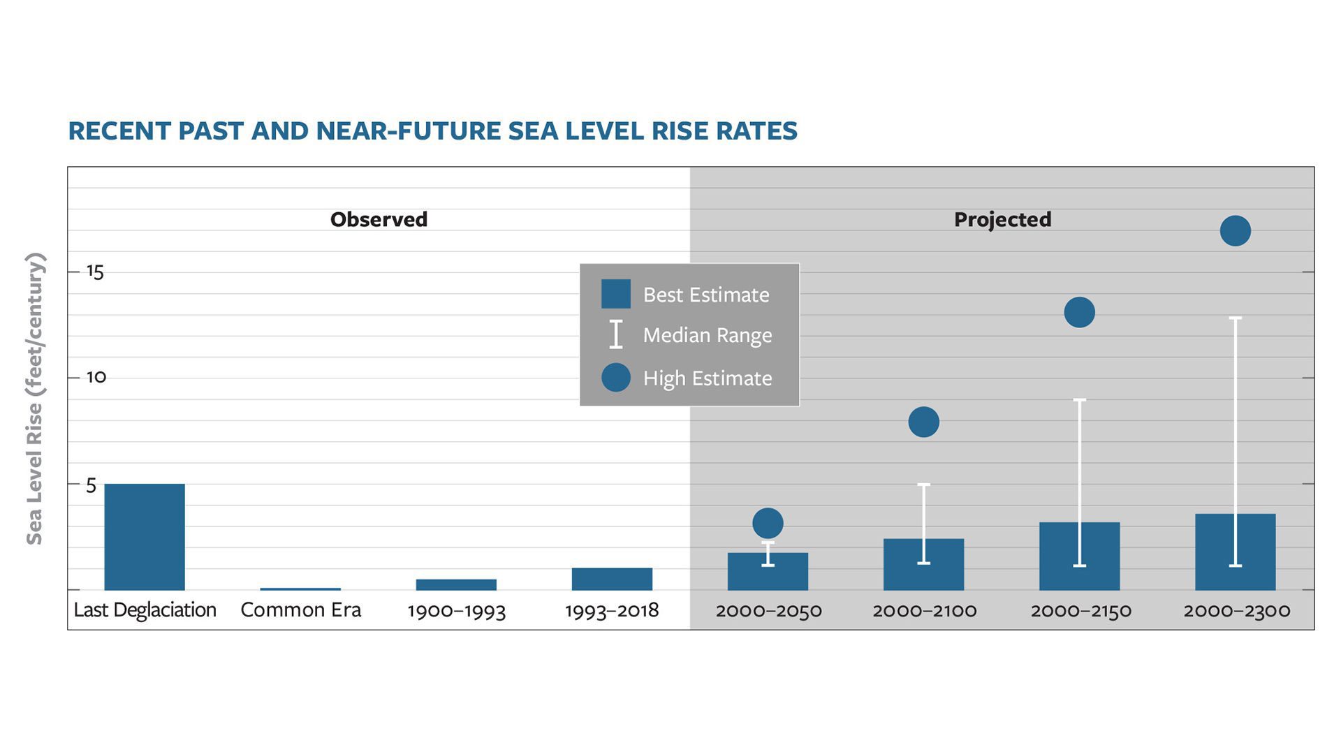
Read MoreRecent Past and Near-Future Sea Level Rise Rates
Dispersants break oil into tiny droplets using detergents and solvents, but sunlight quickly weakens their effectiveness on oil floating at the sea surface.
Read MoreA microbial garden beneath the seafloor
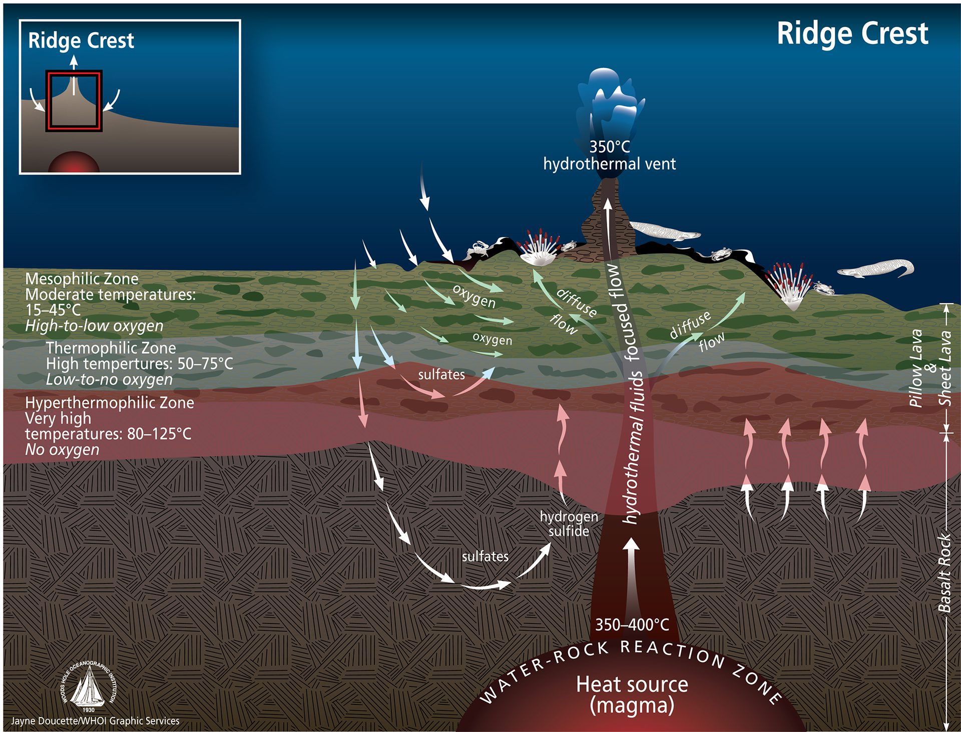
Chemical reactions below the seafloor create energy-rich fluids that sustain a vast, diverse microbial biosphere adapted to specific underground niches.
Read MoreA smorgasbord of chemical reactions
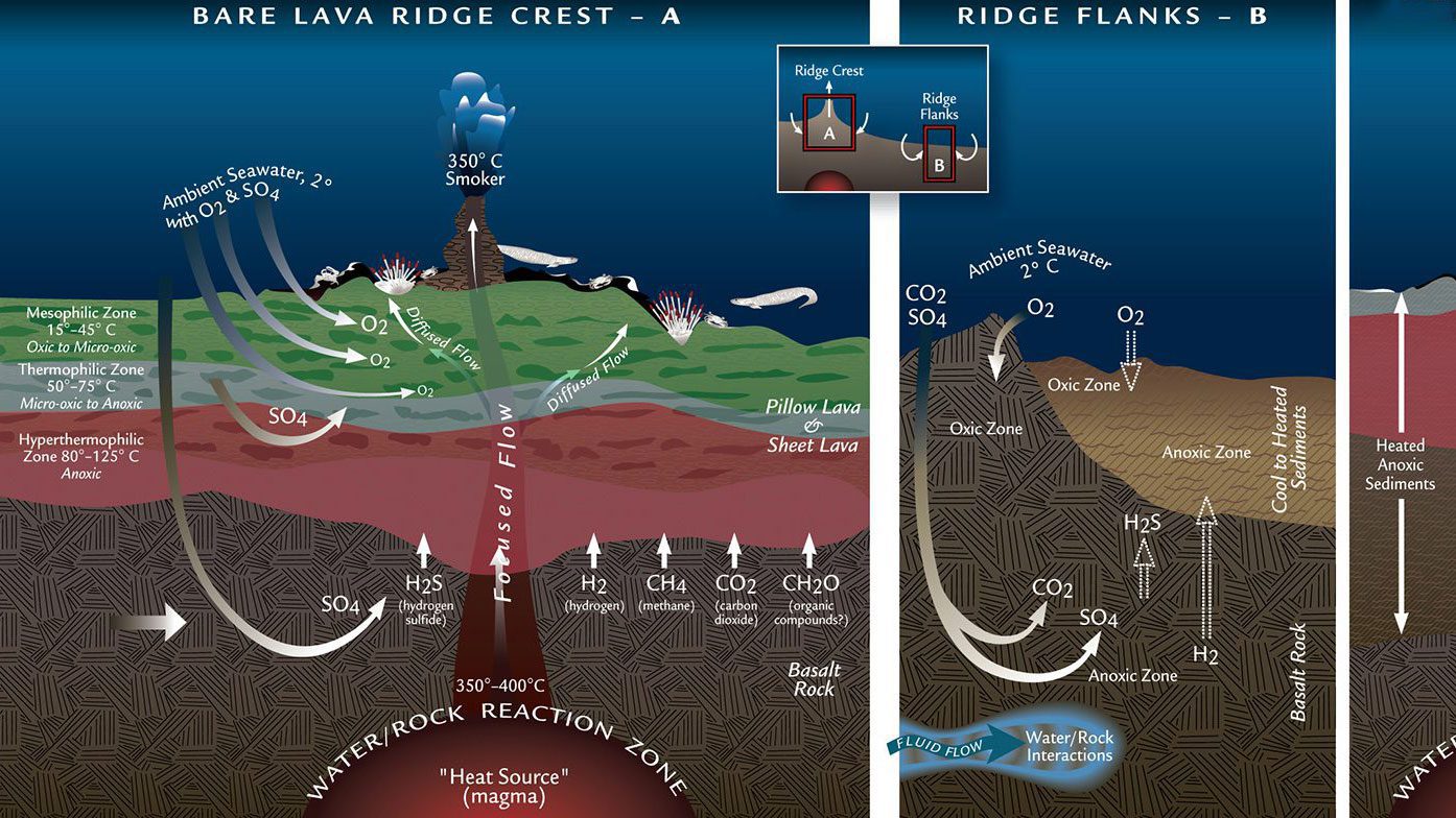
Deep-sea microbes thrive near hydrothermal vents by using diverse chemical reactions—both with and without oxygen—to extract energy and grow underground.
Read MoreScale depicting the concentration of pH and examples of solutions
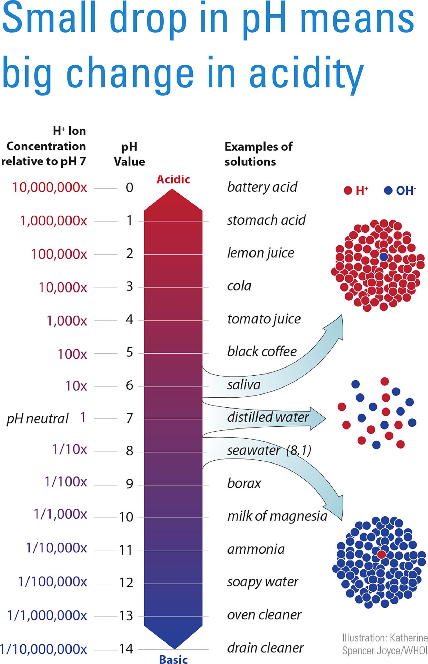
Seawater is becoming more acidic as CO? levels rise. Even small drops in pH can harm marine life that builds shells or skeletons from calcium carbonate.
Read MoreGroundwater cycle
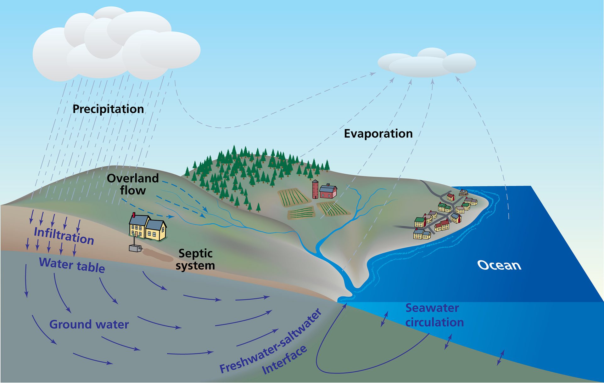
Groundwater flows into the ocean through coastal sediments, carrying chemicals that can impact ocean chemistry—an overlooked part of Earth’s water cycle.
Read MoreMicroplastics breaking down in different areas of the environment
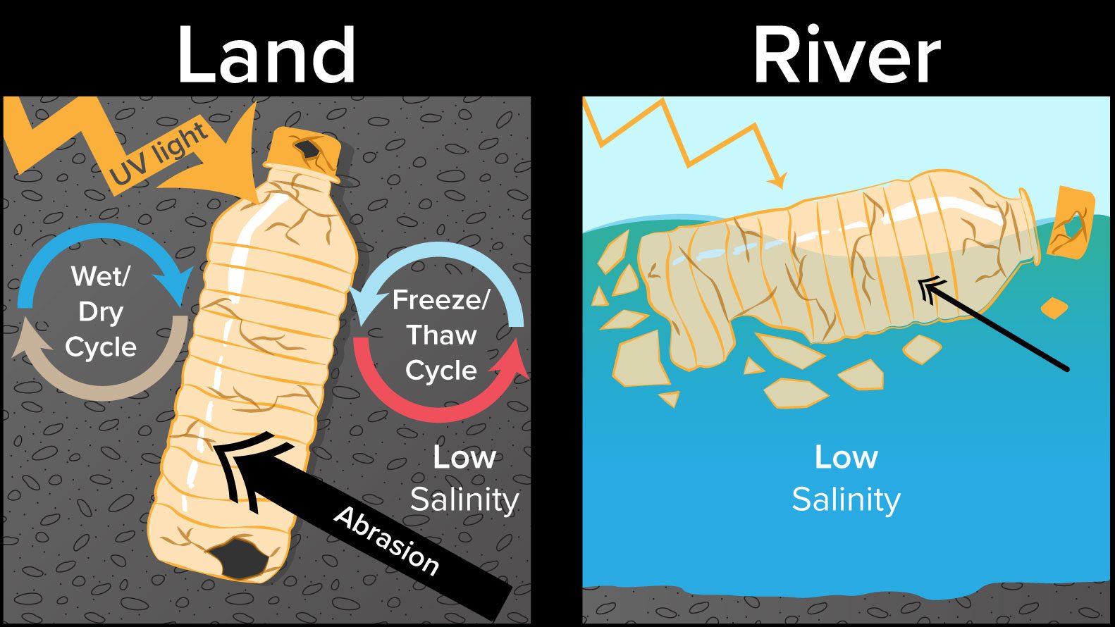
Scientists study how larger plastics break down into microplastics, exploring land and ocean processes like sunlight, temperature, and abrasion that cause plastic fragmentation.
Read MoreMid-Ocean Ridges: Magnetics and Polarity, featuring seafloor spreading
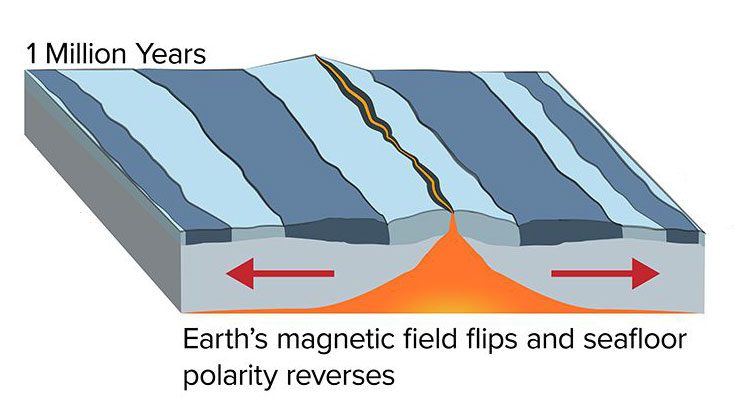
Lava at mid-ocean ridges records Earth’s magnetic flips, creating stripes that reveal seafloor spreading rates and past reversals of Earth’s magnetic field.
Read MoreMonsoon circulation cycle
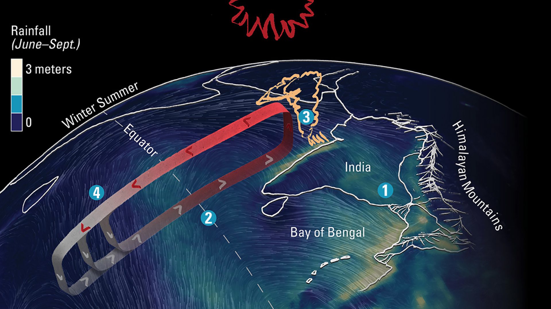
WHOI scientists study the Indian Ocean monsoon cycle, where ocean winds pick up moisture that condenses into heavy rains vital for billions of people’s crops and livelihoods.
Read MoreMonsoon season rain cycle
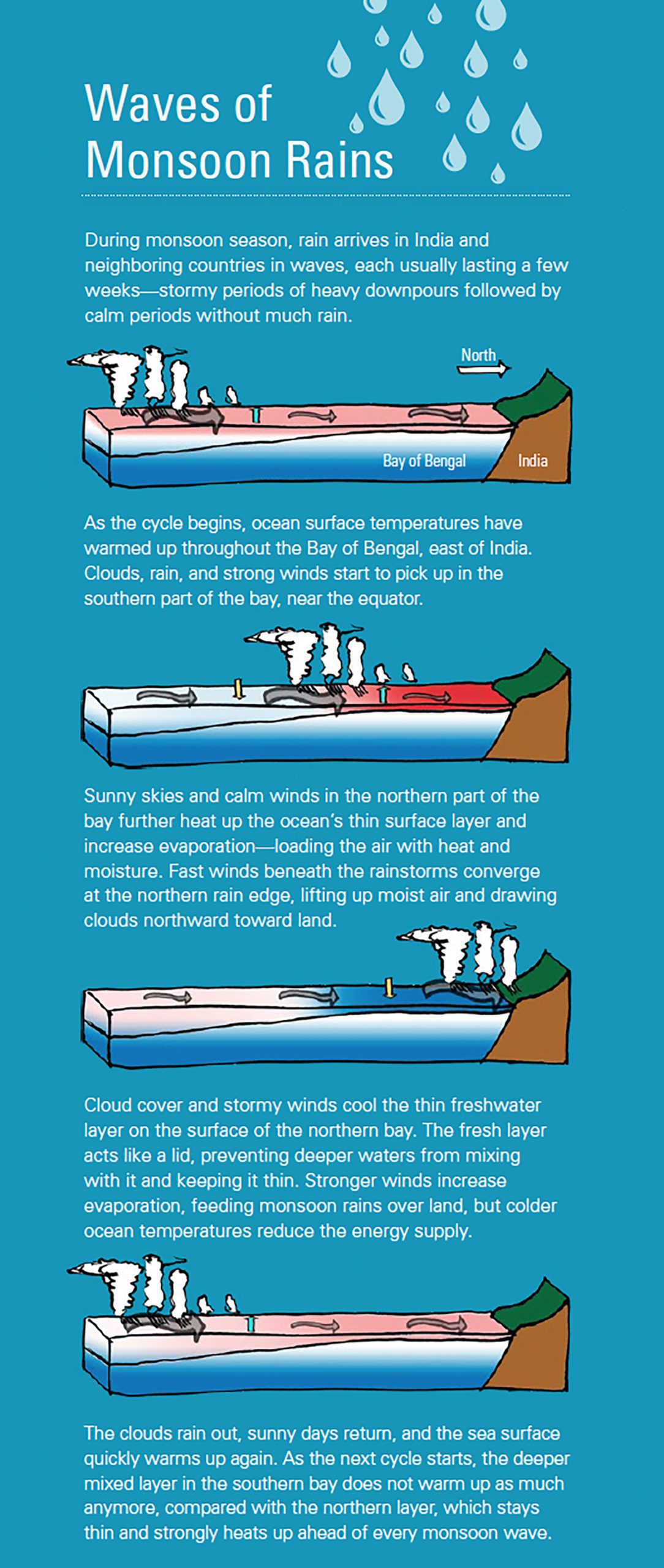
WHOI scientists are studying the link between water at the surface of the Indian Ocean and predicting monsoon rains.
Read MoreMultibeam sonar image of Galápagos seamounts
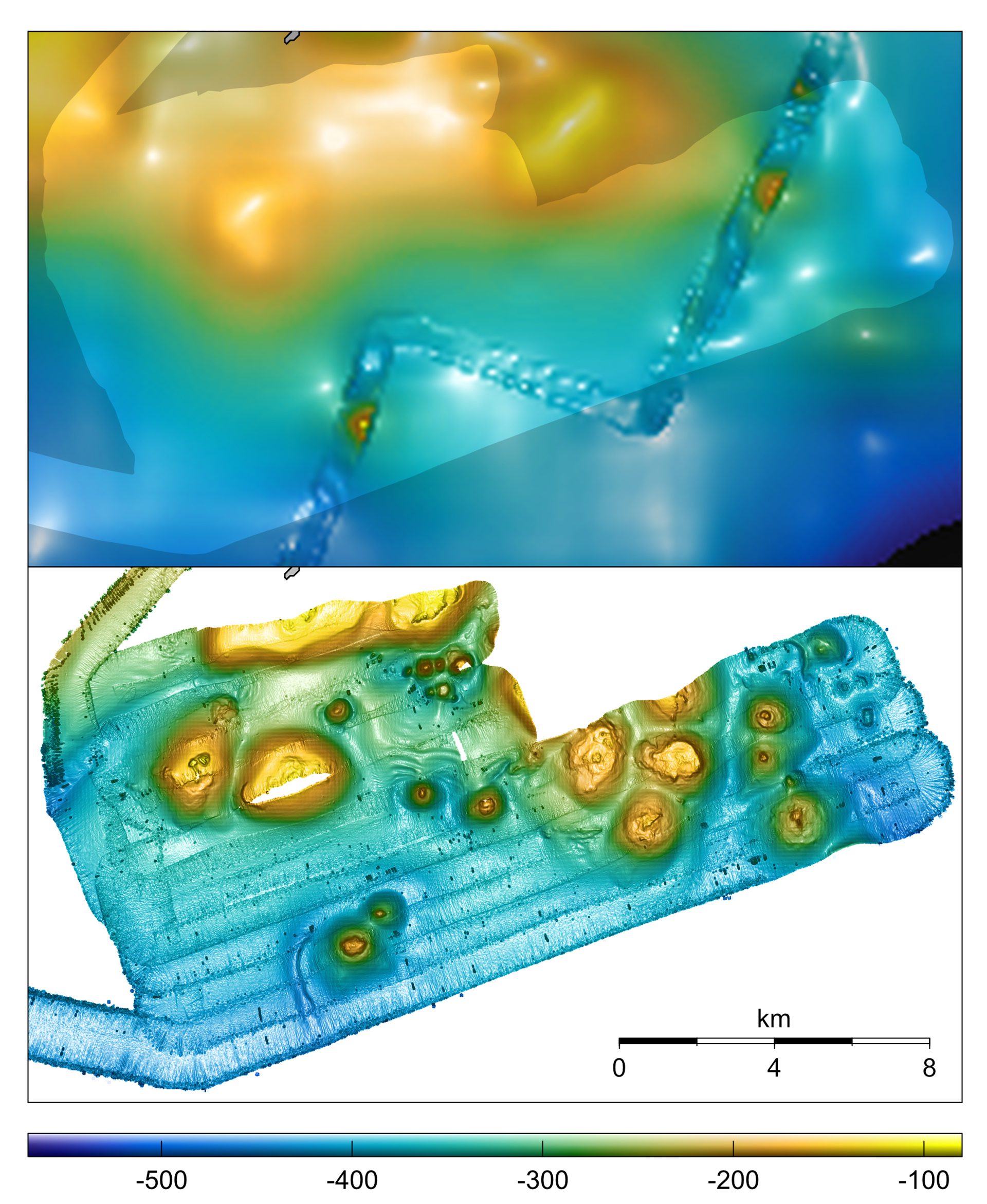
Multibeam sonar provided 1-meter-per-pixel resolution of seafloor bathymetry, compared with 800-meter-per-pixel resolution of the same area provided by satellite altimetry data.
Read MoreNitrogen cycle, with imbedded callouts, captions
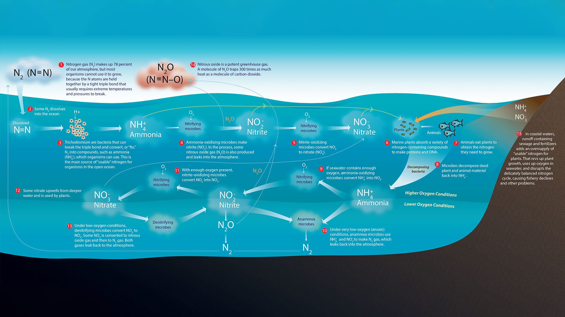
Chemical detectives follow nitrogen’s elusive and essential trail in the ocean.
Read More