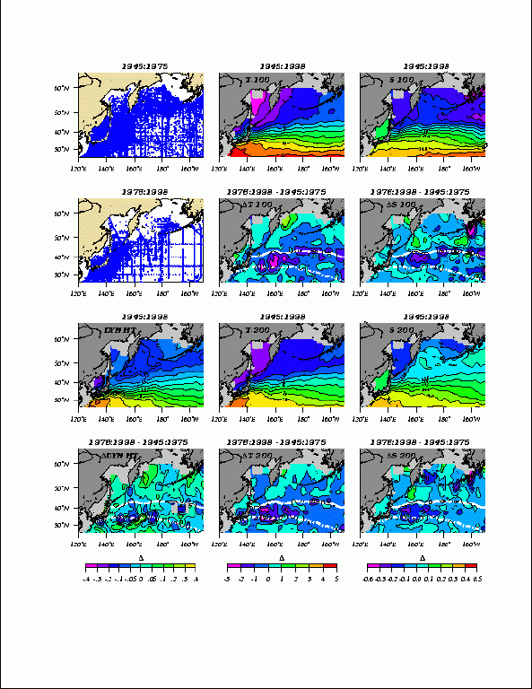
Figure 1. Hydrographic data showing the climatology of dynamic height (0-1000 dbar), temperature & salinity (100 & 200m depth) and their long-term changes with time. The white chain-dashed line is the axis of the KE and the dashed line the subarctic or Oyashio front, as discussed in the text. Color bars at the bottom of the panels refer to changes in dynamic height (m, contour interval: 0.05), temperature (oC, contour interval: 1) and salinity (psu, contour interval: 0.1).
