 |
|
|
ANDRILL - Ross Ice Shelf Observatory 2011 - Velocity and Water Properties under the ice at Coulman High. This NSF program ends Jan 31, 2011 due to logistical constraints?
Brief Outline
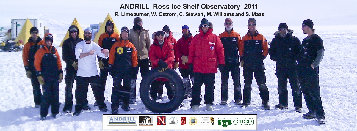
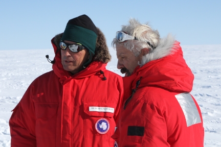
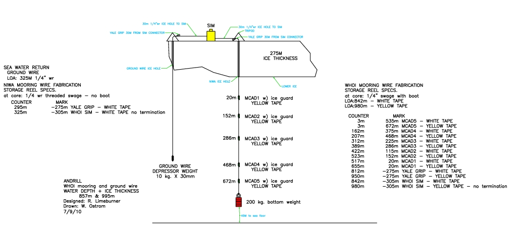
Two current meter moorings were deployed near 77° 26.211'S, 171° 32.391'E on November 24 and December 2, 2010 through the RIS by Richard Limeburner and Will Ostrom (WHOI), Craig Stewart and Mike Williams (National Institute of Water and Atmospheric Research, NIWA), and Sanne Maas (Victoria University, Wellington, NZ). The WHOI mooring is located at the Coulman High site approximately 77 nautical miles east northeast of McMurdo Station, Antarctica. The RIS mooring sites are normally covered with ~275-m of freshwater ice (Figure 4). Five Nortek Aquadopp and five SeaBird Microcat inductive modem instruments were placed in the water column at 5 levels below the ice shelf. A surface inductive modem logger and Iridium satellite communication package were installed on the ice shelf upper surface at the WHOI mooring. The mooring was planned to be recovered in January 2012, but a Rapid proposal to extend the measurements for 14 months was declined. Recovery is unfortunatey now planned for late January 2011. The edited real time moored data will soon be presented here and a full analysis will be done in early 2011.
Deployment
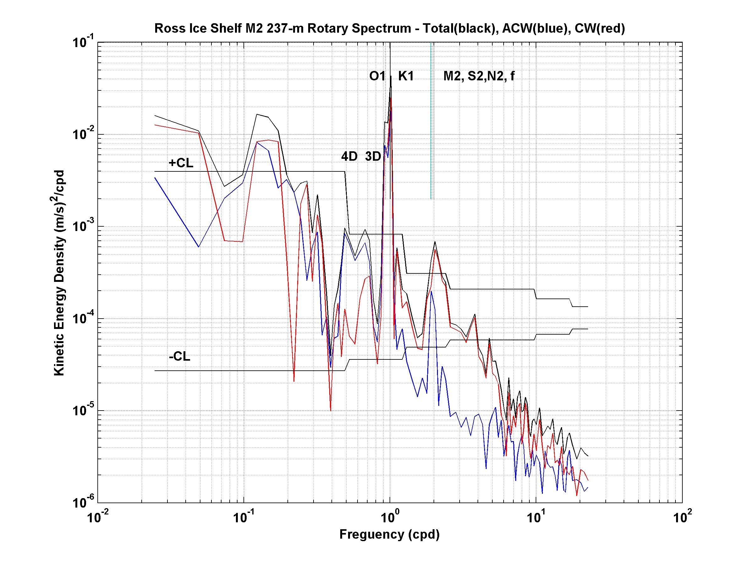
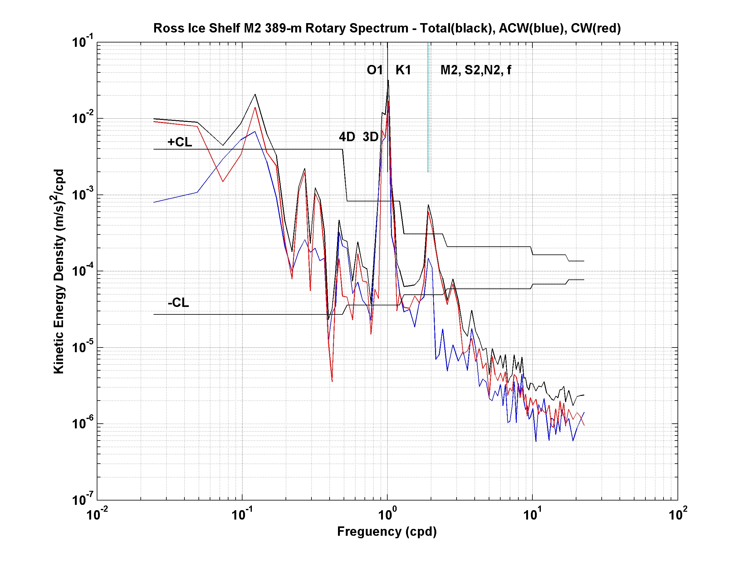
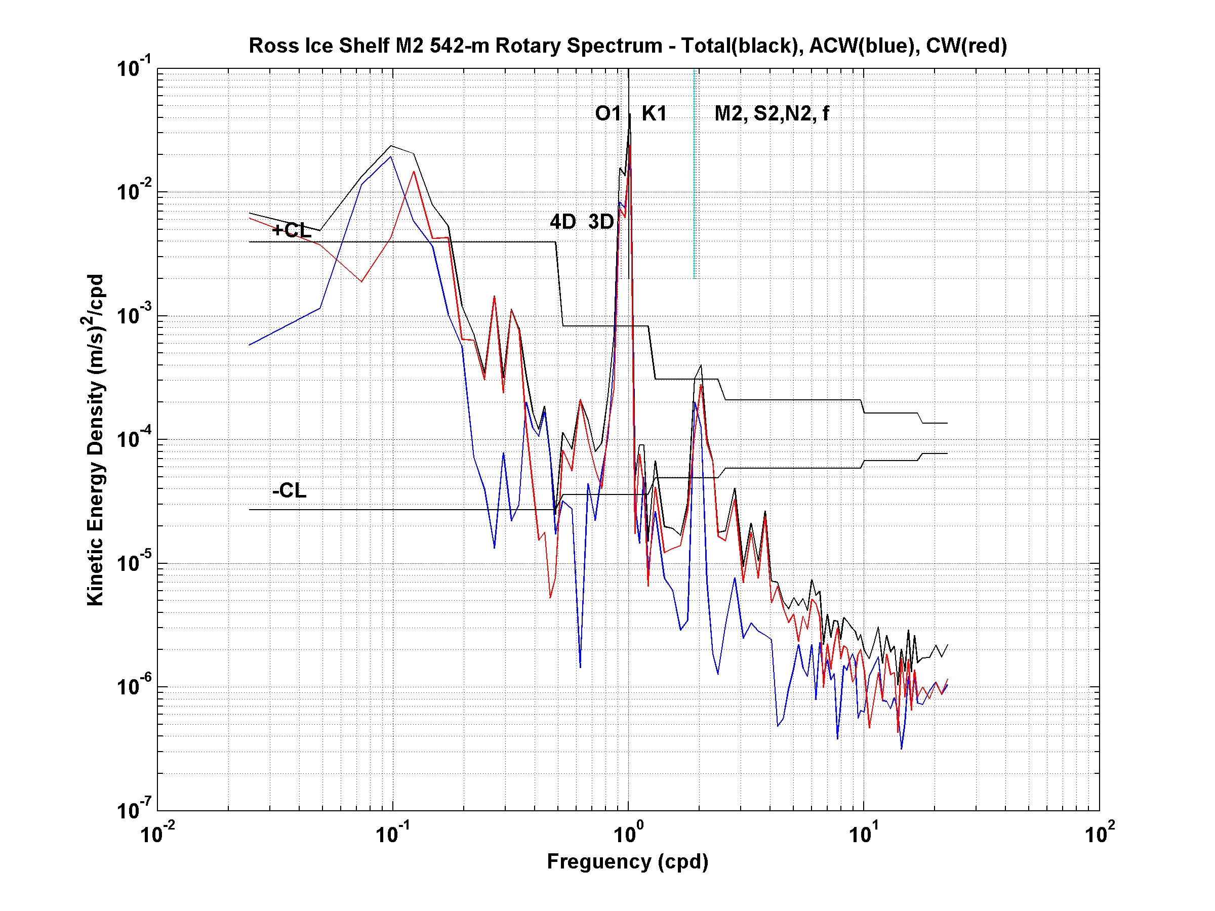
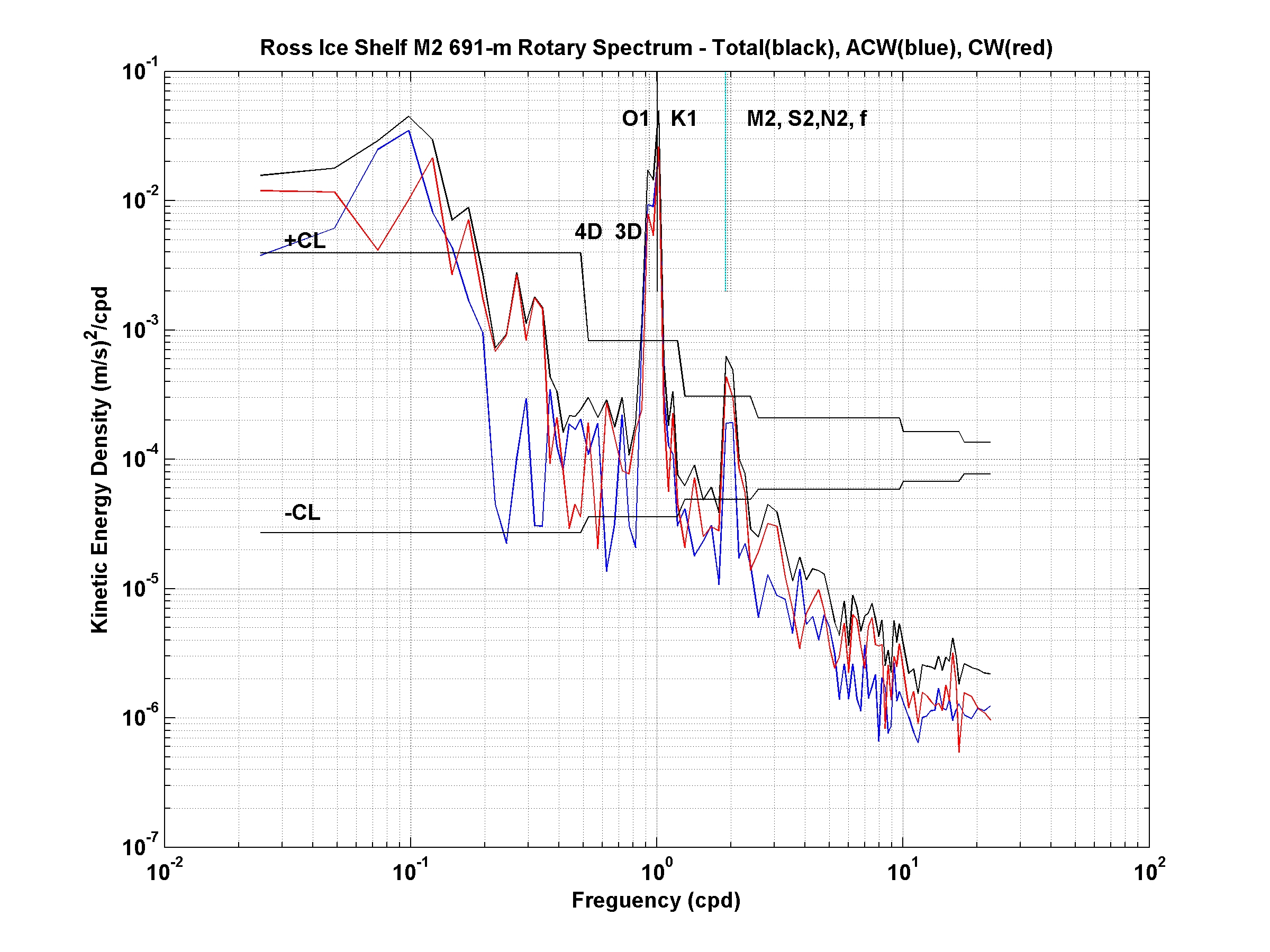
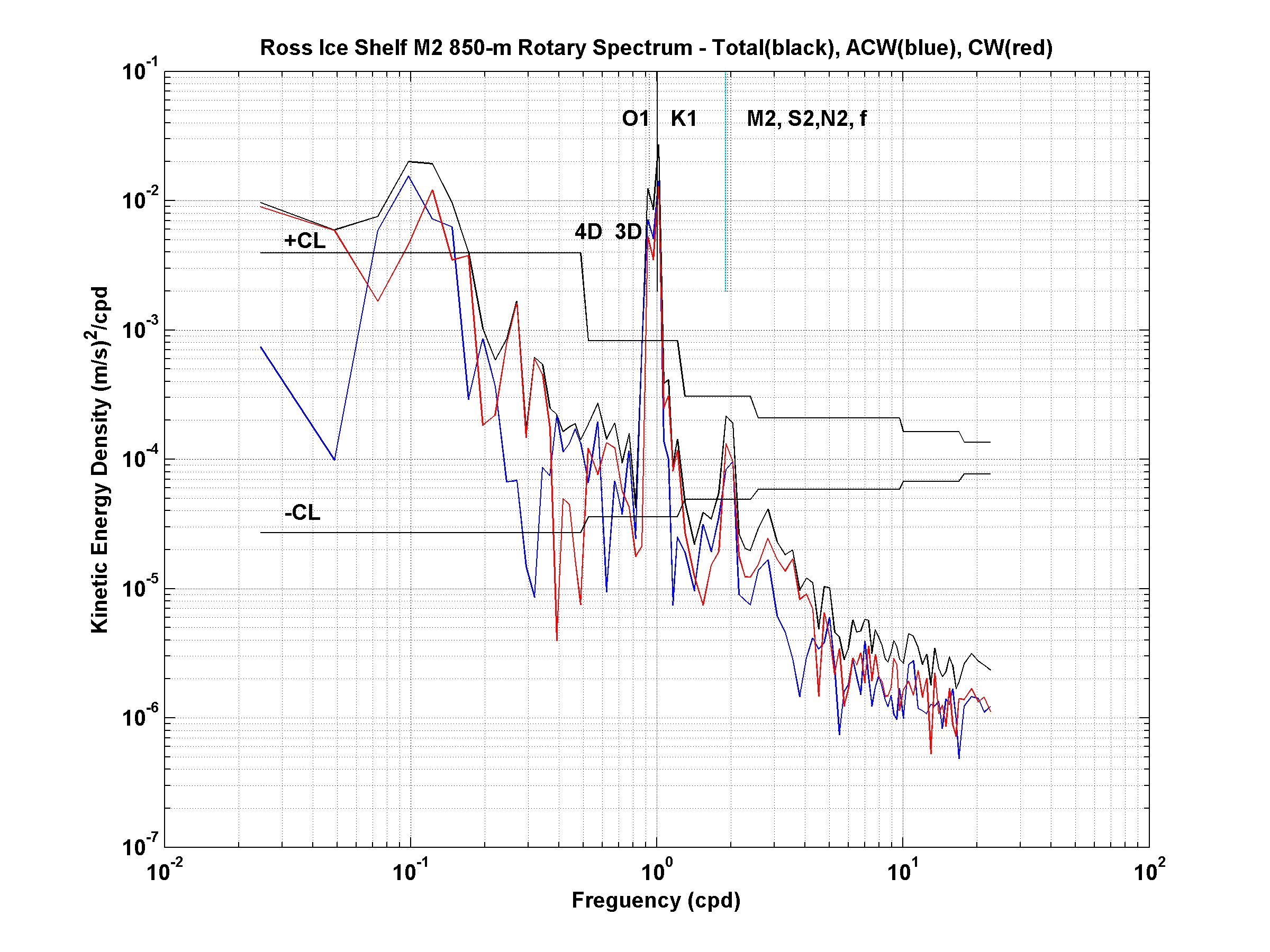
The first real-time velocity and water property data from under the Ross Ice Shelf (RIS) at the Coulman High site approximately 16 km south of the northern ice edge. A local magnetic variation of +137° (East) was applied to the current meter data to obtain true north. Five Nortek AquaDopp current meters and five Sea Bird Microcats with inductive modems were deployed below an ice surface controller/logger/Iridium modem/antenna with special lithium batteries and heat pads - all packed inside 20 cm of rigid foam insulation. The lower boundary of the RIS was at a depth of 228-m below Mean Sea Level (MSL) and 273-m below the upper RIS boundary (air/firn snow interface) at the M2 mooring site. We deployed the M2 mooring on December 1, 2010 during a blizzard, but we worked inside the ANDRILL Hot Water Drill (HWD) protective structure shown in the photos.
The initial 40 days of current meter data indicate (mainly from Figure 2)
- a modulated meridional diurnal tidal cycle embedded in
- an oscillating 2nd baroclinic mode zonal current with a time scale of 3-4 days and
- a sheared southward mean flow (1st baroclinic mode) veering slightly counterclockwise with depth. Maximum speed 21.4 cm/sec. During the last 6 days the mean flow at all levels has been weakly northward.
The M2 mooring was designed and built for a 14 month deployment by R. Limeburner, Will Ostrom and Jeff Obrien from Woods Hole Oceanographic Institution (WHOI) and Bruce Magnell, Archie Todd Morrison, and Minhchau Hung Vu from the Woods Hole Group (WHGrp), Falmouth, MA, USA.
Mooring Recovery
This functioning mooring will be recovered January 31, 2011 due to logistical constraints from above.
This project is funded by the National Science Foundation.
Website by Richard Limeburner and updated
January 12, 2010, Los Angeles, CA
| |