|
 |
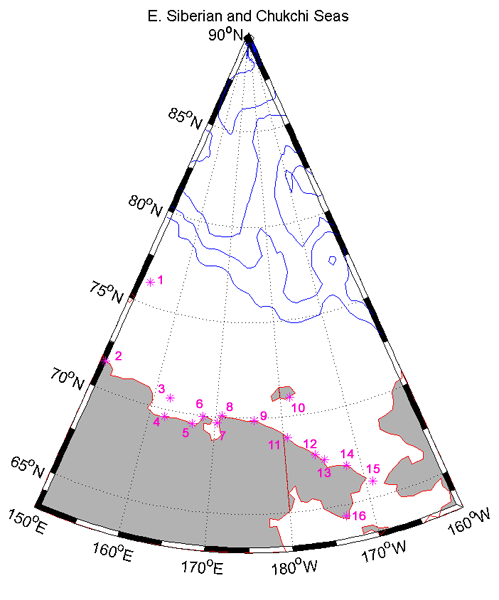
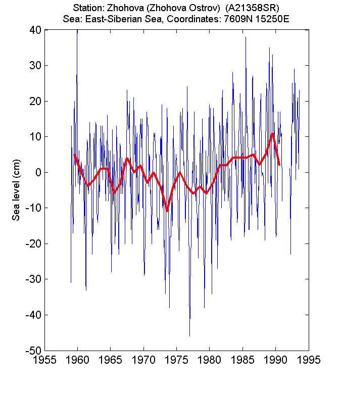
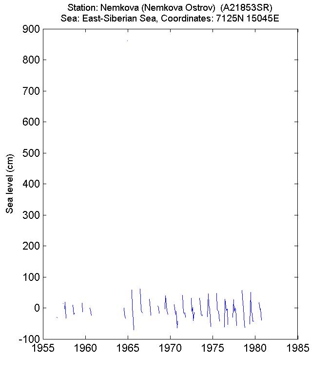
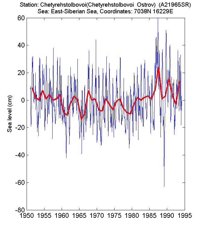
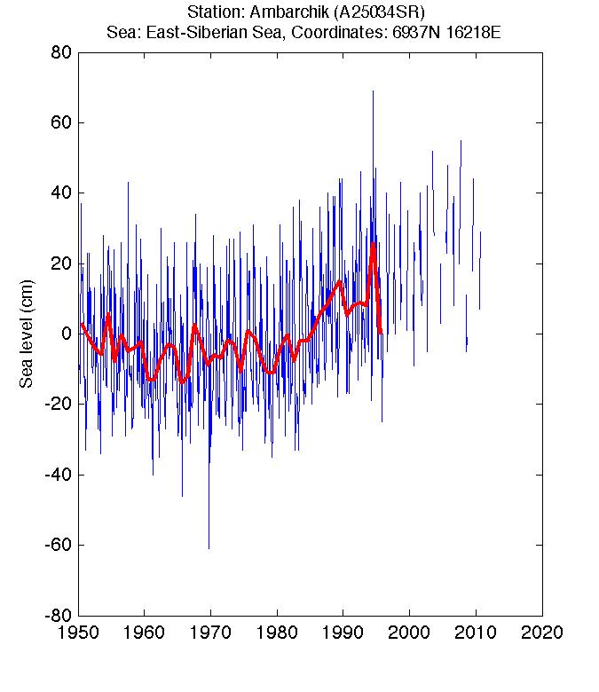
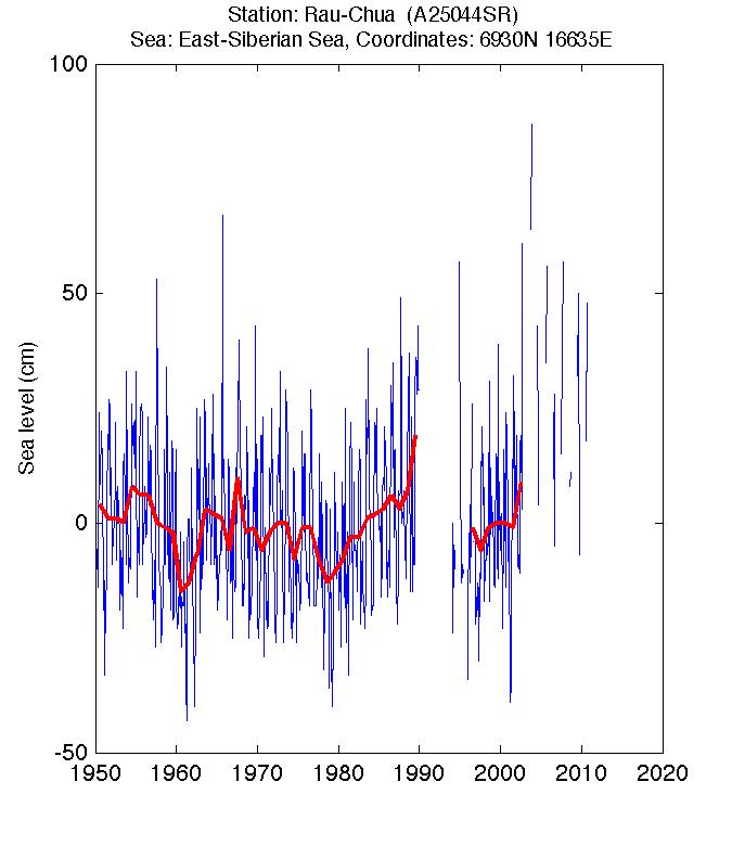
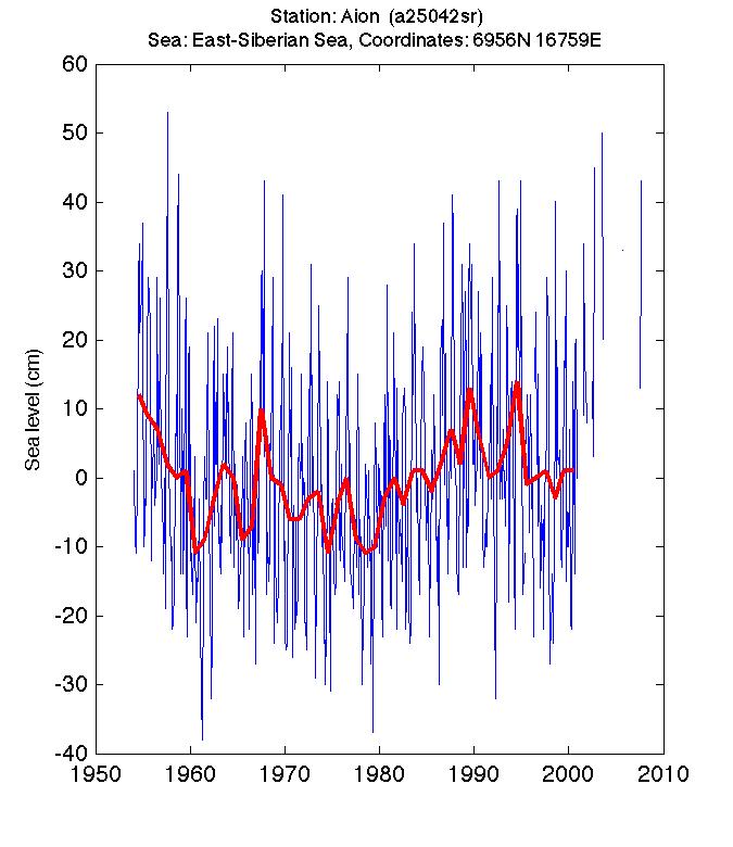
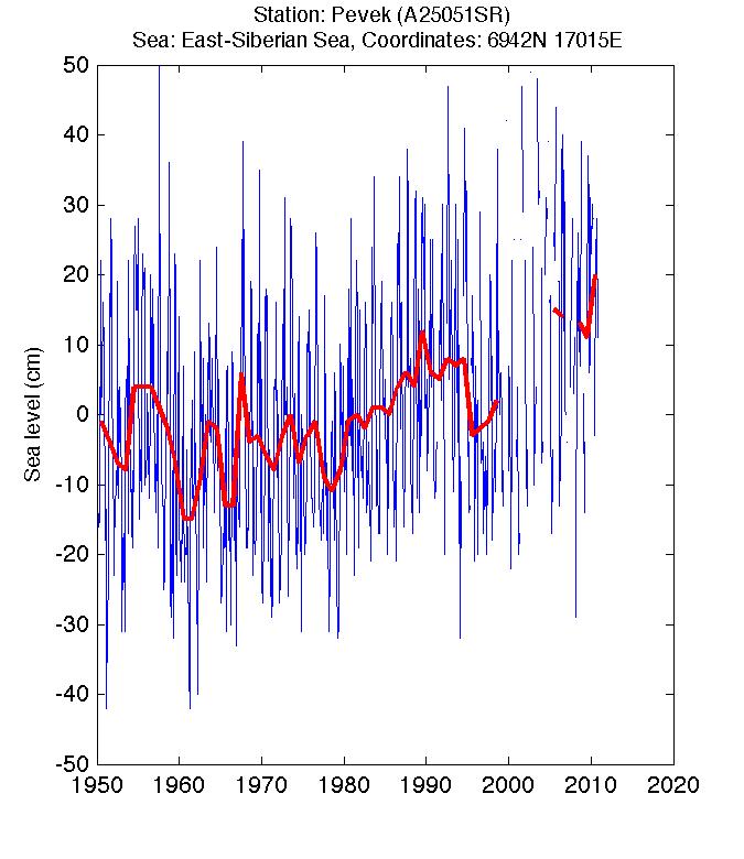
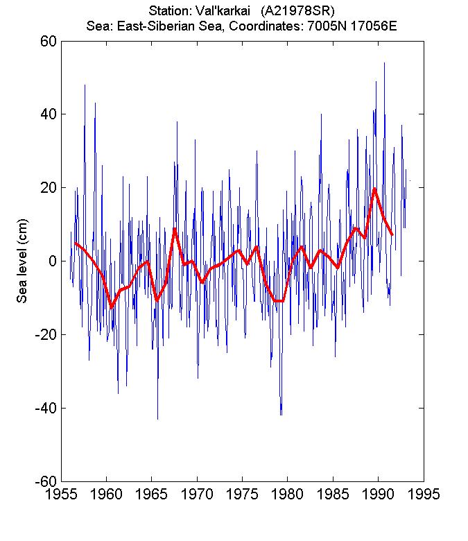
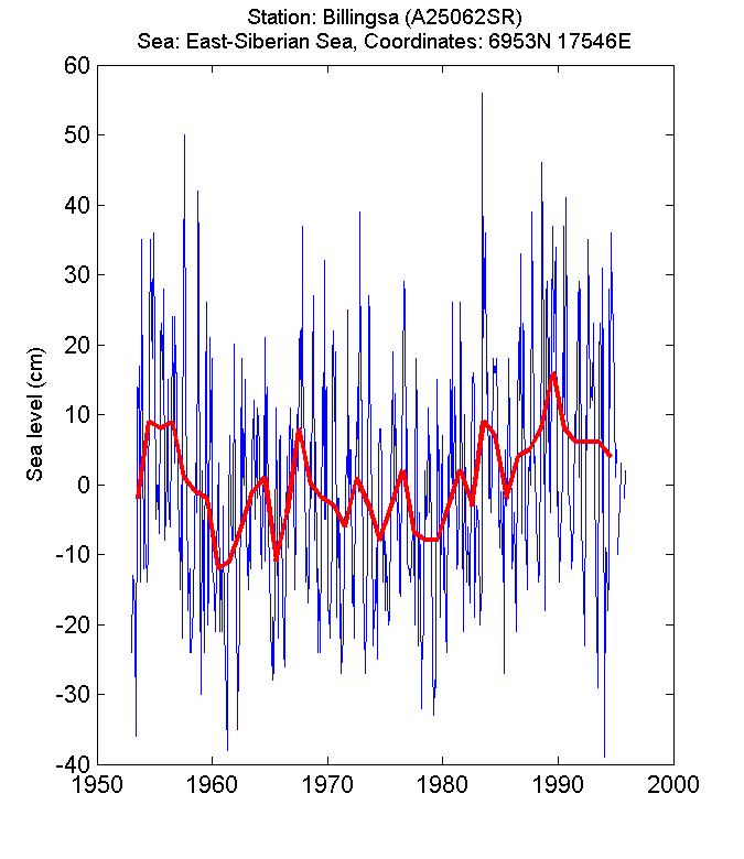
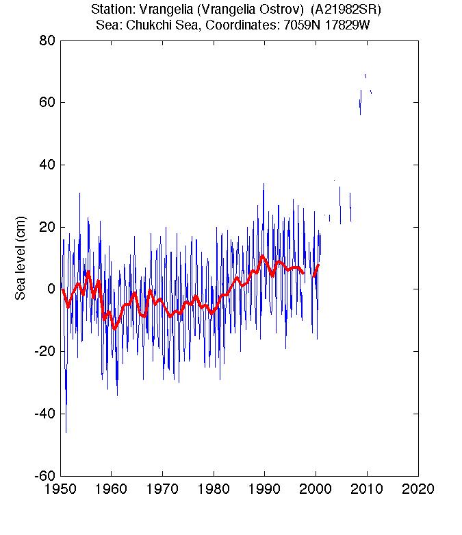
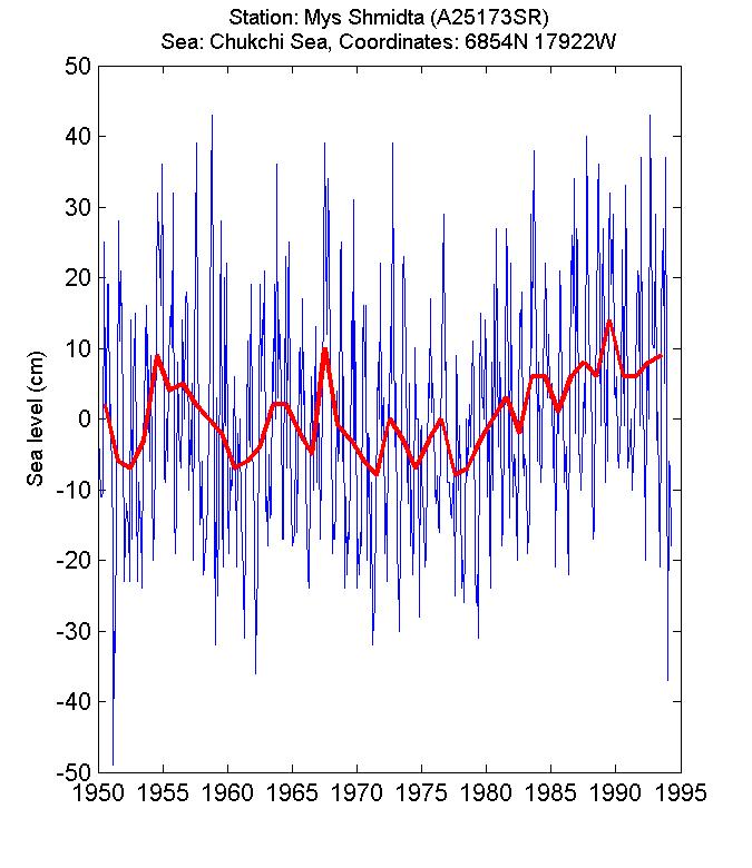
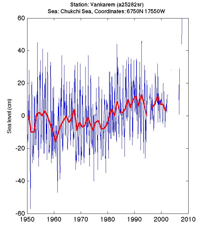
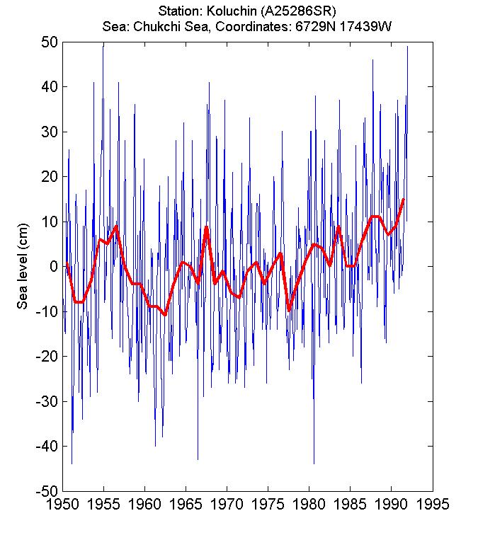
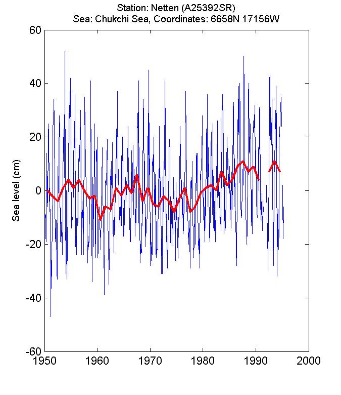
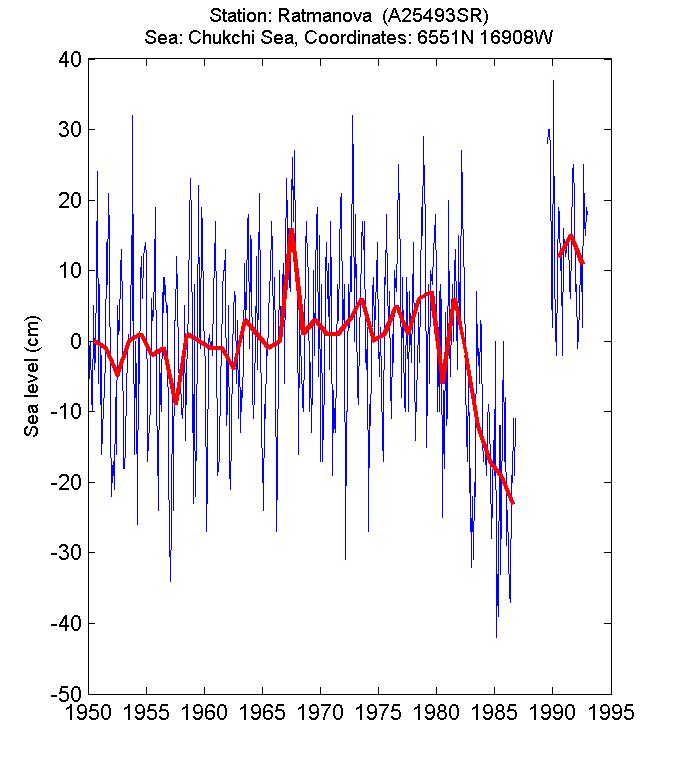
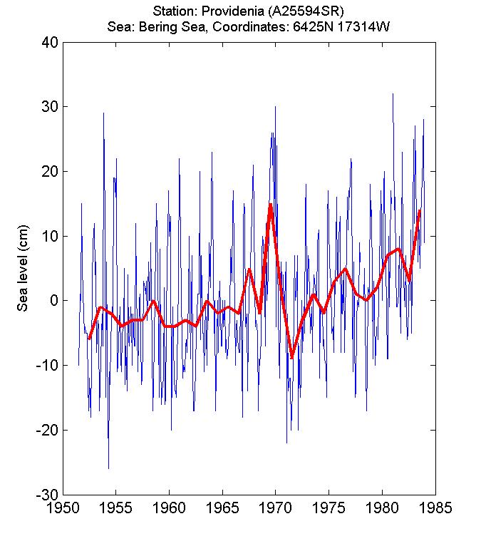
Click on a magenta
station number to see a plot of the monthly mean sea level
(blue) and annual mean sea level (red).
Back to main data
map.
* ASCII Data files
The data files contain the station information
and monthly sea level data for each location shown on the map.
999 indicates no data. The column format is:
(1)Year (2)Jan (3)Feb (4)Mar (5)Apr (6)May (7)Jun (8)Jul
(9)Aug (10)Sep (11)Oct (12)Nov (13)Dec (14)AnnualMean.
All sea level data are in cm.
|

