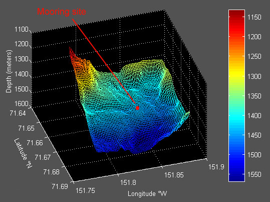
3D bathymetry plot
of the deepest mooring site. The plot is oriented such that
north is in the foreground and south in the background (like
we are looking south towards Alaska from the North Pole). The
mooring location (the deepest mooring of the eight) is in the
center of the plot (red dot). Water depth values are given in
meters to the right - the colors on the scale match the colors
in the plot (blue = deep, red = shallow).
|