Please note: You are viewing the unstyled version of this website. Either your browser does not support CSS (cascading style sheets) or it has been disabled. Skip navigation.

Basic hydrographic and environmental data

   Print Change text to small (default) Change text to medium Change text to large

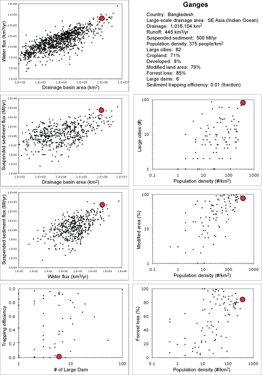
Data on drainage basin area, annual runoff, annual suspended sediment load, population density, number of large cities, cropland area, developed area, total modified area, loss of forrest, percent of eroded land surface, number of large dams (previous eight parameters are from Revenga et al., 1998), and sediment trapping efficiency (Vörösmarty et al., 2003). The diagrams show the characteristics of the Ganges River (red circle) in relation to up to 1249 rivers that are part of the WHOI River Database (Peucker-Ehrenbrink, unpublished).


Last updated: January 11, 2011


whoi logo

Copyright ©2007 Woods Hole Oceanographic Institution, All Rights Reserved, Privacy Policy.
Problems or questions about the site, please contact webdev@whoi.edu