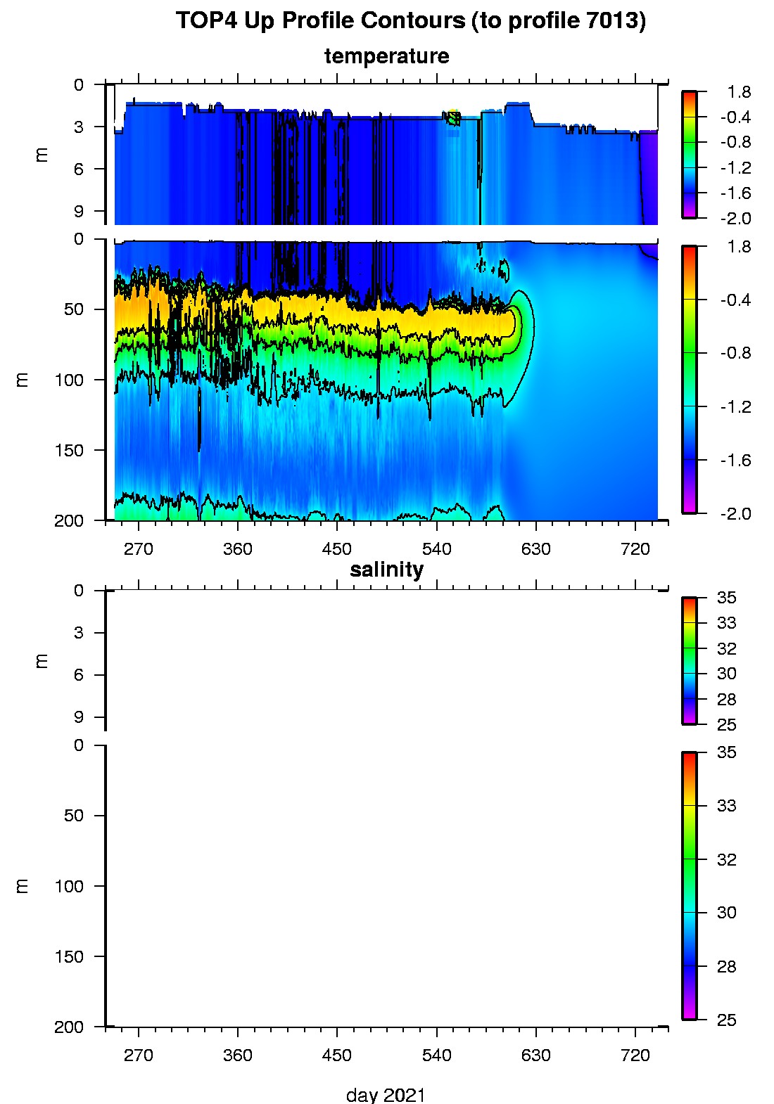
Tethered Ocean Profiler 4 Data Data from TOP4 deployed in September 2021
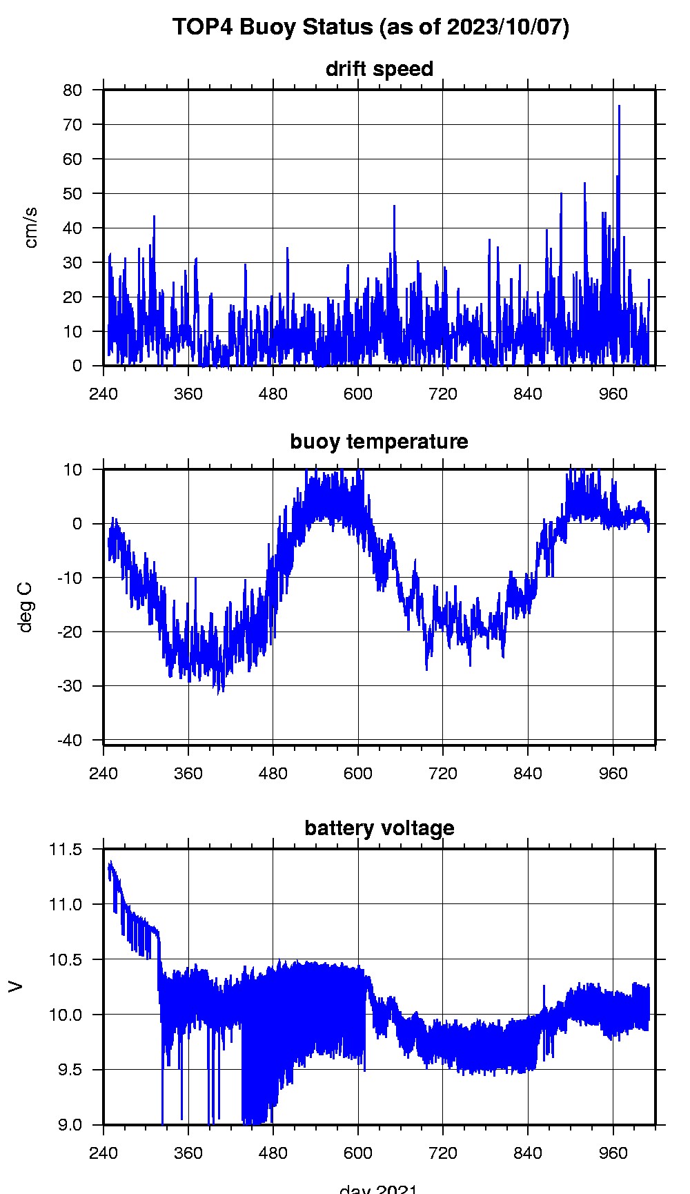
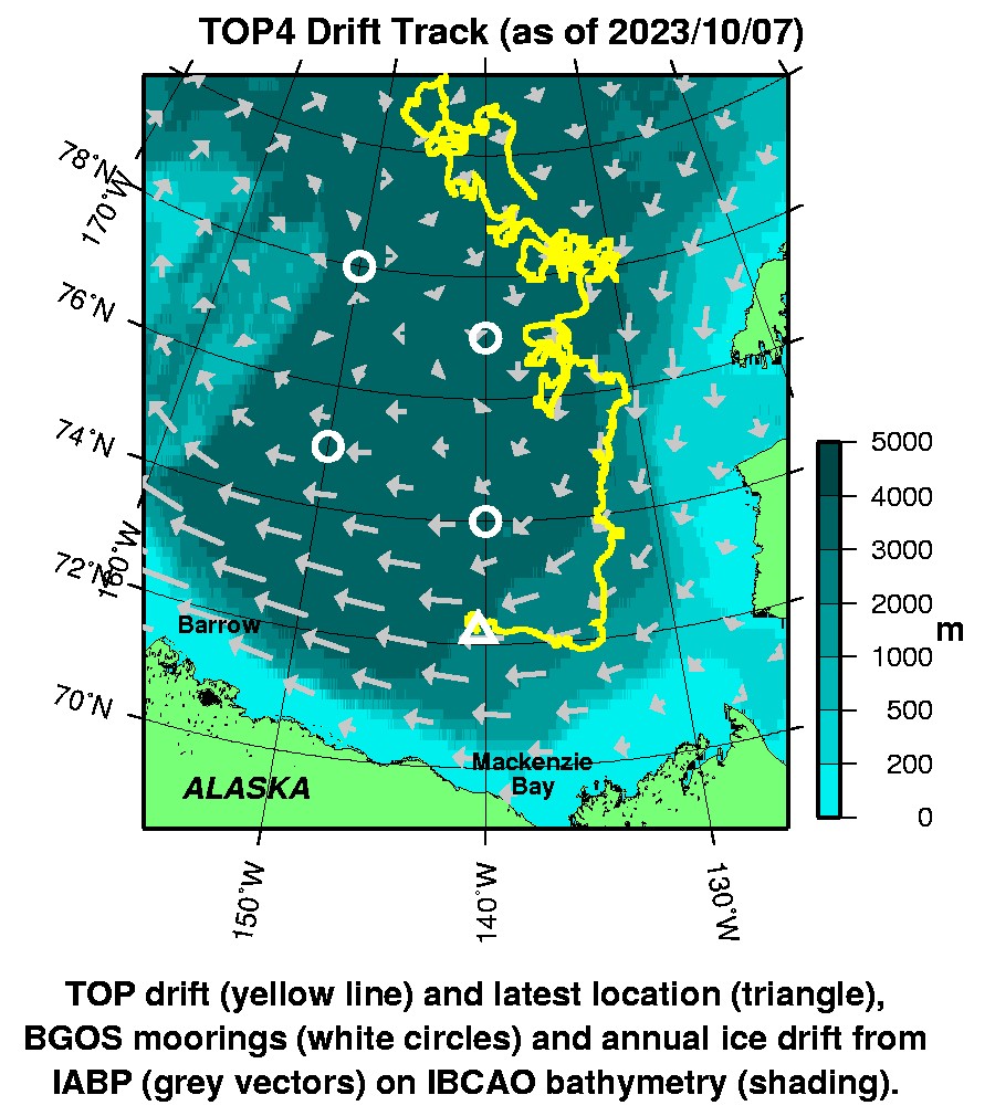
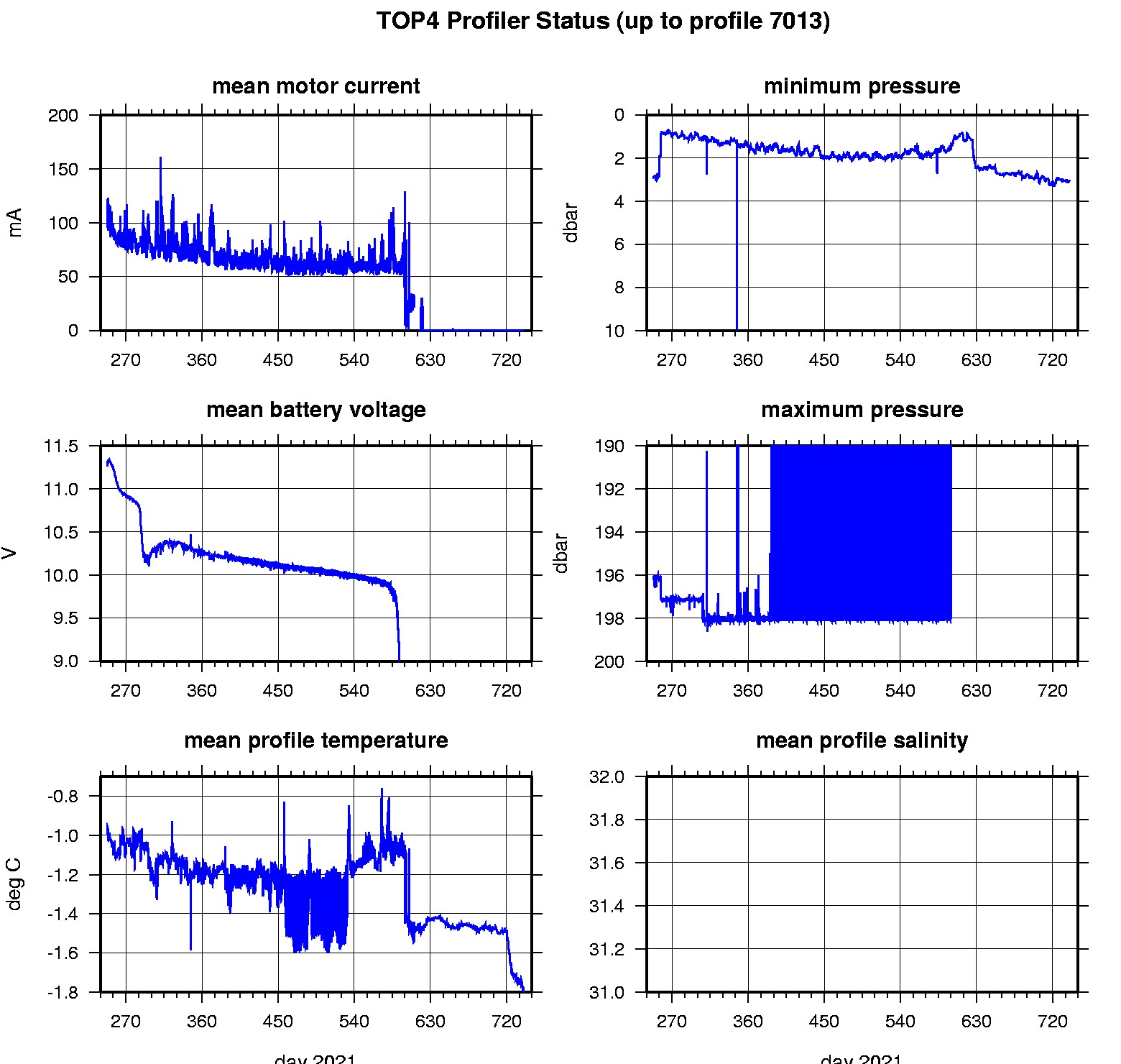
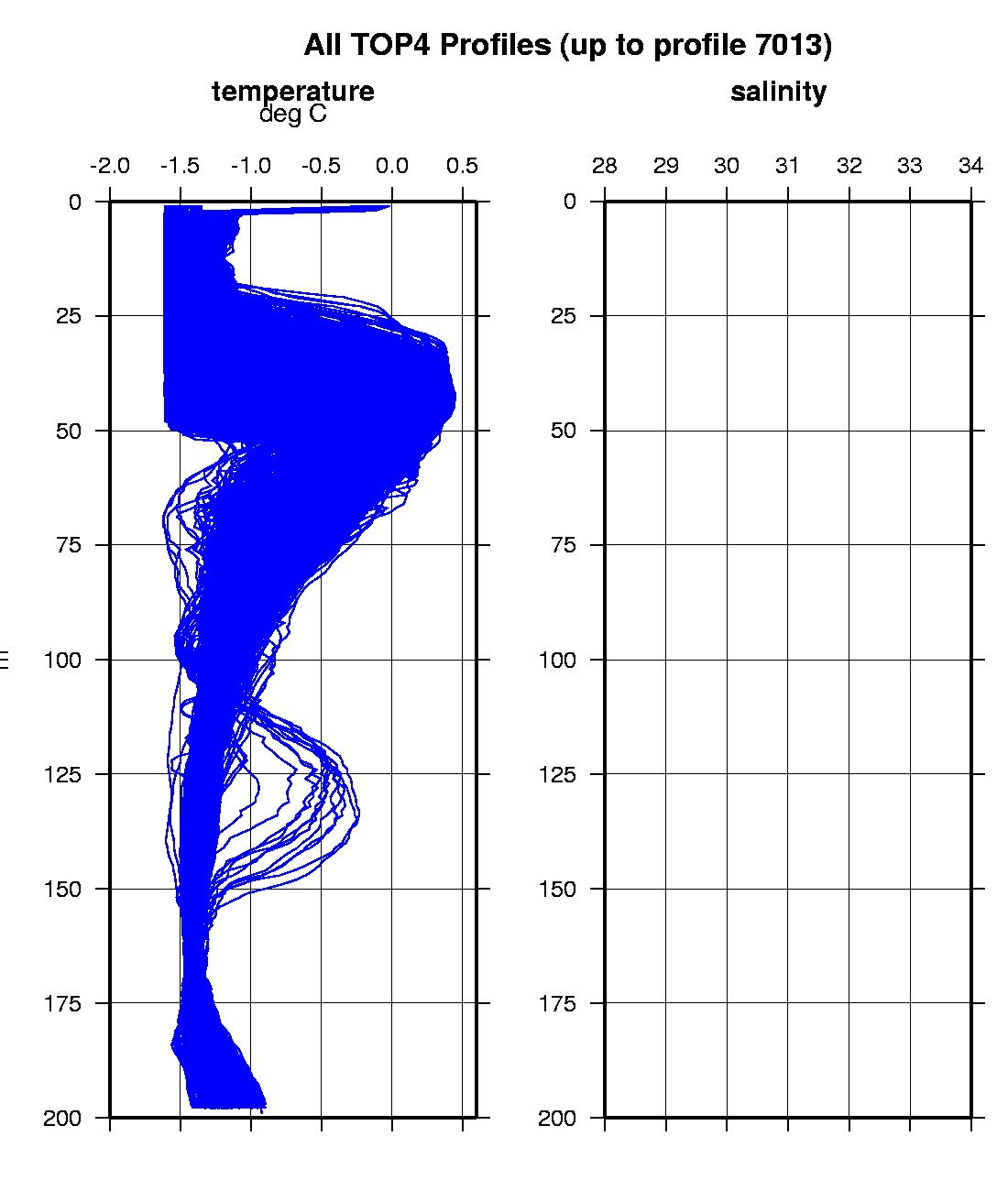
Last buoy status on 2023/10/7 210047 UTC : temperature = 0.875 °C, battery = 10.091 V Last position on 2023/10/7 210047 UTC : 72.206° N, 140.3955° W Last profile (number 7013) on 2023/1/10 835 UTC Last profile mean motor current = 0.23535 mA, mean battery = 4.9401 V Last profile depth: minimum = 3.0703, maximum = 3.0703 m Last profile temperature: minimum = -1.7791, maximum = -1.7791 °C Last profile salinity: minimum = 193.6054, maximum = 193.6054 The raw GPS buoy location data are available in an ASCII file: top4rawlocs.dat Depth averaged profiler data files (with interpolated location) are available in two formats: TOP4 was deployed on an 0.75 m thick ice floe in the Beaufort Sea on September 4, 2021 at 79° 17.0 N, 135° 31.6 W as part of the Beaufort Gyre Observing System (BGOS) during the JOIS 2021 cruise on the CCGS Louis S. St. Laurent. On the same icefloe, an Ice-Tethered Profiler (ITP122), a US Army Cold Regions Research and Engineering Laboratory (CRREL) Seasonal Ice Mass Balance Buoy 3 ,and a Naval Postgraduate School Arctic Ocean Flux Buoy (AOFB48) were also installed. The TOP is operating on a standard sampling schedule of 6 two-way profiles from the surface to 200 m depth each day.
|