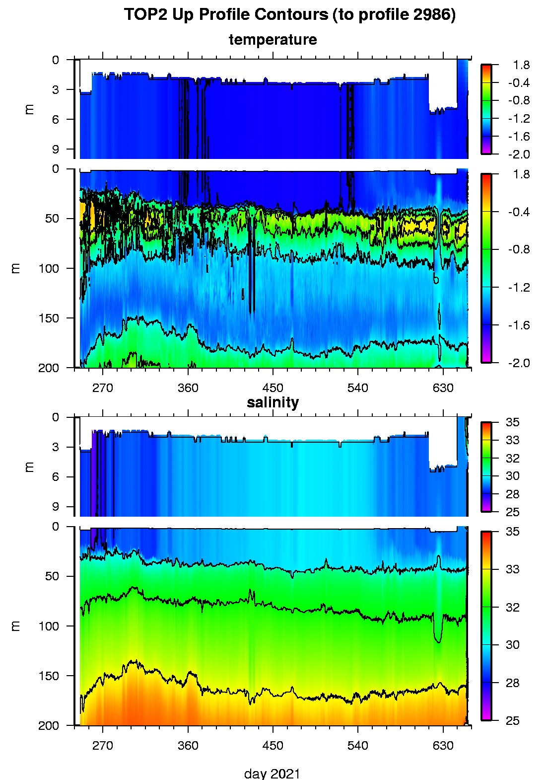
Tethered Ocean Profiler 2 Data Data from TOP2 deployed in September 2021
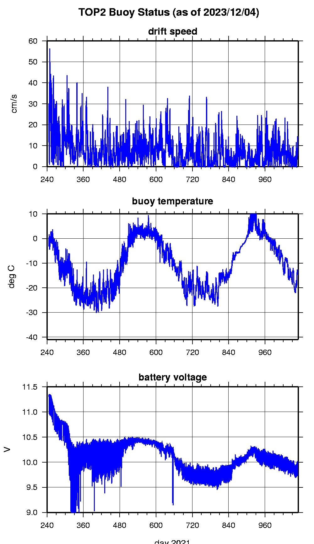
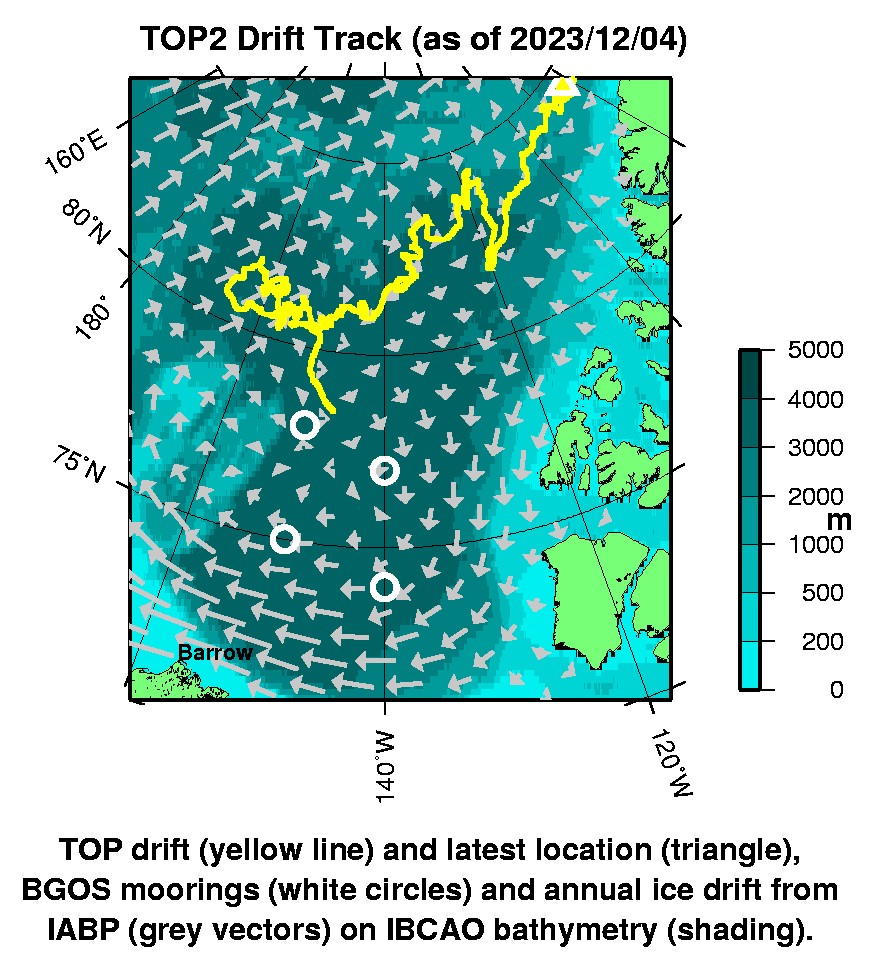
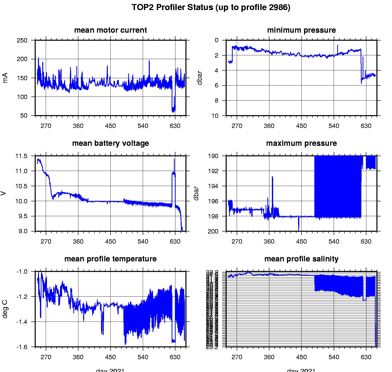
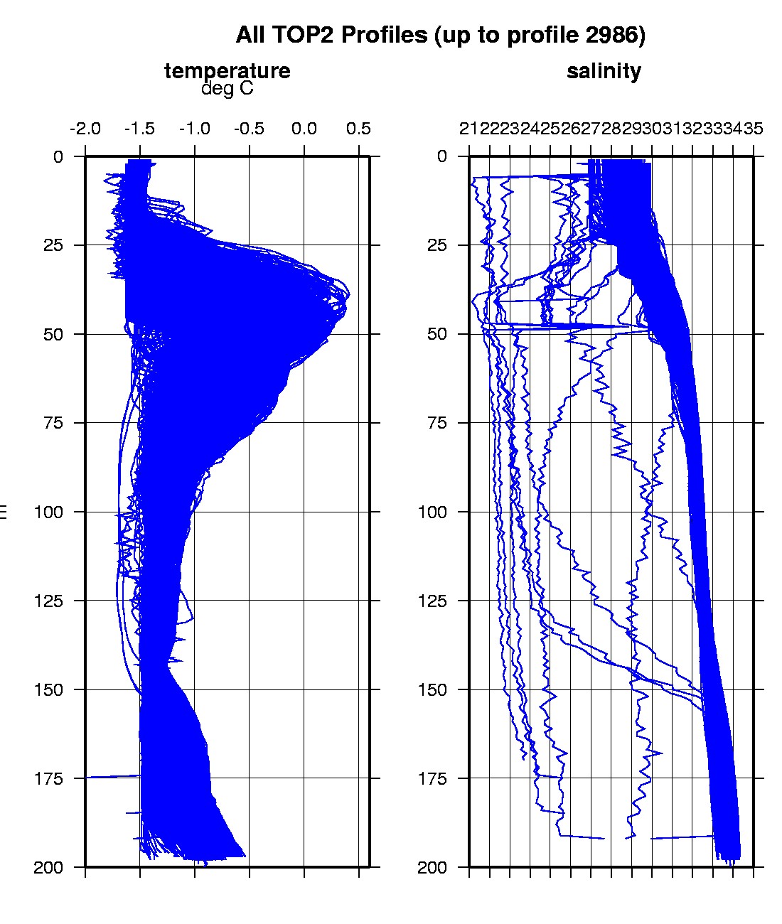
Last buoy status on 2023/12/4 14 UTC : temperature = -14.625 °C, battery = 9.742 V Last position on 2023/12/4 14 UTC : 84.4907° N, 82.1316° W Last profile (number 2986) on 2022/10/18 633 UTC Last profile mean motor current = 160.5912 mA, mean battery = 4.7305 V Last profile depth: minimum = 4.7327, maximum = 169.8319 m Last profile temperature: minimum = -1.7525, maximum = -0.29679 °C Last profile salinity: minimum = 21.6861, maximum = 27.4933 The raw GPS buoy location data are available in an ASCII file: top2rawlocs.dat Depth averaged profiler data files (with interpolated location) are available in two formats: TOP2 was deployed on an 0.85 m thick ice floe in the Beaufort Sea on September 2, 2021 at 78° 34.9 N, 147° 15.5 W as part of the Beaufort Gyre Observing System (BGOS) during the JOIS 2021 cruise on the CCGS Louis S. St. Laurent. On the same icefloe, an Ice-Tethered Profiler (ITP127), and a US Army Cold Regions Research and Engineering Laboratory (CRREL) Seasonal Ice Mass Balance Buoy 3 were also installed. The TOP is operating on a standard sampling schedule of 6 two-way profiles from the surface to 200 m depth each day.
|