Ice Tethered Profiler 137 Data Data from ITP137 deployed in September 2022
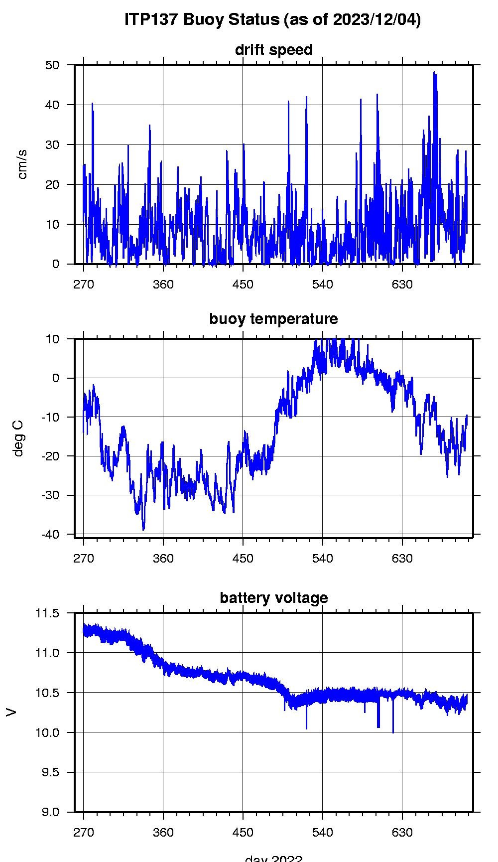
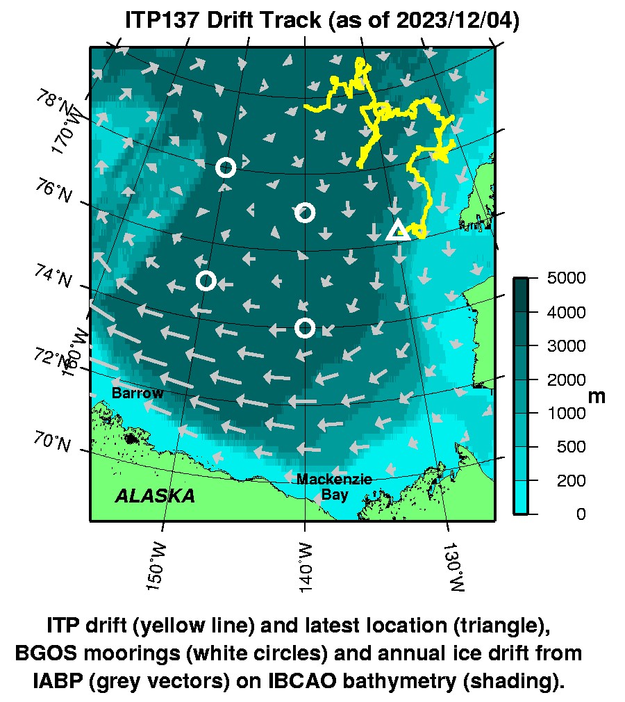
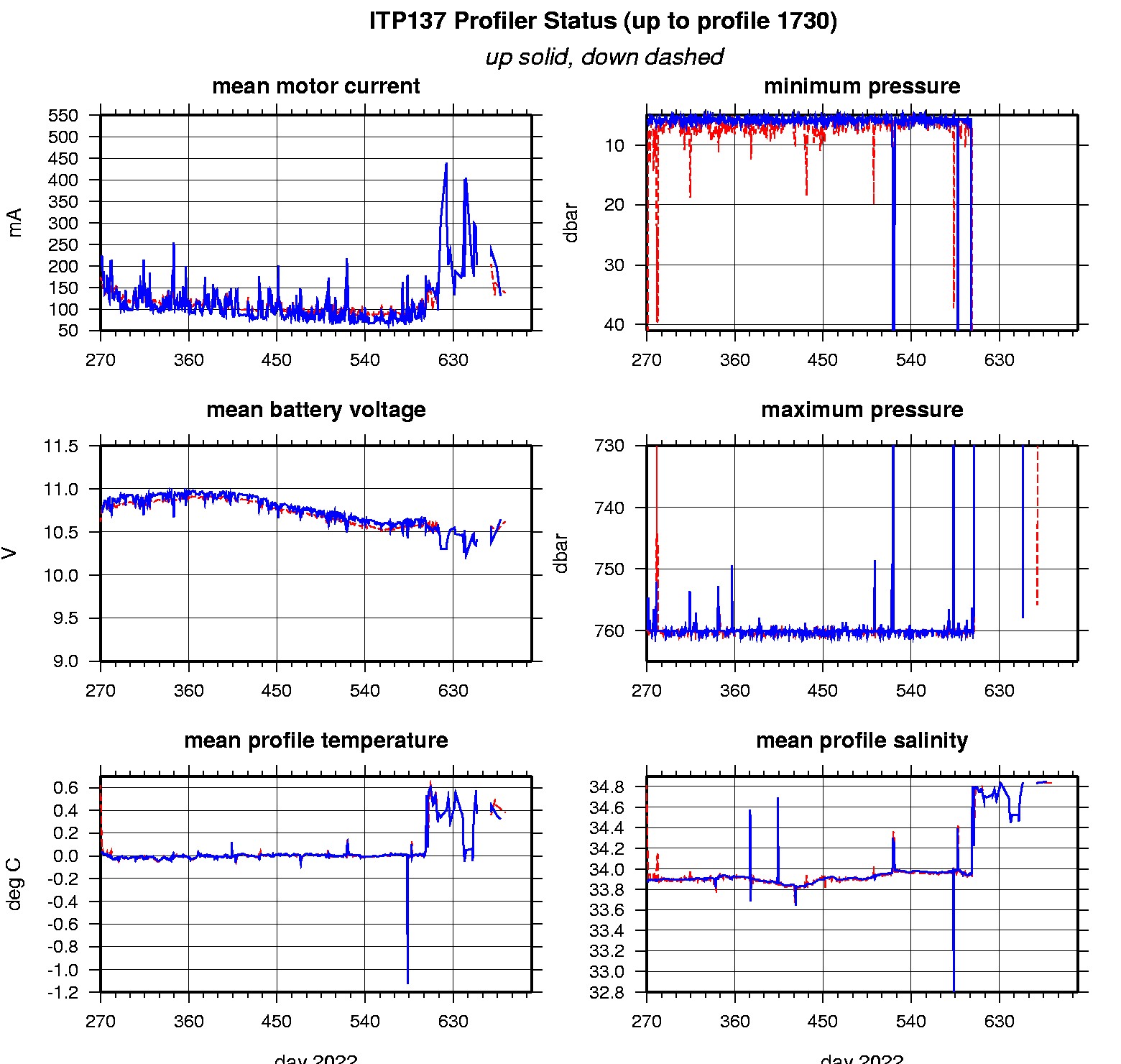
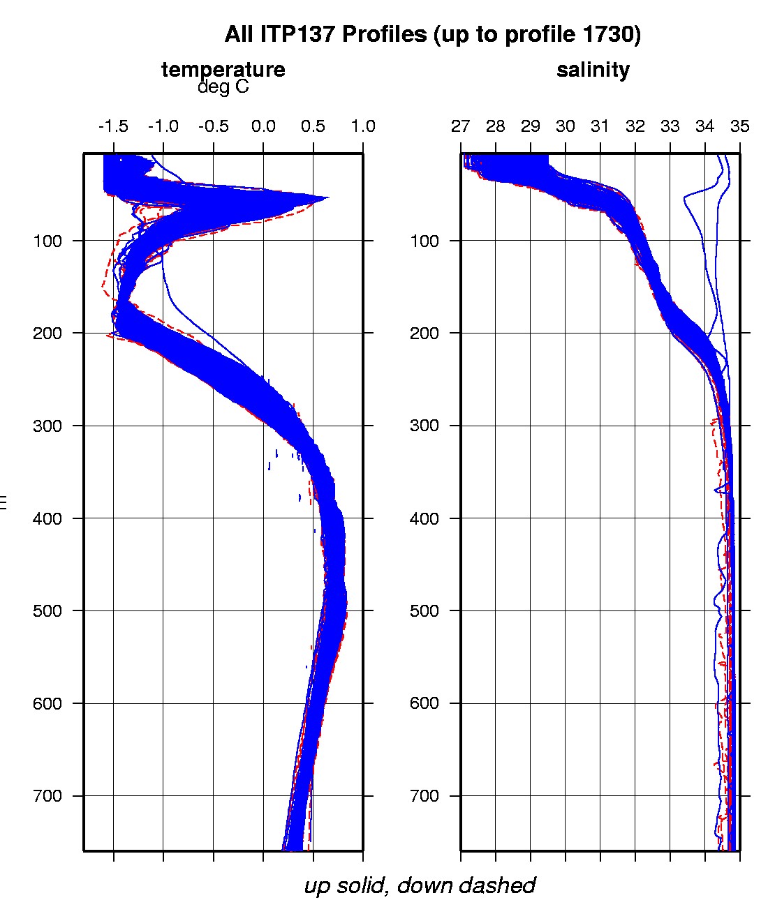
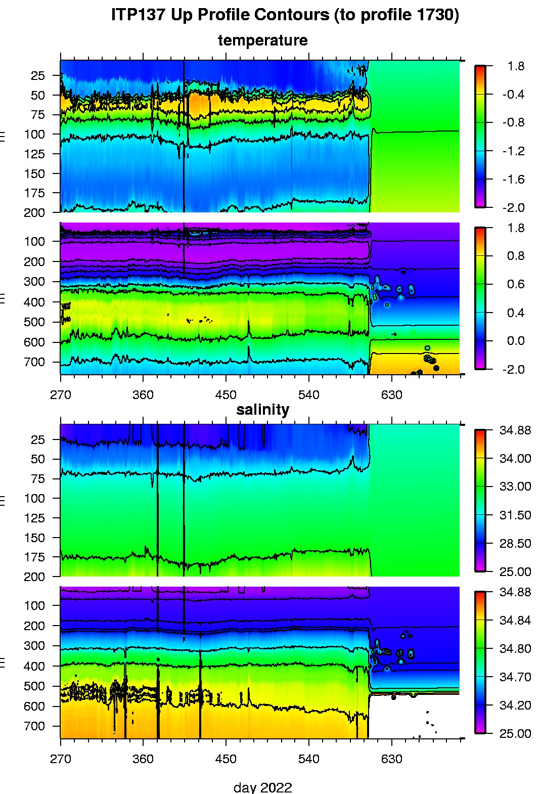
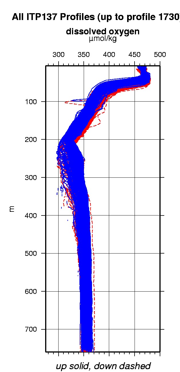
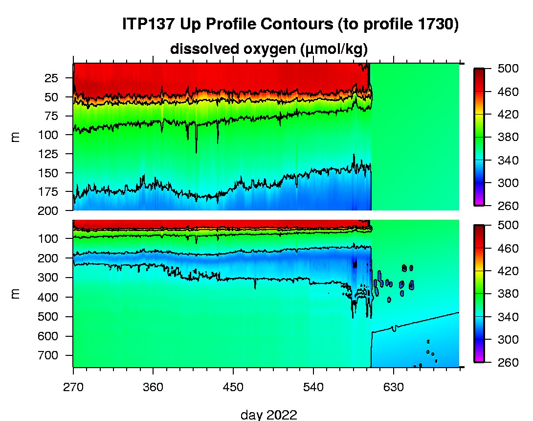
Last buoy status on 2023/12/4 60101 UTC : temperature = -12.125 °C, battery = 10.436 V Last position on 2023/12/4 60101 UTC : 76.2631° N, 129.7262° W Last profile (number 1730) on 2023/11/14 602 UTC Last profile mean motor current = 136.7446 mA, mean battery = 10.6204 V Last profile depth: minimum = 666.5451, maximum = 668.0644 m Last profile temperature: minimum = 0.37903, maximum = 0.38348 °C Last profile salinity: minimum = 34.8414, maximum = 34.8418 Last profile dissolved oxygen: minimum = NaN, maximum = NaN μmol/kg No SAMI data yet The raw GPS buoy location data are available in an ASCII file: itp137rawlocs.dat Depth averaged profiler data files (with interpolated location) are available in two formats: ITP137 was deployed on a 1.0 m ice floe in the Beaufort Sea on September 24, 2022 at 79° 49.1 N, 139° 58.1 W as part of the Beaufort Gyre Observing System (BGOS) during the JOIS 2022 cruise on the CCGS Louis S. St. Laurent. On the same icefloe, a Tethered Ocean Profiler (TOP6) and a US Army Cold Regions Research and Engineering Laboratory (CRREL) Seasonal Ice Mass Balance Buoy 3 were also installed. The ITP includes a dissolved oxygen sensor, is operating on a fast sampling schedule of 4 one-way profiles between 7 and 760 m depth each day and includes a fixed SAMI PCO2 with ODO and PAR at 5 m depth.
|