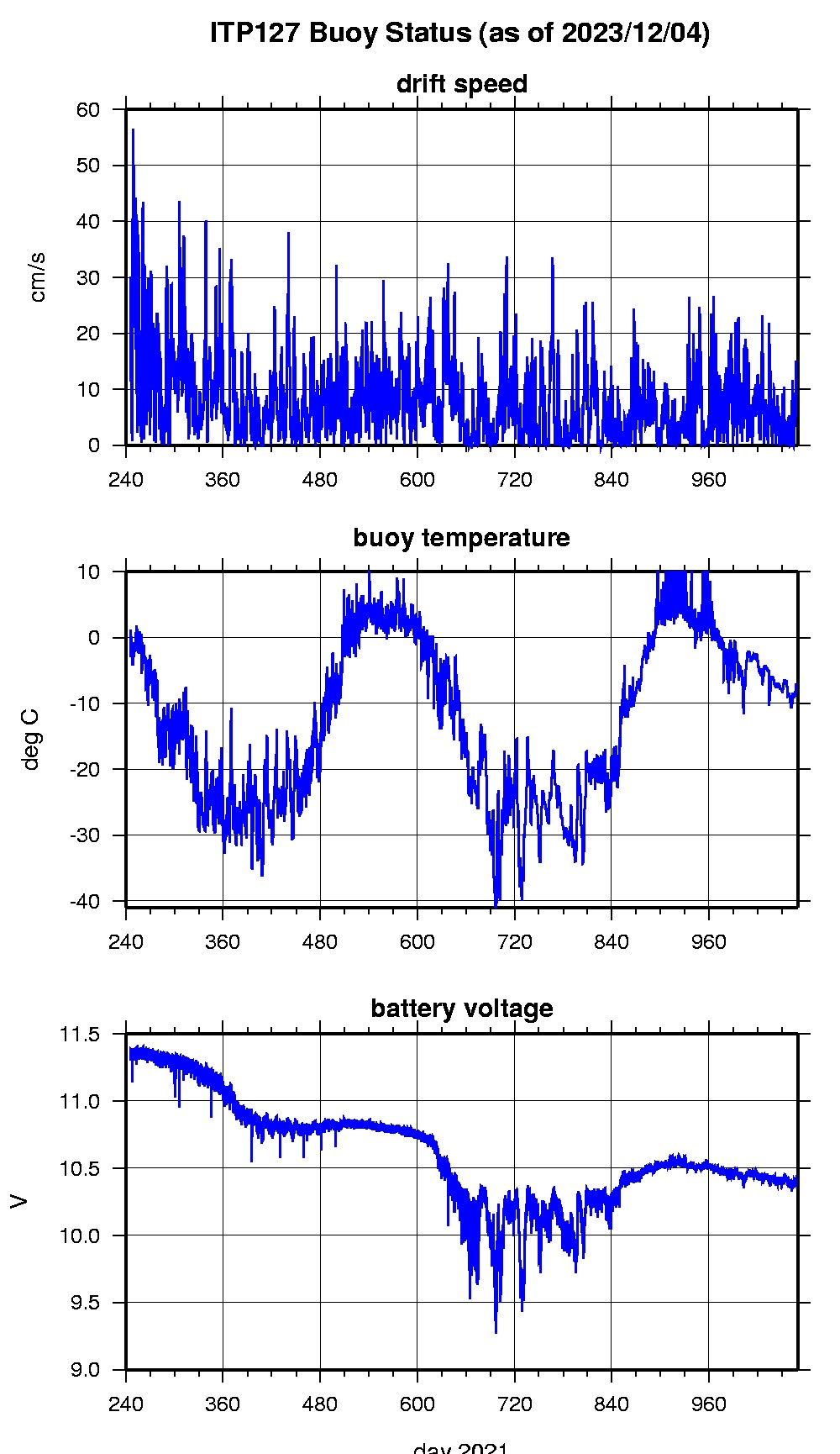
Ice Tethered Profiler 127 Data Data from ITP127 deployed in September 2021
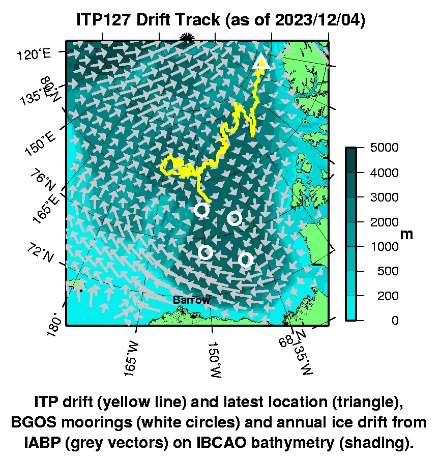
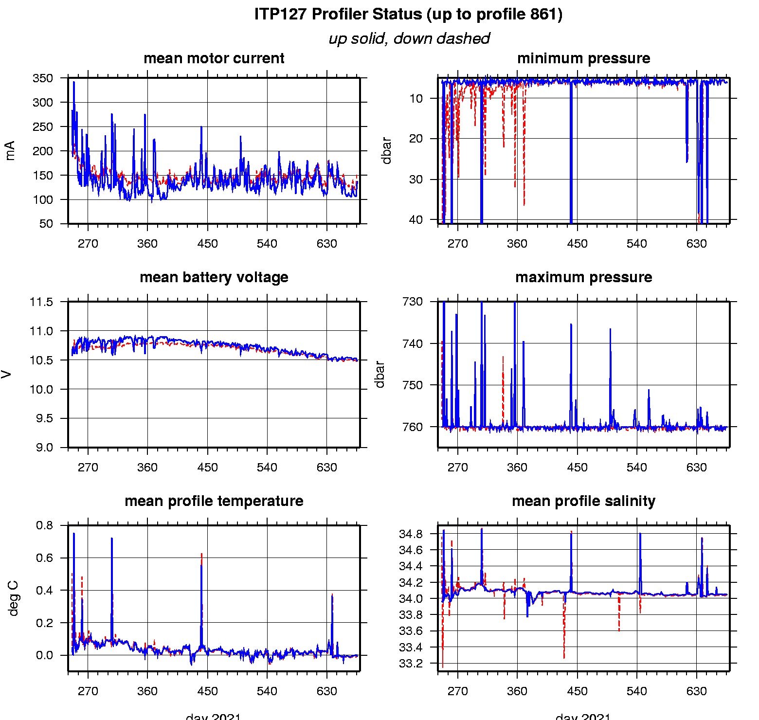
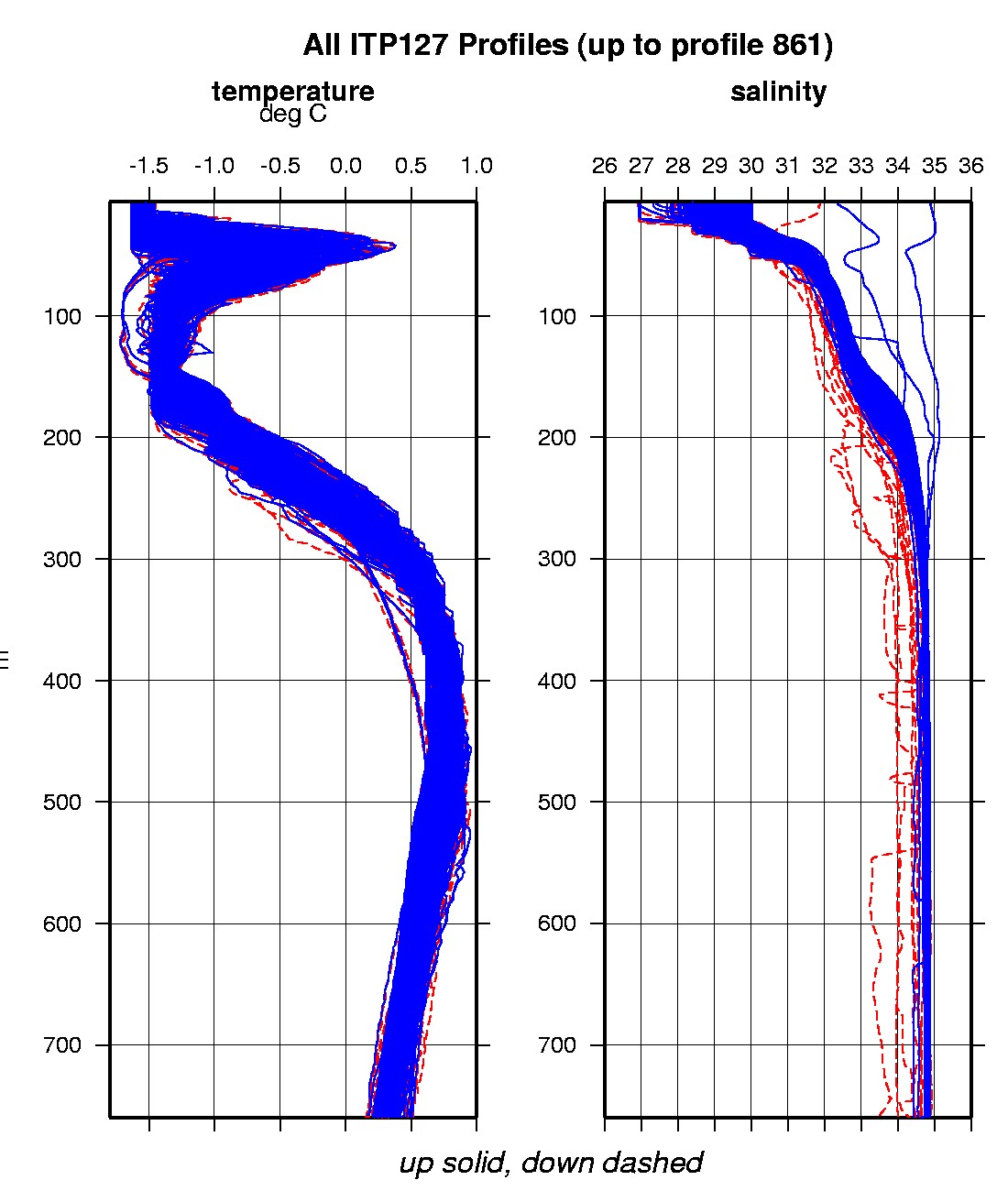
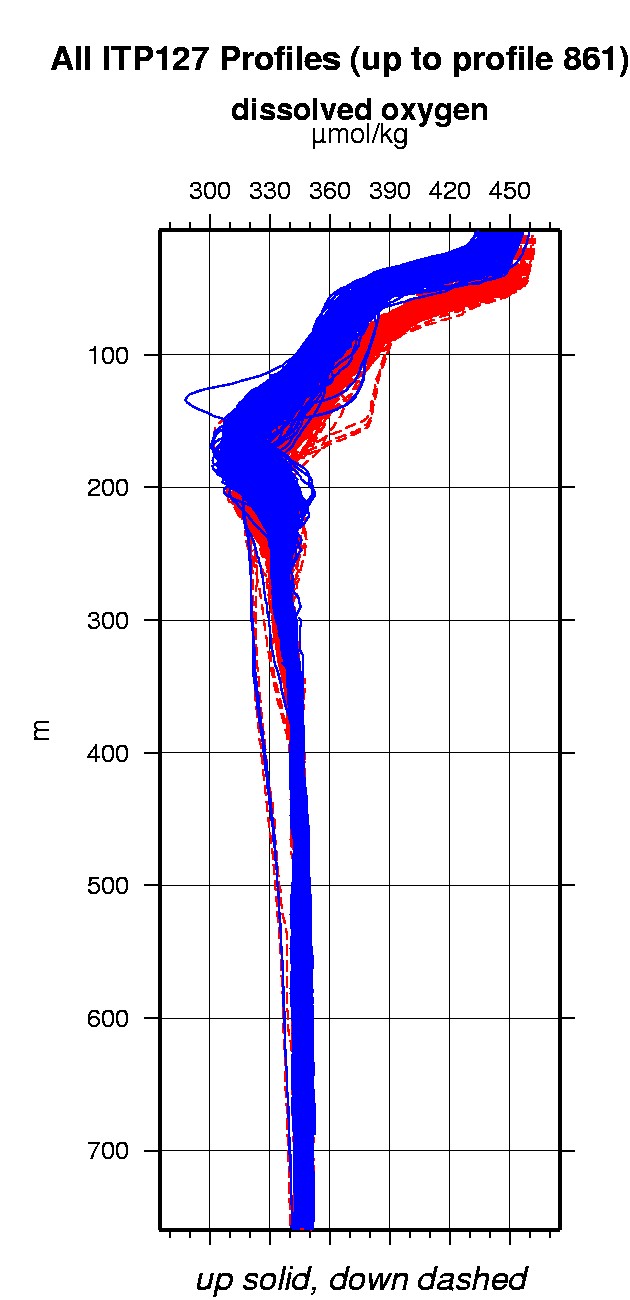
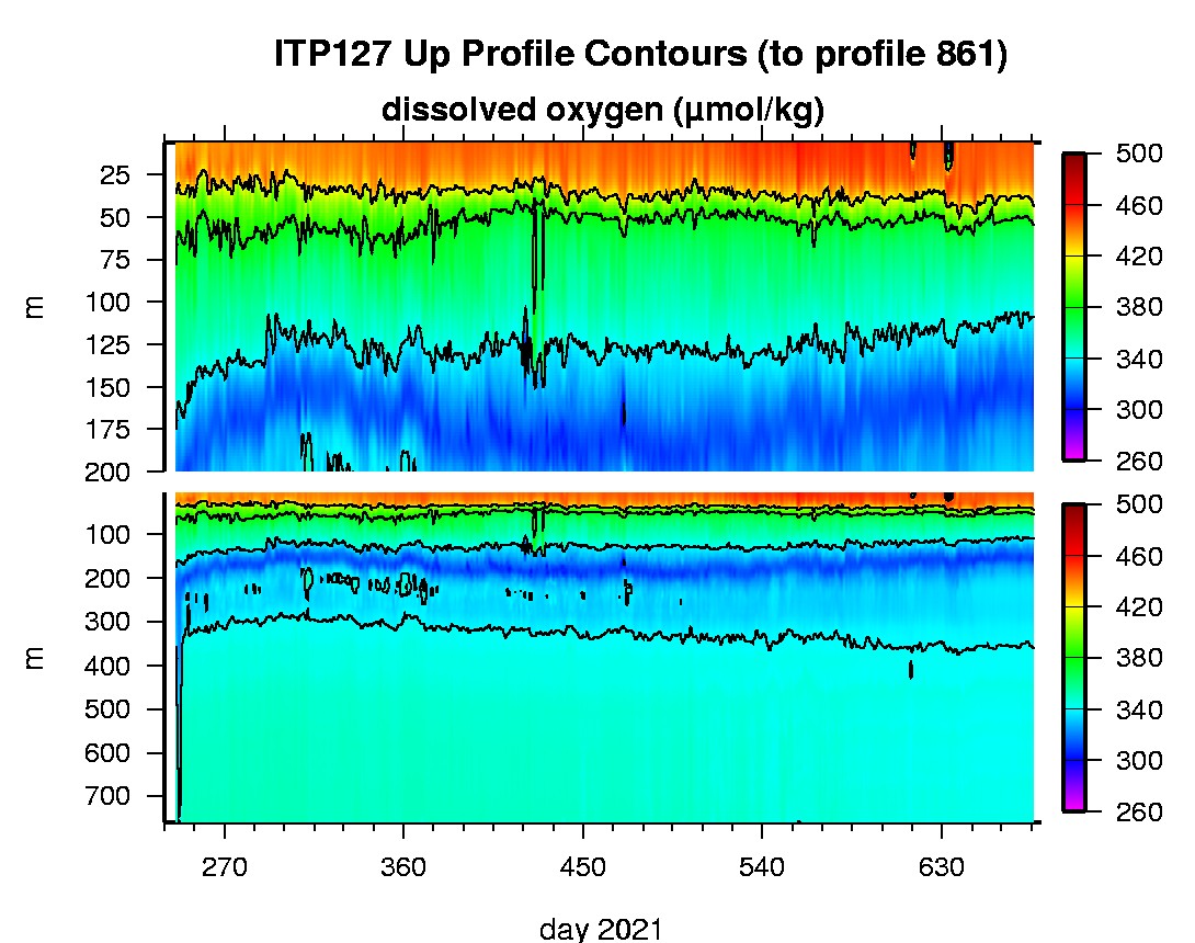
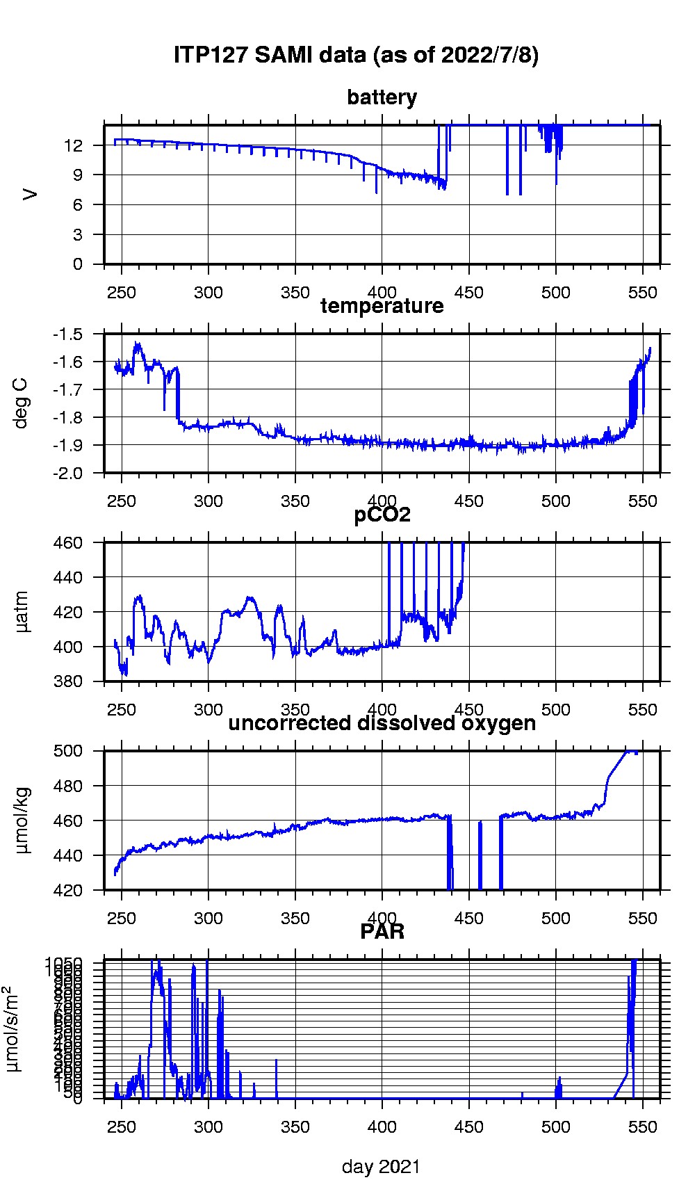
Last buoy status on 2023/12/4 11046 UTC : temperature = -7 °C, battery = 10.414 V Last position on 2023/12/4 11046 UTC : 84.5002° N, 82.1484° W Last profile (number 861) on 2022/11/7 2 UTC Last profile mean motor current = 138.3003 mA, mean battery = 10.4803 V Last profile depth: minimum = 6.2499, maximum = 760.0037 m Last profile temperature: minimum = -1.5938, maximum = 0.66865 °C Last profile salinity: minimum = 29.1872, maximum = 34.87 Last profile dissolved oxygen: minimum = 306.8955, maximum = 448.084 μmol/kg Last SAMI pCO2 sample (number 23787) on 2022/7/8 41517 UTC Last pCO2 = 706.6749 μatm Last SAMI ODO sample (number 23700) on 2022/6/30 221530 UTC Last uncorrected Dissolved Oxygen = 499.9695 μmol/kg Last SAMI PAR sample (number 23701) on 2022/6/30 221537 UTC Last PAR = 1074.8241 μmol/s/m^2 The raw GPS buoy location data are available in an ASCII file: itp127rawlocs.dat Depth averaged profiler data files (with interpolated location) and time series SAMI data are available in two formats: ITP127 was deployed on a 0.85 m ice floe in the Beaufort Sea on September 2, 2021 at 78° 34.9 N, 147° 19.3 W as part of the Beaufort Gyre Observing System (BGOS) during the JOIS 2021 cruise on the CCGS Louis S. St. Laurent. On the same icefloe, a Tethered Ocean Profiler (TOP2), and a US Army Cold Regions Research and Engineering Laboratory (CRREL) Seasonal Ice Mass Balance Buoy 3 were also installed. The ITP is operating on a standard sampling schedule of 2 one-way profiles between 7 and 760 m depth each day and includes a fixed SAMI PCO2 with ODO and PAR at 5 m depth.
|